The Manaslu Circuit trek is one of the restricted-area treks in Nepal, and it is our most requested route for travelers who want the scale of an Everest or Annapurna trek without the crowds on the trail. Our package takes you around the eighth-highest mountain on Earth, through Gurung hill villages and Tibetan Buddhist Nubri settlements, over the 5,106 m Larkya La Pass, and back down into the Annapurna region — with permits, guide, accommodation, and logistics fully arranged so the only thing you need to plan is your flight to Kathmandu.
Below you will find the exact itinerary we run, current 2026 permit costs, what is included in the package price, and answers to the questions our clients ask most before booking. If anything here doesn’t answer your specific question, our team is a message away.
Quick Facts
| Detail | Information |
| Trek duration | 14 days |
| Trek distance | Approximately 177 km (110 miles) |
| Maximum altitude | Larkya La Pass, 5,106 m (16,752 ft) |
| Trek grade | Strenuous |
| Trek style | Tea house / lodge-to-lodge |
| Region | Gorkha and Lamjung districts, western Nepal |
| Starting point | Machha Khola or Soti Khola (7–8 hrs drive from Kathmandu) |
| Ending point | Dharapani, then drive to Besisahar / Kathmandu |
| Guide | Licensed guide included, mandatory by Nepali law |
| Solo travelers | Welcome — solo permits allowed since 22 March 2026 |
| Permits | MRAP, MCAP, ACAP + Chumnubri local fee — all arranged by us |
| Best seasons | Spring (March–May) and Autumn (September–November) |
| Package price | 1,800 per person (14 days) |
Trek Overview
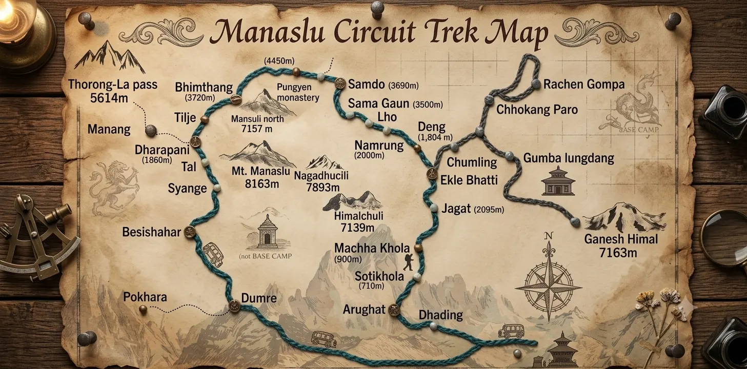
Our itinerary follows the Budhi Gandaki river upstream from Soti Khola to the high Tibetan-influenced villages of Samagaun and Samdo, crosses Larkya La, and descends into the Marsyangdi valley at Dharapani. The first four days climb steadily through forested river gorge; from Namrung onward, the landscape and culture shift visibly toward stone houses, prayer flags, and Buddhist monasteries. We schedule the first full acclimatization day at Samagaun (3,530 m), then continue through Samdo and Dharamsala/Larkya Phedi before staging the pass crossing.
Why Book This Package With Us
Manaslu rewards travelers who want an authentic, less-commercialized Himalayan trek, but it also comes with more logistical complexity than open routes like Everest Base Camp — restricted-area permits, a legally mandatory guide, and limited rescue infrastructure above Samagaun. This is exactly where a properly run package pays for itself: we handle permit processing through our TAAN registration, assign a guide who has crossed Larkya La dozens of times, and build in the acclimatization days that make the difference between an enjoyable crossing and a dangerous one.
We do not oversell this trek. It is physically demanding, the tea houses above Samagaun are simple, and Larkya La day is long. What we can promise is that our itinerary, guides, and on-ground support are built around getting you across that pass safely and getting you the views you booked this trek for.
Day-by-Day Itinerary
| Day | Route | Altitude | Walking Time |
| 1 | Kathmandu to Machha Khola (drive) | 869 m | 7–8 hrs drive |
| 2 | Machha Khola to Jagat | 1,340 m | 6–7 hrs |
| 3 | Jagat to Deng | 1,860 m | 6–7 hrs |
| 4 | Deng to Namrung | 2,630 m | 5–6 hrs |
| 5 | Namrung to Lho | 3,180 m | 3–4 hrs |
| 6 | Lho to Samagaun | 3,530 m | 3–4 hrs |
| 7 | Acclimatization day in Samagaun (Manaslu Base Camp or Birendra Lake) | 3,530 m | 4–6 hrs (day hike) |
| 8 | Samagaun to Samdo | 3,875 m | 3–4 hrs |
| 9 | Samdo to Dharamsala/Larkya Phedi | 4,460 m | 3–4 hrs |
| 10 | Dharamsala to Bimthang via Larkya La (5,106 m) | 3,720 m | 8–9 hrs |
| 11 | Bimthang to Tilije/Dharapani | 1,860–2,300 m | 6–7 hrs |
| 12 | Dharapani to Besisahar (drive), then Kathmandu | — | 6–7 hrs drive + drive/flight |
Our 14 day packages add a buffer day for weather or altitude contingency, plus an additional low-altitude acclimatization stop — a small addition to the schedule that meaningfully improves your odds of a comfortable pass crossing.
Accommodation
This package runs entirely on tea house accommodation, from Soti Khola to Bimthang. Below Namrung, we place you in lodges with private twin rooms and shared bathrooms. From Lho upward, rooms are simpler stone-built guesthouses with communal dining rooms heated by a single stove. Above Samagaun, hot showers are solar-heated and charged separately. We select our partner lodges in Samagaun and Samdo specifically because their owners are experienced hosting foreign trekkers and maintain the best standards on this stretch of the route.
Food
Meals are included throughout the trek: dal bhat, noodle soups, momos, fried rice, potato dishes, and Tibetan bread are the mainstay. Above Samagaun, menus narrow and prices rise as everything is carried in by porter or mule. Our guides recommend vegetarian dal bhat at altitude — it is the most reliable, hygienic, and calorie-dense option, and unlimited refills are standard.
Transportation
Package transportation covers the drive from Kathmandu to Machha Khola or Soti Khola (7–9 hours by jeep), and the return leg from Dharapani via Besisahar back to Kathmandu or on to Pokhara. Private jeep transfers, available as an upgrade, cost more than the shared vehicles included in the standard package but save meaningful time and comfort.
Permits We Arrange For You
Every foreign trekker on this route needs three permits, all processed by our agency as part of your package:
| Permit | Purpose | Approx. Cost (2026) |
| Manaslu Restricted Area Permit (MRAP/RAP) | Entry beyond Jagat checkpoint | USD 100/7 days (Sep–Nov) + USD 15/extra day; USD 75/7 days (Dec–Aug) + USD 10/extra day |
| Manaslu Conservation Area Permit (MCAP) | Entry into the Manaslu Conservation Area | Approx. USD 30 |
| Annapurna Conservation Area Permit (ACAP) | Covers the section joining the Annapurna region near Dharapani | Approx. USD 30 |
| Chumnubri Rural Municipality fee | Local development levy, paid on the trail | Small cash fee (NPR) |
For a standard 14-day trek, total permit costs typically run USD 215–260 per person in autumn, slightly less between December and August. Permits are non-transferable and non-refundable, and can only be processed by a TAAN-registered agency — we handle this end to end so you never need to visit an immigration office yourself.
Important update: as of 22 March 2026, Nepal’s Department of Immigration removed the rule requiring a minimum of two trekkers to jointly apply for the Manaslu RAP. Solo travelers booking with us can now be issued an individual permit. A licensed guide remains mandatory for every trekker, solo or in a group, and is included in every package we run.
Why a Licensed Guide Is Included in Every Package
This is Nepali law for this restricted area, checked at three separate checkpoints, and it is also simply good practice on a route where rescue infrastructure is thin. Larkya La sees genuine weather-related emergencies most seasons. Every guide we assign is licensed, trained in altitude assessment, and experienced coordinating helicopter evacuation if it is ever needed — this is built into the package price, not an optional extra.
Best Time to Book This Trek
We run this package primarily in spring (March–May) and autumn (September–November). Spring brings rhododendron blooms and generally stable weather; autumn offers the clearest post-monsoon skies and typically the safest Larkya La conditions, which is why it is our busiest booking season. Winter departures are possible but the pass can close after heavy snowfall. We do not recommend booking a first Manaslu trek during the monsoon months (June–August).
Weather by Season
| Season | Lower Trail (Machha Khola–Namrung) | Upper Trail (Samagaun–Larkya La) |
| Spring | Warm, occasional afternoon showers | Cold mornings, clear midday skies |
| Autumn | Mild, dry, clear | Cold, dry, stable — best pass conditions |
| Winter | Cool, dry | Very cold, snow risk at the pass |
| Monsoon | Hot, humid, leeches, landslide risk | Cloud-covered, poor visibility |
Difficulty
We grade this package strenuous. Clients who have previously trekked Everest Base Camp or Poon Hill often find Manaslu harder in three specific ways: longer daily walking hours (6–7 hours typically, 8–9 on pass day), rougher trail surfaces with more exposed sections, and less bail-out infrastructure once past Jagat. The hardest single day is the Larkya La crossing — a pre-dawn start, several hours of ascent on loose rock and possible ice near the top, and a long descent to Bimthang. Our guides pace clients deliberately through the days before the pass, since under-pacing early is the most common reason trekkers struggle on summit day.
Fitness Requirements
No mountaineering experience is required, but we ask clients to arrive with a genuine base of cardiovascular fitness — comfortably hiking 5–6 hours with a daypack on hilly terrain, on back-to-back days, for at least a month before departure. Clients who arrive undertrained are the ones most likely to struggle with both altitude symptoms and simple leg fatigue by day 8 or 9.
Altitude Profile & Acclimatization
The trek climbs from 869 m at Machha Khola to 5,106 m at Larkya La, a net gain of over 4,200 m across ten days. We keep daily gain under 500–600 m above 3,000 m wherever the itinerary allows, and we build in a mandatory acclimatization day at Samagaun (3,530 m). Our guides brief every client on hydration (3–4 litres daily above 3,000 m), avoiding alcohol and sleeping pills at altitude, and reporting any headache, nausea, or unusual breathlessness immediately rather than pushing through it. For detailed information on altitude sickness prevention and treatment, please refer to the Himalayan Rescue Association (HRA)
Larkya La Pass
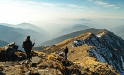
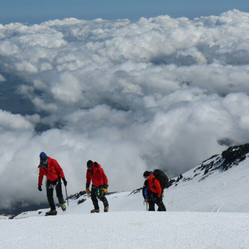
Larkya La (5,106 m) is crossed on a single long day, starting from Dharamsala/Larkya Phedi (4,460 m) around 4:00–5:00 am to cross before afternoon winds pick up and reach Bimthang before dark. The final approach can be icy in late autumn and winter, so we recommend microspikes for these seasons. The descent to Bimthang is steep and long — trekking poles are essential gear we advise every client to bring.
What to Pack
- Layered clothing: base layers, insulated mid-layer, waterproof/windproof outer shell
- Down jacket rated to at least -15°C for the pass crossing
- Sleeping bag rated to -15°C or colder
- Broken-in trekking boots plus camp shoes
- Trekking poles
- Microspikes or lightweight crampons (autumn/winter/early spring departures)
- Headlamp with spare batteries
- Water purification (tablets or filter) and 2–3 litre capacity bottles
- Sun protection: high-SPF sunscreen, UV-rated sunglasses, lip balm
- Basic first-aid kit including Diamox (consult your doctor before travel), blister care, rehydration salts
- Power bank
- Cash in Nepali Rupees for tea houses, snacks, and the Chumnubri local fee
Culture Along the Route
The lower valley is predominantly Gurung and Hindu hill-caste communities; from Namrung and Lho upward you enter Tibetan Buddhist Nubri, with monasteries, mani walls, and chortens that our guides will brief you to pass on the left, in keeping with local custom. We ask clients to check before photographing inside monasteries and to dress modestly in villages and religious sites.
Wildlife
The Manaslu Conservation Area protects habitat for the Himalayan tahr, musk deer, Himalayan black bear, and, at higher and more remote elevations, the snow leopard. Sightings are rare but the species’ presence is part of why this conservation area exists.
Connectivity, Power & Water on the Trail
Wi-Fi is available in most tea houses up to Namrung for a small fee, becoming unreliable above Samdo; a local SIM with data is a more consistent option. Charging is available up to Namrung, usually for a small fee, and is solar/generator-powered and charged per device above Samagaun — a power bank reduces both cost and risk. Boiled or filtered water is available at every tea house; we recommend carrying a filter or purification tablets rather than buying bottled water, both for cost and to reduce plastic waste in a conservation area with no waste removal infrastructure.
Money & ATMs
There are no reliable ATMs beyond the early stages of the trek. Withdraw all the Nepali Rupees you will need in Kathmandu before departure, including a buffer for tea houses, hot showers, charging fees, and the Chumnubri local development fee, often collected in cash on the trail.
Safety & Insurance
The primary safety considerations on this trek are altitude illness and weather at Larkya La. Every package includes a licensed guide monitoring symptoms daily and a realistic acclimatization schedule, with the flexibility to delay a pass crossing in poor weather. We require all clients to carry travel insurance covering high-altitude trekking to at least 6,000 m and helicopter evacuation — confirm your policy explicitly names these, since many standard policies exclude altitudes above 3,000–4,000 m by default. Helicopter evacuation is possible from most points on the route in clear weather and is coordinated directly by our team and your guide if ever needed.
Solo Travelers
Since the 22 March 2026 rule change, we can now issue a Manaslu Restricted Area Permit to solo travelers individually, without needing to pair you with a second trekker on paper. You will still trek with your own licensed guide throughout, as required by law.
Responsible Travel
We ask clients to respect monastery photography customs, pack out non-biodegradable waste, avoid single-use plastic bottles where refill options exist, and support the local tea houses on the route. Permit fees you pay directly fund conservation and community infrastructure in the Manaslu Conservation Area.
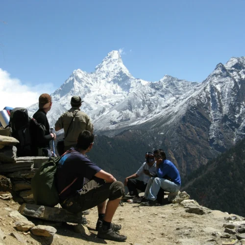
Close-up views of Manaslu (8,163 m), Himalchuli (7,893 m), and Ngadi Chuli (7,871 m) from Samagaun and the Manaslu Base Camp side trip
- Crossing Larkya La at 5,106 m with our experienced local guide
- A rest day in the Tibetan Buddhist village of Samagaun, with an optional Manaslu Base Camp or Birendra Lake excursion
- Optional Tsum Valley extension (adds 5–7 days) for travelers who want to go even further off the main trail
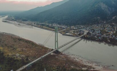
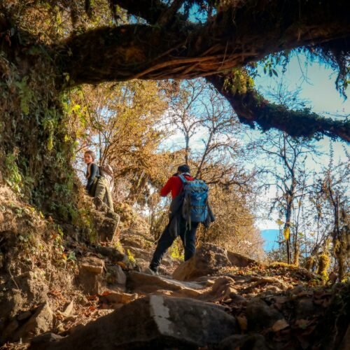
- The Budhi Gandaki river gorge on the lower trail — suspension bridges, waterfalls, and dramatic cliff sections
- Significantly fewer trekkers per day than Everest Base Camp or the Annapurna Circuit
- A seamless finish at Dharapani if you want to extend into the Annapurna Circuit