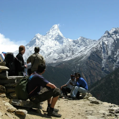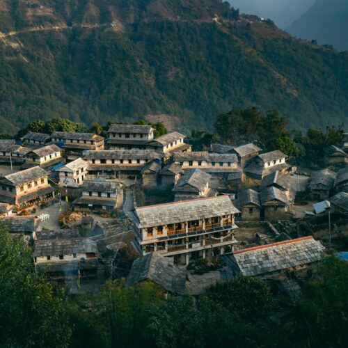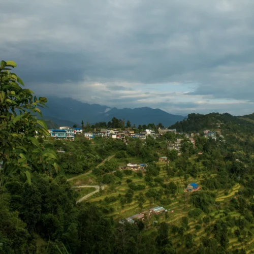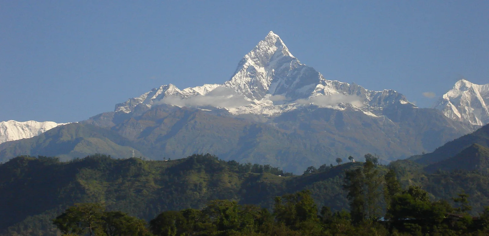
The Annapurna Circuit Trek is one of the most complete trekking experiences in Nepal. Over a fixed 16-day itinerary — Kathmandu to Kathmandu — you walk from the subtropical Marsyangdi valley at around 1,100 meters to the wind-scoured Thorong La Pass at 5,416 meters, then descend into the high-desert landscape of Mustang before flying back to Pokhara and returning to Kathmandu. Along the way the culture shifts too — from Gurung and Magar villages in the lower valleys to Tibetan-influenced Manang and the Buddhist and Hindu communities of the Kali Gandaki valley.
This guide is built for people who are genuinely deciding whether to book this trek, not just browsing. It covers the real day-by-day itinerary, current permit rules, realistic costs, difficulty, best season, packing, and the acclimatization planning that actually keeps trekkers safe on the pass. Where regulations or fees are involved, this guide reflects the current 2026 rules — permit and guide requirements on this route have changed more than once in the last few years, so it’s worth reading even if you’ve researched the trek before.
Annapurna Circuit Trek Overview
| Detail | Information |
| Trek duration | 16 days |
| Maximum altitude | 5,416m (Thorong La Pass) |
| Starting altitude | 760m (Besisahar) |
| Trek difficulty | Moderate to challenging |
| Best seasons | March–May (spring) and September–November (autumn) |
| Accommodation | Teahouses/lodges throughout, hotel in Kathmandu and Pokhara |
| Guide requirement | Mandatory since 2023 |
| Total distance | Approximately 160km on foot |
| Region | Annapurna Conservation Area, Manang and Mustang districts |
Why Choose the Annapurna Circuit Trek
Several treks in Nepal offer mountain views. Few offer the range of terrain and culture the Annapurna Circuit does in a single trip. A few practical reasons this route keeps its reputation:
- Landscape diversity. You pass through six distinct ecological zones — subtropical forest, temperate pine and rhododendron forest, alpine meadow, high desert, and the arid Mustang plateau — all on one trail.
- One clearly defined high point. Thorong La Pass gives the trek a natural climax and a strong sense of achievement, unlike routes that plateau at altitude for days.
- Teahouse infrastructure. Unlike more remote restricted-area treks, the Circuit has a well-established network of teahouses, so you don’t need to carry camping gear or arrange logistics from scratch.
- Flexible duration. Depending on time and interest, the trek can be done in a shorter 10–12 day version focused on the high sections, or a fuller 15–19 day version that includes Poon Hill and side trips like Tilicho Lake.
- Road impact is real, but manageable. Road construction over the past two decades has shortened parts of the original trail, and jeeps now cover some lower sections. This is worth knowing upfront so expectations are accurate — the core experience through Manang, Thorong La, Muktinath, and the upper Kali Gandaki valley remains intact.
Route Description
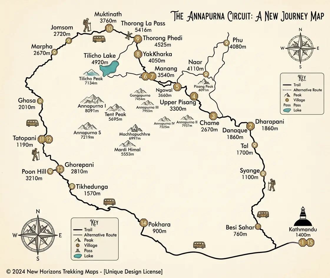
The classic route follows the Marsyangdi River valley north from Besisahar, climbing steadily through Gurung and Manangi villages to Manang. From there it turns west, gaining serious altitude through Yak Kharka and Thorong Phedi before crossing Thorong La into the Mustang district. The descent follows the Kali Gandaki valley south, past Muktinath, Kagbeni, Jomsom, and Marpha, eventually reaching Tatopani. From there, trekkers either finish by vehicle or continue on foot through Ghorepani and Poon Hill to Nayapul, near Pokhara.
Road construction has shortened the original route considerably. In the 16-day itinerary used in this guide, only the Kathmandu–Syange leg is covered by vehicle; every stage from Syange to Muktinath is walked, which keeps the acclimatization schedule gradual and intact. From Muktinath onward the trek finishes by trekking to Jomsom, flying to Pokhara, and then returning to Kathmandu by road or air — the trek itself ends at Muktinath/Jomsom, and Pokhara and Kathmandu afterward are transit and rest, not additional trekking days.
Major Attractions Along the Trek
- Manang village — the cultural and logistical hub of the upper trek, with bakeries, a small hospital, and the Himalayan Rescue Association post
- Gangapurna Lake and Glacier — a short walk from Manang
- Tilicho Lake (4,919m) — an optional 2–3 day side trip, considered one of the highest lakes in the world
- Muktinath Temple — sacred to both Hindus and Buddhists, with 108 water spouts and an eternal flame
- Kagbeni — a whitewashed Thakali village at the gateway to Upper Mustang
- Marpha and Tukche — apple-growing villages known for cider and apple pie
- Tatopani hot springs — a natural stop to recover before or after Poon Hill
Thorong La Pass
At 5,416m, Thorong La is the trek’s highest point and the reason acclimatization planning matters so much on this route. The crossing typically starts before dawn from High Camp or Thorong Phedi, both to catch calmer morning weather and to leave enough daylight for the long descent to Muktinath. Expect 4–6 hours of steady climbing followed by a demanding 1,300–1,600m descent, often on loose scree or, in early or late season, snow. Trekking poles and warm layers for a pre-dawn start are worth carrying specifically for this day.
Highest Elevation
The trek’s highest point is Thorong La Pass at 5,416m. The lowest point, depending on the itinerary’s starting village, is around 760m at Besisahar or Bhulbhule, meaning some itineraries cover more than 4,600m of net elevation gain over the course of the trek — one reason gradual acclimatization is treated as essential rather than optional.
Trek Difficulty
The Annapurna Circuit is generally rated moderate to challenging. It doesn’t require technical climbing skills, but it does require sustained daily walking (5–8 hours on most days) at altitude, several long days above 4,000m, and one very long, physically demanding pass-crossing day. Trekkers with no prior high-altitude experience can complete it successfully, provided they:
- Follow a realistic acclimatization schedule (see below)
- Walk at a slow, steady pace rather than rushing between villages
- Are honest with themselves and their guide about symptoms of altitude sickness
Physical Fitness Requirements
No technical mountaineering skills are needed, but a baseline level of cardiovascular fitness makes the trek considerably more enjoyable. In the 2–3 months before departure, most trekkers benefit from:
- Regular hiking or long walks with a loaded daypack
- Stair climbing or hill repeats to build leg endurance
- General cardiovascular conditioning (running, cycling, or swimming)
- At least one multi-day hike, if possible, to test gear and footwear
Best Time to Visit
Autumn (late September to November) and spring (March to May) are the two reliable windows. Both offer stable weather and clear mountain views, with autumn generally considered slightly more predictable for the Thorong La crossing. Early October can carry some post-monsoon weather instability, so mid-October through mid-November is often treated as the safest stretch. Winter (December–February) sees the pass frequently snowed in and unpredictable, while the monsoon months (June–September) bring heavy rain, leech-heavy lower trails, and poor visibility, though the rain-shadow area beyond Manang stays comparatively dry.
Weather by Season
| Season | Conditions | Notes |
| Spring (Mar–May) | Mild days, cold nights at altitude, rhododendrons in bloom | Good visibility; can get busy |
| Autumn (Sep–Nov) | Clear skies, stable weather, cold at high camps | Most popular season; book teahouses ahead |
| Winter (Dec–Feb) | Very cold above 4,000m, possible pass closure | Fewer trekkers, but real risk of being turned back at Thorong La |
| Monsoon (Jun–Sep) | Heavy rain and cloud in lower valleys, drier past Manang | Landslide risk on lower trails; limited mountain views |
Food and Accommodation
Teahouses line the entire route, offering basic private or shared rooms and a communal dining area. Standards are simple lower down and increasingly basic at higher altitudes, where hot showers and charging often carry a small extra fee. Menus typically feature dal bhat (lentils, rice, and vegetables), noodle and pasta dishes, soups, and simple breakfast items like porridge, eggs, and Tibetan bread. Above Manang, food costs rise and menu variety narrows, since most supplies are carried in by mule or porter. Dal bhat remains the most practical choice at altitude — it’s freshly cooked, refills are usually included, and it provides the carbohydrate load long trekking days require.
Permits Required
Permit and guide rules on this route have changed more than once in recent years, so it’s worth confirming current requirements with your agency or the Nepal Tourism Board shortly before departure.
- Annapurna Conservation Area Permit (ACAP): Mandatory for all foreign trekkers, costing roughly NPR 3,000 (about USD 25–30) per person. It is checked at multiple checkpoints along the route, including Besisahar, Chame, and Manang, and funds conservation and trail maintenance in the Annapurna Conservation Area.
- TIMS card (Trekkers’ Information Management System): The requirement status for TIMS on the Annapurna route has been inconsistent in recent years — some sources describe it as discontinued for this trek since 2023, others as still requested by certain agencies for safety tracking. Because this detail is genuinely in flux, confirm directly with your trekking agency or the Nepal Tourism Board office in Kathmandu or Pokhara before you travel, rather than relying on older blog posts.
- Licensed guide requirement: Since 2023, Nepal has required trekkers on routes like the Annapurna Circuit to trek with a government-licensed guide; solo trekking without a guide is not permitted on this route.
- Permits must be arranged in Kathmandu or Pokhara before entering the trekking area — there is no facility to obtain them on the trail itself, and checkpoints will turn back trekkers without valid documents.
Transportation
In the 16-day itinerary above, transportation runs as follows: a 7–8 hour road journey from Kathmandu to Syange on Day 2 (via Besisahar), a 20-minute flight from Jomsom to Pokhara on Day 12, and either a 6–7 hour road journey or a 25-minute flight from Pokhara back to Kathmandu on Day 14. The Jomsom–Pokhara flight is the one genuine weak point in the schedule — it is short but frequently delayed or cancelled by wind, and flights only operate in the morning. This is exactly why Day 13 in the itinerary is a Pokhara buffer day rather than a same-day connection onward; without it, a single bad-weather morning in Jomsom could cost you an international flight home.
Packing List
- Layered clothing: moisture-wicking base layers, fleece or down mid-layer, waterproof/windproof shell
- Insulated down jacket for high camps and the pass crossing
- Sturdy, broken-in trekking boots and gaiters
- Trekking poles
- Warm hat, sun hat, buff or neck gaiter, and sunglasses with strong UV protection
- Sleeping bag rated for at least -10°C to -15°C
- Headlamp with spare batteries (essential for the pre-dawn pass crossing)
- Water purification tablets or a filter
- Basic first-aid kit, including any personal medications and diamox if prescribed by a doctor
- Power bank, since charging is limited and sometimes charged by the hour at altitude
Altitude Sickness and Acclimatization
Altitude sickness is the single biggest safety concern on this trek, not because the route is unusually dangerous, but because Thorong La forces a serious altitude gain over a short stretch. Standard precautions include:
- Building in at least one full acclimatization day in Manang before continuing higher
- Following the “climb high, sleep low” principle where the itinerary allows it
- Drinking significantly more water than usual and avoiding alcohol at altitude
- Walking at a deliberately slow pace above 3,500m rather than trying to match a fitter hiking partner
- Knowing the early symptoms — headache, nausea, dizziness, loss of appetite — and treating them as a signal to stop ascending, not push through
- Carrying travel insurance that explicitly covers high-altitude helicopter evacuation, since rescues from this route can cost thousands of dollars out of pocket without it
A common mistake among first-time high-altitude trekkers is skipping or shortening the Manang rest day to save time. This is one of the most preventable causes of altitude-related problems later at Thorong La.
Safety Tips
- Trek with a licensed guide, both because it’s required and because local knowledge of weather and trail conditions genuinely matters at altitude
- Check weather conditions before the Thorong La crossing day, and be willing to delay if conditions look poor
- Carry enough water and snacks for the pass day specifically — there are no teahouses between High Camp and Muktinath, only a single tea stop near the top
- Keep printed copies of permits, since digital copies are often not accepted at checkpoints with limited connectivity
- Register your itinerary with your guide’s agency and keep family or friends informed of your rough schedule
Responsible Trekking Practices
- Stay on marked trails to reduce erosion in fragile alpine terrain
- Carry out non-biodegradable waste, including packaging and batteries
- Ask before photographing local people, especially at religious sites like Muktinath
- Support local teahouses and guides rather than bringing all supplies from Kathmandu
- Use a water filter or purification tablets instead of buying bottled water, which creates plastic waste with no disposal infrastructure in remote villages
- Dress modestly and follow local etiquette at monasteries and temples along the route
Crossing Thorong La Pass (5,416m), one of the highest trekking passes in the world
- The high-altitude village of Manang (3,519m), where Tibetan and Nepali cultures meet
- Muktinath Temple, a shared Hindu-Buddhist pilgrimage site with 108 water spouts
- The Kali Gandaki Gorge, one of the deepest river gorges on Earth, running between Annapurna (8,091m) and Dhaulagiri (8,167m)
- Panoramic views of Annapurna II, III, IV, Gangapurna, and Manaslu
- Tilicho Lake (one of the highest lakes in the world) and Ice Lake near Manang
- Sunrise from Poon Hill (3,210m)
- Traditional Thakali villages like Marpha, known for apple orchards and local apple brandy
- Natural hot springs at Tatopani and near Muktinath