

Introduction to Dingboche Nepal Weather
If you are trying to understand Dingboche Nepal weather before an Everest trek, here is the short version: it is a high, dry, sunny village at 4,410 metres where daytime sun can feel pleasant and nights are cold in every season except the summer monsoon. Most trekkers plan one or two nights here for acclimatisation, which means you will sleep through at least one of those cold nights and spend a full rest day in whatever the sky decides to do.
That makes the weather here more than trivia. It decides what you pack, how well you sleep, whether your acclimatisation hike is a highlight or a slog and which month you should book. This guide is built around Dingboche itself, not the Everest region in general, so you get month-by-month numbers, the wind and sun effects that catch people out, and clear advice for each type of trekker.
Dingboche Weather at a Glance
- Altitude: 4,410 metres (14,470 feet), in the Imja Valley of the Khumbu region.
- Climate type: Alpine tundra, with cool, wet summers and dry, cold winters.
- Best trekking windows: Spring (March to May) and autumn (October and November) for stable skies and good views.
- Warmest months: June to August on paper, but that is the monsoon, when cloud and rain hide the mountains.
- Coldest months: December to February, when many lodges in the upper valley close.
- Typical night temperature in trekking season: Below freezing in every month from October to April.
- Biggest comfort factor: Not the thermometer but the combination of wind, shade and a cold, unheated bedroom.
If you want the village itself, the lodges and the trek context rather than weather, our general Dingboche guide covers that. This article stays on the climate.
Why the Weather Behaves This Way at 4,410 Metres
Dingboche sits on a broad, terraced shelf above the Imja Khola, with Ama Dablam and Lhotse in the skyline. At this height the air holds far less heat, so temperatures fall quickly when the sun leaves the valley. Climate summaries classify the village as tundra, which tells you two things: summers never get truly warm, and winters are properly cold.
Two local effects matter more than the averages.
Sun versus shade. In clear weather the sun is intense, and standing in it at midday can feel mild even when the air is near freezing. Step into shade or enter a stone dining room with no heat and the difference is immediate. Nights, with no sun at all, are the coldest part of the cycle.
Wind. Valley winds tend to rise through the day and funnel along the main drainage. Dingboche is generally described as sunnier and less affected by the icy winds that sweep down the valley than neighbouring Pheriche, which is one reason many itineraries prefer it for the acclimatisation stop. That is a relative statement, though. It can still be very windy here, especially in the afternoon, and wind makes cold air feel far colder.
The monsoon also reaches this valley, but in a weaker form than in the lowlands. Rain falls mainly from June to September, and above the village it often falls as snow.
Dingboche Weather by Season
Spring: March to May
Spring is the second main trekking season. Temperatures climb steadily from March to May, days feel milder and the trail is busy with trekkers heading to Base Camp. Mornings are usually clear, and afternoon cloud becomes more common as the season advances. Late in May, pre-monsoon moisture can bring brief showers or snow flurries at height. Nights remain below freezing throughout the season, even as daytime highs improve.
Summer monsoon: June to September
This is the warmest period on paper and the wettest in practice. Averages in the Wikipedia climate summary for Dingboche show July and August as the rainiest months by a wide margin, with well over 100 mm each. The upside is that nights are no longer deeply cold. The downside is persistent cloud, wet trails, leeches at lower elevations and views that come and go. Flights to Lukla are also more disrupted in this season. If you are curious how the wider region behaves then, our guide to Mount Everest in summer explains what monsoon trekking is really like.
Autumn: October and November
Autumn is the classic season. The monsoon has cleared, the air is dry and views of Ama Dablam, Lhotse and the surrounding ridges are at their sharpest. October is milder and busier. By November the nights are much colder, daytime highs fall to single digits and the trail gets quieter as the season winds down.
Winter: December to February
Winter is possible but demanding. Reference sources note that most accommodation in the upper valley closes during winter and that the cold is intense, with daytime temperatures rarely rising above freezing. Snow is more likely, wind is a bigger factor and the margin for error is thinner. This is a season for experienced, well-equipped trekkers who are comfortable in serious cold.
Dingboche Nepal Weather by Month: Temperatures and Rainfall
The table below uses long-term modelled climate averages for Dingboche as published in the Wikipedia entry for Dingboche (which draws on climate-data.org). These are averages for the village itself, so they are better for planning than Kathmandu or Lukla figures. They are modelled rather than measured by an on-site station, so treat them as a guide and expect real days to be colder or warmer.
| Month | Average high | Average low | Average rainfall or snowmelt equivalent | Trekking verdict |
|---|---|---|---|---|
| January | 1.0 °C | minus 15.3 °C | 9 mm | Very cold, lodges may be closed |
| February | 1.5 °C | minus 14.2 °C | 8 mm | Very cold, limited services |
| March | 4.7 °C | minus 10.5 °C | 12 mm | Cold but improving, season begins |
| April | 8.5 °C | minus 7.0 °C | 13 mm | Good, stable, busy |
| May | 11.1 °C | minus 3.5 °C | 16 mm | Good, warmest dry month, late showers possible |
| June | 13.7 °C | 1.1 °C | 64 mm | Monsoon onset, cloudy |
| July | 13.0 °C | 2.9 °C | 140 mm | Wet, limited views |
| August | 12.6 °C | 2.3 °C | 151 mm | Wettest month |
| September | 11.5 °C | 0.3 °C | 71 mm | Clearing, still unsettled early |
| October | 8.9 °C | minus 5.3 °C | 31 mm | Excellent, peak season |
| November | 5.3 °C | minus 11.0 °C | 2 mm | Very dry, clear, cold nights |
| December | 3.2 °C | minus 13.4 °C | 3 mm | Dry but very cold |
A few things stand out. The coldest averages are from December to February, with lows around minus 13 to minus 15 °C. The dry autumn and spring months both have sub-zero lows, with November already close to minus 11 °C. And although the summer months look warm, July and August carry nearly all of the year’s precipitation.
How to read the numbers honestly
Averages hide variation. A real night can be several degrees colder than the monthly low, especially after a clear, windless evening. A real afternoon can be well above the average high if you are standing in strong sun out of the wind. The most reliable way to use the table is to compare months with each other, then add your own safety margin for gear. Sleeping bags and jackets should be chosen for the cold end of the range, not the middle.
Day Versus Night: The Swing That Surprises People
The most useful figure for packing is not the average temperature but the gap between the afternoon high and the pre-dawn low. In spring and autumn that gap is typically around 15 to 20 degrees Celsius in the monthly averages above. In practice it feels larger because the sun is so strong during the day and so completely absent at night.
Here is how a clear-weather day usually unfolds at Dingboche:
- Before sunrise: The coldest moment. Frost on windows, frozen water bottles and an unheated dining room.
- Morning: The sun reaches the village and the temperature rises quickly. Layers come off within an hour of leaving the lodge.
- Midday: Often the warmest and calmest part of the day. Good for hiking and rest-day walks.
- Afternoon: Wind and cloud commonly build. The temperature starts falling well before sunset.
- Evening: The dining room stove, if lit, becomes the only warm room in the lodge.
Wind at Dingboche
Wind is the most underrated part of the weather here. A calm minus 5 °C morning is pleasant. The same temperature with a steady afternoon wind is a different experience, and exposed ridges and terraces make it worse. Wind also dries your throat, chaps lips and speeds up dehydration, which matters when you are already working hard at altitude.
Practical points:
- Pack a proper windproof shell, not just a fleece.
- Carry a buff or balaclava for the face and neck.
- Keep gloves accessible, not buried in your pack.
- Plan rest-day walks for late morning when winds are usually lighter, and turn around if a strong wind starts early.
- Expect rattling windows, doors and roofs at night. Earplugs help.
Sun and UV at 4,410 Metres
The thin atmosphere filters less ultraviolet light, and snow or pale rock can reflect it back at you. On a clear day you can burn quickly even when the air is cold. Skin damage at altitude catches many first-time trekkers because the cold masks the heat on the skin.
- Use high-factor sun cream on face, ears, neck and the backs of hands.
- Wear sunglasses rated for high UV, ideally with side protection.
- Use lip balm with sun protection.
- Bring a brimmed hat or cap in addition to your warm hat.
The same sun that sunburns you also makes the afternoon feel warm, which is why people sometimes underdress for the evening and then struggle when the temperature drops after sunset.
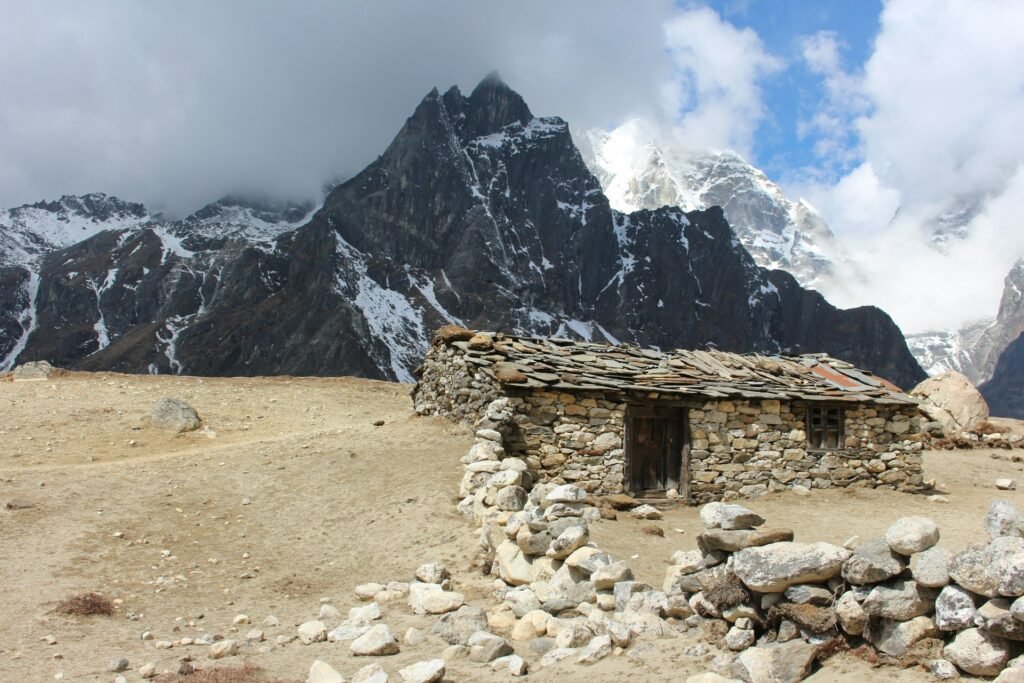
Snow, Rain and Cloud
The driest months in the climate summary are November, December, February and January, each with only single-digit millimetres of precipitation. Spring months are drier than summer but see occasional snow or showers late in the season. October averages more than November, because early October can still carry some post-monsoon moisture.
Snow is most likely in winter, but it can arrive in any season at this altitude, and a light dusting on the trail is common in the shoulder months. Fresh snow changes the trail: it hides loose rocks, makes steps slippery and slows everyone down. A little snow does not stop most treks, but heavy snowfall can close higher passes or delay flights.
Cloud follows a daily pattern. Mornings are clearest. As the day heats up, moisture can rise from the valley and build cloud on the surrounding peaks. If a mountain view matters to you, such as the sunrise on Ama Dablam, get up early.
Weather on Your Acclimatisation Day
Most Everest itineraries stop at Dingboche for two nights so that your body can adjust before you go higher. The rest day is not a day off: the usual routine is a “climb high, sleep low” hike. Nangkartshang Peak viewpoint, at about 5,000 metres, is the most common choice. The other option is a walk toward Chhukhung, at roughly 4,730 metres, which sits below Island Peak.
Weather affects these hikes in three ways.
- Timing. Start early, in the clearest part of the day, and aim to be heading down before afternoon cloud and wind build.
- Visibility. On a clear day, the views over the valley and toward Lhotse and Ama Dablam are among the best of the trek. In cloud, you walk mostly to gain altitude, not for the view.
- Cold exposure. You will be moving slowly and sometimes stopping at the top. Carry your warm jacket and gloves even if the village feels mild.
If the weather is poor on the planned rest day, a good guide will often shorten the walk rather than skip it. Gaining height and coming back down to sleep is the point, not reaching a specific summit. For a safety overview that fits with this, see our guide on how dangerous Everest Base Camp is and how to reduce the risks.
What to Wear at Dingboche in Each Season
Layering is the only approach that works. The aim is to manage a wide temperature range without sweating on the climb or freezing at rest. Our complete Everest Base Camp packing list covers the full kit, and the notes below focus on the Dingboche stop.
| Season | Daytime | Evening and night |
|---|---|---|
| Spring (March to May) | Base layer, fleece, windproof shell, sun hat, sunglasses | Down jacket, warm hat, gloves, thermal bottoms, rated sleeping bag |
| Monsoon (June to September) | Waterproof jacket and trousers, light insulation, quick-dry layers | Warm layer, dry spare clothes, sleeping bag, waterproof bag liners |
| Autumn (October and November) | Base layer, fleece, windproof shell, strong sun protection | Heavy down jacket, insulated trousers, warm hat and gloves, cold-rated sleeping bag |
| Winter (December to February) | Insulated layers, shell, balaclava, goggles in snow | Expedition-grade down, insulated boots or booties, very warm sleeping bag |
A few extras that matter at this height: a spare pair of dry socks, a hot water bottle you can fill at the lodge (check it is leak-proof), hand warmers and a headlamp with spare batteries, because cold drains them quickly.
How to Sleep Warm at Dingboche
Nights are where weather becomes personal. Lodge bedrooms at this altitude are usually unheated, so the room is only slightly warmer than the air outside. A few simple habits make a large difference.
- Choose a sleeping bag for the coldest night, not the average. A bag with a comfort rating well below the expected low gives you margin.
- Use a liner. It adds a few degrees and keeps the bag cleaner.
- Change into dry clothes. Sweat from the day will chill you after you stop moving.
- Fill a hot water bottle and put it in the bag before you get in, taking care it is sealed.
- Drink water before bed, but not so much that you need to leave your bag repeatedly at night.
- Keep tomorrow’s base layer inside the bag so it is warm in the morning.
- Cover your head. A warm hat reduces heat loss significantly.
Do not use stoves or open flames in a closed room to warm it. Carbon monoxide is a real danger in enclosed spaces. If you are cold, add layers, not fire.
Weather, Cold and Altitude Health
Cold and altitude interact. Cold increases fatigue and makes it harder to sleep, and poor sleep can make altitude symptoms feel worse. Dry air also dries the throat, which is why a cough is common at this height.
The key altitude rules are simple: ascend gradually, include acclimatisation days, drink enough fluid, avoid alcohol and sleeping pills, and descend if symptoms get worse. Dingboche is where many trekkers first feel the effect of altitude, with headaches, loss of appetite and disturbed sleep among the typical early signs. For a clear medical overview of symptoms and risk, the Cleveland Clinic has a useful page on altitude sickness, and you should speak to a travel-medicine professional before your trip, especially if you have heart or lung conditions.
Weather does not cause altitude sickness, but a cold, windy, cloudy day can make mild symptoms harder to bear and can delay descent if conditions deteriorate. That is another reason to build spare days into your itinerary.
How to Read a Dingboche Forecast
Mountain forecasts are useful but imperfect. A few rules help.
- Check a forecast point at the right altitude. Some weather services publish a forecast point for Dingboche itself, such as the one on OpenSnow, which is more useful than a forecast for Kathmandu or Lukla.
- Look at trends, not single days. A three- to five-day outlook is more reliable than a ten-day one in mountain terrain.
- Pay attention to wind and cloud as well as temperature. Those two factors decide how comfortable a day is.
- Ask your guide and your lodge owner. Local knowledge of how a valley behaves is often better than an app.
- Do not change safe decisions because of an optimistic forecast. If symptoms or conditions say descend, descend.
For route and elevation context on the stretch around the village, our Everest Base Camp trek map guide shows where Dingboche sits between Tengboche and Lobuche.
Best Month to Be in Dingboche by Trekker Type
First-time trekkers who want comfort and views. Choose October or April. October has the most settled skies and good daytime temperatures but is busy. April is slightly warmer at night and the trail is lively.
Photographers. October to early November for clarity, or April for a mix of clear air and spring light. Early mornings give the best contrast on the peaks.
People who dislike crowds. Late November or late March, accepting colder nights in exchange for quieter trails. Check that lodges are open, because services are thinner at the edges of the season.
Trekkers who hate the cold. April and May have the mildest dry-season nights, with May warmest. Avoid December to February.
Peak climbers heading toward Island Peak. The season is usually the same as the trekking seasons, spring and autumn, because the weather windows are most stable. Our guide to Island Peak covers the climb itself, and Chhukhung, the base for that peak, is only a short walk from Dingboche.
Monsoon trekkers. June to August is possible for people who accept rain, cloud and limited views. It is the quietest period and the warmest at night, but not the best for scenery.

Weather and Your Itinerary Buffer
Weather in the Khumbu does not only affect your comfort in Dingboche. It affects the flights in and out of Lukla, trail conditions on the way and how much time you have for acclimatisation. A tight itinerary leaves no space for delays and tempts people to rush upward, which is the wrong response to a weather setback.
Aim for at least one spare day, and two if your international flight home is fixed. Treat that buffer as part of your safety plan, not a luxury. Our route guide and trekking-time articles can help you see where days can be added.
How Dingboche Compares With Nearby Stops
Weather changes noticeably over a few hours of walking in the Khumbu, so it helps to know what to expect on either side of Dingboche.
Namche Bazaar (3,440 metres). Lower and milder. Namche is the last place on the route where evenings often feel manageable, with more lodges, more heating options and warmer nights than anywhere above it. Many trekkers feel the first real cold at Tengboche and Dingboche, not Namche.
Pheriche. The neighbouring village sits in the same valley system but is described as colder and more exposed to wind than Dingboche, which is why the Imja Valley stop is often preferred for the rest day. The trails link, and some trekkers pass through Pheriche on the way down.
Lobuche and Gorak Shep. Higher, colder and thinner-aired. Nights here are the coldest of a standard Everest Base Camp trek, and the wind is more pronounced. Dingboche works as a rehearsal: if you sleep badly or feel unwell here, it is a warning to be cautious before going higher.
Chhukhung. A little higher up the Imja Valley, at roughly 4,730 metres, it sits closer to the glacier and is colder and starker than Dingboche. It is a popular day-walk destination and the base for Island Peak.
A Sample Two-Night Stay in the Dry Season
This is not a fixed schedule, just a realistic picture of how weather shapes a typical stay in spring or autumn.
Arrival day. You walk in from Tengboche or Pangboche, often arriving by mid-afternoon. The sun is still warm, but the wind is rising. Check in, change out of damp clothes, drink hot fluids and put on your down jacket before the temperature falls. The dining room fills with trekkers, and the stove is usually lit around evening.
First night. This is often the first truly cold night for many trekkers. Expect frost on the inside of the window and a bedroom close to the outside temperature. Sleep may be lighter than usual because of altitude.
Rest day morning. Eat a proper breakfast, drink warm fluids and start the acclimatisation hike once the sun reaches the village. Carry water, sun protection and your warm layers.
Rest day afternoon. Back at the lodge, rest, wash if conditions allow, dry clothes in the sun and watch the cloud. If the afternoon turns windy and cold, retreat to the dining room rather than wandering outside.
Second night. Many people sleep better on the second night as the body begins to adjust. Keep drinking fluids and watch for any headache that worsens.
Departure morning. The day often begins with a cold start. Leave in layers, strip them as the sun warms the trail and continue toward Lobuche with a steady, slow pace.
Weather Questions to Ask Your Trekking Operator
Good operators plan around weather rather than hoping for the best. Before you book, ask direct questions.
- Which month is this itinerary designed for, and how does it change in another month?
- How many nights do you plan at Dingboche, and what is the plan if the rest day is stormy?
- Do you carry or arrange extra insulation, such as sleeping bags or down jackets, for the coldest months?
- What buffer days are included for flight delays and weather?
- Which lodges do you use at Dingboche and are they open in the season I want?
- What is your emergency plan if weather prevents flights or a helicopter evacuation?
A clear, specific answer is a good sign. A vague answer that every month is “perfect” is not.
Common Mistakes People Make
- Using Kathmandu temperatures to plan. The capital is more than 3,000 metres lower and far warmer.
- Underestimating the wind. A fleece is not a substitute for a windproof layer.
- Skipping sun protection. Cold air does not reduce UV exposure.
- Bringing a summer-rated sleeping bag. Even in spring and autumn, nights are below freezing.
- Going out late on the rest day. Afternoon wind and cloud make the acclimatisation hike harder.
- Treating the rest day as a lazy day. A short hike high and a sleep low is usually better for acclimatisation than sitting inside.
- Booking winter without checking lodge availability. Many places close, and options can be thin.
Practical Checklist for Dingboche Weather
- Pick your month using the table, then choose gear for the cold end of that month’s range.
- Pack layers: base layer, fleece, down jacket, windproof shell and waterproof outer.
- Bring sun protection: sunglasses, sun cream, lip balm and a brimmed hat.
- Prepare for the night: a cold-rated sleeping bag, liner, hot water bottle and warm hat.
- Plan the rest day for early morning and keep warm layers in your daypack.
- Check a local forecast for Dingboche itself and ask your guide for local advice.
- Add buffer days for weather and flights.
- Have insurance that covers high-altitude trekking and helicopter evacuation.
The Bottom Line on Dingboche Nepal Weather
Dingboche rewards preparation. Days in the dry seasons are bright and often calm in the morning, with strong sun and spectacular mountain views. Nights are cold and dry, wind can arrive in the afternoon and the monsoon turns the village wet and cloudy. Choose your month with those patterns in mind, pack for the cold end of the range and use your acclimatisation day well, and the weather becomes part of the experience rather than a problem to manage.
Frequently Asked Questions About Dingboche Weather
1. What is the weather like in Dingboche?
Dingboche has an alpine tundra climate: dry and cold for most of the year, with a wet summer monsoon. In the main trekking seasons the days are sunny and the nights are well below freezing.
2. How cold does it get in Dingboche?
Modelled averages show lows of around minus 15 °C in January and minus 11 °C in November, with winter highs close to freezing. Real nights can be colder than the average, especially in clear, still weather.
3. What is the best month to visit Dingboche?
October is the most popular choice for stable skies and good temperatures, with April and May the best spring options. November is clear and dry but colder at night.
4. Does it snow in Dingboche?
Yes, mainly in winter, but light snow can fall in any season at this altitude. Heavy snow is less common in the main trekking months but can affect trails and flights when it does occur.
5. Is Dingboche windy?
It can be, especially in the afternoon. The village is generally described as less exposed to icy valley winds than Pheriche, but wind still makes the air feel much colder than the thermometer reading.
6. Can you trek to Dingboche in winter?
It is possible, but the cold is intense and many lodges in the upper valley close for the season. Winter treks need expedition-level cold-weather gear, careful planning and a flexible schedule.
7. Is Dingboche rainy in the monsoon?
Yes. July and August are the wettest months in the climate averages, with well over 100 mm each, and cloud often hides the mountains. The trails are wetter and flights to Lukla are less reliable.
8. What should I wear in Dingboche?
Wear layers: a base layer, fleece, windproof shell and a down jacket for evenings, plus a warm hat, gloves and sun protection. Sleep in a bag rated for temperatures well below freezing in the dry seasons.
9. How many nights should I spend in Dingboche?
Most Everest itineraries include two nights, with a short high-altitude hike on the rest day. That gives your body time to adjust before you continue to Lobuche and Gorak Shep.
10. Where can I find a forecast for Dingboche?
Some mountain weather services publish a forecast point for Dingboche itself. Use it for trends, and ask your guide or lodge owner for local conditions before you make decisions.
Plan Your Dingboche Trek With Wonder Hikes Nepal
Knowing the Dingboche Nepal weather is useful, but choosing the right month and itinerary is easier with a team that walks these trails. Tell us your dates, group size and trekking experience, and we will help you plan an acclimatisation schedule that fits the season. The quickest way to reach us is on WhatsApp.
Chat with Wonder Hikes Nepal on WhatsApp: +977 986-0221055
Ready to plan your trek?
Tell us your dates and group size. We reply on WhatsApp within a few hours.