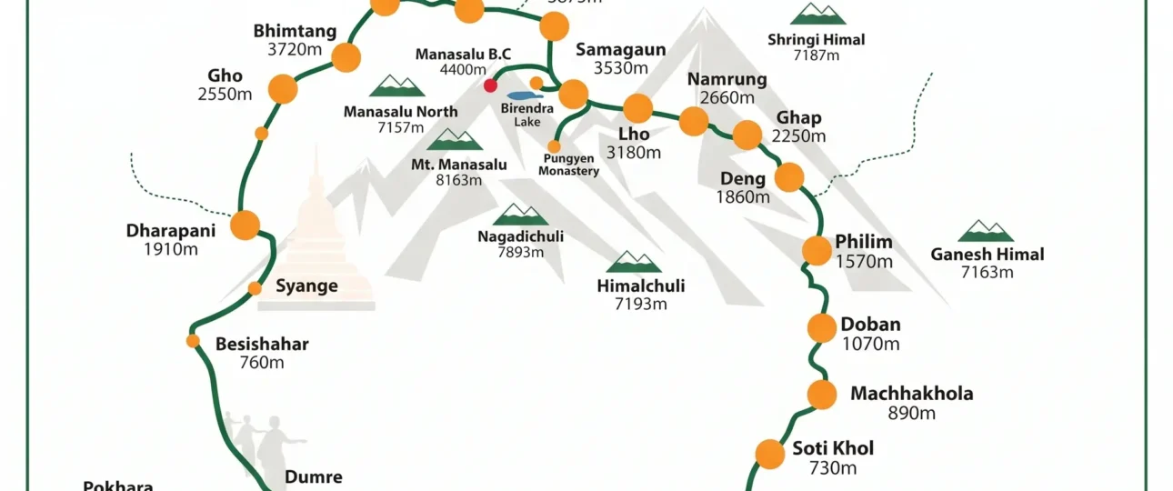
The Manaslu Circuit Trekking Map is the single most useful planning tool you can own for this trek — and the single most misunderstood. Most maps floating around online were drawn before the road reached Phillim. Some show the trek starting at Soti Khola. Others say Machha Khola. One marks Larkya La at 5,106m, another at 5,160m, and a third at 5,135m.
None of these maps are lying. They were drawn at different times, for different purposes, using different measurement methods. But if you are planning a 14-day trek through a restricted Himalayan valley where the trail changes every monsoon, “none of these maps are lying” is not the same as “this map is accurate for 2026.”
This guide does not just show you a Manaslu Circuit route map. It teaches you how to read it, where it is still reliable, where it has been overtaken by road construction, and how to navigate the route offline when your phone battery is the only thing keeping you pointed north.
What the Manaslu Circuit Route Map Actually Shows You
Open any Manaslu Circuit Trek Map and the first thing that hits you is the shape. It is not a circle. It is a horseshoe. You walk up the Budhi Gandaki Valley, cross a high pass at the top, and descend an entirely different valley — the Marsyangdi — on the other side.
That shape is not decorative. It tells you three things that matter for planning:
You never repeat ground. The trail is a one-way arc. There is no walking back to where you started.
The culture changes halfway. The lower valley is Hindu and Gurung. Above Namrung, the Nubri Valley is Tibetan Buddhist. The map shows the geography. It does not show the shift in food, language, and architecture that comes with it.
The two ends are connected by road, not trail. You cannot walk back to Machha Khola from Dharapani without crossing Larkya La again. That is why every itinerary ends with a jeep or bus transfer back to Kathmandu.
The Manaslu Circuit Trekking Map also shows something that a text itinerary cannot: how the trail hugs the river for the first five days, how it turns north into the upper valley, and how the descent from Larkya La drops faster than the climb. That last detail catches first-timers off guard. Descending 1,500m on tired legs at altitude is harder than ascending 650m fresh.
Where the Trek Starts: The Trailhead Confusion, Settled
The Manaslu Circuit route map you download will show one of three starting points. Here is what each one means for your trek:
Soti Khola (700m). The traditional start. Older maps begin here. If you start at Soti Khola, you add roughly 10–14km and a full day of walking through the lower valley. Some trekkers prefer this because it gives a more gradual entry to the trail. Others find the lower section unremarkable compared to what comes above.
Machha Khola (870m). The practical 2026 start for most itineraries. The road now reaches Machha Khola reliably, so most operators drive here and begin walking the next morning. This is the standard start point on current Manaslu trekking maps.
Jagat (1,400m) or Phillim. In the dry season, 4×4 jeeps can sometimes push as far as Jagat or Phillim, skipping another day of lower-valley walking. This is not guaranteed. Landslides and monsoon damage regularly block the road.
For planning purposes: assume the trek starts at Machha Khola. That is what the current Manaslu Circuit Trekking Map reflects, and that is where most 2026 itineraries begin.
The Elevation Profile, Read Properly
The elevation profile on a Manaslu Circuit elevation map is not a picture. It is a planning tool, and most trekkers do not know how to use it.
What the line tells you: From Machha Khola (870m) to Samagaon (3,525m), the profile climbs gradually over seven walking days. That is an average sleeping altitude gain of about 380m per day — slow enough for most people to acclimatize without medication.
What the line hides: The profile flattens through the Nubri Valley, but the sleeping altitude keeps climbing. By the time you reach Samagaon, you have spent two nights above 3,500m. The profile shows elevation, not acclimatization. Those are different things.
The steepest section: Between Namrung (2,660m) and Samagaon (3,525m), the trail gains nearly 900m of sleeping elevation over two days. This is where altitude symptoms appear. The Manaslu Circuit elevation profile shows the numbers. Your itinerary must show the rest day.
The descent: After Larkya La (5,106m), the profile drops sharply to Bimthang (3,590m). That is a 1,516m descent in a single day. On paper, it looks like relief. On the trail, it is a different kind of punishment.
Village-by-Village: Elevation, Distance, and Walking Time
This is the table that should be printed on every Manaslu Circuit Trek Map — and almost never is.
| Village | Elevation | Distance from Previous | Walking Time | Notes |
|---|---|---|---|---|
| Machha Khola | 869m | — | — | Roadhead; 2026 standard start |
| Jagat | 1,410m | 13–14km | 6–7 hrs | Police checkpoint; permit verification |
| Deng | 1,804m | 19–20km | 7–8 hrs | Last village before the gorge narrows |
| Namrung | 2,660m | 18–19km | 6–7 hrs | Entry to Nubri Valley |
| Lho | 3,180m | 10–17km | 4–6 hrs | First full view of Manaslu |
| Shyala | 3,500m | 4km | 2–3 hrs | Short day; treeline transition |
| Samagaon | 3,530m | 8–10km | 3–4 hrs | Acclimatization hub; side trips |
| Samdo | 3,875m | 8km | 3–4 hrs | Last permanent village |
| Dharamsala | 4,460m | 6km | 3–4 hrs | No village; shelters only |
| Larkya La | 5,106m | 15–16km | 9–11 hrs | Highest point; long descent |
| Bimthang | 3,720m | — | — | End of pass day |
| Dharapani | 1,963m | 22–24km | 7–8 hrs | Annapurna Circuit junction |
Total: ~110–120km of walking over 10–11 trekking days, depending on side trips and trailhead choice.
The Machha Khola-to-Jagat day and the Dharamsala-to-Bimthang day via Larkya La are the two hardest stages. Dharamsala to Bimthang is harder by altitude. Machha Khola to Jagat is harder by distance.
Larkya La on the Map: Why the Elevation Varies
Larkya La is marked at 5,106m (16,752 ft) on official Nepal maps, the Himalayan MapHouse NS505 trekking map, and most government survey data. Some GPS devices log it at 5,135m or 5,160m. Both figures appear on different Manaslu Circuit route maps.
The explanation is not controversial. The 5,106m figure is the cartographic standard used by Nepal’s Survey Department. GPS altimeters calculate altitude from barometric pressure, which shifts with weather. A 30–50m difference between the two is normal. For planning — permits, itinerary notes, insurance declarations — use 5,106m. That is what your operator, your permit, and your map will reference.
The map also shows something about Larkya La that matters more than the elevation: the pass is not a sharp notch. It is a broad, snow-covered shoulder that takes 45–60 minutes to cross once you reach the prayer flags. In whiteout conditions, visibility on that shoulder drops to zero. Your guide’s route-finding, not your map, determines whether you cross safely.
Road vs Trail: What the 2026 Map Really Shows
This is where every Manaslu Circuit Trekking Map published before 2025 is outdated.
Road construction along the Budhi Gandaki Valley has been advancing for years. As of 2026, the road has reached Phillim — roughly 20km upstream from Jagat. In the dry season, private 4×4 jeeps can drive as far as Jagat or Phillim, depending on conditions. Public buses currently operate only to Machha Khola.
What this means for your map:
The section from Soti Khola to Machha Khola is now largely road-walking. The trail exists, but you will be walking beside a jeep track for much of it.
Machha Khola to Jagat is a mix of trail and road. The trail is often better maintained than the road, especially after monsoon damage.
Above Phillim, the map still shows trail, because that is still what it is. The road has not reached the Nubri Valley.
The practical takeaway: If you are using a Manaslu trekking map from 2023 or earlier, the lower valley section is no longer accurate. The trail is still there, but it is not the quiet footpath the map implies.
September 2026 Bridge Status: What Changed and What Reopened
On September 6, 2026, a flash flood destroyed the Suksam/Therang River bridge near Namrung. The trail was officially suspended by the District Administration Office in Gorkha.
By September 9, residents of Chumnubri Rural Municipality had rebuilt a temporary wooden bridge and cleared an alternative trail across the crossing. The DAO confirmed that trekking on the Manaslu Circuit and Larkya La route could resume with necessary safety precautions.
What this means for your map: No published map reflects this temporary crossing. The map shows the original bridge location. The reality is a wooden crossing and a bypass trail. Your guide’s local knowledge is not replaceable by a map.
Side Trips and How They Appear on the Map
A good Manaslu Circuit route map shows the side trails branching from Samagaon. Here is what they are and how they fit into your itinerary:
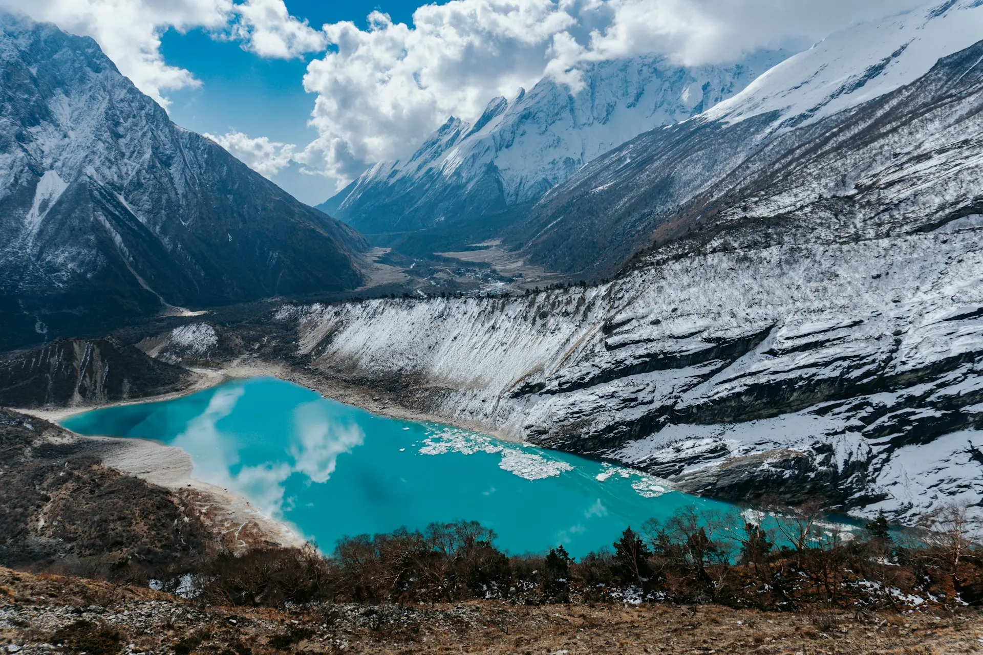
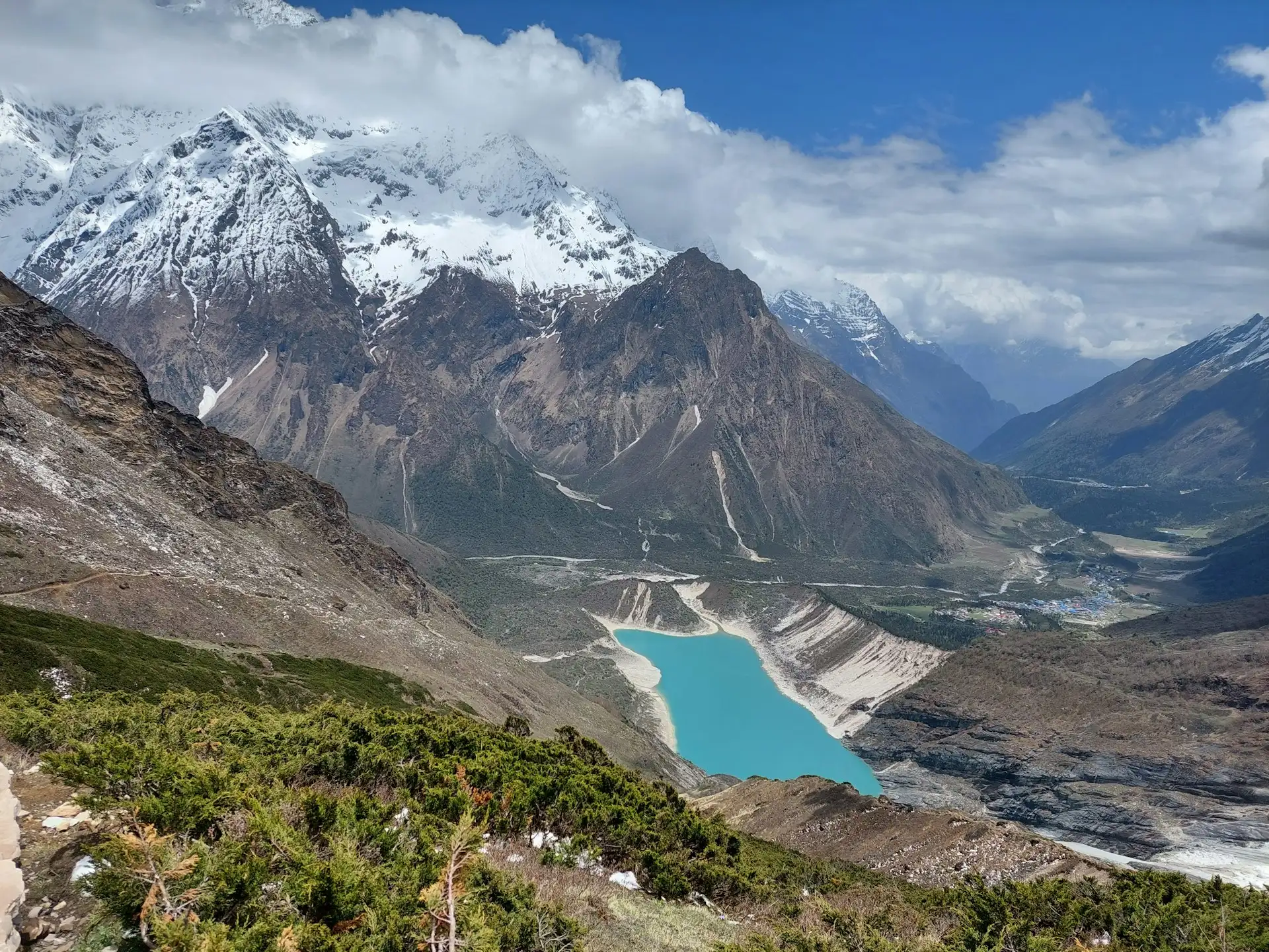
Birendra Lake (3,691m). A glacial lake 1–2 hours above Samagaon. The trail branches east from the village. It is the easiest acclimatization walk and the one most trekkers do.
Manaslu Base Camp (4,800m). A 6–8 hour round trip from Samagaon. The trail follows the Birendra Lake route, then climbs the moraine. This is a serious hike — higher than most people expect for a “side trip.” The map shows the trail. It does not show the altitude impact.
Pungyen Gompa. A monastery on the opposite side of the valley. The trail crosses the Budhi Gandaki and climbs to a ridge with views back toward Manaslu. Less visited than the lake or base camp, and a quieter alternative for acclimatization.
Tsum Valley connection. The Manaslu Circuit Trekking Map shows the Tsum Valley trail branching from near Lokpa, below Deng. Adding Tsum Valley extends the trek by 5–7 days and requires an additional permit.
Offline Navigation: GPX, Apps, and Battery Reality
A paper Manaslu Circuit Trek Map is excellent for planning. It is not sufficient for navigation on the trail.
What actually works:
Download a GPX file of the route before you leave Kathmandu. Load it into an offline navigation app — Gaia GPS, Maps.me, Komoot, or TrekGuard. These apps work with GPS only, no cell signal required. Test the app on a local hike before you leave home.
Paper map as backup. The Himalayan MapHouse NS505 (1:125,000) covers the Manaslu and Tsum Valley regions. It is the cartographic standard. Buy it in Kathmandu or order it before you travel.
Battery management. Your phone is your navigation device. Cold temperatures drain batteries faster. Carry a 10,000mAh power bank minimum, keep the phone inside your jacket, and charge at teahouses whenever the service is available (usually NPR 200–500 per charge).
What the map cannot do: The map shows the route. It does not show bridge status, landslide zones, or the temporary crossings that appear after monsoon damage. Your guide’s knowledge is the live layer that no map provides.
Permits and Checkpoints Marked on the Route
Your Manaslu Circuit Trekking Map should show where permit checks happen. Here is what to expect:
| Checkpoint | Location | What Happens |
|---|---|---|
| Arughat / Soti Khola | Lower valley | RAP and MCAP verification |
| Jagat | 1,410m | Permit check; police registration |
| Deng | 1,804m | MCAP checkpoint |
| Samagaon | 3,530m | Permit verification |
| Dharapani | 1,963m | ACAP entry checkpoint |
Permits required for 2026: Restricted Area Permit (RAP) at USD 100/week in peak season (Sep–Nov) or USD 75/week off-peak (Dec–Aug), plus USD 15/day or USD 10/day for each additional day beyond the first week. Manaslu Conservation Area Permit (MCAP) at NPR 3,000 (~USD 23–30). Annapurna Conservation Area Permit (ACAP) at NPR 3,000 (~USD 23–30). A local development fee of NPR 1,000–2,000 (~USD 8–15) is collected at Jagat.
A licensed guide is mandatory. Solo trekking is prohibited. Minimum group size is two trekkers plus a guide.
Planning with the Map: Acclimatization, Pace, and Contingency
The elevation profile on a Manaslu Circuit elevation map tells you where the trail goes. It does not tell you where to sleep, where to rest, or when to turn around.
Where to add days: Samagaon (3,530m) is the primary acclimatization stop. One full rest day is not optional for most trekkers. Use it for Birendra Lake or Manaslu Base Camp.
Where the map hides risk: The Namrung-to-Samagaon section gains nearly 900m of sleeping altitude in two days. The map shows the numbers. It does not show the headaches, nausea, and breathlessness that come with gaining that altitude too fast.
Contingency planning: Add 2–3 buffer days to your itinerary. Weather, altitude, and road conditions can all delay you. A 14-day trek is a 16–17 day trip in reality.
Frequently Asked Questions
1.Where does the Manaslu Circuit Trek start in 2026?
Most 2026 itineraries start at Machha Khola (869m). The road reaches Machha Khola reliably. Soti Khola (700m) is the traditional start but adds a day of lower-valley walking.
2.Is Larkya La 5,106m or 5,160m?
The official cartographic figure is 5,106m. GPS devices may read 5,135–5,160m due to barometric variation. Use 5,106m for planning and permits.
3.How long is the Manaslu Circuit Trek?
Approximately 110–120km of walking over 10–11 trekking days, or 177km total including road transfers and approach. Total trip length is usually 14–18 days from Kathmandu.
4.Do I need a guide for the Manaslu Circuit?
Yes. The Manaslu region is a restricted area. Solo trekking is prohibited. You need a licensed guide and a minimum group of two trekkers.
5.What permits do I need in 2026?
Restricted Area Permit (RAP), Manaslu Conservation Area Permit (MCAP), and Annapurna Conservation Area Permit (ACAP). All are obtained through a registered trekking agency.
6.How much of the trail is road now?
Road construction has reached Phillim. The Soti Khola-to-Machha Khola section is largely road-walking. Above Phillim, it is still trail.
7.Can I use Google Maps on the Manaslu Circuit?
No. Google Maps does not have reliable trail data for this region. Use a GPX file with an offline app like Gaia GPS, Komoot, or TrekGuard.
8.What is the hardest day on the Manaslu Circuit?
Dharamsala to Bimthang via Larkya La — 15–16km, 5,106m pass, 1,516m descent. It takes 9–11 hours.
9.Where is Manaslu Base Camp on the map?
It is a side trip from Samagaon, branching east. The trail climbs to 4,800m and takes 6–8 hours round trip.
10.What is the best month to cross Larkya La?
October. Weather is most stable, snow risk is lowest, and visibility is best.
11.How do I download a GPX file for the Manaslu Circuit?
Search for “Manaslu Circuit GPX” or check the Great Himalaya Trail website. Load the file into an offline navigation app before you leave Kathmandu.
12.Is the Manaslu Circuit open after the September 2026 flood?
Yes. A temporary wooden bridge was rebuilt at Namrung, and the DAO confirmed trekking could resume on September 9, 2026, with safety precautions.
13.What is the elevation of Samagaon?
3,530m. It is the main acclimatization stop on the trek.
14.How many hours do you walk each day?
Most days are 4–7 hours. The Larkya La crossing day is 9–11 hours.
15.Do I need crampons for Larkya La?
In spring and autumn, usually not. In winter or after heavy snow, yes. Your guide will advise based on current conditions.
Plan Your Manaslu Circuit with Wonder Hikes Nepal
The Manaslu Circuit Trekking Map is a starting point. Trail conditions, bridge status, and road construction change every season. A map from last year may not reflect this year’s trail.
Wonder Hikes Nepal builds Manaslu Circuit itineraries using current route information — including road updates, bridge repairs, and teahouse availability. If you are planning a 2026 trek and want an itinerary that matches the actual trail, not an outdated map, get in touch. We will help you plan a route that fits your pace, your acclimatization needs, and your timeline.