
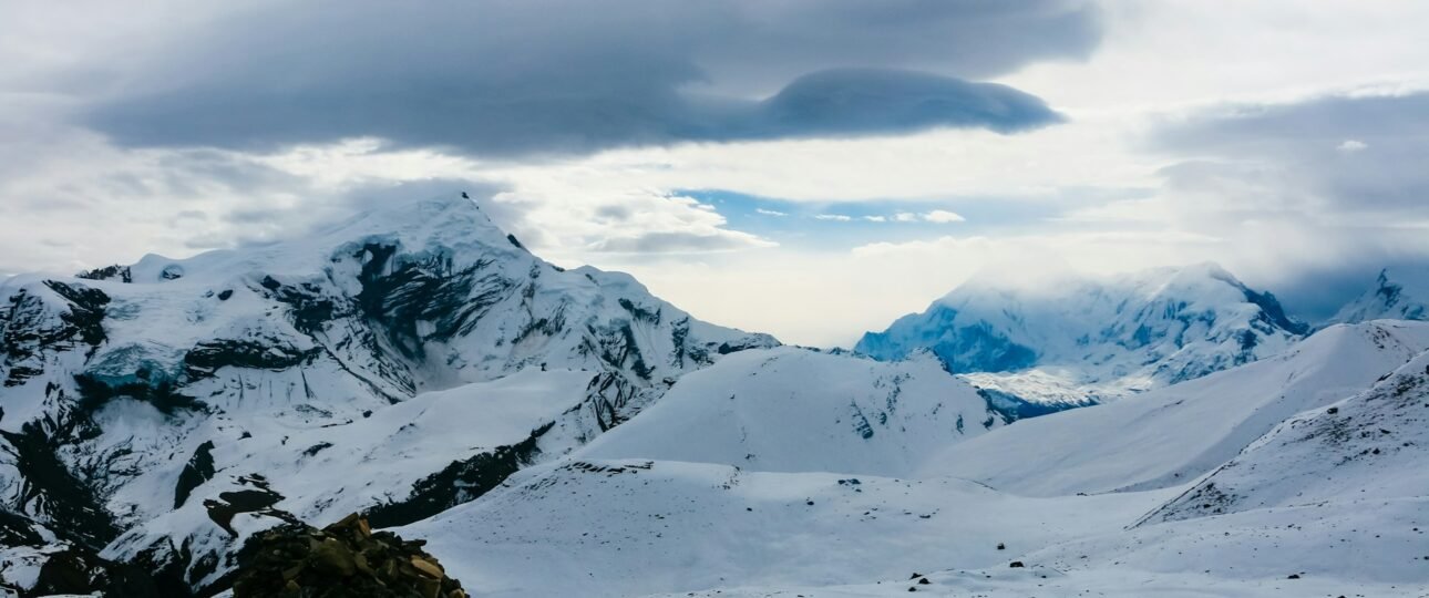
Introduction to Manang Annapurna Circuit
The Manang Annapurna Circuit stop is where the trek is won or lost. Manang sits at about 3,540 metres, roughly two days of walking below the Thorong La pass, and it is the place where almost every itinerary pauses for an acclimatisation day. This guide explains how to use that day well, which hikes are worth doing, what the free altitude talk covers, what the village offers, how the road has changed the approach, and what comes next. The altitudes and times come from operator guides and reference sources that differ slightly, so treat them as typical ranges and confirm details with your guide.
Manang Annapurna Circuit at a Glance
If you only need the essentials, start with this table. Manang is the main acclimatisation stop between the Marsyangdi valley and the high pass.
| Detail | What to know |
|---|---|
| Altitude | About 3,520 to 3,540 m (11,614 ft) |
| Location | Manang district, in the Marsyangdi valley north of the Annapurna range |
| Role on the circuit | Acclimatisation hub before Thorong La (5,416 m) |
| Standard stay | Two nights, with one full rest day |
| Rest-day hikes | Gangapurna Lake, Praken Gompa, Chongkor viewpoint, Ice Lake |
| Free altitude talk | Himalayan Rescue Association clinic, daily at about 3 p.m. in the trekking season |
| Next stage | Yak Kharka, about 4,050 m, in roughly 3 to 5 hours |
| Side trip | Tilicho Lake (4,919 m), adding about 3 to 4 days |
Where Manang Sits on the Circuit
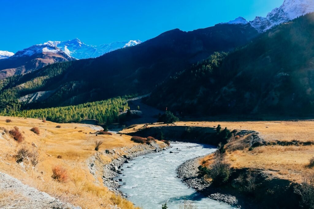
Manang is the largest village on the upper Marsyangdi, on the northern side of the Annapurna range, in a broad glacial valley under Gangapurna (7,455 m) and the Annapurna III ice wall. It sits roughly at the halfway point of the traditional circuit and is the last substantial settlement before Thorong La. Chame, at about 2,670 metres, is the district headquarters and a common starting point for shorter itineraries, and Pisang at about 3,200 to 3,300 metres is the usual stop the night before Manang.
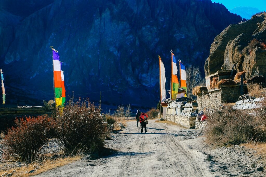
The setting explains why trekkers linger. The village is a cluster of flat-roofed stone houses along narrow lanes, with a small gompa and prayer wheels in the centre, and long views of the glaciers above. The Wikipedia entry for Manang notes that the village has a medical centre specialising in altitude sickness and that most groups trekking the circuit take resting days here before the pass. Manang also has a small airstrip at about 3,401 metres, though most travellers arrive on foot or by jeep.
How to Reach Manang
Road construction has changed the approach. A rough jeep road now runs from Besisahar (about 760 metres) up the Marsyangdi valley, passing through the trail for long stretches, and a vehicle can reach Manang in a single long day. Estimates range from roughly 5 to 12 hours depending on road conditions, weather and stops. Kathmandu to Besisahar by road takes around 6 to 8 hours.
| Option | What it involves | Acclimatisation effect |
|---|---|---|
| Walk the full approach | Several days from Besisahar or Dharapani through Chame and Pisang | Gradual gain, the traditional method |
| Jeep to Dharapani or Chame, then walk | Start walking at about 1,860 or 2,670 m | Moderate gain, a common compromise |
| Jeep straight to Manang | Besisahar to Manang in a day (Chame to Manang is about 30 km, 3 to 4 hours by jeep) | Very rapid gain, higher risk of altitude illness |
The jeep option deserves caution. A vehicle can lift you from about 760 metres to 3,540 metres in hours, a gain that used to happen over five to seven days on foot. If you drive, plan an extra night or two at Manang or lower, and do not treat the jeep as a shortcut past acclimatisation. For the route and distances, see our Annapurna Circuit trek map guide.
How the road changed the circuit
Per the Wikipedia entry on the Annapurna Circuit, the Besisahar to Manang jeep road now follows or crosses the trail for much of its length, and only two sections of two to three walking days, the Thorong La pass and the Ghorepani and Poon Hill section, are now without a motor road. Many itineraries that once took about three weeks now take 7 to 14 days.
The trade-off is real: the road saves days and gives you flexibility, but it brings dust and traffic to parts of the old trail, and it removes the gradual altitude gain that made the original circuit forgiving. Trekkers who want a quieter walk often start at Chame or use the newer side trails that avoid the road.

Choosing an itinerary around Manang
| Itinerary type | Typical length | Shape |
|---|---|---|
| Short circuit | 8 to 11 days | Jeep to Chame, walk to Muktinath over Thorong La, then fly or drive out from Jomsom |
| Standard circuit | 12 to 14 days | Walk from Dharapani or Chame, rest in Manang, cross the pass, finish at Jomsom or Tatopani |
| Circuit with Tilicho Lake | 16 to 20 days | Standard route plus the Tilicho detour and extra acclimatisation |
Whatever shape you choose, protect the Manang rest day. It is the one stop you should never trade away to save time.
The elevation ladder in one table
Seeing the numbers side by side makes the scale of the climb clear. These are typical figures, and they vary by a few dozen metres between sources.
| Place | Approx. altitude |
|---|---|
| Besisahar | 760 m |
| Dharapani | 1,860 m |
| Chame | 2,670 m |
| Pisang | 3,200 to 3,300 m |
| Manang | 3,540 m |
| Yak Kharka | 4,050 m |
| Thorong Phedi | 4,450 m |
| Thorong High Camp | 4,850 m |
| Thorong La | 5,416 m |
| Muktinath | 3,700 to 3,800 m |
Why Manang Is the Acclimatisation Hub
Everything above Manang is higher than most people have slept before. The CDC’s guidance on high-altitude travel recommends that, above 3,000 metres, your sleeping altitude rises by no more than about 500 metres a day, with an extra rest day for every additional 1,000 metres gained. It also notes that fitness does not change your risk. The Manang Annapurna Circuit rest day exists to apply that rule.
Using typical figures, the sleeping-altitude steps look like this.
| Move | Approx. gain in sleeping altitude |
|---|---|
| Pisang (about 3,300 m) to Manang (about 3,540 m) | About 240 m, then a rest day |
| Manang to Yak Kharka (about 4,050 m) | About 510 m |
| Yak Kharka to Thorong Phedi (about 4,450 m) | About 400 m |
| Thorong Phedi to High Camp (about 4,850 m), if used | About 400 m |
The Himalayan Rescue Association post in Manang is reported to recommend spending about five nights between arriving in Manang and crossing the pass, as the Thorong La entry on Wikipedia notes. A standard itinerary meets that with two nights in Manang and further nights at Yak Kharka and Thorong Phedi or High Camp. Operators repeatedly name skipping the Manang rest day, ascending too fast after it and ignoring early symptoms as the main reasons trekkers fail to cross.
The Rest-Day Principle: Climb High, Sleep Low
A rest day does not mean lying in bed. The best approach is to climb above Manang, stay there for a while and come back down to sleep, which exposes your body to higher altitude without raising your sleeping altitude. Keep the effort gentle, drink water, eat well and avoid overdoing it, because a hard day can leave you drained before the next stage.
Who should add an extra night
Two nights is the standard, not a rule. Consider a third night if any of these apply:
- You drove from Besisahar or Chame and gained altitude in hours rather than days.
- You slept badly at Pisang or Manang, or you have had a persistent headache.
- You have had altitude illness before.
- Your group is mixed, and one person is moving more slowly than the rest.
- You plan to add Tilicho Lake, which stresses the body at nearly the height of the pass.
An extra night costs a day and a little money. A forced descent from Thorong Phedi costs far more.
A Typical Rest Day, Hour by Hour
Most groups follow a similar pattern. Treat the times as a guide, not a rule.
- Morning. A late breakfast, then a light hike to Gangapurna Lake or the Chongkor viewpoint, or a longer outing if you are fit and feel strong.
- Late morning to lunch. Return to the village, drink plenty of water and eat a carbohydrate-rich meal.
- Early afternoon. Rest, wash clothes, repack and check your kit for the cold days ahead.
- About 3 p.m. Attend the Himalayan Rescue Association altitude talk, and ask your questions.
- Late afternoon. A walk around the village and the gompa, or a break in a bakery.
- Evening. An early dinner and bed, because Yak Kharka comes next, and the days after that are longer.
If cloud or rain closes in, keep the plan but shorten the outing. Walk around the village, visit the gompa, attend the talk, rest and eat well. A quiet day indoors is still a useful acclimatisation day, as long as you do not go higher to sleep.
Rest-Day Hikes Compared
Four options dominate, and they suit different fitness levels. Altitudes and times vary between sources, so treat the figures as approximate.
| Hike | High point | Time | Effort | Best for |
|---|---|---|---|---|
| Gangapurna Lake and viewpoint | About 3,540 to 3,700 m | About 30 minutes to 3 hours, depending on the variation | Easy to moderate | Most trekkers, glacier views |
| Chongkor viewpoint | Above the village | Short, often combined with the lake | Easy | Views of Manang, the icefall and Annapurna III |
| Praken Gompa | About 3,900 to 3,950 m | About 3 hours round trip | Moderate | Culture and a mid-level climb |
| Ice Lake (Kicho Tal) | About 4,600 to 4,620 m | About 6 to 9 hours round trip | Demanding, about 1,100 m gain | Fit, well-acclimatised trekkers |
Gangapurna Lake and Chongkor viewpoint
Gangapurna Lake sits opposite the village at the foot of the Gangapurna glacier, about 30 minutes from the centre by the shortest route. Icebergs sometimes float in the lake in late autumn. For more effect, continue up to the Chongkor viewpoint, which gives a view over Manang, the icefall and the ridge above. It is the most popular option because it is short, scenic and gentle.
Praken Gompa
Praken Gompa is a cave monastery above Manang at about 3,900 to 3,950 metres, sometimes described as the monastery of a hundred lamas. The round trip takes about three hours and is rated moderate, so it combines a useful climb with a quiet cultural stop.
Ice Lake
Ice Lake, known locally as Kicho Tal, is the serious option. It sits at about 4,600 to 4,620 metres, a gain of roughly 1,100 metres from Manang, and the round trip takes six to nine hours. It gives the strongest acclimatisation stimulus on the circuit, but it is a hard day and not a rest day in the usual sense. Choose it only if you feel strong, and turn around if you develop symptoms. If you are unsure, do Gangapurna and Praken instead, because the next two days will ask a lot of you.
The Free Altitude Talk in Manang
One of the most useful things you can do in Manang costs nothing. The Himalayan Rescue Association runs an aid post in the village during the trekking season, staffed by volunteer doctors, and holds a free talk on altitude sickness every afternoon, usually at 3 p.m. The doctors explain the symptoms of acute mountain sickness and the more serious forms, answer questions and can check your oxygen saturation with a pulse oximeter. Several operators schedule the rest day around it, and it is worth attending even if you have trekked at altitude before.
Go with a clear question in mind. Ask what symptoms mean you should not go higher, how your own checks compare with typical values at 3,540 metres, and what to do if a companion becomes unwell.

Altitude Illness: Symptoms and Rules to Follow
Acute mountain sickness feels like a hangover. Headache is the main symptom, usually with at least one of loss of appetite, dizziness, fatigue, nausea or vomiting. It typically starts a few hours after ascending, often during the first night at a new altitude, and usually settles if you rest without climbing higher.
The dangerous forms are rarer but need quick action. Confusion, loss of balance and unusual drowsiness can signal swelling of the brain. Chest congestion, a cough and breathlessness at rest can signal fluid in the lungs. For both, descent is urgent.
- Do not go up to sleep higher while you have symptoms, however mild.
- Tell your guide early. Do not hide a headache to keep to the schedule.
- Descend if symptoms worsen despite rest.
- Talk to a doctor before you go, especially if you have heart or lung conditions or have had altitude illness before. They can advise on whether preventive medication makes sense for you.
Questions to ask your guide in Manang
- How are we feeling as a group, and who has had headaches or poor sleep?
- Which hike suits today, given everyone’s condition?
- What will we do if someone develops symptoms at Yak Kharka or Thorong Phedi?
- Do we have a spare day in the schedule if the weather or our health demands it?
What Manang Offers: Services, Food and Rest
Manang is the last place on the circuit with a real range of comforts, which is part of its appeal after several days of simple lodges.
- Bakeries and cafes. Apple pie, coffee and baked goods are a ritual for many groups.
- Cinema. Several guides mention small cinemas with daily film screenings.
- Gear shops and laundry. You can replace missing items, though prices are higher than in Kathmandu.
- Pharmacy and clinic. The Himalayan Rescue Association post and a medical centre focus on altitude problems.
- Banking. Some guides list a bank or ATM, but do not rely on it, and carry enough cash for the days ahead.
- Heritage. A small gompa in the village centre, with prayer wheels along its walls, and the nearby monasteries.
Most itineraries spend two nights here. Teahouses in Manang are among the most comfortable on the route, with more menu choice than Yak Kharka or Thorong Phedi, but rooms remain basic and unheated, so pack accordingly.
Where to Sleep and Eat in Manang
Teahouses line the main lanes, and standards vary. Expect small twin rooms, a shared dining room and a menu built around dal bhat, noodles, momos, eggs and soup. Hot showers and device charging usually cost extra, and prices rise as you gain altitude. Eat even when your appetite is low, because cold and altitude blunt hunger and the days ahead burn a lot of energy. Boiled water is cheaper than bottled water, and a filter or tablets reduce plastic waste.
Food, water and hygiene
A stomach upset at 3,500 metres is miserable and can be mistaken for altitude illness, so take simple precautions. Wash or sanitise your hands before eating, drink boiled or treated water, and choose freshly cooked hot meals over anything that has been sitting out. Keep drinking regularly, and tell your guide if you vomit or cannot keep fluids down, because dehydration and altitude illness make each other worse.
Visiting Manang Respectfully
Manang is a living village, not a stage set. Walk clockwise around prayer wheels and mani walls, ask before photographing people, keep your voice down near the gompa and take your rubbish with you. Buy meals and supplies locally, hire local guides and porters through registered agencies, and make sure staff have proper clothing and shelter for the cold. The money you spend here helps a community that depends on a short trekking season.
Tilicho Lake: The Big Side Trip From Manang
Tilicho Lake, at about 4,919 metres, is the most popular extension from Manang. It adds roughly three to four days, though some operators quote two to four, and it builds extra acclimatisation if you have the time. A typical route looks like this.
| Day | Plan | Approx. altitude |
|---|---|---|
| 1 | Manang to Khangsar, with a possible stop at Shree Kharka | Khangsar about 3,734 to 3,756 m; Shree Kharka about 4,050 to 4,060 m |
| 2 | Onward to Tilicho Base Camp, crossing a landslide-prone slope | About 4,150 m |
| 3 | Pre-dawn climb to Tilicho Lake and back to base camp | Lake at about 4,919 m |
| 4 | Walk across to Yak Kharka and rejoin the circuit | About 4,050 m |
The lake day is hard. It climbs about 800 metres from base camp over loose scree and takes five to eight hours, and the stretch between Khangsar and base camp crosses a steep landslide zone where phone signal is poor. Start early, move carefully and check current trail conditions before you commit. Tilicho is almost as high as Thorong La, so it is a serious objective, not a stroll. Add it only if you feel strong, have spare days and are well acclimatised.
Should you add Tilicho?
Think about three things. First, time: the side trip adds three to four days, and walking it as a return to Manang, without crossing the pass, makes a trip of roughly 10 to 12 days, while combining it with the full circuit stretches the whole trek to about 13 to 16 days or more. Second, your fitness and acclimatisation: if you have struggled at Manang or Yak Kharka, skip it. Third, risk: the landslide-prone section and the long, steep lake day mean you need good weather, early starts and a guide who knows the trail. If any of those worry you, the circuit is rewarding without it.
Best Time to Visit Manang
Spring and autumn are the main windows for the whole circuit. October and November are the most reliable, with clear skies and stable weather, though also the busiest. March and April bring warmer days and rhododendrons on the lower trail, and May carries a higher chance of pre-monsoon storms.
| Season | What to expect at Manang and above |
|---|---|
| October to November | Most stable weather and the busiest lodges. Nights are cold. |
| March to April | Warming days. Mornings at the pass are cold, and April is usually steadier. |
| May | Warmer, with pre-monsoon storms possible. |
| June to August | Monsoon. The northern side of the range lies in a rain shadow, so Manang is far drier than the south, but clouds and wet lower sections limit views. |
| December to February | Severe cold and snow. Thorong La can close, and several lodges above Manang shut for the season. |
If you are thinking about a cold-season trip, read our guide to Nepal in the winter, and always ask your agency for current conditions before you commit to the upper section.
Permits, Guides and Costs
Rules change often, so confirm current requirements with a registered agency before you pay.
- Annapurna Conservation Area Permit (ACAP). Required for the circuit, and reported at about NPR 3,000 (roughly US$25 to US$30) for most foreigners. There is a permit checkpoint at Dharapani.
- TIMS card. Some operators list about US$10, while others report that requirements have changed. Ask your agency.
- Licensed guide. Since April 2023, a licensed guide arranged through a registered agency has been required on many national park and conservation-area routes. Check the current rule for the circuit.
- No restricted-area permit. Unlike Manaslu or Upper Mustang, the circuit does not need one.
Operator guides quote guided circuit packages from roughly US$2,200 to about US$2,700 in 2026, depending on length and inclusions. Compare what is included, such as permits, guide, porter, meals and transport. Our Annapurna Circuit trek cost guide breaks down the budget, and our trekking permits guide explains the fees.
What to Pack for Manang and Beyond
Pack for cold nights at altitude and a long, cold crossing day. A warm layering system and a properly rated sleeping bag matter more than gadgets.
- Down jacket. A heavy one for evenings in unheated dining rooms.
- Layers. Thermal base layers, a warm mid layer and a windproof and waterproof shell.
- Hands, head and face. Insulated gloves with liners, a warm hat, a balaclava or buff and sunglasses.
- Sleeping bag. Rated for freezing nights, with a liner.
- Boots and socks. Warm, broken-in boots and spare wool socks.
- Trekking poles. They help on the steep rest-day hikes and on the long descent after the pass.
- Headlamp. Carry spare batteries, because cold drains them.
- Hydration. An insulated bottle, because bladders and tubes freeze higher up.
- Sun protection. Sunscreen, lip balm and sunglasses, because UV is strong at altitude.
After Manang: Yak Kharka, Phedi and the Pass
The days beyond Manang are deliberately short. The trail climbs through Tengi and Gunsang into open alpine pasture, and the vegetation thins as you gain height.
| Stage | Approx. altitude | Typical walking time |
|---|---|---|
| Manang to Yak Kharka | About 4,020 to 4,050 m | About 3 to 5 hours |
| Yak Kharka to Thorong Phedi, via Letdar | About 4,450 m | About 3 to 4 hours |
| Phedi to High Camp (optional) | About 4,850 m | About 1 to 2 hours, steep |
| Crossing Thorong La to Muktinath | 5,416 m, then about 3,700 to 3,800 m | About 7 to 10 hours |
Yak Kharka is a bare collection of teahouses with cold evenings and a short menu, so it is a place to rest, not to explore. If you want to see how the circuit compares with other routes in the region, our Annapurna hiking guide covers the options route by route.
A Quick Checklist for Your Manang Day
- Arrive early enough to rest, eat and drink before the first night.
- Plan the rest day around the 3 p.m. altitude talk.
- Pick a hike that matches how you feel, not how you want to feel.
- Climb high, then sleep low, and keep the effort gentle.
- Eat carbohydrate-rich meals and keep drinking water.
- Collect cash, repair kit and any missing gear before Yak Kharka.
- Tell your guide about every symptom, even a mild headache.
Common Mistakes at Manang
- Skipping the rest day. It is the most common reason trekkers fail the crossing.
- Treating the rest day as a hard hike. Ice Lake is a serious day, so choose it only if you feel strong.
- Driving straight to Manang. A rapid gain from Besisahar raises the risk of altitude illness.
- Missing the altitude talk. It is free and can change how you read your own symptoms.
- Hiding symptoms. Altitude illness gets worse quickly, so speak up early.
- Adding Tilicho without spare days. It is a serious extension, not a casual side trip.
- Assuming a bank or ATM will work. Carry enough cash for the days ahead.
Frequently Asked Questions About Manang on the Annapurna Circuit
- How high is Manang? Manang sits at about 3,520 to 3,540 metres (11,614 feet), and sources vary slightly. It is the main acclimatisation stop on the Annapurna Circuit.
- How many days should I spend in Manang? Most itineraries spend two nights, which gives one full rest day. Add another night if you feel unwell or if you drove most of the approach.
- Do I need an acclimatisation day in Manang? Yes. Operators repeatedly name skipping it as one of the most common reasons trekkers fail to cross Thorong La. Use the day to climb high and sleep low.
- What is the best acclimatisation hike from Manang? Gangapurna Lake and the Chongkor viewpoint suit most people. Praken Gompa is a moderate option, and Ice Lake at about 4,600 metres is the most effective but also the hardest.
- Is there a free altitude talk in Manang? Yes. The Himalayan Rescue Association post runs a free daily talk, usually at about 3 p.m. in the trekking season, with volunteer doctors explaining symptoms and checking oxygen levels.
- Can I drive to Manang? Yes. A rough jeep road reaches Manang from Besisahar in a long day, but the rapid gain raises the risk of altitude illness. Plan extra acclimatisation if you drive.
- How far is Manang from Thorong La? Thorong La is about two walking days beyond Manang, usually via Yak Kharka and Thorong Phedi, with the crossing itself taking about 7 to 10 hours.
- How long is the Tilicho Lake side trip from Manang? It adds about three to four days, via Khangsar and Tilicho Base Camp, and includes a landslide-prone section. Some operators quote two to four days.
- What is there to do in Manang? You can hike to Gangapurna Lake or Praken Gompa, visit the village gompa, attend the altitude talk, eat in the bakeries and rest. Some guides also mention a small cinema.
- When is the best time to visit Manang? October and November are the most reliable, followed by March and April. Winter is cold and can close the pass, and the monsoon brings cloud although the north side is drier than the south.
Plan Your Manang Annapurna Circuit Trek With Wonder Hikes Nepal
A good plan for the Manang Annapurna Circuit stage depends on your dates, how you approach Manang and how you handle altitude. A realistic schedule, a guide who watches your symptoms and a spare day make the difference between a comfortable pause and a rushed one.
To get a plan that fits, contact Wonder Hikes Nepal and share:
- The month or season you are considering and how many days you have.
- Your trekking experience and any altitude history.
- Whether you want to walk the approach or use the jeep road.
- Your rough budget and group size.
Send us those details, and we will help you choose a route and schedule that gives you the best chance of a safe, comfortable crossing.
Author: Rajan Pandit
Ready to plan your trek?
Tell us your dates and group size. We reply on WhatsApp within a few hours.