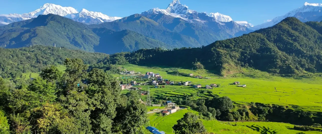
Dingboche Nepal sits at 4,410 metres (14,470 feet) in the Imja Valley of the Khumbu region, and it is where the Everest Base Camp trek fundamentally changes character. The trail below Tengboche still winds through rhododendron forests and Sherpa settlements where life feels connected to lower valleys. Above Dingboche, the landscape opens into glaciated terrain, the tree line disappears entirely, and every step carries the weight of thin air. Most Everest Base Camp itineraries schedule two nights here because the body needs time to adapt before pushing toward Lobuche and Gorak Shep. But treating Dingboche as nothing more than a mandatory rest stop misses what makes this village genuinely distinctive: its sun-drenched valley setting, its living Sherpa community, and the Nangkartshang Peak hike that delivers some of the finest panoramic views on the entire route.
This guide covers Dingboche altitude, weather by season, lodge facilities, the acclimatization routine that keeps trekkers safe, and how this village compares to its neighbour Pheriche. Whether you are building an Everest Base Camp itinerary or planning a side trip toward Island Peak, understanding what Dingboche offers will help you plan a better trek.
What Is Dingboche Nepal?
Dingboche Nepal is a Sherpa village in the Khumbu region of northeastern Nepal, located within Sagarmatha National Park, a UNESCO World Heritage Site. It sits at 27°53′37″ N latitude and 86°49′51″ E longitude in the Imja Valley, just off the main Everest Base Camp trail. The village population was estimated at approximately 200 in 2011, though that number swells significantly during trekking seasons when lodges fill with trekkers, guides, and support staff.
Some trekking resources call Dingboche the “last Sherpa village” on the Everest Base Camp route. The label captures something true: Dingboche is one of the last permanent settlements before the trail enters the seasonally uninhabited, glaciated terrain above Dughla and Lobuche. But it is not the final Sherpa community in the Khumbu. Villages like Chhukung, further up the Imja Valley toward Island Peak, also have Sherpa residents. The phrase works as useful shorthand, not as a precise geographical fact.
Where Is Dingboche Located?
Dingboche altitude places it well above the tree line in a broad, south-facing valley that catches sunlight from mid-morning until late afternoon. The village sits northeast of Tengboche and Pangboche, and the Imja Khola flows along its eastern edge, carrying glacial meltwater from the Imja Glacier and the slopes of Island Peak. To the north, the trail continues toward Dughla and Lobuche. To the east, a side valley leads to Chhukung and the Kongma La pass.
There are no roads to Dingboche. Every supply, from lodge furniture to food to fuel, arrives by yak, mule, or porter. This is one reason prices for charging devices, Wi-Fi, and hot showers are higher here than in lower villages. It also means that everything you see in Dingboche has been carried up the trail by human or animal labour.
The walk from Tengboche to Dingboche covers 12 kilometres and takes 6 to 7 hours depending on pace and conditions. From Dingboche, the trail to Lobuche covers 11 kilometres and takes 5 to 6 hours, gaining roughly 530 metres of elevation. The distance from Dingboche to Everest Base Camp is approximately 12 to 15 kilometres via Lobuche and Gorak Shep, though most trekkers break the journey over two days.
Dingboche Elevation: How High Is It Really?
Dingboche elevation is most commonly cited at 4,410 metres (14,470 feet). This is the figure used by Wikipedia, most trekking companies, and the majority of guidebooks. However, some sources list slightly different numbers. Komoot lists the village at 4,350 metres, while some trekking itineraries cite 4,460 metres or 4,480 metres. These variations arise from differences in measurement methods, the specific point in the village being measured, and rounding conventions.
For practical purposes, 4,410 metres is the standard reference. At this altitude, the air pressure is roughly 60 percent of sea level, meaning each breath delivers significantly less oxygen. This is why the acclimatization stop matters so much: the body needs time to adapt before ascending further. Dingboche sits well above the tree line, and the surrounding peaks—Ama Dablam, Lhotse, Island Peak, Makalu—dominate the skyline in every direction.
Why Dingboche Matters on the Everest Base Camp Trek
Dingboche is the second major acclimatization stop on the standard Everest Base Camp itinerary, after Namche Bazaar at 3,440 metres. The first rest day in Namche helps the body adjust to moderate altitude, but it is not enough on its own. Before trekkers push past 4,400 metres toward Lobuche and Gorak Shep, the body needs another pause. Dingboche provides that pause at a sleeping altitude of 4,410 metres, which is high enough to stimulate adaptation but low enough to allow recovery.
The acclimatization logic follows the “climb high, sleep low” principle. Ascending to a higher elevation during the day—typically the Nangkartshang Peak hike to roughly 5,083 metres—stimulates red blood cell production and improves oxygen transport. Returning to sleep at Dingboche’s lower altitude allows the body to recover without overloading itself. This pattern is repeated throughout the upper Everest trek, but Dingboche is where it becomes essential.
Dingboche is also a decision point. From here, trekkers can continue on the main Everest Base Camp route toward Lobuche and Gorak Shep. Alternatively, they can detour east toward Chhukung for Island Peak, the Kongma La pass, or the Three Passes trek. The village functions as a hub for multiple high-altitude objectives, and many climbing groups use it as a staging point before moving higher.
What Is Dingboche Really Like?
Dingboche feels different from the villages below it. The air is thinner, the wind is sharper, and the landscape is more exposed. The Imja Valley opens up around the village, giving it a sense of space that tighter settlements like Pangboche do not have. Because the valley faces the sun, Dingboche receives more direct sunlight than Pheriche, its neighbour 170 metres lower and about 30 to 40 minutes away on foot. This makes Dingboche noticeably warmer during the day, though nights are cold year-round.
The village itself is small but lively during trekking seasons. Lodges line the main path, and the dining halls fill up in the evenings with trekkers comparing notes on altitude, food, and the next day’s route. There is a bakery or two, a few shops selling basic supplies, and a health post that can provide basic medical advice. The stone-walled fields around the village are planted with barley and potatoes during the brief summer growing season. Buddhist prayer flags flutter across the landscape, and the local monastery serves as a spiritual centre for the community.
One of the most distinctive features of Dingboche is its winter migration. Many residents leave the village during the coldest months, facing below-zero temperatures and heavy snowfalls, and migrate to lower-altitude villages like Pangboche or Tengboche, returning in spring to plant crops. The village does not empty completely, but it becomes much quieter. Trekkers who visit in winter should expect limited services and a very different atmosphere.
Dingboche and Sherpa Culture
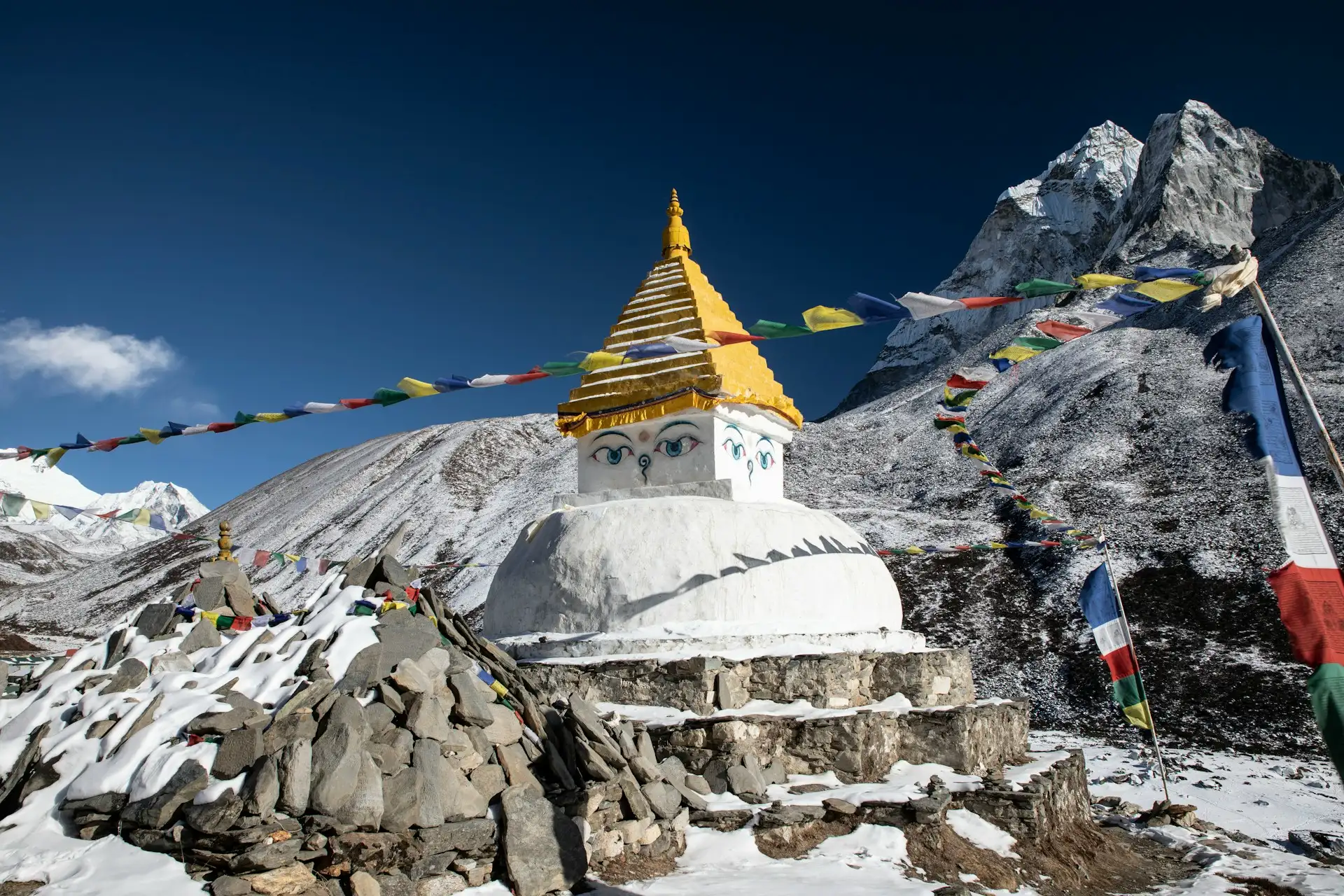
Dingboche is a Sherpa village. The Sherpa people are an ethnic group of Tibetan descent who migrated to the Khumbu region centuries ago. Their language, religion, and traditions are distinct from other Nepali ethnic groups. Sherpa culture is closely tied to Tibetan Buddhism, and the mani walls, chortens, and prayer flags visible throughout the village and along the trails are not decorations—they are part of a living spiritual landscape.
Agriculture remains part of village life, though tourism has become the primary livelihood. Sherpa families grow barley, potatoes, and other hardy crops during the short growing season. Yak herding is also part of the local economy, with yaks used for transport and milk production. Many Sherpa families in Dingboche operate lodges, and some have members who work as climbing Sherpas or trekking guides.
Visitors should understand that Sherpa is an ethnicity, not a job title. Not all Sherpas are climbers or guides. Not all mountain workers are Sherpa. Treating “Sherpa” as a synonym for “porter” or “guide” is inaccurate and disrespectful. When you interact with people in Dingboche, you are interacting with members of a community that has its own history, language, and traditions, not simply service providers.
What to Do in Dingboche
Dingboche offers more than a place to sleep. The acclimatization day is an opportunity to explore the surrounding landscape, and the village itself is worth a slow walk.
Nangkartshang Peak Acclimatization Hike
The Nangkartshang hike is the standard acclimatization activity in Dingboche. The peak rises to approximately 5,083 metres directly above the village. The route is a steep climb, gaining roughly 690 metres over 5.36 kilometres, and takes 3 to 5 hours round trip depending on pace and altitude response. The trail begins on the ridge behind the village and ascends steadily through rocky terrain. There are several false summits, and the altitude makes every step feel harder than it would at sea level.
Trekkers who are struggling can turn around at any point. The goal is not to reach the top but to spend time at a higher elevation and return to sleep lower. The views from the upper sections are exceptional, with Ama Dablam dominating the skyline and Lhotse, Makalu, and Island Peak visible in the distance. Do not attempt this hike if you are already feeling unwell. If you have a headache that will not go away, nausea, or unusual breathlessness at rest, rest in the lodge instead. Acclimatization happens even at village level, and pushing too hard can worsen symptoms.
Explore Dingboche Village
The village itself is small enough to walk in an hour. The stone-walled fields, the mani stones, and the prayer flags are worth slow attention. Lodges often have sunny courtyards where you can sit with tea and watch the light change on Ama Dablam. The bakery is a popular stop for trekkers craving something other than dal bhat.
Walk Toward Chhukung
The trail toward Chhukung follows the Imja Khola upstream, past stone-walled fields and yak pastures. It is a gentle walk compared with the Nangkartshang climb, gaining about 300 metres over roughly 5 kilometres. The route takes 2 to 3 hours one way and offers close views of Island Peak. Chhukung is the gateway to Island Peak Base Camp and the Kongma La pass, which connects to the Everest Base Camp trail near Lobuche.
Enjoy the Himalayan Views
Dingboche is surrounded by some of the most recognisable peaks in the Khumbu. Ama Dablam (6,812 m) dominates the southern skyline. Lhotse (8,516 m) rises to the north. Makalu (8,485 m) is visible to the east. Island Peak (6,189 m) sits at the head of the Imja Valley. Cholatse (6,440 m) and Taboche (6,495 m) are visible to the west. The light is best in the early morning and late afternoon.

Dingboche Acclimatization Day
The acclimatization day in Dingboche follows the “climb high, sleep low” principle. The idea is to ascend to a higher altitude during the day, spend enough time there to stimulate the body’s adaptation mechanisms, and then return to sleep at a lower altitude where recovery is easier.
A typical acclimatization day looks like this: wake up, eat breakfast, and start the Nangkartshang hike by mid-morning. Ascend gradually, taking rest breaks. Spend 20 to 30 minutes at the highest point you reach. Return to Dingboche by mid-afternoon. Rest, hydrate, and eat an early dinner.
What not to do: do not push through severe symptoms. Do not ascend further if you feel unwell. Do not skip the acclimatization day because you feel fine. Some trekkers feel perfectly well at Dingboche and assume they can continue. Acclimatization is not about how you feel in the moment; it is about how your body will respond 500 metres higher the next day.
Symptoms to monitor include headache, nausea, dizziness, loss of appetite, unusual breathlessness at rest, and difficulty sleeping. Mild symptoms often improve with rest and hydration. Symptoms that worsen, or that include confusion, difficulty walking, or breathlessness at rest, require immediate descent and medical attention. The Himalayan Rescue Association clinic in Pheriche, about 30 to 40 minutes away, provides free altitude talks and medical support during trekking seasons.
Dingboche Weather by Season
| Season | Months | Temperature Range | Conditions | Trekking Suitability |
|---|---|---|---|---|
| Spring | March–May | -5°C to 12°C (day); -10°C to -2°C (night) | Clear mornings, afternoon clouds, occasional snow | Excellent. Rhododendrons bloom lower down. |
| Summer/Monsoon | June–August | 2°C to 13°C (day); -2°C to 5°C (night) | Rain, cloud, leeches at lower elevations; snow at Dingboche | Possible but not recommended. Views obscured. |
| Autumn | September–November | -5°C to 10°C (day); -12°C to -3°C (night) | Clear skies, stable weather, cold nights | Excellent. Best visibility. |
| Winter | December–February | -10°C to 3°C (day); -20°C to -10°C (night) | Extreme cold, snow, many lodges closed | Possible for experienced trekkers. Limited services. |
Spring and autumn are the best seasons for trekking through Dingboche. Spring offers warmer temperatures and blooming rhododendrons at lower elevations. Autumn offers the clearest mountain views and stable weather. Both seasons see the highest number of trekkers. During the winter it is possible to trek, but the vast majority of places of accommodation are closed and the cold is intense, rarely above freezing point. Monsoon brings rain, cloud, and poor visibility. The trail becomes muddy and slippery. Dingboche receives less rain than lower villages due to its altitude, but cloud cover often obscures the mountains.
Accommodation, Food, Wi-Fi and Electricity
Dingboche has a range of lodges and tea houses, from basic to relatively comfortable. Rooms are typically small, with two beds, blankets, and a shared bathroom. Some lodges have attached bathrooms with hot showers, usually for an additional fee. Prices for rooms are negotiable during quieter seasons but fixed during peak spring and autumn.
Food is available in lodge dining halls. Typical options include dal bhat (rice, lentil soup, and vegetables), noodle soups, fried rice, momos, pancakes, and apple pie. The bakery in Dingboche is a popular stop for coffee and baked goods. Vegetarian options are widely available. Meat is less common at this altitude, partly because of refrigeration challenges and partly because of Buddhist dietary practices in the Khumbu.
Wi-Fi is available in most lodges but is often slow and unreliable. It usually requires a password and may be free or chargeable depending on the lodge. Charging electronics is possible in most lodges, usually for a fee of a few hundred rupees per device. Power banks are useful because charging points are limited and electricity can be intermittent. Hot showers are available in some lodges for an additional fee.
What to Pack for Dingboche
Dingboche-specific packing advice focuses on cold, wind, sun exposure, and altitude.
-
Layering system: Base layer, mid-layer (fleece or down), and windproof/waterproof shell.
-
Insulated jacket: Down or synthetic, rated for sub-zero temperatures.
-
Windproof shell: Essential for afternoon winds.
-
Hat, gloves, buff: Protect extremities from cold and wind.
-
Sunscreen (SPF 50+): The sun is intense at 4,410 metres.
-
Sunglasses (Category 4): Glacier glasses recommended for snow reflection.
-
Lip balm with SPF: Prevents chapping.
-
Water purification: Tablets or filter; bottled water is expensive and environmentally problematic.
-
Snacks: Energy bars, nuts, chocolate.
-
Headlamp: Useful for early starts and lodge power cuts.
-
Power bank: For charging devices when lodge power is limited.
-
Altitude medication: Consult your doctor before travelling. Acetazolamide (Diamox) is commonly prescribed for altitude.
-
Trekking poles: Helpful for the Nangkartshang descent.
-
Sleeping bag liner: Lodges provide blankets, but a liner adds warmth and hygiene.
Dingboche vs Pheriche
| Feature | Dingboche | Pheriche |
|---|---|---|
| Elevation | 4,410 m | 4,371 m |
| Sun exposure | Sunny, open valley | Windier, less sun |
| Atmosphere | Busier, more lodges, bakeries | Quieter, fewer lodges |
| Acclimatization hike | Nangkartshang Peak (5,083 m) | Gentle ridge walks |
| Medical facility | Basic health post | Himalayan Rescue Association clinic |
| Best for | Acclimatization on the way up | Recovery, medical support, descent |
| Walk between | ~30–40 minutes apart |
Dingboche is the better choice for the acclimatization night on the way up. It is higher, sunnier, and offers the Nangkartshang hike, which is the most effective acclimatization climb on this section of the trail. Pheriche is the better choice if you are feeling unwell, because it has the Himalayan Rescue Association clinic and a quieter environment. Most itineraries route trekkers through Dingboche going up and Pheriche coming down.
Dingboche to Lobuche
The trek from Dingboche to Lobuche is 11 to 12 kilometres depending on the route and takes 5 to 6 hours. The trail ascends gradually, gaining about 530 metres. The route passes through Dughla, where a cluster of memorial chortens honours climbers who have died on Everest and other peaks. The climb to Dughla is steady, with some rocky sections. From Dughla, the trail continues to Lobuche, which sits at 4,940 metres.
This section is where the altitude becomes more noticeable. Many trekkers find the Dingboche-to-Lobuche day harder than expected, not because of distance but because of the elevation gain and thinner air. Walking slowly and taking regular breaks helps.
Dingboche and Island Peak
Dingboche is the gateway to Island Peak (Imja Tse), a 6,189-metre trekking peak that is popular as a first Himalayan climbing objective. From Dingboche, trekkers walk east to Chhukung (4,730 m), which takes 2 to 3 hours. From Chhukung, the trail continues to Island Peak Base Camp (5,100 m). The climb involves glacier travel and requires prior acclimatization, technical skills, and a guide.
Most Island Peak itineraries include a rest and acclimatization day in Dingboche before moving to Chhukung. The Dingboche acclimatization day is important not just for the main Everest Base Camp trek but also for anyone planning to climb Island Peak or cross the Kongma La pass.
Altitude Safety in Dingboche
Altitude response varies between individuals. Some trekkers feel fine at Dingboche; others struggle. Fitness does not prevent altitude sickness. Young, fit trekkers can develop acute mountain sickness while older, less fit trekkers feel fine. There is no reliable way to predict how your body will respond.
Symptoms of altitude sickness include headache, nausea, dizziness, loss of appetite, and difficulty sleeping. Mild symptoms often improve with rest, hydration, and time. Symptoms that worsen, or that include confusion, difficulty walking, or breathlessness at rest, may indicate high-altitude cerebral edema or high-altitude pulmonary edema, which are medical emergencies requiring immediate descent.
Do not push through severe symptoms. Do not ascend further if you feel unwell. The Himalayan Rescue Association clinic in Pheriche provides free altitude talks during trekking seasons and can assess and treat altitude-related conditions. If you are unsure whether your symptoms are serious, err on the side of caution and seek medical advice.
Responsible Tourism in Dingboche
Dingboche is a community, not just a service stop. Trekkers can support the village by staying in local lodges, buying from local shops, and treating residents with respect. Waste management is a challenge at altitude; carry out what you carry in, and avoid single-use plastics where possible.
Choose trekking operators that treat their staff fairly. Ask about insurance, pay, and safety protocols. Sherpa guides and porters are essential to the Everest trekking industry, and their working conditions matter. In April 2026, Nepal’s Department of Tourism issued a notice warning trekking agencies against promoting overnight stay packages at Everest Base Camp without prior approval, clarifying that only authorised personnel are allowed to stay at base camps. This is part of a broader effort to regulate the expedition industry and protect the interests of local workers.
Is Dingboche Worth Visiting?
Dingboche is essential for most Everest Base Camp trekkers. It is the main acclimatization stop above Namche Bazaar, and skipping it increases the risk of altitude sickness higher up. But it is also worth visiting for its own sake. The village has a distinct character, the views are exceptional, and the Nangkartshang hike is one of the most rewarding day hikes in the Khumbu.
Wonder Hikes Nepal works with local Sherpa guides and supports responsible trekking practices. If you are planning an Everest Base Camp trek or a trekking peak expedition, we can help you plan an itinerary that includes appropriate acclimatization and realistic expectations.
Frequently Asked Questions
1. What is Dingboche Nepal?
Dingboche is a Sherpa village in Nepal’s Khumbu region at approximately 4,410 metres. It is the main acclimatization stop on the Everest Base Camp trek after Namche Bazaar.
2. Where is Dingboche located?
Dingboche is in the Imja Valley of Solukhumbu District, inside Sagarmatha National Park. It lies northeast of Tengboche and Pangboche, on the main Everest Base Camp trail.
3. What is the elevation of Dingboche?
Dingboche is commonly cited at 4,410 metres (14,470 feet). Some sources give slightly different figures due to measurement variations.
4. Why is Dingboche important for Everest Base Camp trekkers?
Dingboche is the second major acclimatization stop on the standard itinerary. Most trekkers spend two nights here to reduce the risk of altitude sickness before ascending above 4,500 metres.
5. What is the Dingboche acclimatization hike?
The standard acclimatization hike is to Nangkartshang Peak (approximately 5,083 m). It is a steep climb that takes 3 to 5 hours round trip and offers panoramic views.
6. What is the weather like in Dingboche?
Dingboche has a tundra climate. Spring and autumn offer the best trekking conditions. Winters are extremely cold, and monsoon brings cloud and rain.
7. Where can you stay in Dingboche?
Dingboche has a range of lodges and tea houses. Rooms are basic but comfortable, with shared or attached bathrooms. Hot showers and Wi-Fi are available for a fee.
8. Is there Wi-Fi in Dingboche?
Yes, most lodges have Wi-Fi, but it is often slow and unreliable. It may be free or chargeable.
9. Can you charge electronics in Dingboche?
Yes, most lodges offer charging for a fee. Power can be intermittent, so a power bank is useful.
10. What mountains can you see from Dingboche?
Ama Dablam, Lhotse, Makalu, Island Peak, Cholatse, and Taboche are visible from Dingboche and the surrounding trails.
11. How far is Dingboche from Lobuche?
Dingboche to Lobuche is 11 to 12 kilometres depending on the route, taking 5 to 6 hours.
12. Dingboche or Pheriche — which is better?
Dingboche is sunnier, busier, and better for acclimatization on the way up. Pheriche is quieter, windier, and has the Himalayan Rescue Association clinic.
13. Can you hike from Dingboche to Chhukung?
Yes. The walk from Dingboche to Chhukung takes 2 to 3 hours and follows the Imja Khola. Chhukung is the gateway to Island Peak Base Camp and Kongma La.
14. Can you reach Island Peak from Dingboche?
Yes. Dingboche is the main access point for Chhukung and Island Peak Base Camp. Most Island Peak itineraries include a rest day in Dingboche.
15. What should you pack for Dingboche?
Pack layers, an insulated jacket, windproof shell, hat, gloves, sunscreen, sunglasses, water purification, snacks, headlamp, power bank, and any prescribed altitude medication.
Conclusion
Dingboche is more than a rest stop. It is where the Everest Base Camp trek enters the high-altitude zone, where the body begins to adapt to thinner air, and where Sherpa culture continues despite the challenges of altitude and climate. For trekkers, it is a place to slow down, acclimatize properly, and prepare for the higher sections ahead. For anyone planning an Everest Base Camp trek or a side trip to Island Peak, understanding Dingboche’s role in the itinerary is essential. Wonder Hikes Nepal can help you plan a trek that respects the mountain, the culture, and your own physical limits.
Ready to plan your trek?
Tell us your dates and group size. We reply on WhatsApp within a few hours.