Kyanjin Gompa Viewpoint
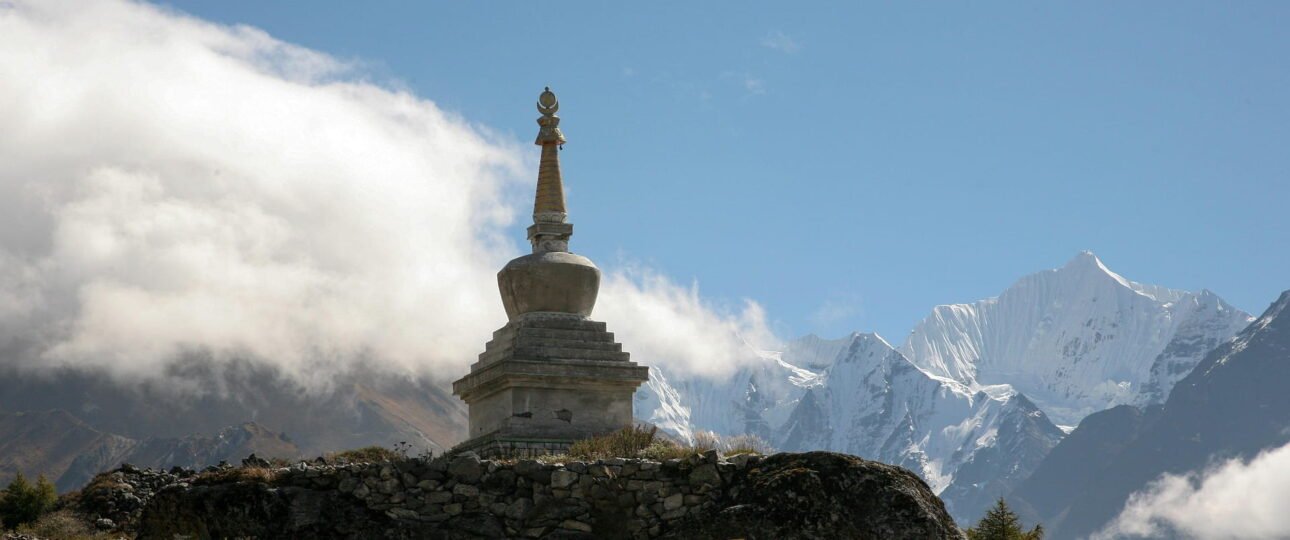
Situated at an altitude of 3,870 m, Kyanjin Gompa is the heart of the Langtang Valley Trek. It is where the valley floor opens wide, the forest that covered most of the walk from Syabrubesi is entirely gone, and the peaks that have been visible in glimpses for two days are suddenly present in a way that stops feeling like scenery and starts feeling like proximity. Langtang Lirung’s north face — 7,227 m of ice and rock — fills the sky directly above the village. The Langshisha glacier’s tongue presses down from the northeast. Yak pastures spread west toward the valley’s upper reaches.
The views at Kyanjin Gompa langtang don’t require a climb to be extraordinary. They are present at village level, in the monastery courtyard, from the teahouse dining room window, on the walk to the cheese factory. But they reach their full expression on the two day hikes that rise from the valley on either side — Kyanjin Ri to the south and Tserko Ri to the north — each offering a different relationship with the same peaks, at different altitudes, with different demands and different rewards.
This guide covers all of it: the village-level viewpoint experience, what Kyanjin Ri specifically gives you and when, what Tserko Ri adds and what it asks of you in return, the glacial lake extension that most trekkers miss entirely, and how to choose between the options given your time, fitness, and acclimatization state.
The Village Itself: The Most Underrated Viewpoint on the Langtang Trek
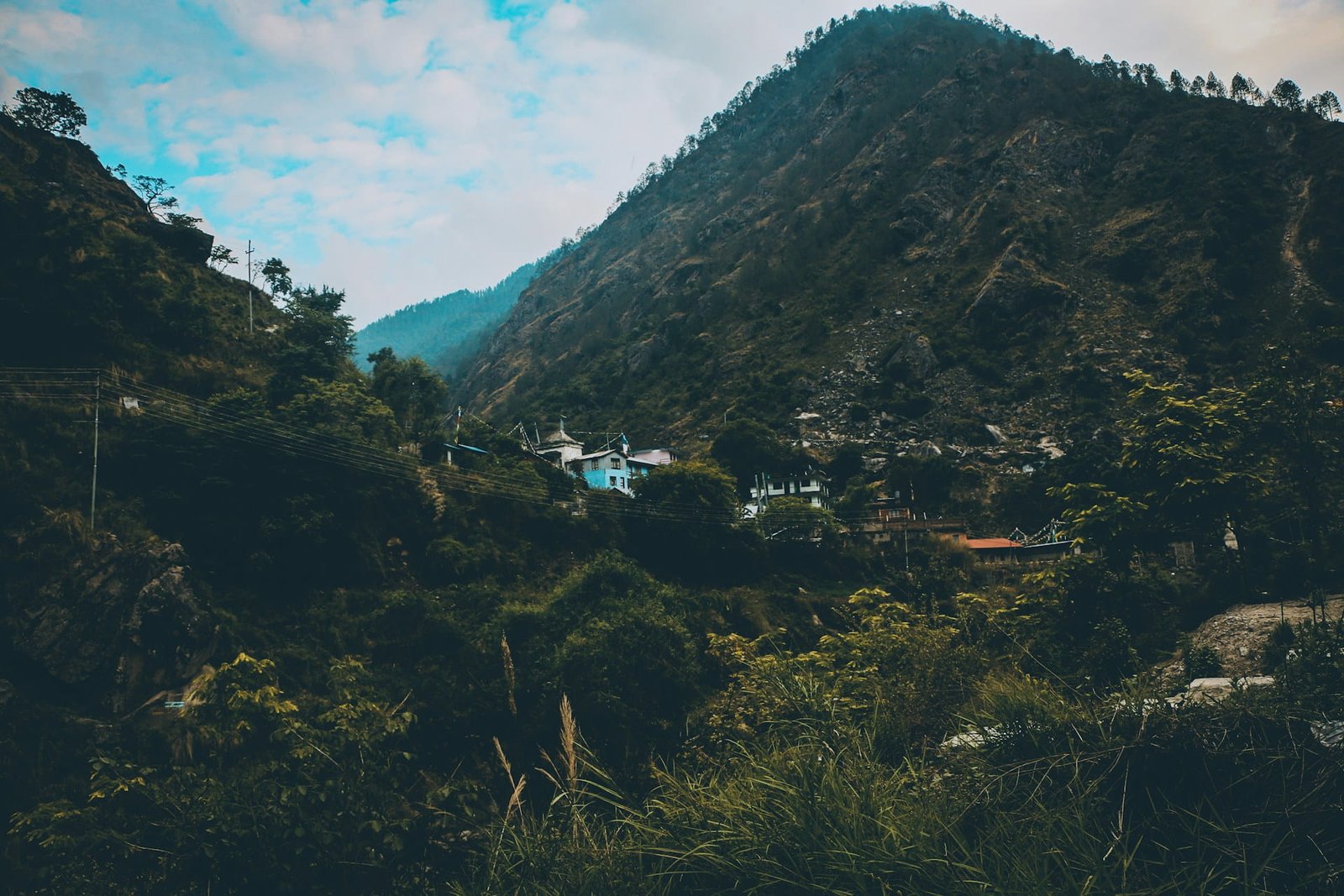
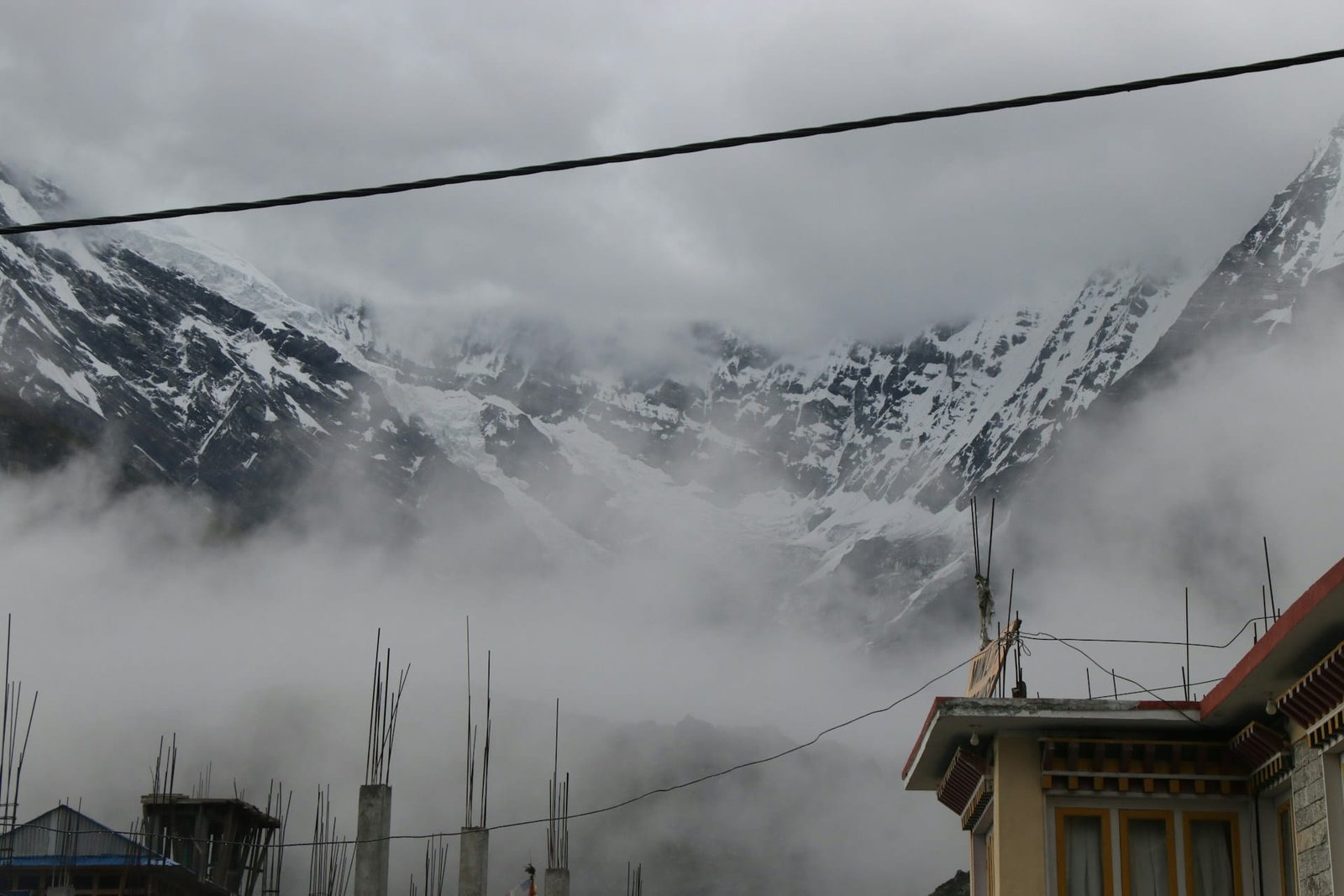
Most other sources about Kyanjin Gompa’s views treat the village as a base from which to climb to the real viewpoints above it. This is the wrong frame. The valley floor at 3,870 m, before anyone attempts a climb, is one of the most visually distinctive places on any standard Nepal trek.
Kyanjin Ri offers some of the most rewarding panoramic views of Langtang Lirung available on the standard Langtang trek route. From the summit, the visible peaks include: Langtang Lirung (7,227 m) filling the northern views. But Langtang Lirung fills the northern view from the village floor equally — and from here, the composition includes the monastery, the mani walls, the yaks, and the human settlement in a way that the bare summit above doesn’t.
The monastery itself is an ancient Tibetan Buddhist structure, active and in daily use. Visiting Kyanjin Gompa, an ancient Buddhist monastery where trekkers can witness monks chanting prayers and spinning prayer wheels. The sound of the prayer wheel turning and the occasional low drone of butter lamps burning in the interior is the specific sensory quality of Kyanjin Gompa at dawn — before anyone else is up, before the day hike crowds begin moving, while the mountains are still catching early light. It is the version of this place that’s worth setting an alarm for even if you’re not climbing that morning.
The late afternoon is equally purposeful. As the sun drops toward the western ridgeline, the light on Langtang Lirung’s ice face moves from white to gold and then to the deep pink of alpenglow — a ten to twenty minute sequence that happens every clear evening from the village floor and doesn’t require you to have earned it through a five-hour climb. Trekkers who were on Tserko Ri that morning often describe watching the same alpenglow from the teahouse steps that evening as the day’s second visual peak.
Kyanjin Ri (4,773 m) — The Reliable Sunrise Viewpoint
Kyanjin Ri is the most reliable sunrise platform in the entire Langtang area. The east-facing slope catches the first light directly, and on clear mornings, the effect on Langtang Lirung is extraordinary. Kyanjin Ri is one of the few viewpoints where the pre-dawn mountain air is cold but the walking warm-up happens fast enough that the wait for first light is genuinely comfortable.
At 4,773 m, Kyanjin Ri is the lower of the two viewpoints. It is located directly behind the Kyanjin Gompa village. Climb time: 2-3 hours up, 1 hour down. The ascent gains more than 750 m in vertical over a relatively short horizontal distance — while short in distance, don’t underestimate this hike as it is incredibly steep and reaches heights of 4,700 meters. The trail begins directly behind the village, rising steeply through open ground with no technical terrain but sustained gradient from the first few minutes.
Most trekkers depart Kyanjin Gompa at around 4:30 a.m. to hike to Kyanjin Ri in time for sunrise. This timing is the single most practically important piece of planning information for this viewpoint. The east-facing orientation means the first light hits the peaks around the same time you’d want to be on the summit — a 4:30 a.m. departure puts most reasonably fit trekkers at the top between 6:30 and 7:00 a.m., which is exactly the right arrival window for the sunrise sequence.
What the summit gives you is specific and worth describing precisely. From Kyanjin Ri, you get an intimate view of the village below and a front-row seat to the Langtang Lirung icefall. You can hear the ice cracking and see the avalanches tumbling down the 7,000 m peak safely across the valley. The icefall audibility — large seracs calving and the sound traveling across the valley — is one of those experiences that trekking guides rarely mention and trekkers consistently cite as unexpectedly affecting. It makes Langtang Lirung feel alive in a way that a purely visual encounter doesn’t.
Kyanjin Ri upper summit provides the cleanest panoramic views of Langtang Lirung without foreground obstruction. Yala Peak (5,520 m) is visible to the east, and Dorje Lakpa (6,966 m) sits to the southeast — together forming the eastern wall of the valley that closes the panorama on the right side of Langtang Lirung’s central mass.
The descent: roughly one hour, on the same steep gradient in reverse. Trekking poles are strongly recommended — the loose soil on dry days and wet rock surface on damp mornings both demand care on the way down.
Who Kyanjin Ri is for: Trekkers who want the sunrise experience and can handle a steep 2-3 hour climb. Those feeling altitude effects after arriving at Kyanjin Gompa can treat Kyanjin Ri as an acclimatization hike before attempting Tserko Ri the following day — which is the recommended two-day strategy for anyone with itinerary flexibility.
Tserko Ri (5,033 m) — The Full-Horizon Langtang Panorama
Tserko Ri stands as the clear highlight of the Langtang Valley trek for experienced hikers. It is a different category of experience from Kyanjin Ri — not just higher, but fundamentally more expansive in what it reveals.
Standing tall at 5,033 m, Tserko Ri is a different beast. The vertical gain from Kyanjin Gompa is approximately 1,150 m — the Tserko Ri viewpoint towers over Kyanjin Gompa and has almost 1,500 m of vertical gain to the summit. The approach begins similarly to Kyanjin Ri, passing through yak grazing areas and open alpine land, before the trail becomes progressively more rocky and exposed on the upper section. In the beginning, the ascent feels gradual, but the trail becomes steeper as you gain altitude. There are no tea houses or shops along the route, so you must carry enough water, snacks, and warm clothing.
The summit itself has a distinctive character that exists nowhere else on this route: a festival years ago at the summit involved carrying many large wooden poles to the top. Those poles remain — weathered, wrapped in fraying prayer flags that crack and snap in the wind — creating a summit that feels marked by human intention in a way bare viewpoint summits often don’t.
What the summit reveals is worth laying out specifically, because it’s the key planning information: from Tserko Ri, you are above the world. You can see deep into Tibet, look down upon the entire Yala Glacier, and spot peaks like Dorje Lakpa and Langshisha Ri that remain hidden from the lower viewpoint. The Tibetan plateau visibility is the defining addition over Kyanjin Ri — and it includes Shishapangma (8,027 m), the fourteenth-highest mountain in the world, located entirely within Tibet. On a clear day, Shishapangma appears across the border as a massive, flat-topped massif — an 8,000 m peak visible from a day hike. This is, genuinely, not something that happens on many Himalayan trekking routes.
Tsergo Ri at dawn offers stunning mountain views across a full 180-degree arc, with the Langtang Himalayas lit from behind as the sun rises over the eastern ridgeline. The sunrise from Tserko Ri requires an even earlier start, typically 3:30 to 4:00 a.m., given the longer ascent. This is the most demanding wake-up on the entire Langtang Valley Trek — 3:30 a.m. in temperatures that can reach -10°C or lower at altitude, with roughly four to five hours of climbing ahead. Headlamps are essential. So are full cold-weather layers for the summit wait.
The wind warning: High winds on Tserko Ri can be dangerous after 12:00 PM. We recommend a 5:00 AM start for Tserko Ri to ensure you are off the summit before the afternoon clouds roll in. The wind on Tserko Ri’s exposed summit is not the gentle breeze of lower viewpoints — it is high-altitude Himalayan wind, and by early afternoon it can be strong enough to be genuinely hazardous. Summit by 9:00-10:00 a.m. and begin the descent before the wind builds.
Who Tserko Ri is for: People should acclimate for a day or two before trying the hike from Kyanjin Gompa. The route requires genuine physical fitness for sustained climbing above 4,000 m, and altitude affects different people differently at this elevation. The ideal preparation is arriving at Kyanjin Gompa, spending one night, climbing Kyanjin Ri on the first morning as an acclimatization hike, resting for the afternoon, sleeping a second night, and then tackling Tserko Ri on the second morning with the benefit of two nights at altitude and one acclimatization climb already done.
The Glacial Lake Walk — The Extension Most Trekkers Miss
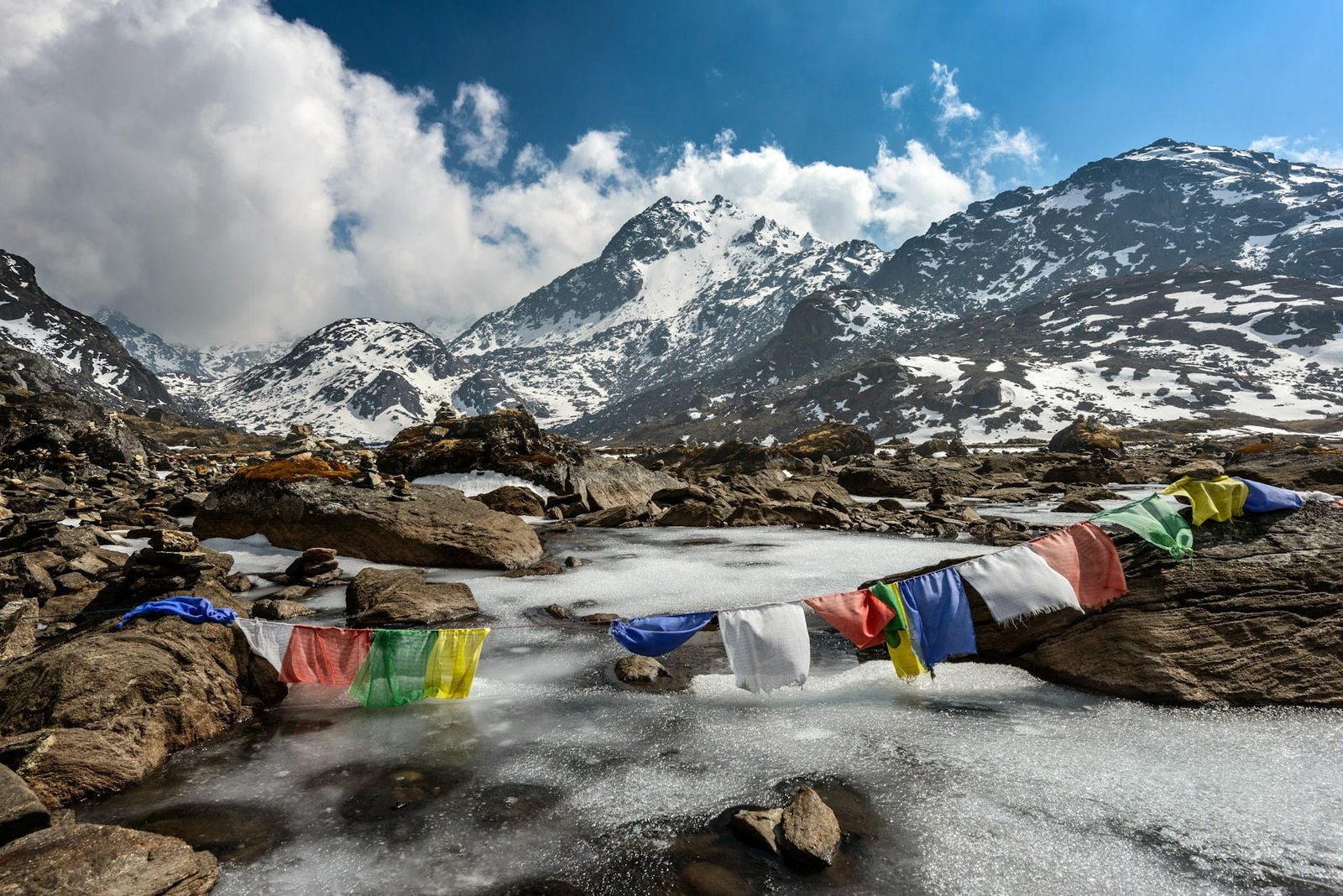
Beyond the two main viewpoint climbs, Kyanjin Gompa viewpoint offers a third visual experience that almost no competing guide adequately covers: the walk toward the Langshisha glacier and the glacial lake above the valley floor.
The glacier tongue descends from the northeast above Kyanjin Gompa, and a trail follows the valley floor upstream in that direction — through increasingly open, rocky terrain with the glacier’s blue-white edge growing larger as you approach. The glacial lake sits at the glacier’s snout, fed by meltwater and typically a vivid grey-blue color from suspended glacial sediment.
This walk requires no climbing and no technical ability — it is a flat to gently inclined valley walk of roughly 2-3 hours return. What it offers is a completely different visual register from the two ridge climbs: proximity to the glacier itself rather than views of it from above, the sound of meltwater channeling under rock, and the specific quality of silence in a high-altitude glacial environment where even the wind drops in the valley floor.
For trekkers who have already done one or both ridge climbs and have a spare afternoon, or for those who arrived late and don’t have the energy for a summit push, the glacial lake walk is a genuinely rewarding alternative that makes purposeful use of the valley’s visual character at its own level.
The Two-Day Strategy: How to See All of It in Kyanjin Gompa Langtang
For those who have the flexibility in their itinerary, a highly rewarding approach is to spend two nights in Kyanjin Gompa — ascending Kyanjin Ri on the first morning as an acclimatisation hike and tackling Tserko Ri the following day. This strategy not only increases your safety at high altitude but ensures you don’t miss out on the two most iconic viewpoints of the Langtang Valley.
This is the recommendation for anyone whose itinerary allows it, and it’s worth building in deliberately. The logistics: arrive at Kyanjin Gompa on day one after walking from Langtang village. Rest the afternoon — acclimatize, visit the cheese factory, walk the village. Day two: rise at 4:30 a.m., climb Kyanjin Ri for sunrise, descend by mid-morning, rest the afternoon. Day three: rise at 3:30-4:00 a.m., climb Tserko Ri, summit by 9:00-10:00 a.m., descend by early afternoon before wind, begin the return walk to Langtang village.
The cheese factory visit fits naturally into the first afternoon — the Kyanjin Cheese Factory, established with Swiss collaboration, produces local yak cheese. It is a working cooperative, not a tourist demonstration, and the cheese available for purchase is among the more genuine trail food experiences in Nepal. The glacial lake walk fits as either a first-afternoon alternative or a second-afternoon option if your energy after Tserko Ri descent allows it.
Frequently Asked Questions about Kyanjin Gompa Viewpoint
- Which is better, Kyanjin Ri or Tserko Ri?
Kyanjin Ri is the more popular and easier of the two hikes, offering a shorter, less strenuous climb with a fantastic close-up view of Langtang Lirung and the icefall. Tserko Ri offers a 360-degree panoramic view including peaks like Shishapangma in Tibet and Dorje Lakpa that remain hidden from the lower viewpoint.
If you can only do one: Tserko Ri for the wider panorama and the Tibet view; Kyanjin Ri for the sunrise experience and a more manageable commitment. If your itinerary allows two days at Kyanjin Gompa, do both. - How long does it take to climb Kyanjin Ri?
2-3 hours up, 1 hour down. Depart by 4:30 a.m. for sunrise timing. - How long does it take to climb Tserko Ri?
Just a 3-4 hour hike from Kyanjin Gompa to the summit, plus descent. Allow 5-6 hours round trip. Depart at 3:30 to 4:00 a.m. to reach the summit before wind builds. - Do I need to acclimatize before attempting Tserko Ri?
Yes. People should acclimate for a day or two before trying the hike from Kyanjin Gompa. Attempting Tserko Ri on the same day you arrive at Kyanjin Gompa after walking from Langtang village is altitude management risk. Spend at least one night at 3,870 m first. - What mountains can you see from Tserko Ri?
Langtang Lirung (7,227 m), Langtang Ri (7,205 m), Yala Peak (5,520 m), Naya Khang (5,844 m), and Shishapangma (8,027 m) in Tibet, plus Dorje Lakpa, Langshisha Ri, and the full arc of the Langtang Himalayas. - Is Kyanjin Gompa langtang worth visiting without doing the hikes?
Completely. The village-level views of Langtang Lirung, the active monastery, the cheese factory, and the glacial lake walk are each substantial experiences independent of the ridge climbs. The viewpoint experience at Kyanjin Gompa begins at 3,870 m, not at the summits above it. - What should I bring for the Langtang Trek?
Warm layered clothing including a down jacket and windproof shell, trekking poles (strongly recommended for both ascents and descents), 1.5-2 liters of water, high-energy snacks, a headlamp with fresh batteries for the pre-dawn start, and sunscreen — UV exposure above 4,500 m is significantly stronger than at sea level. - What is the altitude and difficulty level of Kyanjin Ri compared to Tserko Ri?
Kyanjin Ri tops out around 4,773 m and is considered a moderate climb suited to most trekkers with reasonable fitness. Tserko Ri reaches roughly 5,033 m and demands more sustained effort and better acclimatization, making it the harder of the two despite the relatively modest difference in altitude. - Can I do both Kyanjin Ri and Tserko Ri on the same day?
It’s physically possible but not commonly recommended, since both hikes start pre-dawn and each already takes half a day round trip. Most itineraries that include both spread them across two separate mornings, which also gives a better chance of catching clear conditions on each, since afternoon cloud buildup affects both viewpoints similarly. - Is there a risk of altitude sickness on these hikes?
Yes, given the altitudes involved — headaches, fatigue, and mild nausea are common even in well-acclimatized trekkers on the push to Tserko Ri specifically. Anyone experiencing worsening symptoms rather than mild discomfort should turn back rather than push to the summit, since neither peak justifies risking a more serious altitude-related illness. - Are there any dangers on the trail itself, like ice or exposure?
Both trails are non-technical hiking routes without ropes or fixed lines, but sections can be icy or snow-covered in winter and early spring, especially near the summits. Trekking poles and proper footwear with good traction matter more here than on the lower valley trail, and a guide’s read on current trail conditions is worth deferring to on any given morning.