Langtang Range Nepal: Understanding the Mountain System
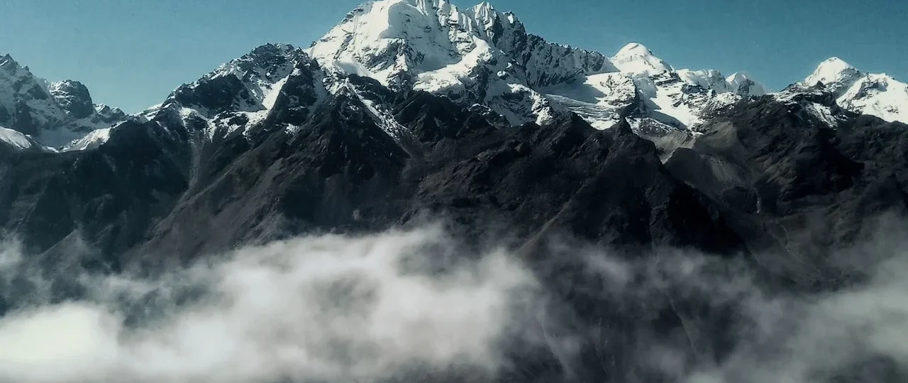
Langtang Range Nepal refers to a major Himalayan mountain range located in the Rasuwa district of north-central Nepal, immediately south of the Nepal-Tibet border. The range extends approximately 80 to 90 kilometers east-west and contains some of the most accessible high-altitude peaks in Nepal. The highest mountain in the Langtang Range Nepal is Langtang Lirung, standing at 7,234 meters (23,734 feet) above sea level.
The Langtang Range Nepal is part of the Great Himalaya, the highest section of the Himalayan mountain system that stretches across Nepal, India, Bhutan, and Tibet. What makes this range particularly significant is its proximity to Kathmandu—the straight-line distance from Nepal’s capital to the range’s southern slopes is only about 50 to 60 kilometers. This makes the Langtang Range Nepal the closest major Himalayan mountain system to Kathmandu and one of the most accessible high-altitude trekking regions in the country.
The relationship between the Langtang Range Nepal and the Langtang Valley is essential to understand. The Langtang Valley is a specific glacial valley within the range, carved by the Langtang River. The valley provides the primary trekking access to the range’s interior, with the standard Langtang Valley Trek following the river from Syabrubesi to Kyanjin Gompa at 3,870 meters. The range itself encompasses far more than this single valley, including multiple peaks, glaciers, high passes, and surrounding valleys across the broader Rasuwa district.
Langtang Range Nepal: Quick Facts at a Glance
| Feature | Details |
|---|---|
| Location | Rasuwa district, north-central Nepal |
| Distance from Kathmandu | 50–60 km straight-line, 120–150 km by road |
| Highest peak | Langtang Lirung (7,234m / 23,734ft) |
| Second highest peak | Langtang Ri (7,205m / 23,638ft) |
| Other major peaks | Dorje Lakpa, Gangchempo, Langshisa Ri, Naya Kanga |
| National park | Langtang National Park (established 1976) |
| Major valley | Langtang Valley |
| Main river | Langtang River |
| Cultural groups | Tamang (primary), some Sherpa communities |
| Standard trek duration | 7–10 days for Langtang Valley Trek |
| Highest trekking point | Tserko Ri (4,984m) or Kyanjin Gompa (3,870m) |
| Best seasons | March–May and October–November |
| Permits required | Langtang National Park Entry Permit, TIMS card |
Langtang Range Nepal: Location and Geographic Setting
The Langtang Range Nepal occupies a strategic position in the central Himalayas, forming part of the mountain barrier that separates the Tibetan Plateau from the lower hills and valleys of Nepal.
Geographic Boundaries
The Langtang Range Nepal is defined by several geographical features:
-
North: The Nepal-Tibet border and the Tibetan Plateau beyond
-
South: The lower hills and river valleys leading toward Kathmandu
-
East: The Bhote Koshi river valley and the boundary with Sindhupalchok district
-
West: The Ganesh Himal range and the Trishuli river valley
These boundaries place the Langtang Range Nepal within a broader Himalayan context that includes neighboring mountain systems such as the Ganesh Himal to the west and the Jugal Himal to the east.
Relationship to Other Himalayan Ranges
The Langtang Range Nepal is part of the central Himalayan system that includes several other significant ranges:
-
Ganesh Himal: Located to the west, with peaks reaching over 7,400 meters
-
Jugal Himal: Located to the east, toward the Sindhupalchok district
-
Everest massif: Located significantly further east, requiring a flight or multi-day road journey
-
Annapurna range: Located to the west, requiring a flight or long road journey
The Langtang Range Nepal stands out because of its accessibility. While other major Himalayan ranges require flights, multi-day road journeys, or extended approach treks, the Langtang Range is reachable in a single day of driving from Kathmandu.
Langtang Range Nepal: Major Peaks and Mountain Elevations
The Langtang Range Nepal contains numerous significant peaks, ranging from trekking peaks accessible to fit hikers to major summits requiring full mountaineering expeditions.
Complete Peak Table
| Peak | Elevation | Location in Range | Climbing Status |
|---|---|---|---|
| Langtang Lirung | 7,234m / 23,734ft | Central section | Major expedition peak |
| Langtang Ri | 7,205m / 23,638ft | Central section | Major expedition peak |
| Dorje Lakpa | 6,966m / 22,854ft | Eastern section | Expedition peak |
| Langshisa Ri | 6,427m / 21,086ft | Eastern section | Expedition peak |
| Gangchempo | 6,388m / 20,958ft | Upper Langtang Valley | Expedition peak |
| Naya Kanga | 5,846m / 19,180ft | Near Kyanjin Gompa | Trekking peak |
| Yala Peak | 5,520m / 18,110ft | Near Kyanjin Gompa | Trekking peak |
Langtang Lirung: The Range’s Highest Mountain
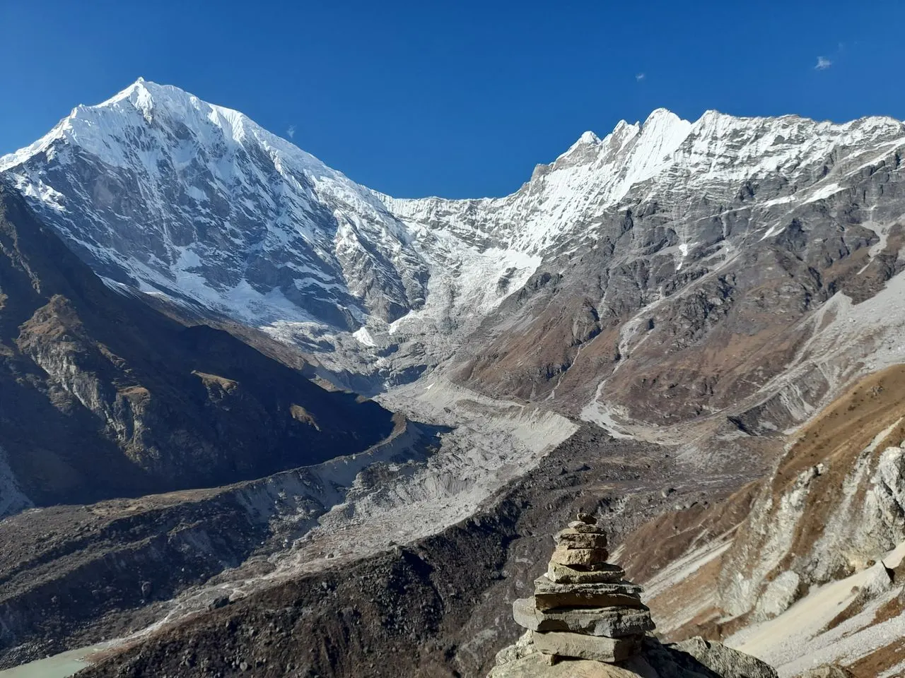
Langtang Lirung is the dominant peak of the Langtang Range Nepal. Rising to 7,234 meters, the mountain forms an imposing south face that is visible from much of the Langtang Valley trekking route. The mountain’s name comes from Tibetan language roots, with “Lirung” referring to a local deity or mountain spirit.
Langtang Lirung was first climbed in 1978 by a Japanese expedition. The mountain is considered a challenging expedition objective, with technical climbing required on most routes. The south face, visible from the trekking trail, is particularly dramatic, rising thousands of meters directly from the valley floor.
Trekking Peaks in the Langtang Range
The Langtang Range Nepal offers several trekking peaks that provide mountaineering experiences for fit trekkers without requiring full expedition logistics:
Naya Kanga (5,846m): A popular trekking peak accessible from Kyanjin Gompa. The climb involves glacier travel and basic mountaineering skills.
Yala Peak (5,520m): A non-technical trekking peak that can be climbed by fit trekkers with basic snow skills. The summit offers panoramic views of the entire Langtang Range.
These trekking peaks make the Langtang Range Nepal attractive for trekkers who want to progress from trekking to basic mountaineering.
Langtang Range Nepal: Glaciers and Glacial Systems
The Langtang Range Nepal contains significant glacial systems that shape the landscape and provide water resources for the region.
Major Glaciers
The most significant glacier in the Langtang Range Nepal is the Langtang Glacier, which extends from the upper reaches of the Langtang Valley toward Kyanjin Gompa. This glacier is the source of the Langtang River and is visible from the upper sections of the trekking route.
Other glaciers in the Langtang Range Nepal descend from:
-
Langtang Lirung’s southern and northern faces
-
Dorje Lakpa’s glacial systems
-
Langshisa Ri’s glacier complex
-
Gangchempo’s ice fields
Glacial Retreat and Climate Change
Like glaciers throughout the Himalayas, the Langtang Range Nepal glaciers are retreating due to climate change. Scientific studies have documented significant glacial retreat over recent decades, with implications for:
-
Water resources in the Trishuli River system
-
Glacial lake formation and potential flood risks
-
Ecosystem changes at high elevations
-
Long-term impacts on agriculture and communities
The retreat of glaciers in the Langtang Range Nepal is part of a broader Himalayan pattern that scientists are monitoring closely.
Langtang Range Nepal: Langtang National Park
The Langtang Range Nepal lies largely within Langtang National Park, established in 1976 as Nepal’s first Himalayan national park. The park covers approximately 1,710 square kilometers and protects the range’s diverse ecosystems and cultural heritage.
Park Overview
Langtang National Park encompasses elevations ranging from approximately 1,000 meters to over 7,200 meters at Langtang Lirung’s summit. This elevation range creates diverse ecological zones:
-
Subtropical forests (1,000–2,000m): Sal trees, mixed broadleaf species
-
Temperate forests (2,000–3,000m): Oak, rhododendron, pine
-
Subalpine forests (3,000–4,000m): Fir, birch, juniper
-
Alpine meadows (4,000–5,000m): Grasses, herbs, dwarf shrubs
-
High alpine zone (above 5,000m): Rock, ice, and snow
Wildlife of the Langtang Range
The Langtang Range Nepal supports significant wildlife populations within the national park:
Mammals:
-
Red panda (endangered)
-
Snow leopard (rare, high elevations)
-
Himalayan black bear
-
Musk deer
-
Himalayan tahr
-
Rhesus macaque
-
Langur monkeys
Birds:
-
Himalayan monal (Nepal’s national bird)
-
Blood pheasant
-
Various raptor species
-
High-altitude passerines
Conservation Significance
The Langtang Range Nepal national park is significant because it protects an accessible Himalayan ecosystem close to Kathmandu. The park demonstrates that conservation and human settlement can coexist, with Tamang communities living within park boundaries and participating in conservation efforts.
Langtang Range Nepal: Cultural Heritage and Tamang Communities
The Langtang Range Nepal is home to significant cultural communities, primarily the Tamang people, who have inhabited the region for centuries.
The Tamang People
The Tamang are one of Nepal’s largest indigenous ethnic groups, concentrated in the central Himalayan region including the Langtang Range Nepal area. Tamang communities have developed distinctive cultural practices adapted to mountain environments:
Language: Tamang language, part of the Tibeto-Burman language family
Religion: Tibetan Buddhism with older shamanic elements
Architecture: Stone houses with wooden balconies, distinctive roof designs, Buddhist symbols
Agriculture: Terrace farming of millet, maize, potatoes, barley, and vegetables
Crafts: Wool weaving, bamboo work, traditional textile production
Buddhist Heritage Sites
The Langtang Range Nepal contains significant Buddhist sites:
-
Kyanjin Gompa: A monastery in the upper Langtang Valley, rebuilt after the 2015 earthquake
-
Village chortens: Stone Buddhist monuments found throughout the region
-
Mani walls: Stone walls carved with Buddhist mantras
-
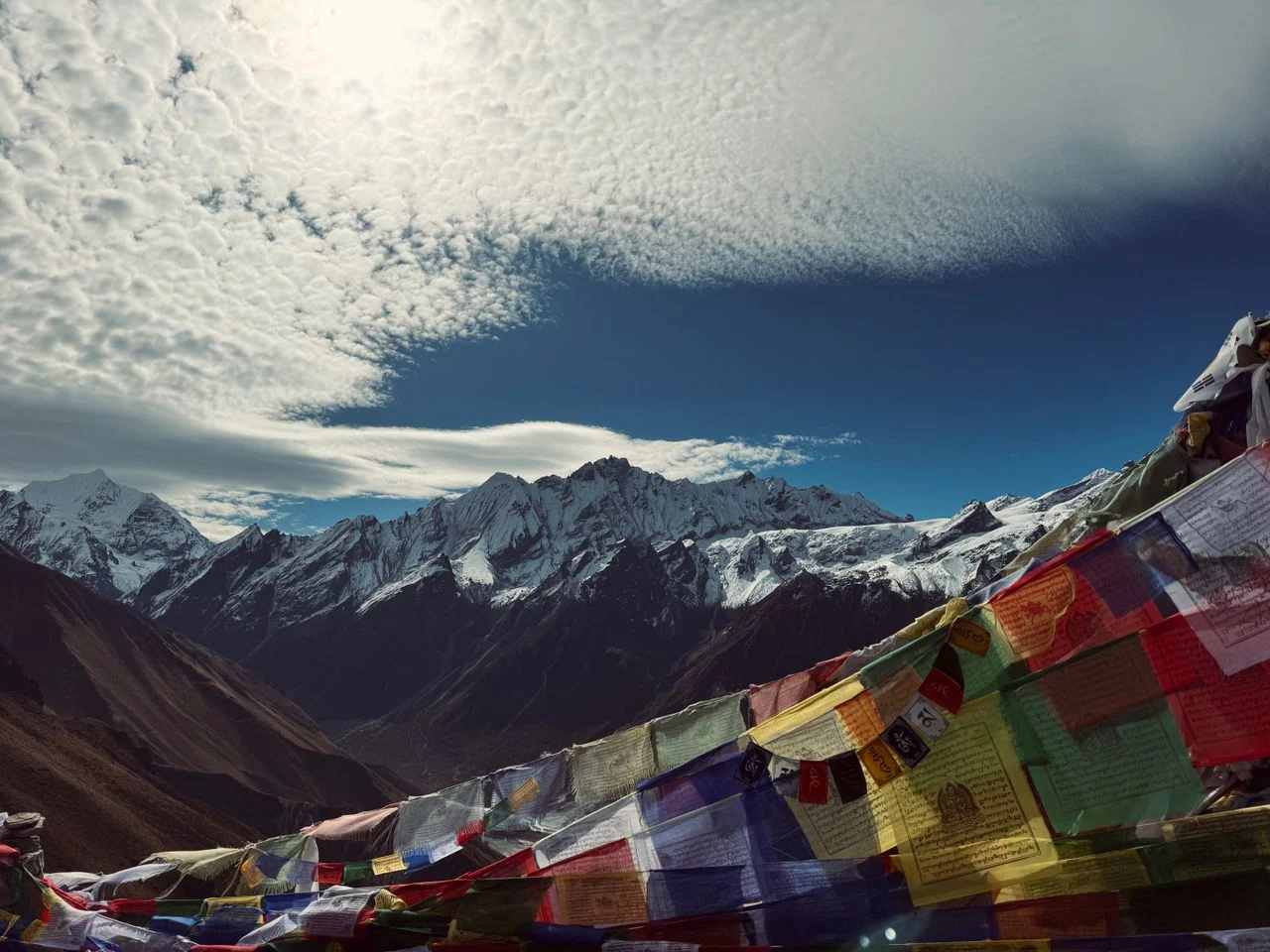
Prayer flags: Colorful flags marking trails, passes, and sacred locations
Festivals and Traditions
Tamang communities in the Langtang Range Nepal celebrate:
-
Losar: Tibetan New Year, typically February–March
-
Buddha Jayanti: Celebration of Buddha’s birth and enlightenment
-
Harvest festivals: Marking agricultural cycles
-
Shamanic ceremonies: Traditional healing and ritual practices
The 2015 Earthquake Impact
The 2015 Gorkha earthquake devastated many Langtang Range Nepal communities. The earthquake triggered a massive avalanche in the Langtang Valley that destroyed Langtang Village and killed over 200 people. The rebuilding process has been gradual, with communities reconstructing homes, trails, and cultural sites while maintaining traditions.
Visiting the Langtang Range Nepal today means witnessing both the resilience of these communities and the ongoing recovery process. Tourism plays an important role in supporting local economies during this rebuilding period.
Langtang Range Nepal: Trekking Routes Overview
The Langtang Range Nepal offers multiple trekking routes that access different parts of the mountain system. Understanding these options helps travelers choose appropriate itineraries.
Major Trekking Routes
| Route | Duration | Difficulty | Primary Focus |
|---|---|---|---|
| Langtang Valley Trek | 7–10 days | Moderate | Mountain scenery, Kyanjin Gompa |
| Tamang Heritage Trail | 5–7 days | Easy to moderate | Cultural villages, homestays |
| Langtang Gosaikunda Trek | 14–16 days | Moderate to challenging | Combined valley and lake trek |
| Ganja La Pass Trek | 10–12 days | Challenging | High-altitude pass crossing |
| Yala Peak Climb | 12–14 days | Challenging | Trekking peak summit |
The Langtang Valley Trek
The Langtang Valley Trek is the primary route for experiencing the Langtang Range Nepal. The trek follows the Langtang River from Syabrubesi (1,500m) through forests and villages to Kyanjin Gompa (3,870m). The route provides close-up views of Langtang Lirung, Gangchempo, and other range peaks.
Key highlights of the Langtang Valley Trek:
-
Gradual elevation gain through diverse ecological zones
-
Traditional Tamang villages including Langtang Village
-
Kyanjin Gompa monastery and yak cheese factory
-
Optional climbs to Kyanjin Ri (4,773m) or Tserko Ri (4,984m)
-
Panoramic views of the entire Langtang Range
Trekking Difficulty
The Langtang Range Nepal offers trekking options across difficulty levels:
Easy treks: Tamang Heritage Trail with moderate distances and lower elevations
Moderate treks: Standard Langtang Valley Trek with 5–7 hour walking days
Challenging treks: Ganja La Pass requiring high-altitude experience and technical skills
Mountaineering: Yala Peak, Naya Kanga, and expedition peaks
The range’s accessibility makes it suitable for both first-time Himalayan trekkers and experienced mountaineers seeking expedition objectives.
Langtang Range Nepal: Understanding Trekking Seasons
Seasonal conditions significantly affect the Langtang Range Nepal trekking experience.
Seasonal Overview Table
| Season | Months | Temperature | Precipitation | Visibility | Trekking Suitability |
|---|---|---|---|---|---|
| Spring | March–May | Moderate | Low to moderate | Good | Excellent |
| Summer/Monsoon | June–September | Warm | Heavy | Poor | Poor |
| Autumn | October–November | Cool | Low | Excellent | Excellent |
| Winter | December–February | Cold | Low to moderate | Good | Possible with preparation |
Best Time to Visit the Langtang Range
Spring (March–May): Spring offers moderate temperatures and blooming rhododendrons. The Langtang Range Nepal is particularly beautiful during this season, with colorful vegetation and generally good visibility. Afternoon clouds are common but rarely disrupt trekking significantly.
Autumn (October–November): Autumn provides the most stable weather with clear skies and excellent mountain views. This is the most popular season for the Langtang Range Nepal, and teahouses can be busy. Cold nights at higher elevations require warm gear.
Off-Season Considerations
Summer/Monsoon: The Langtang Range Nepal receives heavy rainfall during the monsoon. Trails become muddy, leeches are present, and mountain views are often obscured. Landslide risk increases. Most trekkers avoid this season.
Winter: The Langtang Range Nepal remains accessible in winter but requires cold-weather preparation. Higher sections receive snow, and some teahouses close. The clear skies and solitude can be rewarding for prepared trekkers.
Langtang Range Nepal: Transportation and Access
Access to the Langtang Range Nepal is exclusively by road, with no flight options available.
Getting to the Trailhead
| Route | Distance | Time | Transport Options |
|---|---|---|---|
| Kathmandu to Syabrubesi | 120–150 km | 7–9 hours | Private jeep, local bus |
| Kathmandu to Dhunche | 100–120 km | 6–8 hours | Private jeep, local bus |
The Road Journey
The road to the Langtang Range Nepal trailhead follows the Pasang Lhamu Highway north from Kathmandu through the Trishuli Valley. The route passes through:
-
Trishuli Valley: River valley with terraced hillsides
-
Betrawati: Common stopping point for meals
-
Dhunche: District headquarters at approximately 2,030 meters
-
Syabrubesi: Main trailhead at approximately 1,500 meters
Why No Flights?
Unlike the Everest region (Lukla airstrip) or Annapurna region (Jomsom airstrip), the Langtang Range Nepal has no operational airstrip serving the trekking region. The steep, narrow valleys do not provide suitable terrain for fixed-wing aircraft operations. Road travel is the only standard access method.
Wonder Hikes Nepal coordinates private jeep transportation from Kathmandu to the Langtang trailhead, using experienced drivers familiar with the mountain roads and current conditions.
Langtang Range Nepal: Accommodation and Facilities
Accommodation for exploring the Langtang Range Nepal varies by location and trekking route.
Trailhead Accommodation
Syabrubesi offers basic guesthouses and lodges with:
-
Simple rooms with shared bathrooms
-
Restaurant facilities
-
Limited Wi-Fi availability
-
Basic supplies for trekking
On-Trail Accommodation
Along the Langtang Valley Trek and other Langtang Range Nepal routes:
Teahouses/Lodges:
-
Twin rooms with basic bedding
-
Shared toilets
-
Common dining areas with stoves
-
Limited electricity and charging
-
No bedroom heating
Village Homestays (Tamang Heritage Trail):
-
Family homes with guest rooms
-
Home-cooked meals
-
Cultural interaction
-
Shared facilities
Realistic Expectations
Accommodation in the Langtang Range Nepal region is basic. Trekkers should expect:
-
Cold rooms at higher elevations
-
Limited hot water
-
Shared bathroom facilities
-
Simple but nutritious meals
-
No luxury amenities
This basic accommodation is part of the authentic Himalayan trekking experience and helps keep trekking costs accessible compared with more developed regions.
Langtang Range Nepal: Practical Safety Considerations
Exploring the Langtang Range Nepal requires awareness of safety considerations specific to high-mountain environments.
Altitude Safety
The standard Langtang Range Nepal trekking routes reach elevations up to 3,870 meters (Kyanjin Gompa), with optional climbs to nearly 5,000 meters. Altitude sickness is a genuine risk.
Key principles:
-
Ascend gradually
-
Stay hydrated
-
Eat regularly
-
Monitor for symptoms
-
Descend if symptoms worsen
Weather Safety
Weather in the Langtang Range Nepal can change rapidly:
-
Carry rain gear regardless of season
-
Be prepared for cold temperatures
-
Check forecasts before departure
-
Adjust plans based on conditions
Trail Safety
Trails in the Langtang Range Nepal are generally well-established but require care:
-
Stone steps can be slippery
-
Some sections have drop-offs
-
Descending requires knee care
-
Trekking poles provide support
Emergency Preparedness
Travel insurance with trekking coverage and emergency evacuation is essential. Mobile coverage is limited in the Langtang Range Nepal, and guides should carry communication equipment for emergencies.
Langtang Range Nepal: Responsible Tourism Practices
Visiting the Langtang Range Nepal carries responsibilities toward the environment and local communities.
Environmental Responsibility
-
Pack out all waste
-
Avoid single-use plastics
-
Use water purification instead of bottled water
-
Stay on established trails
-
Respect wildlife and natural features
Cultural Responsibility
-
Respect local customs and traditions
-
Ask permission before photographing people
-
Dress modestly in villages and monasteries
-
Support local businesses
-
Learn basic greetings in local languages
Supporting Community Recovery
The Langtang Range Nepal communities continue recovering from the 2015 earthquake. Trekkers can support recovery by:
-
Trekking with locally staffed agencies
-
Staying in locally owned accommodation
-
Purchasing local products
-
Hiring local guides and porters
-
Contributing to community projects where appropriate
Wonder Hikes Nepal prioritizes local employment and community benefit in all its Langtang trekking operations.
How Wonder Hikes Nepal Helps You Explore the Langtang Range Nepal
Wonder Hikes Nepal is a registered trekking agency that helps travelers experience the Langtang Range Nepal through well-planned itineraries, local expertise, and practical logistics support.
When you book a Langtang trek with Wonder Hikes Nepal, the team:
-
Designs appropriate itineraries: Routes are planned to match your fitness, experience, and goals
-
Coordinates transportation: Kathmandu to Syabrubesi and return arranged
-
Processes permits: Langtang National Park and TIMS permits handled before departure
-
Provides licensed guides: Experienced guides with local knowledge of the range’s geography, culture, and trails
-
Arranges accommodation: Teahouse and homestay reservations made in advance
-
Offers route options: Langtang Valley Trek, Tamang Heritage Trail, combined itineraries, and trekking peak climbs
-
Monitors current conditions: Trail conditions, weather, and route changes tracked
The goal is to help you experience the Langtang Range Nepal safely, comfortably, and with meaningful cultural engagement.
Frequently Asked Questions About Langtang Range Nepal
1. What is the Langtang Range Nepal?
The Langtang Range Nepal is a major Himalayan mountain range in the Rasuwa district north of Kathmandu. Its highest peak is Langtang Lirung at 7,234 meters.
2. Where is the Langtang Range located?
The Langtang Range is in north-central Nepal, approximately 50–60 kilometers straight-line from Kathmandu. The trailhead is 120–150 kilometers by road.
3. What is the highest peak in the Langtang Range?
The highest peak in the Langtang Range is Langtang Lirung at 7,234 meters (23,734 feet).
4. Is Langtang part of the Himalayas?
Yes, the Langtang Range is part of the Great Himalaya, the highest section of the Himalayan mountain system.
5. How far is Langtang from Kathmandu?
The Langtang Range is approximately 50–60 kilometers straight-line from Kathmandu. Road access to the trailhead takes 7–9 hours covering 120–150 kilometers.
6. What mountains can you see in Langtang?
From the Langtang Range trekking routes, you can see Langtang Lirung, Dorje Lakpa, Langtang Ri, Gangchempo, Naya Kanga, and other peaks.
7. Is Langtang inside a national park?
Yes, most of the Langtang Range lies within Langtang National Park, established in 1976 as Nepal’s first Himalayan national park.
8. What wildlife is found in Langtang National Park?
Langtang National Park protects red pandas, snow leopards, Himalayan black bears, musk deer, Himalayan tahr, and diverse bird species.
9. What is the Langtang Valley?
The Langtang Valley is a glacial valley within the Langtang Range, carved by the Langtang River. It provides the primary trekking access to the range.
10. Can you trek in the Langtang Range?
Yes, the Langtang Range offers multiple trekking routes including the Langtang Valley Trek, Tamang Heritage Trail, and Langtang Gosaikunda Trek.
11. What is the best time to visit the Langtang Range?
The best times to visit are March to May and October to November, when weather is most stable.
12. How difficult is Langtang trekking?
The standard Langtang Valley Trek is moderate in difficulty. Other routes range from easy (Tamang Heritage Trail) to challenging (Ganja La Pass).
13. What permits are required for Langtang?
You need the Langtang National Park Entry Permit and TIMS card. Both are obtainable in Kathmandu.
14. What is the difference between Langtang Range and Langtang Valley?
The Langtang Range is the entire mountain system, while the Langtang Valley is one specific valley within that range providing trekking access.
15. Who are the Tamang people?
The Tamang are an indigenous ethnic group native to the central Himalayan region, including the Langtang Range area, with distinct language, culture, and Buddhist traditions.
Plan Your Langtang Range Nepal Adventure With Wonder Hikes Nepal
The Langtang Range Nepal offers one of the most accessible high-mountain experiences in the Himalayas. From the dramatic peaks of Langtang Lirung to the cultural villages of the Tamang people, this mountain system provides genuine adventure within a single day’s journey from Kathmandu.
Wonder Hikes Nepal can help you plan the right itinerary for exploring the Langtang Range Nepal, whether you choose the classic Langtang Valley Trek, the cultural Tamang Heritage Trail, or a combined route. Contact Wonder Hikes Nepal to discuss your trekking goals and receive a personalized recommendation for your 2026 adventure.