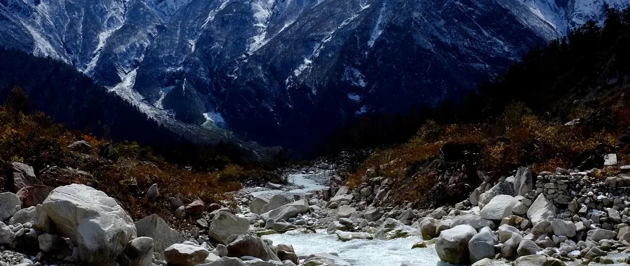
What Manaslu Himal Means
Manaslu Himal refers to a distinct mountain range within the Nepalese Himalayas, centered around Mount Manaslu, the world’s eighth-highest mountain. The term “Himal” in Nepali means “mountain” or “range of mountains,” so Manaslu Himal translates roughly to “the Manaslu mountain range” or “the mountains of Manaslu.”
Manaslu Himal is not just Mount Manaslu itself. The range includes several significant peaks, glaciers, and high valleys. When trekking agencies refer to “Manaslu Himal,” they are typically referencing the broader region through which the Manaslu Circuit Trek passes—a restricted area requiring special permits and guides.
Manaslu Himal range is also known as Mansiri Himal, which is the older name still used in some geographic references and mountaineering literature. Both terms describe the same mountain massif—a compact but dramatic cluster of peaks rising between the Budhi Gandaki River to the west and the Marsyangdi River to the east.
Understanding Manaslu Himal requires distinguishing between several related terms that are often confused:
-
Manaslu Himal: The mountain range or massif
-
Mount Manaslu: The highest peak within the range (8,163m)
-
Mansiri Himal: An alternative name for the same range
-
Manaslu Conservation Area: The protected zone surrounding the range
-
Manaslu Circuit: The primary trekking route circling Mount Manaslu
This distinction matters because it determines what kind of experience you can have here. The range is not just a single mountain—it is a complete Himalayan ecosystem with peaks, glaciers, valleys, villages, and a rich cultural landscape.
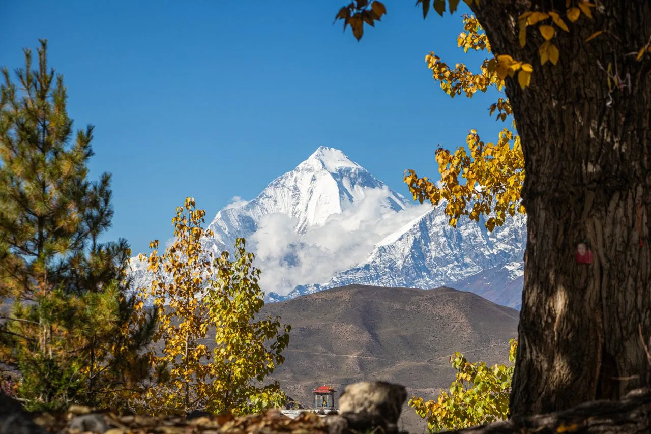
Manaslu Himal vs Mount Manaslu vs Mansiri Himal
Manaslu Himal vs Mount Manaslu is the most common source of confusion. Mount Manaslu is one mountain—the highest in the range—while Manaslu Himal encompasses the entire massif, including multiple peaks, glaciers, and high valleys. Think of Mount Manaslu as the tallest building in a city, while Manaslu Himal is the entire city.
Mansiri Himal and Manaslu Himal refer to the same geographic feature. “Mansiri” is derived from the Sanskrit word “Manasa,” meaning “Mountain of the Spirit” or “Mountain of the Soul.” This older name still appears in some mountaineering references and geographic databases.
The relationship between these terms can be summarized:
| Term | What It Refers To | Common Usage |
|---|---|---|
| Manaslu Himal | The entire mountain range | Trekking and tourism |
| Mansiri Himal | The same mountain range | Geographic/mountaineering |
| Mount Manaslu | The highest peak (8,163m) | General reference |
| Manaslu Conservation Area | Protected zone around the range | Conservation context |
| Manaslu Circuit | Trekking route around the range | Trekking context |
Manaslu Himal mountain range is not just a single mountain—it is a complete Himalayan ecosystem with peaks, glaciers, valleys, villages, and a rich cultural landscape. For trekkers, understanding this distinction prevents confusion when reading itineraries, maps, and government regulations.
Where Manaslu Himal Is Located
Manaslu Himal location places it in north-central Nepal, primarily within Gorkha District, with portions extending into Manang District. The range sits approximately 100 kilometers northwest of Kathmandu as the crow flies, though road access adds considerable distance.
Manaslu Himal is located between two significant river systems. The Budhi Gandaki River defines the western edge, flowing south from its source near Larkya La Pass. The Marsyangdi River marks the eastern boundary, separating Manaslu Himal from the Annapurna range to the west.
Manaslu Himal region occupies a strategic position in the Nepal Himalaya. It lies between the Annapurna range to the west and the Ganesh Himal to the east. This positioning creates a distinct geographic identity, with the range’s peaks forming a compact massif rather than a linear chain.
The region’s administrative geography matters for trekkers. The Manaslu Conservation Area, which encompasses much of the range, spans approximately 1,663 square kilometers. This protected zone includes portions of Gorkha and Manang districts, managed under the National Trust for Nature Conservation.
Manaslu Himal trekking region remains one of Nepal’s more remote trekking destinations, with road access limited to the lower valleys. Trekkers typically drive from Kathmandu to Soti Khola or Machha Khola, then continue on foot through the Budhi Gandaki valley into the heart of the range.
The Peaks of Manaslu Himal
Manaslu Himal peaks form an impressive collection of high mountains, with several exceeding 7,000 meters. While Mount Manaslu dominates the range, the surrounding peaks create a complex and dramatic alpine landscape.
Major Peaks in Manaslu Himal
| Peak Name | Elevation | Notes |
|---|---|---|
| Mount Manaslu | 8,163m | Eighth-highest mountain globally |
| Himalchuli | 7,893m | Second-highest in the range |
| Ngadi Chuli | 7,871m | Also called Peak 29 |
| Baudha Himal | 6,672m | Significant subsidiary peak |
| Larkya Peak | 6,249m | Near Larkya La Pass |
| Naike Peak | 6,211m | Visible from trekking route |
Manaslu Himal highest peak is Mount Manaslu at 8,163m, but the range contains multiple significant summits. Himalchuli and Ngadi Chuli are significant mountains in their own right. Himalchuli, at 7,893m, is the world’s 18th-highest mountain. Ngadi Chuli, at 7,871m, ranks 20th globally.
Manaslu Himal mountains create a compact massif unlike more linear Himalayan ranges. The major peaks cluster together, separated by steep valleys and glaciers. This geography creates the dramatic landscape that trekkers experience on the Manaslu Circuit—a constant presence of high peaks rather than distant views.
The range’s compact nature distinguishes it from more linear Himalayan ranges. Manaslu Himal also contains numerous peaks in the 5,000-6,500m range that are rarely named in trekking literature but contribute to the region’s alpine character.
Mount Manaslu: The Eighth-Highest Mountain
Mount Manaslu elevation of 8,163 meters (26,781 feet) makes it the eighth-highest mountain on Earth and one of Nepal’s most significant peaks. The mountain’s name comes from the Sanskrit “Manasa,” meaning “Mountain of the Spirit.”
Mount Manaslu height places it in the “eight-thousander” category—mountains exceeding 8,000 meters. This classification carries significant prestige in mountaineering circles. The mountain’s technical difficulty is considered moderate compared to other eight-thousanders, though it still demands serious mountaineering skills.
Mount Manaslu rises dramatically from the surrounding landscape. Its north face towers over the Budhi Gandaki valley, creating a vertical relief of over 4,500 meters from valley floor to summit. The mountain’s northeast face is particularly impressive, presenting a massive wall of ice and rock visible from the Samagaon area.
The mountain supports extensive glacier systems. The Manaslu Glacier flows from the upper reaches of the mountain toward the east, while other glaciers radiate from the massif in multiple directions. These glaciers feed the rivers that sustain villages and agriculture throughout the region.
Mount Manaslu provides a constant visual backdrop throughout the Manaslu Circuit. The mountain appears from multiple angles as the trail circles around it, offering different perspectives of its faces and ridges.
Manaslu Conservation Area: Protection and Biodiversity
Manaslu Conservation Area covers approximately 1,663 square kilometers surrounding the Manaslu Himal range. Established in 1998, this protected area aims to conserve the region’s natural ecosystems while supporting sustainable development for local communities.
Manaslu Himal conservation efforts focus on protecting the region’s extraordinary biodiversity. The conservation area encompasses diverse ecosystems ranging from subtropical forests at lower elevations to alpine meadows and permanent ice at high altitudes. This elevational range supports species that have disappeared from more developed parts of Nepal.
Snow leopard is perhaps the most significant species in the Manaslu Conservation Area. This elusive predator finds refuge in the region’s remote alpine zones, where prey species like blue sheep and Himalayan tahr remain relatively abundant. Other notable wildlife includes Himalayan black bear, red panda, and various species of pheasant.
Manaslu Himal protected area regulations directly affect trekkers. The restricted-area status requires special permits, and all trekkers must be accompanied by licensed guides. These regulations aim to protect both the natural environment and the cultural heritage of communities within the conservation area.
The Manaslu Conservation Area Project, managed under the National Trust for Nature Conservation, coordinates conservation efforts with local community development. This integrated approach recognizes that protecting biodiversity requires supporting the people who live alongside it.
The Valleys of Manaslu Himal: Nubri and Tsum
Manaslu Himal valleys create the human geography of the region. Two major valleys define the cultural landscape: Nubri Valley and Tsum Valley.
Nubri Valley
The Nubri Valley follows the Budhi Gandaki River northward toward the Tibetan border. This valley forms the main corridor of the Manaslu Circuit Trek, with villages like Jagat, Deng, Namrung, and Samagaon strung along the river. The name “Nubri” means “western valley” in Tibetan, reflecting the region’s historical connections to Tibet.
Manaslu Himal Nubri Valley is inhabited primarily by Nubri people, who speak a Tibetan dialect and practice Tibetan Buddhism. The valley’s culture reflects centuries of trade and cultural exchange across the Himalayan passes. Monasteries, mani walls, and prayer flags are common features of the landscape.
Tsum Valley
The Tsum Valley branches east from the main Budhi Gandaki corridor, leading toward the Tibetan border. This valley was closed to trekkers until 2008 and remains less visited than the main Nubri corridor. The name “Tsum” comes from the Tibetan word “Tsombo,” meaning “vivid.”
Manaslu Himal Tsum Valley holds exceptional cultural significance. The valley is home to ancient monasteries, including Mu Gompa and Rachen Gompa, which preserve Buddhist traditions that have disappeared elsewhere. The isolation of Tsum Valley helped maintain its distinctive cultural character.
Both valleys within Manaslu Himal demonstrate the deep connection between geography and culture. The mountains have shaped human settlement patterns, trade routes, and religious practices for centuries.
Climbing History of Mount Manaslu
Manaslu climbing history begins with the first ascent in 1956 by a Japanese expedition. Toshio Imanishi and Gyalzen Norbu reached the summit on May 9, 1956, establishing a route on the northeast face that remains significant today.
Mount Manaslu first ascent represented a major achievement in Himalayan mountaineering. At the time, only a handful of 8,000-meter peaks had been climbed. The Japanese team’s success established Japan’s presence in Himalayan mountaineering and demonstrated that Manaslu was accessible to skilled expeditions.
Manaslu Himal mountaineering maintained strong Japanese connections in subsequent decades. Several significant routes were established by Japanese expeditions in the 1970s and 1980s. This Japanese connection continues today, with Japanese climbers representing a notable portion of Manaslu expeditions.
The mountain’s climbing history includes tragedy as well. In 1972, an avalanche struck a Korean expedition, killing fifteen climbers. This incident highlighted the objective dangers of the mountain and the unpredictable nature of Himalayan weather.
Mount Manaslu climbing remains popular among mountaineers seeking 8,000-meter peaks. The mountain offers a more accessible objective than Everest or K2 while providing genuine expedition experience. Climbing permits are issued through the Nepal government, with fees varying by season.
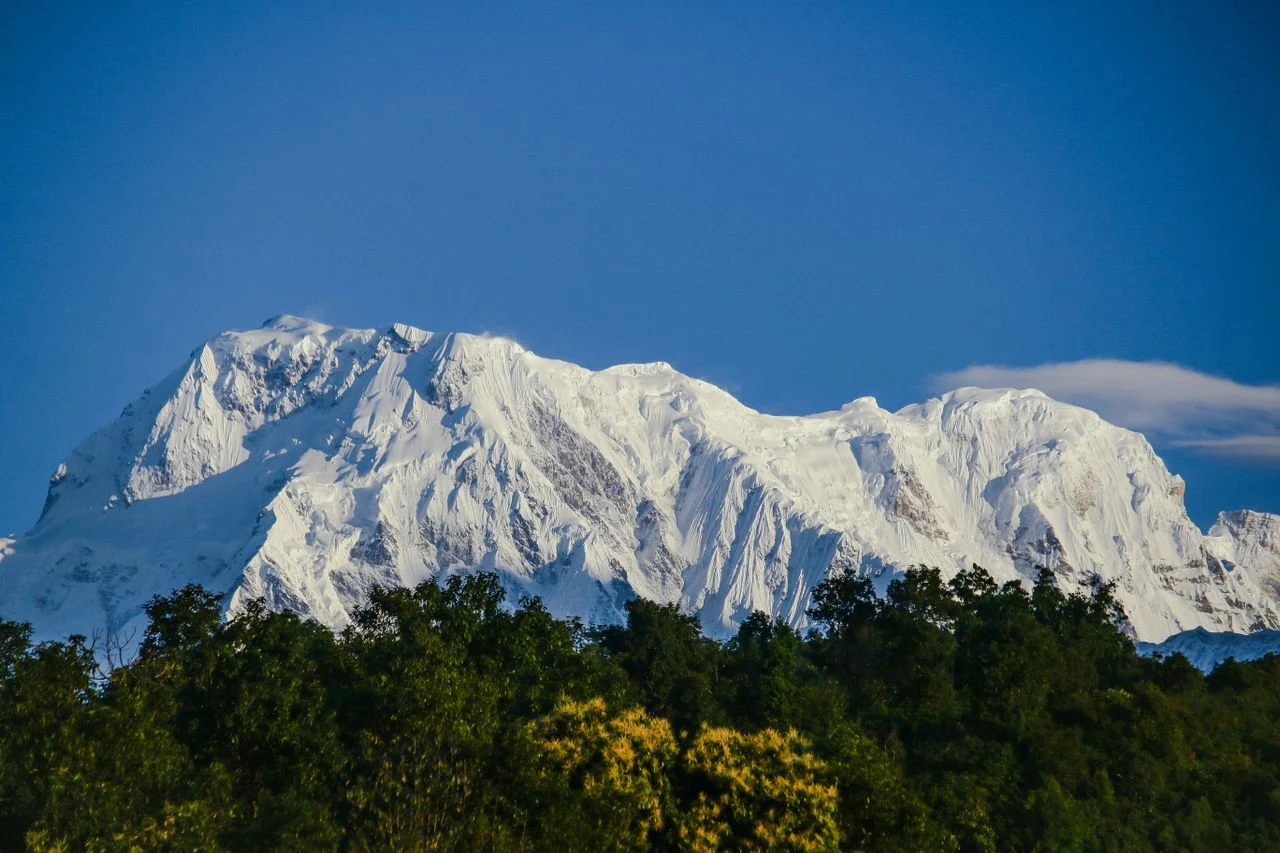
Trekking Through Manaslu Himal
Manaslu Himal trekking offers some of Nepal’s most rewarding high-altitude experiences without requiring mountaineering skills. The region’s restricted status has preserved both natural environments and cultural traditions that have been lost in more accessible trekking areas.
Manaslu Himal trek options include the classic Manaslu Circuit, the Tsum Valley extension, and the Manaslu Base Camp excursion. Each provides different perspectives on the range and suits different fitness levels and time constraints.
Manaslu Circuit Trek is the primary trekking experience, a 14-18 day journey that circles Mount Manaslu, crossing Larkya La Pass at 5,160 meters. This trek provides comprehensive exposure to the Manaslu Himal range, from subtropical river valleys to high alpine terrain.
Manaslu Circuit Trek difficulty is moderate to challenging. The trek demands good physical fitness, previous trekking experience, and the ability to manage altitude. Daily hiking involves 5-8 hours on trail, with significant elevation gains and losses.
Tsum Valley Trek offers an alternative or extension to the standard Circuit. This trek enters the culturally rich Tsum Valley, visiting ancient monasteries and traditional villages. The Tsum Valley can be combined with the Manaslu Circuit for a comprehensive experience of the region.
Manaslu Base Camp provides another option for trekkers seeking to approach Mount Manaslu closely. This side trip from Samagaon offers glacier views and a high-altitude experience without the full Circuit commitment.
All Manaslu Himal trekking requires licensed guides and restricted-area permits. This regulation ensures safety in the remote terrain while protecting the region’s cultural and natural heritage.
Manaslu Circuit: The Classic Trekking Route
Manaslu Circuit Trek represents the most comprehensive way to experience Manaslu Himal. The route circles Mount Manaslu, traversing the full geographic and cultural range of the region.
Manaslu Circuit itinerary spans 14-18 days, beginning from Soti Khola or Machha Khola after a drive from Kathmandu. The trail follows the Budhi Gandaki River northward, passing through villages that become increasingly Tibetan in character as elevation increases.
Key locations along the Manaslu Circuit include:
Jagat: The entry point to the restricted area, where permits are checked
Deng: A small village marking the transition into higher terrain
Namrung: Offers first clear views of Mount Manaslu
Samagaon: The largest village in the upper valley, with excellent acclimatization options
Samdo: The last permanent settlement before Larkya La
Dharamsala: A high-altitude stop before the pass crossing
Larkya La: The highest point of the trek at 5,160 meters
Bimtang: The first village after crossing into the Annapurna region
Manaslu Circuit Trek route delivers comprehensive exposure to the range’s geography. Trekkers see Mount Manaslu from multiple angles, traverse valleys created by glacial action, and cross a major Himalayan pass that connects distinct cultural regions.
Trekking Difficulty in Manaslu Himal
Manaslu Himal trek difficulty requires honest assessment. The region offers challenging trekking that demands proper preparation.
Manaslu Himal trekking difficulty factors include altitude, remote terrain, weather, and physical demands. The Manaslu Circuit crosses Larkya La at 5,160m, placing trekkers in the high-altitude zone where Acute Mountain Sickness becomes a genuine risk.
Altitude: The Manaslu Circuit crosses Larkya La at 5,160m. Proper acclimatization is essential for managing this elevation safely.
Remote terrain: The region lacks road access, meaning all supplies arrive by foot or helicopter. Teahouses offer basic facilities, but trekkers must be self-sufficient in terms of personal gear and medications.
Weather: Himalayan weather changes rapidly. Trekkers must be prepared for cold temperatures, strong winds, precipitation, and limited visibility at higher elevations.
Physical demands: Daily hiking of 5-8 hours on steep terrain requires good cardiovascular fitness. Trekkers should arrive with a solid training base.
Manaslu Himal trek difficulty compares to other major Nepal treks like the Annapurna Circuit or Everest Base Camp. The altitude profile is similar, though the remote nature adds a dimension of self-sufficiency not required on more developed routes.
Best Time to Visit Manaslu Himal
Manaslu Himal best time follows the standard Nepal trekking seasons, with spring and autumn offering optimal conditions.
Spring (March-May)
Manaslu Himal weather in spring offers stable conditions, warming temperatures, and excellent visibility. Rhododendrons bloom in lower valleys, adding color to the approach hike. April sees the highest trekking traffic before the monsoon arrives.
Autumn (September-November)
Manaslu Himal best season for most trekkers is autumn. Post-monsoon air is clean, offering sharp mountain views. October is the most popular month for the Manaslu Circuit.
Winter (December-February)
Manaslu Himal winter brings cold temperatures and snow at higher elevations. The Larkya La crossing becomes challenging or impossible during heavy snow. Only experienced winter trekkers should attempt the Circuit during this season.
Monsoon (June-August)
Manaslu Himal monsoon brings rain, mud, leeches, and limited visibility. The Manaslu region receives significant rainfall during this period. Most trekkers avoid the Circuit during monsoon.
Manaslu Himal best time to visit depends on your priorities. October offers the best weather, March-April offers blooming vegetation and fewer crowds, and winter offers solitude for experienced trekkers.
Permits and Regulations for Manaslu Himal
Manaslu Himal permits reflect the region’s restricted-area status. Trekkers must obtain specific permits before entering the Manaslu Conservation Area.
Manaslu Himal permit requirements include:
Restricted Area Permit: Required for all foreign trekkers in the Manaslu region. This permit has seasonal pricing and limits stay duration within the restricted zone.
Manaslu Conservation Area Permit (MCAP): Covers entry to the conservation area and supports conservation efforts.
Annapurna Conservation Area Permit (ACAP): Required because the Manaslu Circuit exits into the Annapurna region.
TIMS Card: Trekkers’ Information Management System registration for safety purposes.
Manaslu Himal guide requirement mandates that all trekkers must be accompanied by licensed guides. Solo trekking remains prohibited in the restricted area. This regulation ensures safety in remote terrain while supporting local employment.
Manaslu Himal permit costs vary by season. The Restricted Area Permit costs $100 per person for the first 7 days during September-November, and $75 during other seasons. Additional days cost $15 per day. Total permit costs typically range from $135 to $255 per person.
How to Experience Manaslu Himal
Manaslu Himal offers multiple experiences depending on your interests, fitness, and available time.
For Serious Trekkers: The Manaslu Circuit
Manaslu Himal Circuit trek provides the most comprehensive experience of the range. This 14-18 day trek circles Mount Manaslu, crosses Larkya La, and offers complete immersion in the region’s geography and culture.
For Cultural Travelers: The Tsum Valley Extension
Manaslu Himal Tsum Valley provides deeper cultural immersion. This extension visits ancient monasteries and preserves Tibetan Buddhist traditions.
For Time-Limited Trekkers: Shorter Options
Manaslu Himal short trek options provide a taste of the region without the complete Circuit. Some agencies offer shorter trek variations.
For Mountaineers: Climbing Expeditions
Mount Manaslu climbing offers a genuine 8,000-meter climbing objective. This requires significant mountaineering experience, expedition logistics, and climbing permits.
For Armchair Explorers: Understanding the Range
Even without trekking, understanding Manaslu Himal enriches your appreciation of Himalayan geography and mountaineering history.
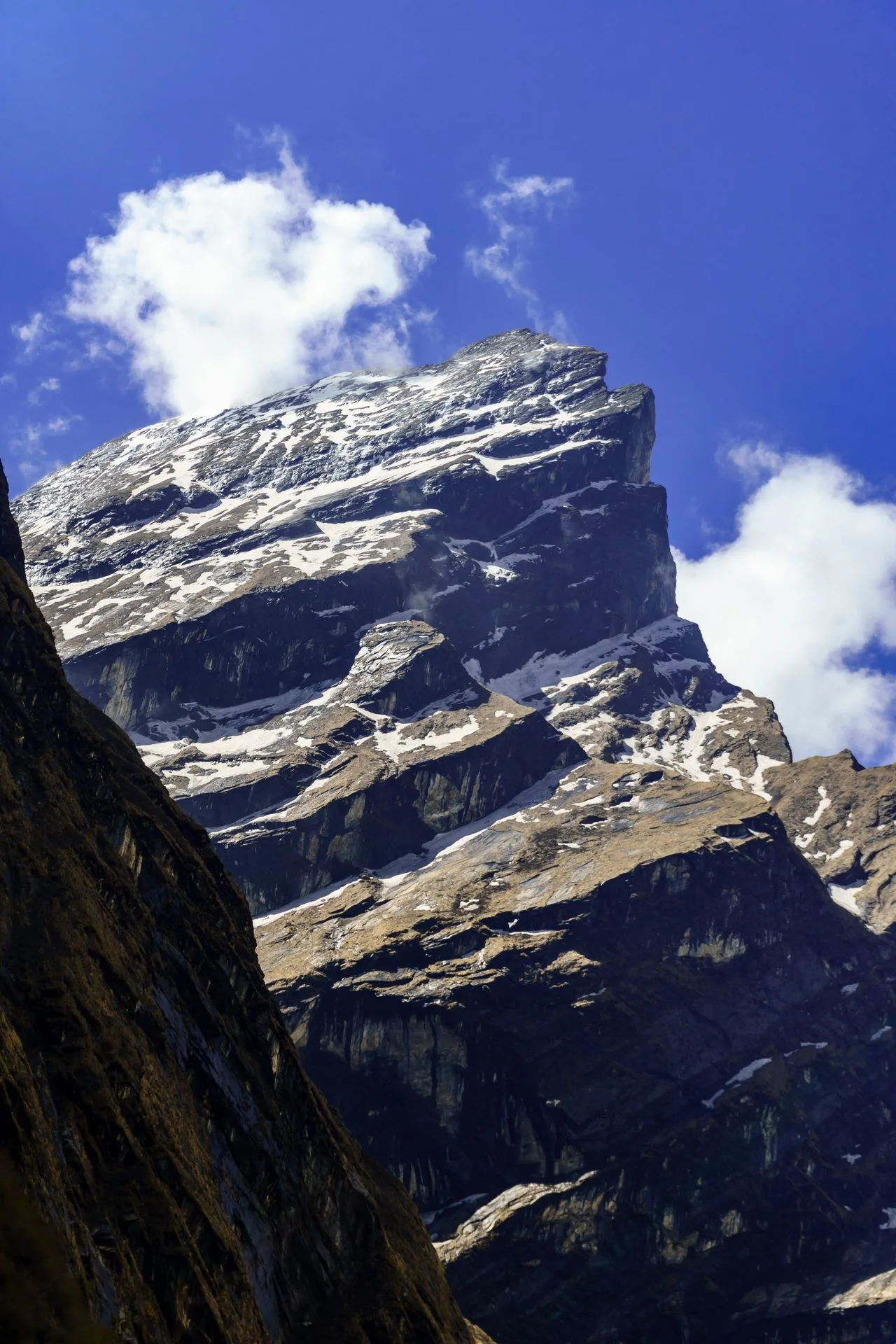
Wonder Hikes Nepal: Planning Your Manaslu Journey
Wonder Hikes Nepal helps travelers experience Manaslu Himal through well-planned trekking itineraries. Our Manaslu Circuit packages include all permits, guide services, teahouse accommodation, meals, and transportation.
Manaslu Himal trek with Wonder Hikes Nepal provides transparent information about the region, current regulations, and what to expect on the trail. Our guides understand the geography, culture, and practical challenges of trekking in Manaslu Himal.
Wonder Hikes Nepal Manaslu packages include customized planning for the full Manaslu Circuit, Tsum Valley extension, or shorter trek variations. We provide honest guidance about pacing, acclimatization, and excursion options.
Whether you are planning the full Manaslu Circuit, considering the Tsum Valley extension, or seeking information about permits and logistics, Wonder Hikes Nepal can assist with customized planning and honest guidance.
Plan Your Manaslu Himal Trek – Contact Wonder Hikes Nepal
FAQs about Manaslu Himal
1. What is Manaslu Himal?
Manaslu Himal is a mountain range in north-central Nepal centered around Mount Manaslu, the world’s eighth-highest mountain. The range includes multiple peaks over 7,000 meters, extensive glaciers, and the valleys through which the Manaslu Circuit Trek passes.
2. Is Manaslu Himal the same as Mount Manaslu?
No. Manaslu Himal refers to the entire mountain range, while Mount Manaslu is the highest single peak within that range. The range includes several other significant mountains, including Himalchuli and Ngadi Chuli.
3. Is Manaslu Himal the same as Mansiri Himal?
Yes, Manaslu Himal and Mansiri Himal refer to the same mountain range. Mansiri Himal is the older name, derived from the Sanskrit “Manasa,” while Manaslu Himal is more commonly used in trekking and tourism contexts.
4. Where is Manaslu Himal located?
Manaslu Himal is located in north-central Nepal, primarily in Gorkha District with portions extending into Manang District. The range lies approximately 100 kilometers northwest of Kathmandu.
5. How high is Mount Manaslu?
Mount Manaslu elevation is 8,163 meters (26,781 feet), making it the eighth-highest mountain on Earth and the highest peak in the Manaslu Himal range.
6. Which peaks are in Manaslu Himal?
Manaslu Himal peaks include Mount Manaslu (8,163m), Himalchuli (7,893m), Ngadi Chuli (7,871m), Baudha Himal (6,672m), Larkya Peak (6,249m), and Naike Peak (6,211m), along with numerous lesser summits.
7. Is Manaslu Himal a mountain or a mountain range?
Manaslu Himal is a mountain range or massif, not a single mountain. The term “Himal” in Nepali means “mountain range.” Mount Manaslu is the highest peak within this range.
8. Can I trek in Manaslu Himal?
Yes, Manaslu Himal trekking is possible through the Manaslu Circuit Trek, the Tsum Valley Trek, or the Manaslu Base Camp excursion. All trekking requires licensed guides and restricted-area permits.
9. Is the Manaslu Circuit inside Manaslu Himal?
Yes, the Manaslu Circuit Trek circles through the Manaslu Himal range, passing through valleys, crossing Larkya La Pass, and providing multiple perspectives of Mount Manaslu.
10. What is the Manaslu Conservation Area?
The Manaslu Conservation Area is a protected zone covering approximately 1,663 square kilometers surrounding the Manaslu Himal range. Established in 1998, it protects biodiversity including snow leopards while supporting sustainable community development.
11. How difficult is trekking in Manaslu Himal?
Manaslu Himal trek difficulty is moderate to challenging. The Circuit crosses Larkya La at 5,160m, requires daily hiking of 5-8 hours, and demands good cardiovascular fitness and prior trekking experience.
12. When is the best time to visit Manaslu Himal?
The best time for Manaslu Himal is spring (March-May) and autumn (September-November). October offers the clearest skies, while March-April provides blooming vegetation and fewer crowds.
13. Do I need permits for Manaslu Himal?
Yes, Manaslu Himal permits include the Restricted Area Permit, Manaslu Conservation Area Permit, Annapurna Conservation Area Permit, and TIMS Card. Total permit costs range from $135 to $255 per person.
14. Can I see Mount Manaslu without climbing it?
Yes, Mount Manaslu is visible throughout the Manaslu Circuit Trek. The best views come from Samagaon, Manaslu Base Camp, and the approach to Larkya La. No mountaineering skills are needed for trekking views.
15. What animals live in Manaslu Himal?
Manaslu Himal wildlife includes snow leopards, Himalayan black bears, red pandas, blue sheep, Himalayan tahr, and numerous bird species including pheasants. The Manaslu Conservation Area protects these species and their habitats.