Mount Everest Location
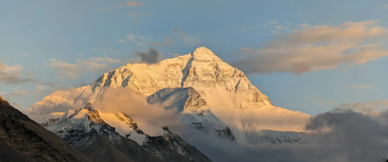
Mount Everest sits directly on the international border between Nepal and the Tibet Autonomous Region of China. The summit, at 8,848.86 meters, is the highest point on Earth, positioned in the Mahalangur Himal sub-range of the greater Himalayan mountain system.
If you need just one sentence: Everest is shared between Nepal and China, with the summit marking the exact boundary between the two countries.
Is Mount Everest in Nepal or China?
This is the question that trips up most people searching for Everest’s location. The answer requires precision.
Mount Everest is in both Nepal and China. The international boundary passes directly over the summit. Neither country exclusively owns the mountain.
What this means practically:
-
South side (Nepal): This is where the classic Everest Base Camp trek takes place. Trekkers fly to Lukla and walk through Sherpa villages to reach South Base Camp at approximately 5,364 meters.
-
North side (Tibet/China): This side offers vehicle access to North Base Camp, located below the Rongbuk Glacier at around 5,150 meters.
The confusion often arises because most trekking content focuses on the Nepal side, leading people to assume Everest is “in Nepal.” Similarly, Chinese sources emphasize the Tibetan approach. The geographic reality is that the mountain belongs to both nations equally.
Where Is Mount Everest Exactly? Coordinates and Map Position
The summit of Mount Everest is located at approximately:
-
Latitude: 27°59’17” N
-
Longitude: 86°55’31” E
In decimal degrees: 27.9881° N, 86.9250° E.
What these coordinates actually tell you:
The latitude of roughly 28° places Everest at the same distance from the equator as Tampa, Florida. This surprises many people who assume the world’s highest mountain must be in a polar region. It’s not — Everest sits in a temperate latitude zone, which influences its weather patterns and climbing seasons.
The longitude of about 86.9° E positions Everest well east of Kathmandu, very close to the Nepal-Tibet border region.
On a map, you’ll find Everest:
-
In southern Asia
-
Within the Himalayan arc that curves across Nepal, India, Bhutan, and Tibet
-
Northeast of Kathmandu
-
South of the Tibetan Plateau
Where Is Mount Everest in Nepal?
From Nepal’s administrative perspective, Everest falls within:
-
Province: Koshi Province
-
District: Solukhumbu District
-
Region: Khumbu
Solukhumbu District is one of Nepal’s 77 districts and covers the mountainous terrain surrounding Everest. The district headquarters is at Salleri, though Lukla serves as the primary air gateway for trekkers.
Khumbu refers to the high-altitude region around Everest, inhabited primarily by Sherpa communities. This is the cultural and trekking heart of the Everest region.
Sagarmatha National Park, a UNESCO World Heritage Site, encompasses much of the Khumbu region, including Everest Base Camp. “Sagarmatha” is the Nepali name for Everest, meaning “forehead of the sky”.
Where Is Everest Base Camp?
Everest Base Camp and the Everest summit are two very different geographic points, separated by 3,448 vertical meters and several days of difficult trekking.
South Base Camp (Nepal)
-
Location: On the Khumbu Glacier in Sagarmatha National Park
-
Elevation: Approximately 5,364 meters
-
Access: Requires 8–12 days of trekking from Lukla
North Base Camp (Tibet/China)
-
Location: Below the Rongbuk Glacier in Tibet Autonomous Region
-
Elevation: Approximately 5,150 meters
-
Access: Vehicles can drive directly to the camp
Critical distinction: The Nepal-side Everest Base Camp is not on the summit of Everest. It sits at the foot of the Khumbu Glacier, roughly 3,448 meters below the summit. The trek to Base Camp does not take you to the top of the mountain — it takes you to the staging area where summit expeditions begin.
How Far Is Mount Everest From Kathmandu?
The straight-line distance from Kathmandu to Everest is approximately 160 kilometers (100 miles).
This figure can be misleading. The actual journey involves:
-
Flight: Kathmandu to Lukla (approximately 30–40 minutes)
-
Trek: Lukla to Everest Base Camp (8–12 days on foot)
The Himalayan terrain makes direct travel impossible. Trekkers follow river valleys and ridge lines that add substantial distance and elevation gain. The total round-trip distance from Lukla to Base Camp and back is approximately 130 kilometers.
How Do You Reach Mount Everest From Nepal?
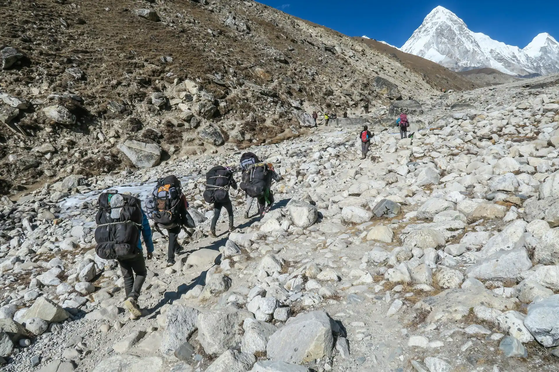
The Nepal-side approach follows a well-established route:
Kathmandu → Lukla (flight) → Phakding → Namche Bazaar → Tengboche → Dingboche → Lobuche → Gorak Shep → Everest Base Camp
Key points along the route:
-
Lukla (2,850 m): The gateway village with the famous Tenzing-Hillary Airport. Starting point for all Nepal-side Everest treks.
-
Namche Bazaar (3,500 m): The largest Sherpa settlement in the Khumbu, used for acclimatization.
-
Tengboche: Site of the famous monastery with panoramic views of Everest, Lhotse, and Ama Dablam.
-
Dingboche and Pheriche: Key acclimatization stops at around 4,400 m.
-
Gorak Shep (5,164 m): The last settlement before Base Camp.
The trek typically takes 12–14 days round trip, allowing for proper acclimatization.
What Is the Nearest Town to Mount Everest?
Calling any settlement near Everest a “town” requires qualification. The Khumbu region has villages, not cities.
Lukla: The air gateway. Not particularly close to Everest in trekking terms (several days away), but it’s where the journey begins.
Namche Bazaar: The largest settlement in the Khumbu. Has lodges, shops, bakeries, and an acclimatization culture. Two days’ walk from Lukla.
Dingboche and Pheriche: Higher villages used for acclimatization.
Gorak Shep: The final settlement before Base Camp. Extremely basic, seasonal teahouses only.
None of these are “cities” in the conventional sense. They are small mountain settlements that exist primarily to support trekking and climbing.
Can You See Mount Everest From Kathmandu?
No, not under normal conditions. Everest is approximately 160 km from Kathmandu, and the city’s topography and air quality usually prevent any view of the mountain.
A rare exception: During the 2020 COVID-19 lockdown, reduced air pollution allowed a photographer to capture Everest from the Kathmandu Valley for the first time in decades. This was an extraordinary circumstance, not a reliable expectation.
What does work: Mountain flights from Kathmandu’s domestic airport offer aerial views of the Himalayan range, including Everest, on clear days. These flights typically last about an hour.
Where Can You See Mount Everest From Nepal?
The most reliable viewpoints for seeing Everest from Nepal include:
-
Kala Patthar (5,545 m): The classic Everest viewpoint. Provides the most accessible close-up view of the summit.
-
Gokyo Ri (5,357 m): Offers views of Everest along with the Gokyo Lakes.
-
Tengboche Monastery: Panoramic views including Everest, Lhotse, and Ama Dablam.
-
Pikey Peak (4,065 m): A lesser-known viewpoint that Edmund Hillary reportedly called the best Everest panorama. It receives a fraction of the crowds compared to more famous viewpoints.
The higher you go, the better the view — but also the greater the altitude risk. Acclimatization is essential before attempting any of these viewpoints.
Nepal Side vs. Tibet Side of Everest
| Feature | Nepal Side (South) | Tibet Side (North) |
|---|---|---|
| Base Camp Elevation | ~5,364 m | ~5,150 m |
| Access to Base Camp | Trekking only (8–12 days) | Vehicle access possible |
| Route Name | South Col | North Ridge |
| Permit Cost | Higher | Lower |
| Crowds | More trekkers and climbers | Fewer |
| Views | Classic Khumbu views | Tibetan Plateau views |
| Cultural Experience | Sherpa villages | Tibetan settlements |
The Nepal side is more popular for trekkers and offers a richer cultural experience. The Tibet side offers easier logistics for climbers but less trekking infrastructure.
Mount Everest Height and Location
Mount Everest’s official height is 8,848.86 meters (29,031.7 feet), as jointly announced by Nepal and China in December 2020.
Historical context: Previous figures included 8,848 m (1954 Survey of India) and 8,850 m (1999 GPS measurement). The 2020 announcement ended a long-standing discrepancy between Nepal’s snow-height measurement and China’s rock-height measurement.
For location purposes, the height matters less than the geographic position. Everest’s elevation does not change its location on the border. But understanding the current official height prevents reliance on outdated figures still circulating online.
Why Is Mount Everest’s Location Important?
Everest’s position on the Nepal-China border has practical implications:
Trekking and climbing logistics: The Nepal side requires permits from Nepal’s Department of Tourism and Sagarmatha National Park. The Tibet side requires Chinese permits and typically higher fees.
Cultural context: The Nepal-side approach passes through Sherpa villages with deep mountaineering heritage. The Tibet-side approach is more remote and less culturally oriented toward climbing.
Accessibility: Lukla’s airport makes the Nepal side more accessible to trekkers. The Tibet side is better suited to climbers who want vehicle access to Base Camp.
Conservation: Sagarmatha National Park (Nepal) and Qomolangma National Nature Preserve (Tibet) protect the mountain’s ecosystems on their respective sides.
Mount Everest Location: What Travelers Should Know
Key takeaways for trip planning:
-
Everest’s summit is on the Nepal-China border. Neither country exclusively “owns” it.
-
Everest Base Camp is not the summit. South Base Camp (Nepal) sits at ~5,364 m; the summit is at 8,848.86 m.
-
Lukla is the gateway, not the destination. From Lukla, expect 8–12 days of trekking to reach Base Camp.
-
Kathmandu to Everest is ~160 km straight-line. Actual travel requires flight plus multi-day trek.
-
You cannot see Everest from Kathmandu under normal conditions.
-
The Nepal side is the standard trekking route. It offers Sherpa culture, established teahouses, and the classic Everest experience.
-
Acclimatization is non-negotiable. The altitude gain from Lukla (2,850 m) to Base Camp (5,364 m) requires a gradual ascent.
Frequently Asked Questions
1. Where is Mount Everest located?
Mount Everest is located on the border between Nepal and the Tibet Autonomous Region of China, in the Mahalangur Himal sub-range of the Himalayas.
2. Is Mount Everest in Nepal or China?
Both. The summit lies exactly on the international border. The southern side is in Nepal; the northern side is in China.
3. What country owns Mount Everest?
No single country owns Everest. The summit is shared between Nepal and China.
4. What district is Mount Everest in?
Solukhumbu District, Koshi Province, Nepal.
5. What mountain range is Mount Everest part of?
The Himalayas, specifically the Mahalangur Himal sub-range.
6. What are the coordinates of Mount Everest?
Approximately 27°59’17” N, 86°55’31” E.
7. Where is Everest Base Camp located?
South Base Camp is in Sagarmatha National Park, Nepal (~5,364 m). North Base Camp is in Tibet, China (~5,150 m).
8. How far is Mount Everest from Kathmandu?
Approximately 160 km (100 miles) straight-line. Actual travel requires a flight to Lukla plus 8–12 days of trekking.
9. Can you see Mount Everest from Kathmandu?
No, not under normal conditions. Rare exceptions have occurred during extreme pollution reductions.
10. What is the nearest town to Mount Everest?
Lukla is the air gateway; Namche Bazaar is the largest settlement in the Khumbu region.
11. Where does the Everest Base Camp trek start?
The standard Nepal-side trek starts at Lukla after a flight from Kathmandu.
12. Is Everest Base Camp on Mount Everest?
No. Base Camp is at the foot of the Khumbu Glacier, approximately 3,448 meters below the summit.
13. What is the height of Mount Everest?
8,848.86 meters (29,031.7 feet), officially agreed by Nepal and China in 2020.
14. What is Mount Everest called in Nepal?
Sagarmatha, meaning “forehead of the sky”.
15. What is the best way to experience Mount Everest from Nepal?
Trek to Everest Base Camp via Lukla and Namche Bazaar, with proper acclimatization. The trek typically takes 12–14 days round trip.
Plan Your Everest Experience With Wonder Hikes Nepal
Understanding Everest’s location is the first step. The next step is experiencing it.
Wonder Hikes Nepal specializes in Everest Base Camp treks and Khumbu region adventures. From Lukla flights to acclimatization schedules, permit arrangements to teahouse bookings, the team handles the logistics so you can focus on the journey.
Ready to see Everest for yourself? Visit wonderhikes.com to explore trekking packages, itineraries, and expert guidance for your Nepal adventure.
Ready to plan your trek?
Tell us your dates and group size. We reply on WhatsApp within a few hours.