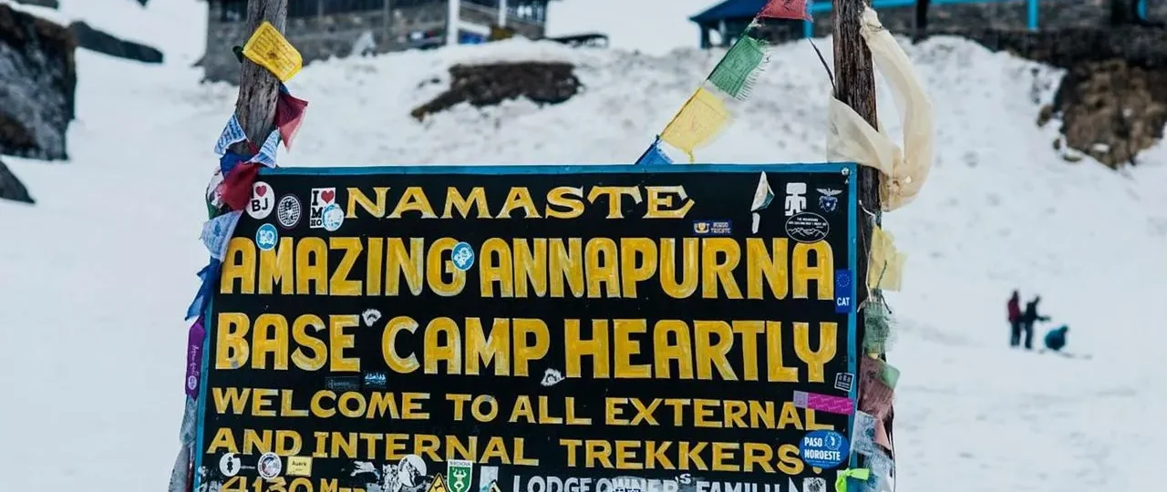
How Many Miles Is the Annapurna Circuit?
If you’ve started researching the Annapurna Circuit, you’ve likely seen a frustrating range of distances: 100 miles, 130 miles, 145 miles—sometimes even within the same article. One source says 160 km. Another says 230 km. A third says 259 km. So, what’s the actual distance?
The short answer is the Annapurna Circuit is between 160 km (100 miles) and 230 km (145 miles), depending on your route, start and end points, use of road transport, and whether you include side trips like Tilicho Lake . If you take a jeep to Chame and exit at Jomsom, you may walk as little as 85–100 km (53–62 miles) . If you do the classic route from Besisahar to Pokhara via the full circuit, you’ll walk closer to 230 km .
This guide explains exactly why the numbers vary and—more importantly—what your actual walking distance will be.
What Is the Total Annapurna Circuit Distance in Miles and KM?
The most common baseline figures you’ll encounter are:
-
160–230 km (100–145 miles): The standard modern range, recognizing route variations
-
160–180 km (100–112 miles): The “modern standard” route with jeep assistance and a standard finish
-
210–230 km (130–145 miles): The “classic” full route from Besisahar to Nayapul
-
~100 km (~62 miles): The “compact” route starting at Chame and ending at Jomsom
The most defensible answer: The Annapurna Circuit’s total available route distance ranges from 100 to 145 miles (160–230 km). Your actual walking distance depends on the choices detailed below.
Why Do Different Websites Give Different Numbers?
You’re not imagining it—the numbers really do conflict. Here’s why:
1. The Roads Changed Everything
Roads now push deep into the valleys on both sides of Thorong La—as far as Manang on the eastern side and Muktinath/Jomsom on the western side . The original trail often ran alongside or on these roads, especially in the lower sections. Modern trekkers can take a jeep to skip the road sections .
What does this mean for distance?
-
Driving from Besisahar to Dharapani cuts about 35 km (22 miles) from your walking distance
-
Driving all the way to Chame cuts about 65 km (40 miles)
-
Ending at Muktinath (instead of walking to Jomsom or Tatopani) cuts about 60 km (37 miles)
2. Where You Start and End
Every itinerary starts and ends differently. Besisahar is the traditional starting point, but many now start at Dharapani or Chame . At the other end, you can finish at Muktinath immediately after the pass, Jomsom, Tatopani, or Nayapul (near Pokhara) .
3. Side Trips
The most common side trip is to Tilicho Lake (4,919 m), the world’s highest lake. It adds roughly 25–40 km (15–25 miles) to your trek, taking 2–3 extra days . The classic route also includes a detour to Ghorepani/Poon Hill, adding significant mileage .
4. NATT Trails vs. Road Walking
To combat the road construction, the Annapurna Conservation Area Project (ACAP) developed NATT (Nepal Annapurna Trekking Trails) —marked off-road alternatives that bypass vehicle roads . These trails are often longer and more strenuous than the road sections, but they preserve the authentic trekking experience. For example, the Tal to Dharapani alternative follows the east bank of the Marsyangdi River rather than the road on the west bank .
5. GPS and Route Variations
GPS devices can report different distances due to altitude, terrain, and map projection. A 259 km figure likely includes multiple NATT alternatives, side trips, and a longer route through the Kaligandaki Valley .
Total Route Distance vs. Actual Walking Distance
This is the most important distinction trekkers need to understand.
-
Total Route Distance: The GPS-mapped length of the “full” trail (including road sections and NATT alternatives), typically 160–230 km
-
Actual Walking Distance: The distance you cover on foot, excluding driven sections. If you take a jeep for road sections, your walking distance can be as low as 85–100 km (53–62 miles)
For a standard 14-day modern itinerary, the walking distance is around 145–160 km (90–100 miles) of actual footpath, using NATT alternatives to avoid road walking.
Road/Jeep Impact: How Much Does Transport Shorten the Trek?
The road sections on the Annapurna Circuit are now extensive. Taking a jeep significantly reduces total walking distance, but most experienced trekkers do it to skip the least scenic, dustiest lower sections .
| Transport Decision | Effect on Walking Distance |
|---|---|
| Drive Besisahar → Dharapani | Saves about 35 km (22 miles) |
| Drive Besisahar → Chame | Saves about 65 km (40 miles) |
| End at Muktinath (instead of Jomsom) | Saves about 25 km (15 miles) |
| End at Jomsom (instead of Tatopani) | Saves about 30 km (18 miles) |
| End at Tatopani (instead of Nayapul) | Adds about 25 km (15 miles) |
The Tilicho Lake Side Trip Distance
Tilicho Lake is a major decision point for many Annapurna Circuit trekkers. From Manang, you typically take a 2–3 day detour to the lake and back .
Distance Impact: The round trip from Manang to Tilicho Lake and back to the main circuit adds approximately 25–40 km (15–25 miles) of walking, depending on your exact starting point . The walk from Tilicho Base Camp to the lake itself involves a steep and exposed ascent that takes 3–4 hours one way. The lake sits at 4,919 m.
Route Details:
-
Manang to Shree Kharka: 3–4 hours
-
Shree Kharka to Tilicho Base Camp: 4–5 hours
-
Tilicho Base Camp to Tilicho Lake: 3–4 hours one way
Typical Daily Walking Distance on the Annapurna Circuit
The daily distance varies significantly by altitude. You’ll cover more miles in the lower valleys and fewer at higher elevations where altitude slows your pace .
-
Lower section (Besisahar to Chame): 13–17 km (8–11 miles) per day, 5–7 hours walking
-
Mid-altitude (Chame to Manang): 12–17 km (7.5–10.5 miles) per day, 5–7 hours walking
-
High altitude (Manang to Thorong La): 8–12 km (5–7.5 miles) per day, 4–6 hours walking
-
Thorong La crossing day: ~16 km (10 miles), 8–10 hours walking
Important: At altitude, distance becomes less important than time. A 10 km day at 4,000 m can feel as demanding as a 25 km day at sea level .
The Upper Pisang Route Choice: A Distance Decision That Matters
From Pisang, you have two route choices to reach Manang:
-
The Lower Trail: Follows the valley floor and is faster but runs closer to the road
-
The Upper Trail: Climbs to Ghyaru (3,730 m) and Ngawal (3,657 m), offering unobstructed Annapurna II and Gangapurna views . It adds roughly 3 km and 2 hours compared to the lower trail but provides significantly better scenery and extra acclimatization benefit
Annapurna Circuit Trek Distance in Miles & KM: Day-by-Day Breakdown
To help you visualize the journey, here is a typical 14-day modern itinerary :
| Day | Route | Distance (km) | Distance (miles) | Walking Time |
|---|---|---|---|---|
| 1 | Drive Kathmandu → Dharapani | 213 km drive | 132 miles drive | 9–10 hours |
| 2 | Trek Dharapani → Chame | 15.5 km | 9.6 miles | 5–6 hours |
| 3 | Trek Chame → Upper Pisang | 13.2 km | 8.2 miles | 5 hours |
| 4 | Trek Upper Pisang → Manang | 17 km | 10.5 miles | 7 hours |
| 5 | Acclimatization Day (Manang) | 4–6 km optional | 2.5–3.7 miles | 2–3 hours |
| 6 | Trek Manang → Yak Kharka | 12 km | 7.5 miles | 4–5 hours |
| 7 | Trek Yak Kharka → Letdar/Thorong Phedi | 8 km | 5 miles | 4 hours |
| 8 | Cross Thorong La → Muktinath | 16 km | 10 miles | 8 hours |
| 9 | Drive Muktinath → Jomsom → Pokhara | Drive | Drive | — |
Total walking on this modern standard itinerary: Approximately 90–100 km (56–62 miles)
Distance vs. Difficulty: Why Altitude Matters More Than Miles
The Annapurna Circuit is not a race. The key challenge is altitude, not distance. You climb from under 1,000 m to 5,416 m at Thorong La Pass . At elevations above 3,000 m, the thin air makes every step more demanding .
-
Acclimatization: Proper acclimatization days are essential. The distance you cover is secondary to allowing your body to adapt to the altitude. Trekkers require 1–2 rest days in Manang (3,519 m) before attempting Thorong La
-
Daily Walking Time: The “standard” itinerary is built to manage altitude gain, not mileage. You can hike 15 km in the low valleys, but at high altitude, you’ll be slower
-
Terrain: The route includes steep ascents/descents, rocky trails, and loose scree, especially near Thorong La
-
Cumulative Elevation: Total ascent is approximately 11,500–12,500 meters, and total descent approximately 12,800–13,500 meters . This explains why the trek feels harder than distance alone suggests
-
The 50% oxygen threshold: At Thorong La Pass (5,416 m), atmospheric oxygen is approximately half that of sea level. Your heart rate at rest will be noticeably elevated
Route Variations: How to Calculate Your Actual Distance
To estimate your actual walking distance, choose your start, end, and transport options.
Classic Full Route
-
Start: Besisahar (walking from the start)
-
End: Nayapul (via Ghorepani/Poon Hill)
-
Distance: ~210–230 km (130–145 miles)
-
Duration: 18–22 days
Modern Standard Route (Most Common)
-
Start: Jeep to Dharapani or Chame, then walk
-
End: Jomsom, then fly/drive to Pokhara
-
Distance: ~145–160 km (90–100 miles) walking
-
Duration: 12–15 days
Compact/Short Route
-
Start: Jeep to Dharapani or Chame
-
End: Muktinath (road transport out)
-
Distance: ~55–100 km (34–62 miles) walking
-
Duration: 10–13 days
Full Circuit with Tilicho Lake
-
Start: Besisahar or jeep-assisted
-
End: Nayapul or Jomsom
-
Distance: Base route + 25–40 km (15–25 miles)
-
Duration: Base route + 2–3 days
Ultra-Extended Circuit with Annapurna Base Camp
-
Distance: ~285–300 km
-
Duration: 22–25 trekking days
How Many Days Does the Trek Take?
The number of days depends on your route and itinerary choices .
| Itinerary | Trekking Days | Approx. Total Walking Distance |
|---|---|---|
| Short/Compact | 10–12 days | ~55–100 km (34–62 miles) |
| Standard Modern | 12–15 days | ~145–160 km (90–100 miles) |
| Classic Full Route | 18–22 days | ~210–230 km (130–145 miles) |
| With Tilicho Lake | 14–21 days | Base + 25–40 km (15–25 miles) |
Can a Beginner Handle the Distance?
The Annapurna Circuit is considered moderate to challenging . A “beginner” in this context means someone with good fitness but limited multi-day trekking experience. With proper preparation, many beginners complete the circuit .
-
Physical Fitness: You should be comfortable walking 10–15 km (6–9 miles) per day over varied terrain for 10+ days. Hill/mountain hiking practice is highly recommended. A good level of physical fitness is essential to complete the trek safely
-
Altitude: This is the bigger challenge. Proper acclimatization and paying attention to AMS symptoms are more important than raw fitness. Acute Mountain Sickness (AMS) develops when ascent rate exceeds approximately 500 m per day above 3,000 m
-
Training: Even beginners can complete this journey if they train for at least three months ahead of the trek. Cycling, swimming, jogging, and cardiovascular activities are some techniques to prepare your body
-
Support: Using a guide and porter significantly reduces the physical burden of carrying a heavy pack, making the distance more manageable
-
Pace: The itinerary sets a moderate pace. Many first-time trekkers succeed by choosing a longer itinerary with more rest/acclimatization days
Annapurna Circuit Trekking Routes: Section-by-Section Guide
Lower Marsyangdi Valley (Below 3,000 m)
This section sees the most road overlap . Below Jagat, the trail crosses suspension bridges over the Marsyangdi River, passing through Gurung and Tamang villages with terraced rice fields, waterfalls, and subtropical bamboo forest. Most experienced trekkers take a jeep from Besisahar to Chame, saving approximately 65 km of walking .
Chame to Manang (2,670 m to 3,540 m)
This is where the Annapurna Circuit Trail earns its reputation . The landscape shifts from dense pine forest to open semi-arid valley. Enormous rock faces rise directly above the trail near Chame. From Pisang, you have two route choices:
-
The lower trail follows the valley floor and is faster
-
The upper trail climbs to Ghyaru (3,730 m) and Ngawal (3,657 m)
Manang to Thorong La (3,540 m to 5,416 m)
Above Manang, the landscape changes completely. Trees disappear and the valley opens into a high-altitude desert environment with sparse vegetation and grazing yaks . From Yak Kharka (4,018 m) to Thorong Phedi (4,560 m), the terrain is rocky and fully exposed.
Important 2025/2026 trail update: Landslides have destroyed two older trail variants between Yak Kharka and Thorong Phedi. Trekkers must now cross a suspension bridge and use the current designated path. Cross this zone in the morning due to rockfall risk.
Muktinath to Jomsom Descent
The Kali Gandaki Gorge below Muktinath (3,800 m) is one of the deepest gorges in the world. The trail passes through Kagbeni, Marpha, and Tukuche before reaching Jomsom (2,720 m). However, most of this section now runs alongside a road. Many trekkers choose to fly from Jomsom to Pokhara .
How to Compare Annapurna Circuit Itineraries Like a Pro
When evaluating different trekking company itineraries, ask these questions to understand your actual walking distance :
-
Where does the trek start? Besisahar (walk) or Dharapani/Chame (jeep)?
-
Where does the trek end? Muktinath, Jomsom, Tatopani, or Nayapul?
-
Which sections are driven? Besisahar to Dharapani? Dharapani to Chame? Muktinath to Jomsom?
-
Does the itinerary use NATT trails? This adds scenic value but may add distance
-
Are side trips included? Tilicho Lake? Ghorepani/Poon Hill?
-
How many acclimatization days? More days = slower pace = easier, but same distance
-
What’s the daily walking time? Not just distance—this tells you about terrain and altitude
-
Is there a guide? This affects pace, logistics, and safety—not distance, but your ability to handle it
The Road-Free NATT Trails: Why Your GPS Might Show More Than You’ll Walk
One of the most confusing elements of Annapurna Circuit distance calculations is the NATT trail system — Nepal Annapurna Trekking Trails. These are off-road alternatives developed by ACAP to preserve the trekking experience as roads expanded into the valleys .
Here’s what NATT means for your distance:
The standard GPS-mapped “total route” often includes NATT alternatives, which can push the mapped distance toward 230–260 km . But here’s the crucial distinction: NATT trails are optional. Many modern itineraries use them selectively, which is why two trekkers on the same “Annapurna Circuit” can report different distances.
Key NATT sections that affect your mileage:
| NATT Section | Distance Impact | Why It Matters |
|---|---|---|
| Tal → Dharapani (east bank alternative) | Adds ~2–3 km | Bypasses the dusty jeep road on the west bank; quieter and more scenic |
| Upper Pisang → Ghyaru → Ngawal → Manang | Adds ~3 km + 2 hours | The most important NATT section; completely road-free with unobstructed Annapurna II, III, and IV views |
| Ngawal → Manang forest descent | Adds minimal distance | Passes through juniper stands and ancient mani walls rather than the jeep track |
Blue-and-white NATT markers identify these alternatives at trail junctions, while red-and-white markers indicate the standard ACAP route .
The practical takeaway: If you see a distance figure like 257.6 km , it likely includes all NATT alternatives plus side trips. Your actual walking distance on a modern standard itinerary—using NATT selectively—remains around 145–160 km (90–100 miles).
How Side Trips Change Your Total Distance and Itinerary
Beyond Tilicho Lake, the Annapurna Circuit offers several detours that can significantly affect your total mileage. Here’s what each adds:
Tilicho Lake (Most Popular Side Trip)
The round trip from Manang to Tilicho Lake and back to the main circuit adds approximately 25–40 km (15–25 miles) and requires 2–3 extra days .
Detailed Tilicho breakdown :
| Segment | Distance | Walking Time | Altitude |
|---|---|---|---|
| Manang → Tilicho Base Camp | ~6–8 km | 5–6 hours | 3,540 m → 4,150 m |
| Tilicho Base Camp → Tilicho Lake | ~4 km one-way | 3–4 hours up, 2–3 hours down | 4,150 m → 4,919 m |
| Tilicho Base Camp → Shree Kharka | ~8 km | 3–4 hours | 4,150 m → 4,000 m |
| Shree Kharka → Yak Kharka | ~8.4 km | 4–5 hours | 4,000 m → 4,018 m |
Critical acclimatization note: You should already have spent 2 nights in Manang (3,540 m) before starting the Tilicho side trip . Going from Manang to Tilicho Base Camp (4,150 m) is a 610 m altitude gain, then to Tilicho Lake (4,919 m) is a 769 m gain—both within reasonable limits only if you are well acclimatized .
2026 Tilicho costs: Approximately USD 100–150 extra for the 3-day detour, including tea-house nights and meals .
Ice Lake (Alternative Side Trip)
Ice Lake sits at 4,600 m and takes 4–5 hours round trip from Manang. It adds 1 extra day and is less physically demanding than Tilicho Lake . While Tilicho offers the high-altitude lake experience, Ice Lake provides panoramic Himalayan views .
Both Tilicho and Ice Lake
Some trekkers choose to do both, which requires 3 additional days beyond the standard circuit . The total extra distance is approximately 30–45 km (18–28 miles) . The combined experience is highly recommended by experienced guides, but it requires strong fitness and solid acclimatization .
Short vs. Standard vs. Extended: Which Route Matches Your Fitness?
The distance you walk isn’t just about the trail—it’s about matching the route to your fitness and available time .
Short Route (10–12 Days)
-
Walking distance: ~55–100 km (34–62 miles)
-
Start: Jeep to Chame (skips lower valley)
-
End: Flight from Jomsom
-
Best for: Fit trekkers with previous high-altitude experience and limited vacation days
-
Important: You gain altitude more quickly since you start directly at Chame (2,710 m). Your body experiences greater physiological stress on this shorter journey
Standard Route (14–18 Days)
-
Walking distance: ~145–160 km (90–100 miles)
-
Start: Jeep to Dharapani or Chame, then walk
-
End: Jomsom or Nayapul
-
Best for: Most trekkers with moderate fitness, no specific altitude experience requirement, and adequate time
-
Includes: 1–2 acclimatization days at Manang and optional Poon Hill detour
Extended Route (21–28 Days)
-
Walking distance: 210–260 km (130–160 miles)
-
Best for: Trekkers prioritizing complete immersion, side trips (Tilicho Lake, Ice Lake, Nar Phu Valley), and flexibility
-
Includes: Buffer days at multiple villages, high route via Ghyaru and Ngawal, Poon Hill finish
First-time high-altitude trekkers consistently benefit from choosing the standard or extended itinerary over the short version . The extra days near 3,500 m to 4,000 m build acclimatization and reduce Thorong La crossing risk.
Why Altitude Trumps Distance: The Science Behind the Struggle
The Annapurna Circuit’s challenge is altitude, not mileage . Here’s why:
-
At 4,000 m (13,123 ft), you receive roughly 30% less oxygen per breath than at sea level .
-
At Thorong La (5,416 m), oxygen is approximately half of sea-level levels.
This explains why a 10 km day at 4,000 m can feel far more demanding than a 15 km day in the lower valleys . Your body works harder to supply oxygen to your muscles. Your pace slows naturally, breathing gets heavier, and recovery takes longer .
How daily distance changes with altitude :
| Altitude Zone | Typical Daily Distance | Walking Time | Key Challenge |
|---|---|---|---|
| Below 3,000 m | 15–17 km (9–11 miles) | 5–7 hours | Longer distances |
| 3,000–4,000 m | 10–12 km (6–7.5 miles) | 4–6 hours | Reduced oxygen |
| Above 4,000 m | 8–10 km (5–6 miles) | 3–5 hours | Significant oxygen drop |
| Thorong La day | 15–17 km (9–11 miles) | 8–10 hours | Extreme altitude + long day |
Why itineraries reduce daily distance at altitude: Covering fewer kilometers at altitude can feel way more demanding than walking longer distances down in the lower valleys. Well-planned Annapurna Circuit itineraries cut back on daily distance as altitude increases. These are not rest days—they’re strategic acclimatization days designed to help prevent altitude sickness .
A note on your walking pace: Above 4,000 m, even experienced trekkers slow to 2–3 km per hour . At lower elevations, you might walk 4–5 km per hour. This is why walking time is often a more reliable variable than distance for estimating daily effort .
Practical Guide: Choosing Your Ideal Annapurna Circuit Distance
If you have 10–12 days:
-
Choose the short route starting at Chame
-
Accept that you’ll walk ~55–100 km
-
Crucial: You need prior high-altitude experience—your body gains altitude quickly on this condensed itinerary
If you have 14–18 days:
-
Choose the standard modern route
-
You’ll walk ~145–160 km (90–100 miles)
-
This works for most trekkers with moderate fitness
-
Includes proper acclimatization days at Manang
If you have 21+ days:
-
Choose the extended route
-
You’ll walk 210+ km (130+ miles)
-
Includes Tilicho Lake, Ice Lake, or Nar Phu Valley
-
Best for the complete, immersive experience
The most common mistake: Skipping acclimatization days to save time. A headache at Manang (3,540 m) is normal—a headache that worsens after rest, combined with nausea or loss of coordination, is a signal to descend immediately .
Updated Distance Summary Table (Revised)
| Route Variation | Walking Distance | Trekking Days | Key Features |
|---|---|---|---|
| Short/Compact | ~55–100 km (34–62 mi) | 10–12 | Jeep to Chame; flight from Jomsom |
| Modern Standard | ~145–160 km (90–100 mi) | 14–18 | Jeep to Dharapani; Jomsom exit; 1–2 acclimatization days |
| Classic Full | ~210–230 km (130–145 mi) | 18–22 | Besisahar start; Nayapul finish; Poon Hill detour |
| With Tilicho Lake | Base + 25–40 km (15–25 mi) | 14–21 | Adds 2–3 days; requires extra acclimatization |
| With Nar Phu Valley | Base + 60–70 km (37–43 mi) | 21–28 | 5–6 extra days; remote valley experience |
| NATT Full (GPS) | ~257 km (160 mi) | 20–25 | Includes all NATT alternatives—not your typical walking distance |
Frequently Asked Questions About Annapurna Circuit Distance
1. How many miles is the full Annapurna Circuit?
The full classic route is approximately 130–145 miles (210–230 km) .
2. How many miles is the Annapurna Circuit if I take a jeep?
With a jeep to Dharapani or Chame and exit at Muktinath, the walking distance can be as low as 55 miles (88 km) .
3. How many kilometers is the Annapurna Circuit?
The distance is generally quoted as 160–230 km, depending on the itinerary .
4. Why do some websites say 160 km and others say 230 km?
The difference comes down to road transport, start/end points, and whether side trips are included .
5. Is the Annapurna Circuit actually 160 km or 230 km?
Both are correct—160 km represents a modern standard itinerary, while 230 km represents the classic full route .
6. Does walking on the road count toward the distance?
Yes, but most modern trekkers take jeeps to skip road sections, which reduces the walking distance .
7. How much distance does Tilicho Lake add?
The Tilicho Lake side trip adds approximately 25–40 km (15–25 miles) to your total walking distance .
8. How many miles do people walk per day on the Annapurna Circuit?
On average, 5–10.5 miles (8–17 km) per day, with shorter days at higher altitudes .
9. How many days is the Annapurna Circuit trek?
Typically 12–18 days, but can range from 10 to 22 days depending on the itinerary .
10. What is the easiest starting point?
Besisahar is the traditional start. Dharapani or Chame saves lower valley walking .
11. What is the best ending point?
Jomsom is the most common exit. Extending to Tatopani or Nayapul adds distance and scenery .
12. How hard is the Thorong La crossing?
It’s the toughest day—approximately 10 miles (16 km) at high altitude with significant ascent and descent .
13. Can a beginner trek the Annapurna Circuit?
Yes, with good fitness, proper acclimatization, and a suitable itinerary .
14. Is altitude more important than mileage?
Yes. The altitude gain is the primary challenge; distance is secondary .
15. How do NATT trails affect the distance?
NATT trails are off-road alternatives that bypass vehicle roads. They are often longer than the road but provide a more scenic, traditional trekking experience .
How to Prepare for the Annapurna Circuit Distance
Physical Preparation
-
Start training 3–4 months in advance
-
Build endurance: Walk 8–12 km (5–7 miles) daily with a loaded pack
-
Practice elevation gain: Find local hills and do 500–800 m (1,600–2,600 ft) of elevation gain per session
-
Strength training: Core and leg strength help with steep descents
Mental Preparation
-
Accept slow days: At high altitude, 8 km (5 miles) can take 5–6 hours
-
Plan for acclimatization: Rest days aren’t “wasted”—they’re essential. Skipping rest days is the most common mistake on the circuit
-
Adjust expectations: The circuit isn’t a race; it’s an endurance journey
-
Find your “Himalayan Pace”: Walk at a speed where you can still hold a full conversation without gasping for breath. If you’re too breathless to talk, you’re moving too fast for the altitude
Packing for Distance
-
Keep pack weight under 10–12 kg (22–26 lbs) if self-trekking
-
Use a porter to reduce physical strain and enjoy the scenery
-
Wear comfortable, well-broken-in hiking boots—blisters ruin any distance
-
Hydration is your secret weapon: Aim to drink 3–4 liters of water daily. Dehydration mimics and worsens altitude sickness symptoms
Wonder Hikes Nepal: Making Sense of Your Annapurna Circuit Distance
If you’re comparing Annapurna Circuit itineraries, Wonder Hikes Nepal can help you understand exactly which sections are walked, where transport is used, and how the itinerary affects your total distance. Whether you prefer a full classic trek or a modern jeep-assisted route, clarity about your mileage helps you prepare physically and choose the right itinerary for your fitness and available time.
Their experienced team can explain:
-
Which route variations suit your fitness level
-
How transport choices affect walking distance and scenery
-
Whether Tilicho Lake is right for your timeline
-
How daily distances align with altitude acclimatization needs
Final Thoughts: The Real Distance Is What You Walk
The most important takeaway is this: the Annapurna Circuit’s distance isn’t a fixed number—it’s a range that depends on your choices. The classic 230 km route still exists, but most modern trekkers walk 145–160 km (90–100 miles) using jeep assistance for road sections . Some walk as little as 55 miles (88 km) on a compact itinerary .
What matters isn’t the total number but how the distance fits with your fitness, available time, and trekking goals. A longer route with more scenery and acclimatization may be more enjoyable than a shorter, road-intensive itinerary.
Plan your route intentionally. Understand what you’re walking—and what you’re driving. And choose an itinerary that matches your physical preparation and your desire for an authentic Himalayan trekking experience .