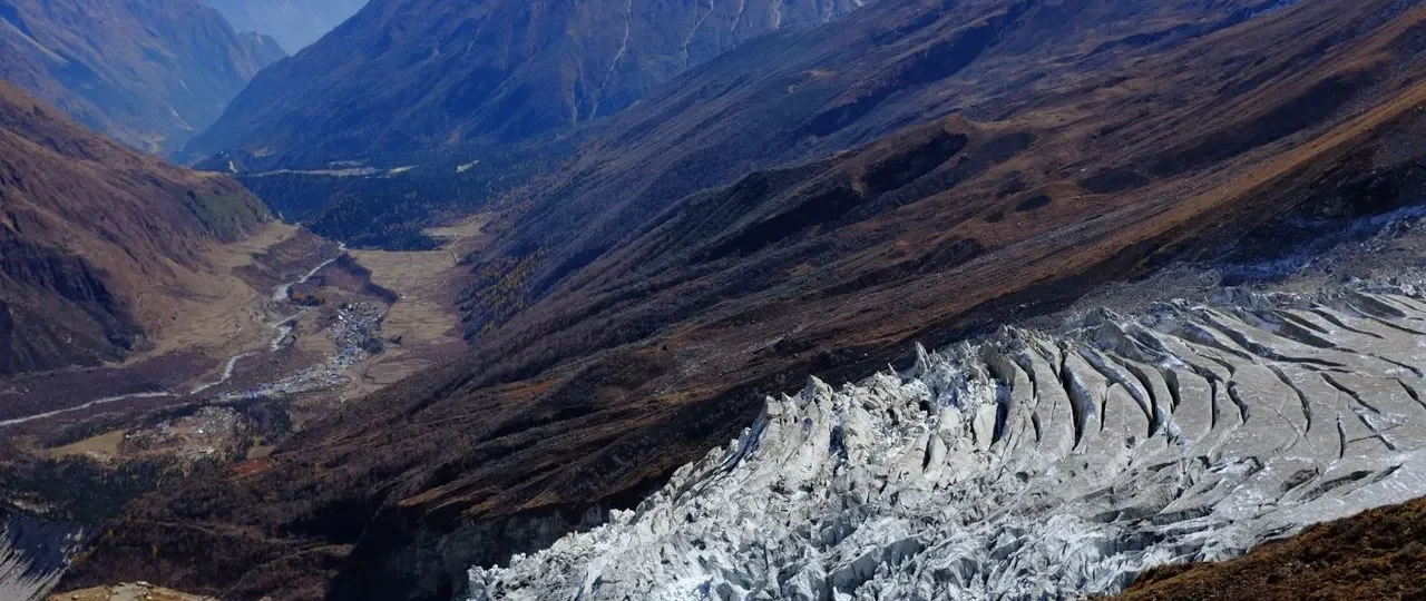
Where Is Manaslu Located? Direct Answer
Where is Manaslu located is a question with a precise answer: Mount Manaslu sits in Nepal’s Gandaki Province, on the border between Gorkha District and Manang District, within the Mansiri Himal mountain range. The mountain lies approximately 100 kilometers northwest of Kathmandu and about 25 kilometers south of the Tibetan border.
Manaslu location is entirely within Nepal, not on the border with Tibet. This is a common point of confusion because the Manaslu region has strong cultural connections to Tibet and lies close to the frontier. However, the mountain itself is firmly within Nepalese territory, unlike some Himalayan peaks that straddle international boundaries.
Where is Mount Manaslu located in relation to other Nepalese mountains? The mountain sits between the Annapurna range to the west and the Ganesh Himal to the east. It is not part of the Annapurna range, though the two massifs are relatively close neighbors. The Marsyangdi River Valley separates the Annapurna and Manaslu ranges.
Manaslu Nepal location places the mountain in the north-central part of the country. The peak rises from the Mansiri Himal, a compact mountain massif that stands somewhat isolated from the main Himalayan crest that forms Nepal’s northern border with Tibet.
For practical purposes, trekkers should understand that Manaslu located in this position means access requires significant travel. The trailhead villages of Soti Khola and Machha Khola are reached by road from Kathmandu, a journey of 7-10 hours. From there, trekkers continue on foot through the Budhi Gandaki Valley toward the mountain.
Manaslu Location on the Map of Nepal
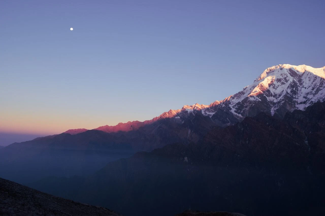
Manaslu location on the map places it in the north-central portion of Nepal, closer to the western side of the country than the eastern side. When trekkers look at a standard map of Nepal, Manaslu appears northwest of Kathmandu, positioned between the better-known Annapurna range and the lesser-known Ganesh Himal.
Manaslu Nepal map position shows the mountain rising from a southward-projecting spur of the Himalaya. This geographic feature explains why Manaslu sits well within Nepalese territory rather than straddling the border with Tibet. The main Himalayan crest lies north of Manaslu, closer to the actual border.
Where is Manaslu on the map in terms of elevation context? The mountain rises dramatically from relatively low valleys. The Budhi Gandaki Valley, at the mountain’s western base, lies between 1,000 and 2,000 meters above sea level. This means Mount Manaslu rises over 6,000 vertical meters from the valley floor to the summit.
Manaslu location in Nepal map also reveals the mountain’s isolation. Unlike peaks on the main Himalayan crest that are visible from distant locations, Manaslu is hidden within its own compact massif. Trekkers do not see the mountain until they have penetrated deep into the Budhi Gandaki Valley.
Understanding Manaslu map location helps trekkers plan their approach. The mountain is not accessible from Pokhara, despite Pokhara’s proximity to the Annapurna region. Instead, trekkers must travel north from Kathmandu through Gorkha District to reach the Manaslu trailheads.
Manaslu District: Gorkha vs Manang Explained
Manaslu district attribution is genuinely confusing because the mountain sits on the boundary between two districts. Different sources correctly attribute Manaslu to either Gorkha District or Manang District, depending on which side of the mountain they reference.
Manaslu Gorkha District is the most common attribution. The standard trekking route approaches through Gorkha District, following the Budhi Gandaki Valley northward. Trekkers begin their journey in Gorkha, pass through Gorkha villages, and spend most of their time within Gorkha’s administrative boundaries. The village of Samagaon, the primary settlement near the mountain, is in Gorkha District.
Manaslu Manang District is also accurate for the mountain’s eastern slopes. The district boundary between Gorkha and Manang runs through the Manaslu massif. When trekkers cross Larkya La Pass, they transition from Gorkha District into Manang District. The eastern approaches to the mountain fall within Manang’s territory.
Which district is Manaslu in does not have a single answer. The mountain straddles both districts, which explains the conflicting attributions. For practical trekking purposes, the Gorkha attribution is more useful because the primary access route lies within Gorkha District.
Mount Manaslu district location matters for administrative purposes, including permit regulations and local governance. However, trekkers do not need to navigate district boundaries themselves. Trekking agencies and guides handle all administrative requirements, and the district distinction does not affect the trekking experience.
Understanding Manaslu which district helps resolve confusion when reading different sources. When a source says “Manaslu is in Gorkha District,” it is referencing the primary access route. When a source says “Manaslu is in Manang District,” it is referencing the eastern slopes. Both are partially correct.
Manaslu Mountain Range: Mansiri Himal and Manaslu Himal
Manaslu mountain range identification requires understanding the Mansiri Himal. This mountain range contains Mount Manaslu as its highest peak and includes several other significant summits.
Mansiri Himal is the formal geographic name for the range. The term “Mansiri” derives from the Sanskrit word “Manasa,” meaning “mountain of the spirit.” This name appears in mountaineering literature, geographic databases, and official mapping.
Manaslu Himal is the more commonly used term in trekking and tourism contexts. It refers to the same range but emphasizes the connection to Mount Manaslu, the range’s most famous peak. Trekking agencies use “Manaslu Himal” because it is more recognizable to international travelers.
Manaslu Himal and Mansiri Himal are not different ranges. They are different names for the same geographic feature. The relationship can be understood as follows:
| Term | Usage Context | Geographic Scope |
|---|---|---|
| Mansiri Himal | Geographic/mountaineering | The entire mountain range |
| Manaslu Himal | Trekking/tourism | The same mountain range |
| Mount Manaslu | General reference | The highest peak in the range |
Manaslu mountain range name confusion is similar to other Himalayan naming situations. Many ranges have both formal geographic names and common tourism names. Trekkers can use either term confidently.
The Mansiri Himal contains several significant peaks beyond Mount Manaslu. Himalchuli, at 7,893 meters, is the world’s 18th-highest mountain. Ngadi Chuli, at 7,871 meters, ranks 20th globally. These peaks cluster together with Mount Manaslu, creating a compact and dramatic mountain massif.
Manaslu Elevation and Geographic Coordinates
Manaslu elevation is 8,163 meters (26,781 feet), making it the eighth-highest mountain on Earth. This elevation places Manaslu firmly among the “eight-thousanders”—the fourteen mountains worldwide that exceed 8,000 meters.
Mount Manaslu height in meters of 8,163 meters is well-established and consistently reported across authoritative sources. The elevation was first accurately measured in the mid-20th century and has been refined through subsequent surveys. There is no significant controversy about Manaslu’s elevation.
Manaslu height in feet of 26,781 feet is useful for trekkers familiar with imperial measurements. The conversion is straightforward: 8,163 meters equals 26,781 feet.
Manaslu coordinates place the summit at approximately 28°33′N latitude and 84°34′E longitude. These coordinates are consistent across geographic databases and mountaineering references. The summit sits in the central Nepal Himalaya, slightly west of the country’s longitudinal center.
Manaslu elevation in meters relative to its surroundings creates dramatic vertical relief. The Budhi Gandaki Valley, at the mountain’s western base, lies between 1,000 and 2,000 meters. This means Mount Manaslu rises over 6,000 vertical meters from the valley floor to the summit—one of the most dramatic elevation profiles in Nepal.
Understanding Manaslu elevation and coordinates provides essential context for trekkers. The mountain’s height and position determine the trekking difficulty, the altitude challenges, and the visual experience of the Manaslu Circuit.
Where Is the Manaslu Region Located?
Manaslu region location refers to a broader geographic area than Mount Manaslu itself. The region encompasses the mountain, its surrounding valleys, the Manaslu Conservation Area, and the villages along the approach routes.
Where is the Manaslu region in Nepal? The region occupies the northern portion of Gorkha District, with extensions into Manang District. It is bounded by the Budhi Gandaki River to the west and south, the Marsyangdi River to the east, and the Tibetan border to the north.
Manaslu region Nepal is remote by Nepalese standards. Road access extends only to the southern edge of the region, at villages like Soti Khola and Machha Khola. Beyond these trailheads, travel is exclusively on foot, following trails that have been used for centuries by local communities and traders.
Manaslu region location within Gandaki Province places it in the same administrative region as Pokhara, though the mountain is significantly farther north. Gandaki Province extends from the Indian border in the south to the Tibetan border in the north.
The Manaslu region is culturally distinct from other parts of Nepal. The northern portions are inhabited by Nubri and Tsumba people, who speak Tibetan dialects and practice Tibetan Buddhism. This cultural character reflects the region’s historical connections to Tibet, despite its geographic location within Nepal.
Understanding where the Manaslu region is located helps trekkers prepare for the experience. The region is not a day trip from Kathmandu, nor is it easily accessible from Pokhara. Reaching the Manaslu region requires commitment, planning, and a willingness to travel through remote terrain.
Where Is the Manaslu Conservation Area?
Manaslu Conservation Area location covers approximately 1,663 square kilometers of protected landscape surrounding Mount Manaslu. Established in 1998, this conservation area encompasses diverse ecosystems from subtropical forests to permanent ice.
Where is Manaslu Conservation Area in relation to the mountain? The conservation area surrounds Mount Manaslu, extending across the Budhi Gandaki Valley in Gorkha District and reaching eastward toward the Marsyangdi Valley. The conservation area includes the entire Manaslu Circuit trekking route within its boundaries.
Manaslu Conservation Area Gorkha is the primary administrative context. The conservation area is managed under the National Trust for Nature Conservation, with local offices coordinating with Gorkha and Manang district authorities.
The conservation area’s boundaries align closely with the geographic Manaslu region. The southern boundary lies near the village of Jagat, where the restricted area begins. The northern boundary approaches the Tibetan border. The western and eastern boundaries follow topographic features that separate the Manaslu massif from neighboring ranges.
Manaslu Conservation Area permit requirements apply to all trekkers. The restricted-area status requires special permits and licensed guides. These regulations serve both conservation and safety purposes.
Understanding Manaslu Conservation Area location helps trekkers appreciate why the region is managed differently from more accessible trekking areas. The conservation status protects biodiversity, cultural heritage, and the natural landscape that makes the Manaslu region unique.
Where Is the Manaslu Circuit Trek Located?
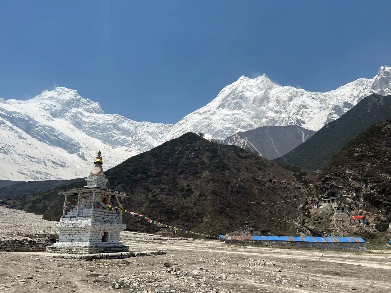
Manaslu Circuit location refers to the trekking route that circles Mount Manaslu. This route follows the Budhi Gandaki River northward, crosses Larkya La Pass, then descends through the Marsyangdi Valley to connect with the Annapurna region.
Where is the Manaslu Circuit trek in relation to the mountain? The circuit traces a counterclockwise route around Mount Manaslu. The western half follows the Budhi Gandaki Valley, providing primary views of the mountain’s western and northern faces. The eastern half crosses Larkya La and descends through terrain revealing the mountain’s eastern aspects.
Manaslu Circuit trek route begins in Gorkha District at the trailhead villages of Soti Khola or Machha Khola. The trail climbs steadily through the Budhi Gandaki Valley, passing through villages like Jagat, Deng, Namrung, and Samagaon. The route reaches its highest point at Larkya La Pass, 5,160 meters above sea level.
Manaslu Circuit location map shows the route as a horseshoe-shaped loop around the mountain. The circuit is not a simple circular trail. It is a route that circles the mountain from south to north, then crosses a high pass and descends through a different valley system.
Key locations along the Manaslu Circuit trek include:
| Location | Elevation | Significance |
|---|---|---|
| Soti Khola | 700m | Trailhead |
| Jagat | 1,410m | Restricted area entry |
| Deng | 1,860m | Transition village |
| Namrung | 2,630m | First mountain views |
| Samagaon | 3,520m | Acclimatization stop |
| Samdo | 3,860m | Last village before pass |
| Larkya La | 5,160m | Highest point |
| Bimtang | 3,720m | Post-pass village |
| Dharapani | 1,860m | Circuit end |
Where Is Manaslu Base Camp Located?
Manaslu Base Camp location places it on the northeastern side of Mount Manaslu, above the village of Samagaon. The base camp is a high-altitude viewpoint and traditional stopping point rather than a permanent mountaineering facility.
Where is Manaslu Base Camp in relation to Samagaon? The base camp lies approximately 6-8 kilometers northeast of Samagaon, at an elevation of approximately 4,800 meters. Trekkers reach the base camp as a day hike from Samagaon, typically taking 4-5 hours for the ascent.
Manaslu Base Camp altitude of approximately 4,800 meters places it firmly in the high-altitude zone. Trekkers who visit the base camp as an acclimatization hike gain valuable altitude exposure that helps them prepare for the higher elevations ahead.
Manaslu Base Camp Nepal sits on the lower slopes of Mount Manaslu, near the Manaslu Glacier. The location offers dramatic views of the mountain’s northeast face, which rises over 3,000 vertical meters from the base camp area to the summit.
Where is Manaslu Base Camp located in relation to the circuit? The base camp is a side trip from Samagaon, not a separate trek. It is typically visited on the acclimatization day during the standard Manaslu Circuit itinerary.
Understanding Manaslu Base Camp location clarifies a common point of confusion. The base camp is not a mountaineering camp with permanent facilities. It is a trekking destination that provides close-up views of Mount Manaslu and the glacier system.
Manaslu Location Relative to Annapurna and Tibet
Manaslu to Annapurna relationship is geographic, not administrative. The two mountain ranges are neighbors but remain distinct. The Annapurna range lies to the west of Manaslu, separated by the Marsyangdi River Valley.
Manaslu Annapurna distance is approximately 60 kilometers between the two massifs at their closest points. This proximity explains why the Manaslu Circuit eventually connects with the Annapurna region. When trekkers cross Larkya La, they descend into the Marsyangdi Valley, which lies between the two ranges.
Manaslu to Tibet distance is approximately 25 kilometers from the mountain to the border. This proximity to Tibet explains the region’s restricted-area status and its cultural connections to Tibetan communities. However, the mountain itself is entirely within Nepalese territory.
Manaslu Tibet border proximity means the northern approaches to the mountain are sensitive areas. The restricted-area designation reflects security considerations related to the border, as well as conservation and cultural protection priorities.
Manaslu Annapurna Tibet relationship helps orient the mountain within the broader Himalayan geography. Manaslu sits between the better-known Annapurna range and the Tibetan Plateau, occupying a transitional zone that combines elements of both landscapes.
Understanding Manaslu relative location helps trekkers visualize the mountain’s position. Manaslu is not isolated in an inaccessible corner of Nepal. It sits in a region that connects to both the Annapurna trekking network and the Tibetan cultural sphere.
Manaslu Distance from Kathmandu
Manaslu to Kathmandu distance is approximately 100 kilometers as the crow flies. However, road travel to the trailheads takes significantly longer due to the mountainous terrain and road conditions.
Kathmandu to Manaslu distance by road to Soti Khola or Machha Khola ranges from 130 to 160 kilometers, depending on the route taken. This journey typically takes 7-10 hours by private jeep or bus, reflecting the challenging road conditions rather than the direct distance.
Manaslu distance from Kathmandu in terms of the full trekking route is even longer. The Manaslu Circuit trek covers approximately 177 kilometers of trail from start to finish. Trekkers begin with a road journey from Kathmandu, then complete the circuit on foot.
How far is Manaslu from Kathmandu is a practical question for trek planning. The answer depends on what is being measured: direct distance, road distance, or total trekking distance.
| Measurement | Distance | Travel Time |
|---|---|---|
| Direct distance | ~100 km | N/A (straight line) |
| Road to trailhead | 130-160 km | 7-10 hours |
| Full circuit trek | ~177 km | 14-18 days |
Manaslu Kathmandu orientation is northwest. Trekkers leave Kathmandu heading west, then north, following the Budhi Gandaki River upstream toward the mountain. The route passes through Gorkha District, which also contains the historic Gorkha Durbar.
Understanding Manaslu distance from Kathmandu helps trekkers plan their journey. Manaslu is not accessible as a day trip or weekend excursion. Reaching the mountain and completing the circuit requires a minimum of two weeks, including travel time.
The Budhi Gandaki Valley and Manaslu Location
Budhi Gandaki Valley Manaslu defines the western approach to the mountain. This river valley provides the primary access route for trekkers approaching Manaslu from the south and west.
Manaslu Budhi Gandaki River relationship is fundamental to understanding the mountain’s geography. The Budhi Gandaki originates in the high glaciers of the Manaslu massif, flowing south through the western side of the range. The river’s course creates the valley that trekkers follow for most of the Manaslu Circuit.
Budhi Gandaki Valley location lies entirely within Gorkha District. The valley begins at the Tibetan border and extends southward toward the Gorkha town area. The upper valley, above Jagat, falls within the restricted Manaslu area.
Manaslu Budhi Gandaki geography explains why the western approach to Manaslu is the most accessible. The river has carved a deep valley through the range, creating a natural corridor that trekkers have used for centuries. Villages along the river developed to serve trade between Tibet and Nepal.
The Budhi Gandaki’s flow pattern also explains the elevation profile of the circuit. Trekkers begin at low elevation near the river’s southern reaches, then climb steadily as the valley narrows and rises toward the mountain. This gradual ascent provides natural acclimatization for the higher elevations ahead.
Understanding Manaslu and Budhi Gandaki Valley relationship helps trekkers appreciate the geographic logic of the circuit. The trek follows the river upstream, passes beneath the mountain, then crosses a high pass to reach the next valley system.
Samagaon: The Main Village Near Mount Manaslu
Samagaon Manaslu relationship is significant for trekkers. This village, located at 3,520 meters, is the largest settlement in the upper Budhi Gandaki Valley and the primary base for exploring Mount Manaslu.
Samagaon location places it approximately 10 kilometers southeast of Mount Manaslu. The village sits in a broad valley with direct views of the mountain’s northern face. This proximity makes Samagaon the primary acclimatization stop on the Manaslu Circuit.
Samagaon Manaslu Base Camp connection is direct. The trail to Manaslu Base Camp begins at the upper edge of Samagaon, climbing through alpine terrain toward the glacier. Trekkers typically spend two nights at Samagaon, using the rest day for the Base Camp excursion.
Samagaon village Manaslu serves multiple functions for trekkers. It offers teahouse accommodation, food services, and an opportunity to rest and prepare for the higher elevations ahead. The village also provides cultural experiences, with Tibetan Buddhist monasteries and traditional Nubri culture.
Samagaon elevation of 3,520 meters places it in the moderate altitude zone where most trekkers sleep comfortably. The village’s position makes it an ideal acclimatization point before continuing toward Larkya La.
Understanding Samagaon’s location relative to Manaslu helps trekkers plan their itinerary. The village is not directly at the mountain’s base but provides the most practical access point. From Samagaon, trekkers can reach Manaslu Base Camp in a day hike, making it the strategic center for exploring the mountain.
How to Visit Manaslu Without Climbing
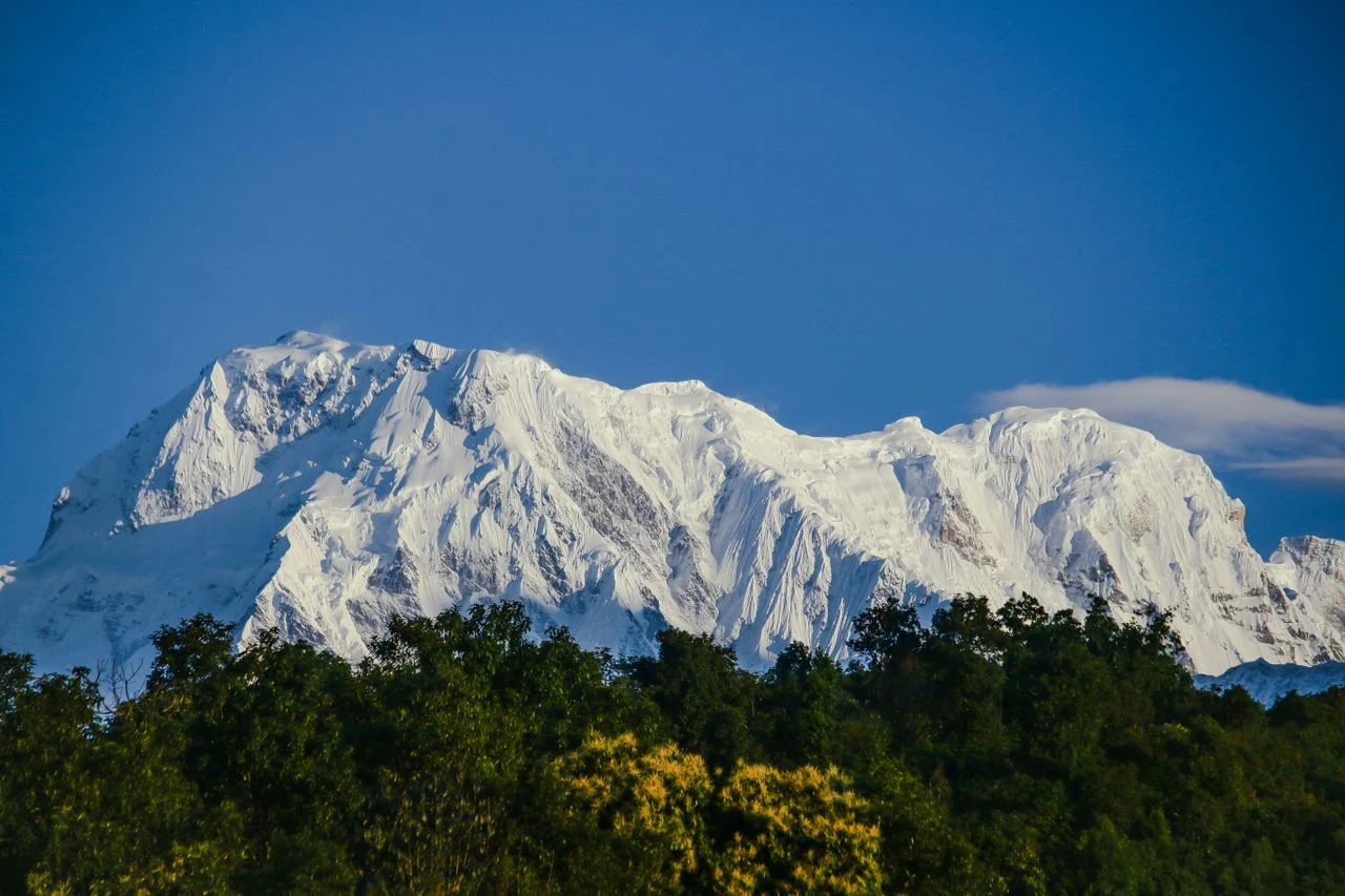
Visiting Manaslu without climbing is entirely possible and is the most common way to experience the mountain. The Manaslu Circuit Trek provides comprehensive access to the mountain’s slopes, valleys, and views without any mountaineering skills.
Can you visit Manaslu as a regular trekker? Yes. The Manaslu Circuit is a teahouse trek, meaning trekkers stay in village guesthouses along the route. No camping or technical climbing is required for the standard circuit.
How to see Manaslu without climbing involves joining a guided trek. The Manaslu region is a restricted area, requiring all trekkers to be accompanied by licensed guides. Trekking agencies like Wonder Hikes Nepal arrange permits, guides, accommodation, and logistics.
Manaslu trekking without mountaineering delivers impressive mountain views. Trekkers see Mount Manaslu from multiple angles throughout the circuit, with particularly dramatic views from Samagaon, Manaslu Base Camp, and the approach to Larkya La.
Manaslu travel options for non-climbers include:
-
Full Manaslu Circuit: 14-18 days, comprehensive mountain views
-
Tsum Valley Extension: Adds 4-6 days for cultural exploration
-
Manaslu Base Camp Excursion: Day hike from Samagaon
-
Shorter Treks: Limited options due to restricted area requirements
The Manaslu Circuit’s restricted-area status means independent trekking is prohibited. All trekkers must arrange their journey through registered agencies. This regulation ensures safety in remote terrain while protecting the region’s natural and cultural heritage.
Wonder Hikes Nepal: Planning Your Manaslu Trek
Wonder Hikes Nepal helps travelers plan their journey to the Manaslu region. As a Kathmandu-based trekking agency, we arrange complete Manaslu Circuit packages including permits, guides, teahouse accommodation, meals, and transportation.
Manaslu trek with Wonder Hikes Nepal provides transparent information about the region, current regulations, and what to expect on the trail. Our guides understand the geography, culture, and practical challenges of trekking in the Manaslu region.
Wonder Hikes Nepal Manaslu packages include customized planning for the full Manaslu Circuit, Tsum Valley extension, or shorter trek variations. We provide honest guidance about pacing, acclimatization, and excursion options.
Understanding where Manaslu is located is the first step in planning a trek. Our itineraries provide detailed geographic information, so trekkers know exactly where they are going and what to expect each day.
Whether you are planning the full Manaslu Circuit, considering the Tsum Valley extension, or seeking information about Manaslu Base Camp, Wonder Hikes Nepal provides transparent guidance and customized planning.
Plan Your Manaslu Trek – Contact Wonder Hikes Nepal
FAQs about Where Is Manaslu Located
1. Where exactly is Mount Manaslu located?
Mount Manaslu is located in Nepal’s Gandaki Province, on the border between Gorkha District and Manang District. The mountain sits within the Mansiri Himal range, approximately 100 kilometers northwest of Kathmandu.
2. Is Manaslu in Nepal or Tibet?
Manaslu is in Nepal, not Tibet. The mountain lies approximately 25 kilometers south of the Tibetan border, but it is entirely within Nepalese territory. The region’s cultural connections to Tibet sometimes create confusion about political geography.
3. Which district is Manaslu in?
Manaslu is in both Gorkha District and Manang District. The mountain sits on the district boundary. The standard trekking route approaches from Gorkha District, while the eastern slopes fall within Manang District.
4. Is Manaslu in Gorkha or Manang?
Manaslu straddles both Gorkha and Manang districts. The western and southern approaches lie in Gorkha District, while the eastern approaches fall within Manang District. The district boundary runs through the Manaslu massif.
5. What mountain range is Manaslu part of?
Manaslu is part of the Mansiri Himal, also known as Manaslu Himal. This subrange of the Nepalese Himalaya is located between the Budhi Gandaki River and the Marsyangdi River.
6. Is Manaslu Himal the same as Mansiri Himal?
Yes, Manaslu Himal and Mansiri Himal refer to the same mountain range. Mansiri Himal is the older geographic name, while Manaslu Himal is more commonly used in trekking and tourism contexts.
7. How high is Mount Manaslu?
Mount Manaslu is 8,163 meters (26,781 feet) high, making it the eighth-highest mountain on Earth and one of the fourteen “eight-thousanders.”
8. How far is Manaslu from Kathmandu?
Manaslu is approximately 100 kilometers northwest of Kathmandu as the crow flies. Road travel to the trailhead takes 7-10 hours, covering 130-160 kilometers.
9. Is Manaslu near Annapurna?
Yes, Manaslu is relatively close to Annapurna. The two mountain ranges are separated by approximately 60 kilometers at their closest points, with the Marsyangdi Valley between them.
10. Where is the Manaslu Conservation Area?
The Manaslu Conservation Area covers approximately 1,663 square kilometers surrounding Mount Manaslu. It spans Gorkha and Manang districts, encompassing the entire Manaslu Circuit trekking route.
11. Where is the Manaslu Circuit located?
The Manaslu Circuit circles Mount Manaslu, following the Budhi Gandaki Valley northward through Gorkha District, crossing Larkya La Pass, then descending through the Marsyangdi Valley into Manang District.
12. Where is Manaslu Base Camp?
Manaslu Base Camp is located approximately 6-8 kilometers northeast of Samagaon village, at an elevation of approximately 4,800 meters. It is a day hike from Samagaon, offering close-up views of Mount Manaslu’s northeast face.
13. Can I visit Manaslu without climbing it?
Yes, you can visit Manaslu without climbing. The Manaslu Circuit Trek provides extensive access to Mount Manaslu without any mountaineering skills. All trekking requires guides and permits.
14. What is the nearest village to Mount Manaslu?
Samagaon is the nearest significant village to Mount Manaslu. Located at 3,520 meters, Samagaon serves as the primary acclimatization stop and base for the Manaslu Base Camp excursion.
15. Why do different sources describe Manaslu’s location differently?
Different sources emphasize different aspects of Manaslu’s location. Some focus on the district (Gorkha vs Manang), others on the mountain range (Mansiri Himal vs Manaslu Himal), and still others on the trekking region. The mountain spans district boundaries, and the range has multiple names, creating natural variation in descriptions.