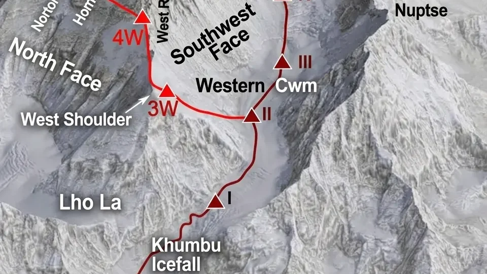
Introduction to Everest Base Camp Trek Map
Everest Base Camp Trek Map is more than a picture of a trail. It is a planning instrument that tells you where you will walk, how high you will climb, and how hard each day will actually feel. But a map alone is not enough. In 2026, the Everest Base Camp trek involves logistical changes that do not appear on any topographic sheet: flights are diverted to Manthali during peak seasons, Monjo checkpoint enforcement has tightened, and digital navigation tools have become more sophisticated than ever.
This guide, prepared by the editorial team at Wonder Hikes Nepal, teaches you how to read the Everest Base Camp Trek Map, what the elevation profile actually means, and what has changed for 2026.
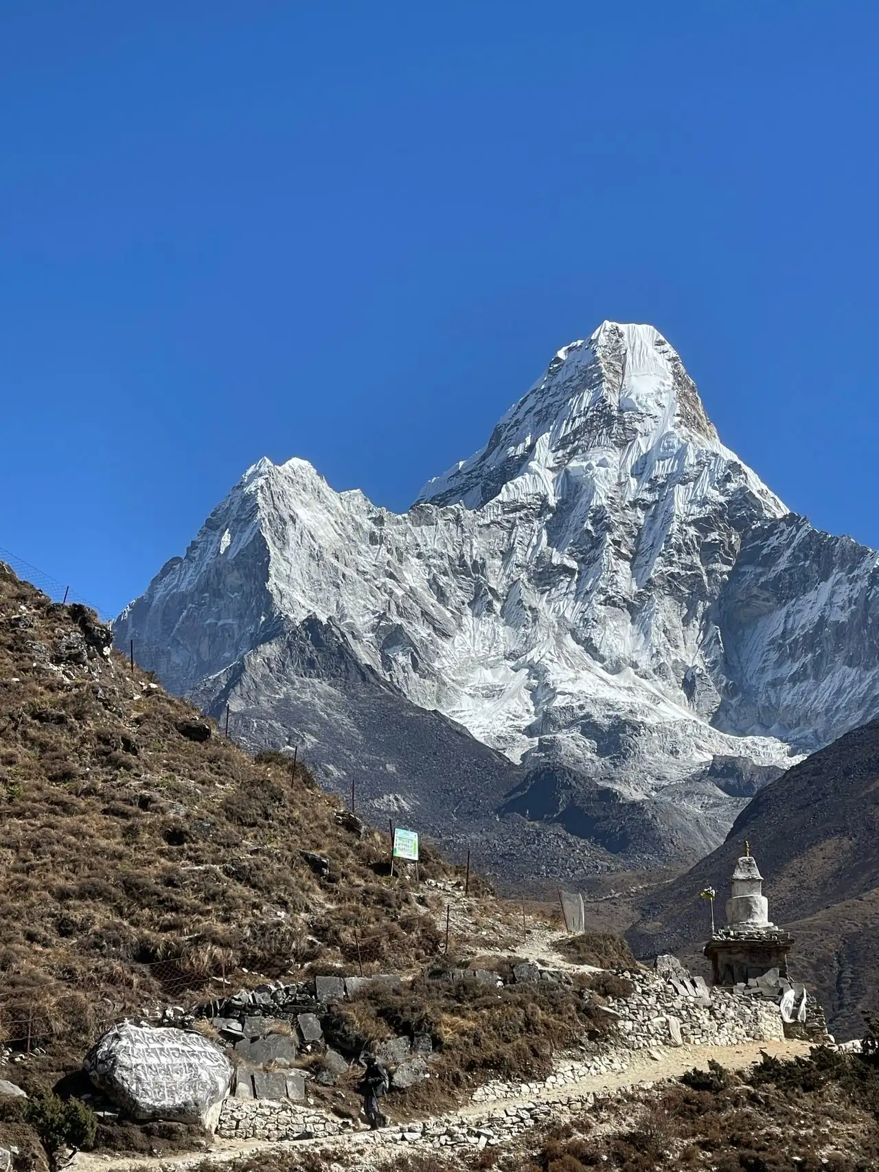
What the Everest Base Camp Trek Map Actually Shows
Everest Base Camp Trek Map should display four layers of information at once: the route line, the villages along the way, the elevation at each stop, and the approximate walking time between them. A map that only shows the trail is incomplete. A map that shows elevation without walking time is misleading.
The classic EBC route is an out-and-back trail, not a loop. You walk from Lukla to Base Camp along the Dudh Koshi River valley, then return along essentially the same trail. On a well-made map, this appears as a single continuous line from Lukla to Base Camp, with short side branches for acclimatization hikes.
These side branches matter more than they look. The climb from Namche to the Everest View Hotel, the walk from Dingboche to Nangkartshang, and the detour to Chhukung are not optional decorations. They are where acclimatization actually happens. On a detailed Everest Base Camp Trek Map, these appear as dotted or lighter-colored paths branching off the main trail.
A proper map also shows fixed points along the route: Sagarmatha National Park entry checkpoint at Monjo, suspension bridges crossing the Dudh Koshi, Tengboche Monastery, and emergency helipads near larger villages. Some detailed maps also mark seasonal water sources, which matter more than you might expect during dry pre-monsoon weeks.
How to Read the Elevation Profile (The Skill Most Trekkers Skip)
Everest Base Camp Trek Map elevation profiles are usually printed as a separate chart running below the top-down view. This chart plots altitude on the vertical axis and distance on the horizontal axis. Reading it correctly is more useful than memorizing village elevations.
The EBC trek is not a steady climb. It rises, drops, and rises again. From Lukla at 2,860 meters, the trail actually descends to Phakding at approximately 2,610 meters before climbing to Namche at 3,440 meters. This first descent is deliberate. Sleeping lower on the first night helps your body begin adjusting to altitude.
| Location | Elevation | Gain/Loss |
|---|---|---|
| Lukla | 2,860 m | Start |
| Phakding | 2,610 m | −250 m |
| Namche Bazaar | 3,440 m | +830 m |
| Tengboche | 3,867 m | +427 m |
| Dingboche | 4,410 m | +543 m |
| Lobuche | 4,910 m | +500 m |
| Gorak Shep | 5,164 m | +254 m |
| Everest Base Camp | 5,364 m | +200 m |
| Kala Patthar | 5,545 m | +181 m |
The biggest single climb is Phakding to Namche: over 800 meters of elevation gain in one day. The second biggest is Dingboche to Lobuche. Days that look short on the horizontal map, like the Lobuche to Gorak Shep leg, are moderate climbs at high altitude where every step feels heavier.
Scale distortion is a real trap on printed maps. A map compressed to fit a single page can make the distance between Namche and Tengboche look deceptively short, when the actual walking time runs closer to five hours across genuinely varied terrain. Always trust the elevation profile and walking times over the visual distance on the map.
The Classic Route: Lukla to Base Camp and Back
Everest Base Camp Trek Map classic route follows a single valley from Lukla through the Khumbu to Base Camp. The trail begins at Tenzing-Hillary Airport in Lukla, one of the world’s most dramatic short-runway airstrips, then drops to the Dudh Koshi River and follows it upstream through pine forests and farming settlements.
From Phakding, the trail climbs steadily into Namche Bazaar at 3,440 meters. Namche is the unofficial capital of the Khumbu and the last proper town before villages thin out. On the map, Namche appears as a natural junction point where the standard Base Camp route splits from the trail leading toward Gokyo Lakes.
The middle section passes through Tengboche at 3,867 meters, home of the region’s main monastery, then through Deboche and Pangboche before reaching Dingboche at 4,410 meters. From Dingboche, the trail climbs past Thukla at 4,620 meters to Lobuche at 4,910 meters, then to Gorak Shep at 5,164 meters, the last settlement before Base Camp.
The final push from Gorak Shep to Everest Base Camp at 5,364 meters is a 2 to 3 hour walk across glacial moraine. Trekkers typically drop their bags at Gorak Shep, walk to Base Camp, and return to Gorak Shep to sleep. The next morning, many climb Kala Patthar at 5,545 meters for the best views of Everest before descending.
The return route largely follows the outbound trail, but many itineraries take a variation from Gorak Shep down through Pheriche at 4,210 meters, where the HRA Aid Post is marked on detailed maps.
Where the Route Splits: Gokyo, Cho La, and the Three Passes
Everest Base Camp Trek Map becomes significantly more complex when you add the Gokyo Lakes or the Three Passes. These are not minor detours. They are substantial extensions that add days to the itinerary and change the shape of the route entirely.
Gokyo Lakes extension: From Namche, a side trail branches northwest toward the Gokyo Valley, passing through Dole, Machhermo, and reaching the Gokyo Lakes at approximately 4,790 meters. From Gokyo, trekkers can cross the Cho La (5,420m) to rejoin the main EBC trail at Lobuche. The Cho La crossing involves 1.5 to 2 kilometers of glacier ice requiring crampons and trekking poles — this is mandatory equipment, not optional.
Three Passes Trek: This is the most demanding variant. It connects Kongma La (5,535m), Cho La (5,420m), and Renjo La (5,360m) in a large loop that includes both Everest Base Camp and Gokyo Lakes. The Kongma La crosses from Chhukung to Lobuche, the Cho La connects Gokyo to Lobuche, and the Renjo La leads from Gokyo back toward Thame and Namche.
| Route Variant | Days from Lukla | Max Elevation | Key Passes |
|---|---|---|---|
| Classic EBC | 12–14 | 5,545 m (Kala Patthar) | None |
| EBC + Gokyo | 16–18 | 5,545 m | Cho La (5,420m) |
| Three Passes | 18–21 | 5,545 m | Kongma La, Cho La, Renjo La |
On a detailed Everest Base Camp Trek Map, these variants appear as branching colored lines. If your map only shows one line, it is not detailed enough for planning an extended trek. The Knife Edge Outdoor map at 1:40,000 covers Classic EBC, Three Passes, and Gokyo Lakes, all clearly color-coded, and includes free GPX downloads.
What the Map Doesn’t Show: Daily Effort and Acclimatization Reality
Everest Base Camp Trek Map distance is not the same as effort. A 10-kilometer day below 3,000 meters feels completely different from a 10-kilometer day above 4,500 meters. The map shows horizontal distance. Your body experiences altitude.
Trekking days on the EBC route average 5 to 7 hours of walking, covering 8 to 15 kilometers. But those numbers flatten at altitude. A day that would take 4 hours at sea level can take 6 or 7 hours above 4,000 meters, even at a slow pace.
This is why acclimatization days are marked on good maps as separate symbols. The climb from Namche to the Everest View Hotel at 3,880 meters is a classic example. You gain 440 meters during the day, then descend back to 3,440 meters for the night. The map shows this as a small loop. The elevation profile shows it as a spike. Both are accurate.
The same applies to the Nangkartshang viewpoint above Dingboche at approximately 5,083 meters. It is a side trip marked on detailed maps, and it serves as an active acclimatization hike during the second rest day.
2026 Map Updates: Manthali Flights, Monjo Checkpoints, and Permit Changes
Everest Base Camp Trek Map planning for 2026 requires awareness of logistical changes that do not appear on the trail map itself.
Manthali flight diversion: During peak trekking seasons (spring and autumn), the Civil Aviation Authority of Nepal diverts all Lukla flights from Kathmandu to Manthali Airport in Ramechhap district. Manthali sits 132 kilometers east of Kathmandu. Trekkers leave their hotel between 1 AM and 3 AM and drive 4 to 5 hours to catch the morning flight. The flight from Manthali to Lukla takes only 15 to 20 minutes, compared to 25 to 35 minutes from Kathmandu. Outside peak season, you fly directly from Kathmandu and skip the drive completely.
Monjo checkpoint: Every trekker on the EBC route passes through Sagarmatha National Park from the park entrance at Monjo (2,840m) to Base Camp. The Monjo queue during peak season can be significant. Permits can be purchased in Kathmandu or at the Monjo checkpoint, but buying in advance saves time.
TIMS card update: Since the Khumbu Pasang Lhamu Rural Municipality introduced its own entry permit, TIMS is no longer required for the standard EBC route through Lukla. You need the Sagarmatha National Park Entry Permit (NPR 3,000) and the Khumbu Pasang Lhamu Rural Municipality Permit. A licensed guide is legally required for the EBC trek.
Physical vs. Digital Maps: What to Carry on the Trail
Everest Base Camp Trek Map options fall into two categories: physical topographic maps and digital resources.
National Geographic Adventure Map — Everest Base Camp: This is the standard physical map for the region. It is waterproof, tear-resistant, and shows detailed topographic trail routes, altitude profiles, and trekking distances. It covers Sagarmatha National Park and parts of Makalu Barun National Park. Scale is 1:50,000.
Knife Edge Outdoor — Everest Base Camp Trekking Map: This is the most detailed sheet map available for the region at 1:40,000. It covers Classic EBC, Three Passes, and Gokyo Lakes with color-coded routes and includes free GPX downloads for GPS compatibility.
GHT Digital Map Everest: The Great Himalaya Trail digital map is georeferenced and searchable. It covers the full EBC Trek and all GHT routes in the region. Updated for 2026, it is available as a high-resolution geo-referenced TIF and a medium-resolution text-searchable PDF for $20.
On the trail itself, the EBC route is well-marked and heavily trafficked. You will not need a GPS for navigation in the classic sense. But carrying a physical map is still useful for understanding where you are and what is ahead. Several offline navigation apps now offer detailed EBC routes with GPS tracking, altitude profiles, and offline access — Goreto, Trekk, and TrekGuard are three options that provide offline maps for the Everest region.
Using the Map to Plan Your Itinerary
Everest Base Camp Trek Map planning comes down to one question: how many days do you have, and where do you want to spend them?
A standard 12-day EBC trek from Lukla includes two acclimatization days (Namche and Dingboche) and reaches Base Camp on Day 9. A 14-day itinerary adds buffer days for weather delays or altitude issues. A 16-day itinerary may include an extra acclimatization day or a side trip to Chhukung.
The map tells you where the bottlenecks are. The biggest single climb is Phakding to Namche. The highest sleeping altitude before Base Camp is Gorak Shep at 5,164 meters. The highest point of the trek is Kala Patthar at 5,545 meters. If your itinerary has you sleeping at Gorak Shep and then climbing Kala Patthar the next morning, you will have spent a night above 5,000 meters before your highest point. This is good for acclimatization, but it is also the point where altitude sickness is most likely to appear.
Wonder Hikes Nepal designs Everest Base Camp itineraries with these map realities in mind. We place acclimatization days where the elevation profile demands them, not where they fit neatly into a 12-day schedule. If you want to see how our itinerary maps to the route, our Everest Base Camp Trek page shows the day-by-day breakdown with elevation and walking times.
Everest Base Camp Trek Map at a Glance
| Feature | Detail |
|---|---|
| Route type | Out-and-back (not a loop) |
| Total distance | ~130 km round trip |
| Start/End | Lukla (2,860 m) |
| Highest point | Kala Patthar (5,545 m) |
| Base Camp elevation | 5,364 m |
| Average daily distance | 8–15 km |
| Average daily walking time | 5–7 hours |
| Acclimatization stops | Namche (2 nights), Dingboche (2 nights) |
| Major side trips | Everest View Hotel, Nangkartshang, Chhukung |
| Alternative routes | Gokyo Lakes, Three Passes |
| Best physical map | Knife Edge Outdoor (1:40,000) |
| Best digital map | GHT Digital Map Everest (2026) |
| 2026 flight note | Manthali diversion during peak season |
| 2026 permit note | TIMS no longer required; SNP + Khumbu permits needed |
Frequently Asked Questions About the Everest Base Camp Trek Map
1. Is the Everest Base Camp trek a loop?
No. It is an out-and-back route. You walk from Lukla to Base Camp and return along essentially the same trail, with a possible variation through Pheriche on the descent.
2. How far is the Everest Base Camp trek?
Approximately 130 kilometers (80 miles) round trip from Lukla.
3. What is the highest point on the Everest Base Camp trek?
Kala Patthar at 5,545 meters. Everest Base Camp itself is at 5,364 meters.
4. How many days does the Everest Base Camp trek take?
Most treks take 12 to 14 days from Lukla to Lukla, with 14-day itineraries being the most common for adequate acclimatization.
5. Where does the Everest Base Camp trek start?
The trek starts at Lukla, where you land at Tenzing-Hillary Airport. The trail immediately descends to Phakding before climbing to Namche Bazaar.
6. What villages are on the Everest Base Camp trek map?
The main villages are Lukla, Phakding, Namche Bazaar, Tengboche, Dingboche, Lobuche, and Gorak Shep.
7. Where is the best place to see Everest on the trek?
Kala Patthar at 5,545 meters offers the best views of Everest. The Everest View Hotel above Namche also offers views, but Everest is more distant from there.
8. Does the Everest Base Camp trek map show Gokyo Lakes?
Some detailed maps show the Gokyo Lakes extension, but basic EBC maps do not. You need a map that specifically covers the Gokyo and Cho La routes if you plan to extend.
9. What is the elevation gain on the Everest Base Camp trek?
The biggest single gain is Phakding to Namche, approximately 830 meters. Total elevation gain from Lukla to Base Camp is roughly 2,500 meters.
10. Do I need a GPS for the Everest Base Camp trek?
No. The trail is well-marked and heavily trafficked. A paper map is useful for planning, and a phone app with offline maps is sufficient for position checks.
11. What does the Sagarmatha National Park permit cover?
It covers entry to the national park and funds conservation and park management. It is checked at the Monjo checkpoint.
12. Can I trek Everest Base Camp without a guide?
A licensed guide is legally required for the EBC trek. Independent trekking is no longer permitted on this route.
13. What is the Three Passes Trek?
The Three Passes Trek is a longer variant that crosses Kongma La, Cho La, and Renjo La, connecting Everest Base Camp and Gokyo Lakes in a loop. It adds 5 to 7 days.
14. Is there a map that shows teahouses and lodges?
Knife Edge Outdoor and National Geographic maps show teahouse villages, but they do not mark individual lodges. Teahouse locations are generally obvious from the trail.
15. What changed for the Everest Base Camp trek in 2026?
Peak-season Lukla flights are diverted to Manthali Airport in Ramechhap. TIMS cards are no longer required for the standard EBC route. Monjo checkpoint enforcement has tightened.
How Wonder Hikes Nepal Can Help You Plan
Wonder Hikes Nepal designs Everest Base Camp treks with a focus on acclimatization, safety, and honest itinerary design. We use the same map tools described in this article to plan routes that match the elevation profile to your fitness and timeline.