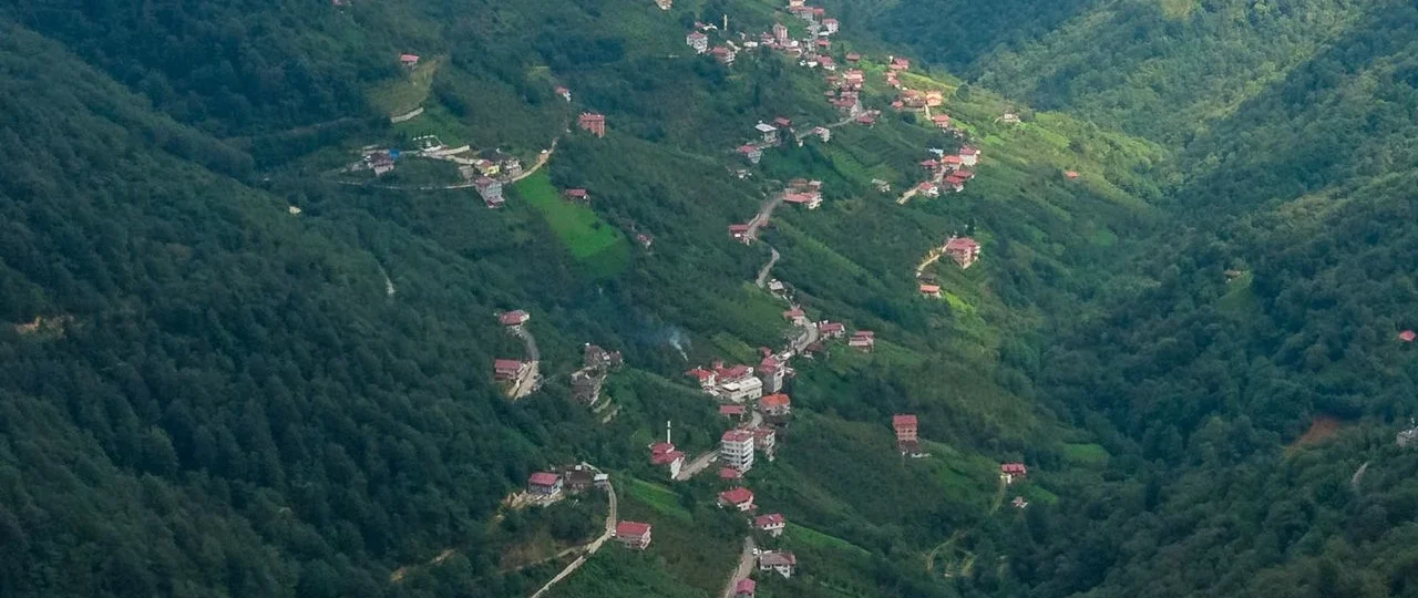
Syabrubesi is a road-head village in Rasuwa District, Bagmati Province, sitting at roughly 1,460 metres where the Bhote Koshi and Langtang rivers meet. It is the last settlement you can drive to before the Langtang National Park wilderness begins. For most travellers, Syabru is not a destination. It is a transition point — the place where a long, bumpy jeep ride ends and a multi-day Himalayan trek begins.
The village exists because of three trekking routes that all start from its main street: the Langtang Valley Trek, the Tamang Heritage Trail, and the extended Langtang–Gosaikunda combination. Search interest in spikes every trekking season, but the searches themselves are rarely about the village. They are logistical. Can I get there? How long does it take? Is the road open? What do I need? This guide answers those questions directly, with current 2026 information that most trekking websites have not updated since the August Rasuwa flood.
Sits and Why Its Location Matters
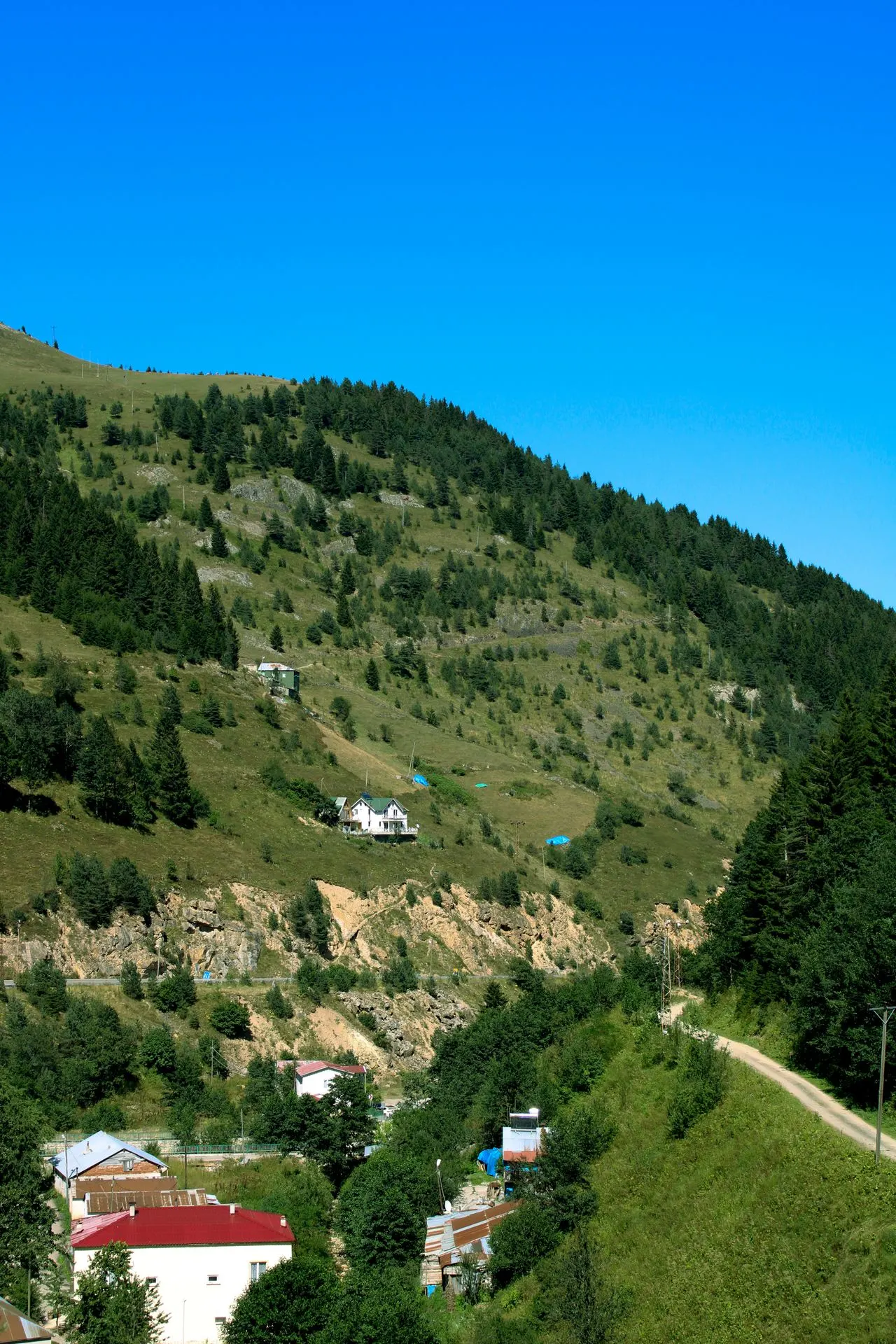
It is in Gosaikunda Rural Municipality, northern Rasuwa District. The Pasang Lhamu Highway connects it to Kathmandu, approximately 122 kilometres to the south. Dhunche, the district headquarters and permit checkpoint, is 14 kilometres down the road. The Nepal–China border at Rasuwagadhi is 16 kilometres north.
This geography explains almost everything about the village’s role. It is far enough from Kathmandu to feel genuinely remote, but close enough to be reachable in a single, long day of driving. It is positioned at the exact point where the road ends and the trail begins. And it sits on a historic trade route to Tibet — the same path used for centuries by traders, pilgrims, and travellers moving between Kathmandu and Lhasa.
Its altitude is commonly cited as 1,460 metres, though you will see figures ranging from 1,430m to 1,600m across different sources. The variation comes from measurement points along the river valley, rounding conventions, and copying errors. Treat 1,460–1,550m as your working range for planning purposes. What matters more is the altitude you gain after leaving the village: over 1,000 metres on the first trekking day alone.
The 2026 Access Reality: What the Rasuwa Flood Changed
On 26 August 2026, a glacial collapse on the Tibet side of the border sent a catastrophic surge down the Lhende Khola into the Bhote Koshi River. Floodwaters tore through the corridor from Timure to , Betrawati, and Trishuli Bazaar. The damage was extensive: approximately 40 kilometres of road destroyed in Nuwakot and Rasuwa districts, numerous bridges washed out, and communications and hydropower infrastructure severely compromised.
Every route was affected. The Kathmandu Valley Traffic Police halted vehicles heading toward Rasuwa. The Galchhi–Nuwakot–Rasuwa–road was officially discouraged for travel.
By late September 2026, the Department of Roads had begun opening temporary tracks and installing Bailey bridges. A 72-metre Bailey bridge was planned for Betrabati, and a one-lane gravel route from Tokha–Chhahare–Bidur–Nuwakot was established as an alternative. However, the road department itself acknowledged that long repairs lie ahead — the old road between Dhunge Bazar and Betrawati is now occupied by the Trishuli River, and rebuilding will take time.
What This Means for Your 2026 Trek
| Question | Honest Answer |
|---|---|
| Is the road open? | Partially, via temporary routes. Not the original highway. |
| Can I drive from Kathmandu? | Yes, via alternative tracks, but expect delays and rough conditions. |
| Are buses running? | Some services have resumed. Schedules are unreliable. Verify locally. |
| Is it safe? | The US State Department has issued a Level 4 advisory for the Rasuwagadhi–Timure–Syabrubesi corridor specifically. Understand the scope. |
| Should I go? | Only with current local information and a flexible itinerary. |
Do not rely on pre-flood bus or jeep schedules. If you are planning a Langtang trek in late 2026 or 2027, contact a local operator who tracks road conditions daily. Wonder Hikes Nepal, for example, coordinates transport based on real-time access reports rather than outdated timetables.
Getting There: Your Transport Options Compared
Road access is the only way in. Here is how the three main options compare in normal conditions — with the caveat that post-flood conditions override everything below.
| Factor | Local Bus | Shared Jeep | Private Jeep |
|---|---|---|---|
| Approximate cost | NPR 1,000–1,200 | USD 14–20 per person | USD 180–220 |
| Travel time | 7–10 hours | 6–8 hours | 6–8 hours |
| Comfort level | Basic, crowded | Moderate | High |
| Luggage handling | On the roof — waterproof cover essential | Limited space | Flexible |
| Departure point | Machhapokhari Bus Park, Kathmandu | Various pick-up points | Your hotel |
| Departure time | 6:00–8:00 AM | Morning | Flexible |
Local bus remains the cheapest option and the most culturally immersive. Buses leave from Machhapokhari New Bus Park early in the morning. Your bag goes on the roof. Make sure it is waterproof. The journey is long, the seats are tight, and the stops are frequent — but you will see rural Nepal in a way that a private vehicle does not show you.
Shared jeep costs roughly NPR 1,200–1,400 per person and is faster and more comfortable than the bus. Jeeps fill up quickly in peak season, so book through your trekking agency or guesthouse a day in advance.
Private jeep offers the most control over your schedule. You can stop when you want, leave when you want, and adjust if road conditions change. For groups of three or four, the per-person cost becomes reasonable.
Important: After the flood, the route through Tokha–Chhahare–Bidur–Nuwakot has become the primary alternative. It adds distance but bypasses the worst damage on the original highway. Your driver or agency should know the current best route.
Permits for Langtang: What You Need in 2026
Permits are not optional. You need two documents before you can legally enter Langtang National Park from the trailhead.
Langtang National Park Entry Permit
-
Foreign nationals: NPR 3,000 (approximately USD 22)
-
SAARC nationals: NPR 1,500
-
Nepali citizens: NPR 100
-
Issued by the Department of National Parks and Wildlife Conservation
-
Available at the Nepal Tourism Board office in Kathmandu or at the park entry gate near Dhunche
TIMS Card (Trekkers’ Information Management System)
-
FIT (independent trekker): NPR 2,000
-
Group trekker (booked through a registered agency): NPR 1,000
-
Issued through the Nepal Tourism Board or TAAN
-
As of 2026, TIMS cards for foreign trekkers are issued only through licensed agencies when booking a guide
Guide Requirement
Since 1 April 2023, licensed guides are mandatory for all foreign trekkers in Langtang National Park. This is not a suggestion. Checkpoints enforce it. If you attempt to trek independently, you may be turned back or fined.
Total permit cost for a foreign trekker booking through an agency: approximately USD 30–35, depending on group size and agency arrangements.
What Treks Start?
It is the shared trailhead for three distinct trekking experiences. They all begin on the same street, but they diverge quickly.
Langtang Valley Trek
The most popular route. 7–8 days from Kathmandu to Kathmandu, following the Langtang Khola through bamboo and rhododendron forests to Lama Hotel, Langtang Village, and Kyanjin Gompa.
The altitude profile is aggressive:
| Stage | Altitude | Gain |
|---|---|---|
| Syabrubesi | 1,460m | — |
| Lama Hotel | 2,470m | +1,010m |
| Langtang Village | 3,430m | +960m |
| Kyanjin Gompa | 3,870m | +440m |
The first trekking day gains over 1,000 metres — the steepest single-day gain on the route. Do not underestimate it.
Tamang Heritage Trail
A 6–7 day cultural loop through Tamang villages north. No glaciers, no high passes, no summit push. The highest point is Nagthali viewpoint at 3,165 metres, once a Buddhist meditation site. The route passes through Gatlang, Tatopani (natural hot springs), Thuman, and Briddim. Briddim runs on community homestay tourism — you eat and sleep in a Tamang family’s home.
This is the trek to choose if you want culture, hot springs, and Himalayan views without the altitude risk of a high-altitude route.
Langtang–Gosaikunda Combination
A 13–17 day extended trek that combines the Langtang Valley with the sacred Gosaikunda lakes and the crossing of the Laurebina La pass, follows the Langtang Valley to Kyanjin Gompa, then diverts west toward Gosaikunda and exits at Sundarijal near Kathmandu. This is for experienced trekkers with time and fitness.
Accommodation and Food
It has the best-developed accommodation on the entire Langtang route. This is a road-connected town, and it shows. Rooms have attached or nearby shared bathrooms, reliable electricity, and hot showers that often do not cost extra.
Prices run NPR 400–700 per room — slightly higher than trailside lodges because the facilities are better. For a village of its size, the range is decent:
-
Budget guesthouses: Basic rooms, shared bathroom, sometimes hot shower
-
Mid-range lodges: Private room, attached bathroom, reliable hot shower
-
Hotel White Palace: A 3-star option with restaurant, bar, and coffee shop
Food follows the standard trekking menu: dal bhat, noodles, momos, Tibetan bread, eggs, and tea. Dal bhat is the best value — usually unlimited refills and designed to fuel a day of walking. You will find Tibetan dishes alongside Nepali staples. Try gyakok (Tibetan hot pot) if you have time before your trek begins.
WiFi is available at many lodges but expect messaging speeds, not streaming. Power outages are common.
Cash, ATMs, and the Money Question
Assume no reliable ATM
There may be one or two machines. They may work. They may be out of cash. After the August 2026 flood, infrastructure reliability in the area has been further compromised. Sources contradict each other on ATM availability — which is itself the answer. If a service is unreliable enough that sources disagree, treat it as unavailable.
What to do:
-
Withdraw enough Nepalese Rupees in Kathmandu to cover your entire trek, plus a buffer
-
Carry small denominations (NPR 100, 500) — large notes are hard to break in mountain villages
-
Budget for permits, accommodation, food, hot showers, WiFi, and tips
-
Keep a separate emergency stash in a different bag
The nearest reliable ATMs are in Trishuli Bazaar or Battar,
Best Time to Visit
| Season | Months | Conditions | Verdict |
|---|---|---|---|
| Autumn | October–November | Stable weather, clearest views, peak season | Best overall |
| Spring | March–May | Rhododendrons blooming, warming temperatures | Excellent |
| Winter | December–February | Cold, possible snow at higher altitudes, quiet | Possible for experienced trekkers |
| Monsoon | June–August | Heavy rain, landslides, leeches, poor visibility | Avoid |
Autumn offers the most stable conditions and the clearest mountain views. Spring is equally good and adds rhododendron forests in bloom. Both seasons are busy — book accommodation and guides in advance.
Monsoon is genuinely dangerous in Langtang. The 2026 Rasuwa flood occurred during monsoon season. Do not plan a trek between June and August unless you have specific local guidance and accept the risks.
Winter treks are possible but cold. Teahouses above Lama Hotel may be closed. Check in advance.
Safety, Altitude, and Responsible Preparation
Altitude
The rapid gain from Syabru to Kyanjin Gompa — nearly 2,500 metres in four to five days — causes symptoms in a significant proportion of trekkers. Know the symptoms: headache, nausea, dizziness, breathlessness at rest. Respect them. Descend if they worsen.
Road Safety
Nepal’s mountain roads are narrow, winding, and sometimes damaged. Bus drivers are experienced but the roads are unpredictable. Sit toward the front if you get motion sick. Avoid night travel.
Flood and Landslide Risk
The August 2026 Rasuwa flood demonstrated how quickly conditions can change. If you are traveling during or after monsoon, check road and trail conditions daily. Do not cross landslide zones if local guides advise against it.
Travel Advisories
The US State Department has issued a Level 4 “Do Not Travel” advisory for the Rasuwagadhi–Timure– corridor. This is a specific corridor, not the entire Langtang region. Check your own government’s advisory and understand its scope before you travel.
Insurance
Trekking insurance that covers helicopter evacuation is strongly recommended. Verify that your policy covers trekking in Nepal above 3,000 metres.
Preparation Checklist
| Category | Action |
|---|---|
| Permits | Arrange TIMS and Langtang National Park permit before leaving Kathmandu |
| Guide | Book through a licensed agency; guide is mandatory |
| Cash | Withdraw enough NPR in Kathmandu; assume no ATM |
| Transport | Verify current road conditions; book bus or jeep in advance |
| Insurance | Trekking insurance with helicopter evacuation coverage |
| Gear | Layers, waterproofs, broken-in boots, water purification, headlamp |
| Medicine | Diamox (consult doctor), first aid, blister care, electrolytes |
| Fitness | Train with loaded backpack hikes |
| Flexibility | Build buffer days into your itinerary |
| Documents | Passport, passport photos, permit copies, insurance details |
Planning Your Trek with Wonder Hikes Nepal
The difference between a smooth Langtang trek and a stressful one often comes down to current information. It is a straightforward trailhead in good conditions and a complicated one in bad conditions. The August 2026 flood made that distinction sharper than ever.
Wonder Hikes Nepal operates treks in the Langtang region with licensed guides who track route conditions, road access, and teahouse availability. They can help you:
-
Arrange TIMS cards and Langtang National Park permits
-
Coordinate transport from Kathmandu based on current road status
-
Assign a licensed guide (mandatory for Langtang)
-
Build realistic itineraries that account for altitude and weather
-
Adjust plans if access conditions change
If you are planning a Langtang Valley Trek, Tamang Heritage Trail, or Gosaikunda trek starting from Syabru, contact Wonder Hikes Nepal for current route information and itinerary planning. They will tell you what is actually possible — not just what is advertised.
Frequently Asked Questions
1. What is the altitude?
Most sources cite 1,460 metres, though figures range from 1,430m to 1,600m depending on the measurement point. For trekking purposes, treat as approximately 1,460–1,550 metres above sea level.
2. How far is Syabrufrom Kathmandu?
Approximately 122 kilometres by road. Travel time ranges from 6 to 10 hours depending on vehicle type and road conditions.
3. How do I get from Kathmandu to Syabru?
By local bus, shared jeep, or private jeep. Buses leave early morning from Machhapokhari. Shared jeeps are faster. Private jeeps offer the most flexibility. There is no airport.
4. Is the road to Syabru open in 2026?
This is changing. The August 2026 Rasuwa flood damaged major sections of the Pasang Lhamu Highway. Some access has been restored via temporary routes, but conditions remain unstable. Verify current status with a local operator before traveling.
5. What treks start from Syabru?
The Langtang Valley Trek, Tamang Heritage Trail, and Langtang–Gosaikunda combination trek all start from Syabru.
6. Do I need a guide for the Langtang trek?
Yes. Licensed guides have been mandatory for foreign trekkers in Langtang National Park since April 2023.
7. What permits do I need for Langtang?
Two permits: Langtang National Park Entry Permit (NPR 3,000 for foreigners) and TIMS Card (NPR 2,000 for FIT, NPR 1,000 through an agency).
8. Is there an ATM ?
ATM availability is unreliable. Assume no reliable ATM. Withdraw enough cash in Kathmandu for your entire trek.
9. Is Syabru safe?
The village itself is generally safe. The main risks are road conditions, altitude sickness on the trek, and landslide zones during monsoon. Follow local guidance and travel with a licensed guide.
10. What is the best time to visit?
Autumn (October–November) and spring (March–May) offer the best weather and clearest views. Avoid monsoon (June–August) due to landslide risk.
11. How long is the Langtang Valley Trek?
Typically 7–8 days from Kathmandu to Kathmandu. The trek itself (Syabru to Kyanjin Gompa and back) takes 5–6 days.
12. What is the Tamang Heritage Trail?
A 6–7 day cultural trek through Tamang villages north of Syabru, including Gatlang, Tatopani, Thuman, and Briddim. Maximum altitude is 3,165m at Nagthali.
13. Can I trek Langtang without a guide?
No. Licensed guides are mandatory for foreign trekkers in Langtang National Park as of April 2023.
14. What should I pack for Langtang?
Layers, waterproof jacket and trousers, broken-in hiking boots, water purification, headlamp, first aid kit, Diamox (consult doctor), and enough cash. See the preparation checklist above.
15. Is It affected by the 2026 flood?
Yes. The August 2026 Rasuwa flood damaged roads and infrastructure in the Syabru area. Access has been partially restored via temporary routes, but conditions remain unstable. Verify current status before traveling.
Ready to plan your trek?
Tell us your dates and group size. We reply on WhatsApp within a few hours.