Chisapani Nagarkot hiking is a corridor — a ridge-and-forest route running from the northern edge of Kathmandu Valley to its eastern hills — with several viable paths between the same start and end points. Once you understand the corridor rather than expecting a single number, the conflicting figures stop being confusing and start being useful, because they’re describing real different choices you can make.
This detailed complete guide of Chisapani Nagarkot hiking breaks down the actual distances and elevations with the discrepancies explained, gives you a realistic difficulty assessment, maps out the route variants and extensions properly, and tells you specifically when to go and why — including the detail almost no one mentions: which direction to walk it, and when that choice actually matters.
How Far Is Chisapani Nagarkot Hiking Trail, Really?
Sundarijal to Chisapani
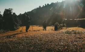
This first leg is consistently described as passing through Shivapuri Nagarjun National Park, climbing through forest past the Sundarijal waterfall and through Tamang villages including Mulkharka. The distance figures you’ll encounter are, 10–11 km, 12 km, 15 km, and 16 km, which reflect different trail choices within the park rather than measurement error.
The shorter figures (10–12 km) describe the more direct forest trail; the longer figures (15–16 km) typically include additional ridge sections or a slightly longer approach route that some operators use to add scenic variety. Walking time across all versions clusters consistently at 4 to 6 hours, which tells you the distance variation mostly reflects gradient and trail surface differences rather than wildly different routes — a steeper, more direct 11 km can take as long as a gentler 16 km.
Practical figure to plan around: 11–16 km, 4–6 hours, depending on exact trail taken.
Chisapani to Nagarkot Trail
This is where the numbers diverge most dramatically — 11–12 km on one end, up to 26 km on the other. This gap is explained by genuinely different route choices, not measurement noise:
The shorter figures (11–12 km, 6–7 hours) describe routes that include more direct ridge-and-forest paths with “gradual ascents and wide ridgeline views.”
The longer figures (20–26 km, 6–8 hours) describe the route via Jhule, Jarsingpauwa, and Kartike Bhanjyang (Kattike) — a path that follows more village trail and roadway sections, including an 11 km stretch to Jhule alone, before continuing toward Nagarkot via either a steep final climb or the longer Nagarkot Eco-Trail option.
Both are real, walkable, guided routes. The shorter version is more purely “trail.” The longer version trades some directness for more village contact and a wider geographic sweep through the hills east of Shivapuri.
Practical figure to plan around: 12–26 km depending on route choice, 6–8 hours.
Total trip distance of Chisapani Nagarkot Hiking
The “22-25 km” figures describe the 2-day core hike using the shorter route choices on both legs. The “45-50 km” figure describes the full 3-day version using the longer Chisapani–Nagarkot route plus the Nagarkot–Changu Narayan extension on day three. Both are accurate descriptions of different, equally valid trips — they are not competing claims about the same trip.
Elevation of Chisapani Nagarkot Hiking Trail
The elevation of Chisapani which is anywhere from 1,915 m to 2,215 m, and Nagarkot at anywhere from 1,932 m to 2,195 m — reflect two real factors: which specific point within each settlement is being measured (both Chisapani and Nagarkot are spread-out hill settlements with meaningful elevation variation across their own footprint, not single points), and rounding/source differences between GPS-based and map-based figures.
For practical purposes, treat both Chisapani and Nagarkot as sitting in the same general elevation band — roughly 1,900 to 2,200 meters. The genuinely useful takeaway isn’t the exact meter count for either point; it’s that the hike does not involve a dramatic net climb or descent between its two named endpoints. Both sit at similar hill-station altitude. What varies along the way — and what actually matters for difficulty — is the up-and-down profile of the ridges in between, not the start-to-end elevation difference.
Trek Difficulty of Chisapani Nagarkot Hiking
- Chisapani Nagarkot Hiking is a genuine, sustained uphill forest walk of 4 to 6 hours through Shivapuri Nagarjun National Park.
- It is not technical — no exposure, no scrambling — but it is a real climb, and at the end of a hot day, tired legs on the final approach to Chisapani are a common experience, even for reasonably fit hikers.
The trails are well-defined, well-trodden, and pass through inhabited areas with regular village contact — you are never more than a few hours from a settlement with food, water, and (in most areas) phone signal. The genuine requirement is reasonable cardiovascular fitness for multi-hour uphill walking, not prior trekking-specific skills.
The honest summary: If you can comfortably walk for 5–6 hours with some sustained uphill sections and carry a daypack, you’ll manage this hike.
Route Variants of Chisapani Nagarkot Hiking Trail
Day 1 — Sundarijal to Chisapani
The route through Shivapuri Nagarjun National Park past the Sundarijal waterfall and through Mulkharka is the standard, well-marked path. The 4–6 hour, 11–16 km range simply reflects natural variation in exactly which forest trail your guide or map app selects within the park — not a strategic decision you need to make in advance.
Day 2 — Chisapani to Nagarkot
Choose the shorter ridge route (roughly 11–12 km, 6–7 hours) if your priority is mountain views and a more “trail-feeling” day — gradual ascents, wide ridgeline panoramas, less road-walking.
Choose the longer route via Jhule–Jarsingpauwa–Kartike Bhanjyang (roughly 20–26 km, 6–8 hours) if your priority is village contact and a fuller day — this route includes more time in inhabited areas, a lunch stop at Jhule roughly 11 km in, and either a final steep 300 m climb from Kartike Bhanjyang directly into Nagarkot, or a gentler approach via the Nagarkot Eco-Trail (about 750 m longer from the same junction). If you’re tired by this point in the day, the Eco-Trail option is worth knowing about specifically because it trades a short steep push for a longer gentle approach.
Day 3 (optional) — Nagarkot to Changu Narayan, Dhulikhel, or Namo Buddha.
This is an extension, not a continuation everyone needs.
Changu Narayan (roughly 6–7 km, about 3 hours, easy descent) is the most natural fit if your goal is a clean, short third day ending at a genuinely significant cultural site — Changu Narayan is one of the oldest Hindu temples in Kathmandu Valley, and the descent from Nagarkot through terraced fields and villages to reach it is gentle compared to the previous two days.
Dhulikhel and Namo Buddha are mentioned by some operators as alternative extensions but represent a more substantial additional commitment — these are worth considering only if you’re treating this as the start of a longer regional hiking trip rather than a self-contained 2–3 day outing.
Going In Reverse: Nagarkot To Chisapani To Sundarijal
Every source describes this hike in one direction — Sundarijal first, Nagarkot last. Nobody addresses the reverse, but it’s a legitimate option worth considering for two groups of people.
If you’re staying in or near Nagarkot or Bhaktapur (a common choice for visitors who want easy access to Nagarkot’s sunrise views as a base), starting from Nagarkot and finishing at Sundarijal — close to Kathmandu’s Ring Road and easy onward transport — can be more logistically convenient than the reverse.
There’s also a genuine experiential argument for the reverse direction: doing the longer Jhule-route climb on Day 1 while fresh (Nagarkot to Chisapani direction) and finishing with the descent through Shivapuri Nagarjun National Park toward Sundarijal on Day 2 front-loads the harder day. For hikers who prefer to get the bigger effort out of the way first rather than finishing with it, this is worth considering.
The trail itself doesn’t change character based on direction — it’s the same forest, ridges, and villages either way. The choice is purely about logistics (where you’re staying, where you want to end up) and pacing preference (harder day first vs. harder day second).
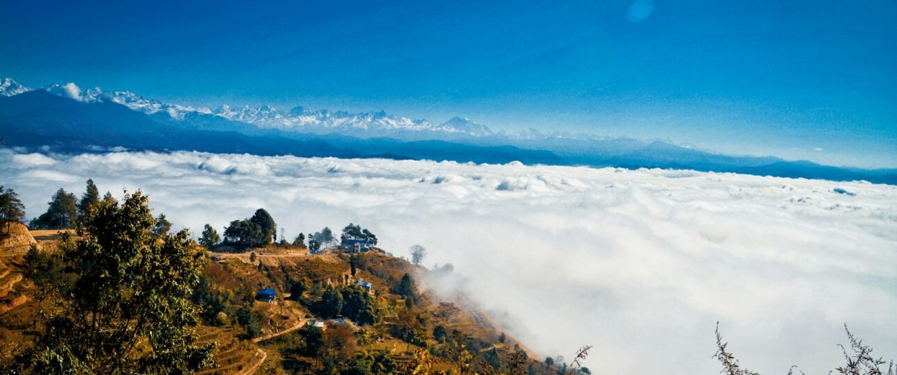
The Nagarkot Sunrise: What You’ll Actually See
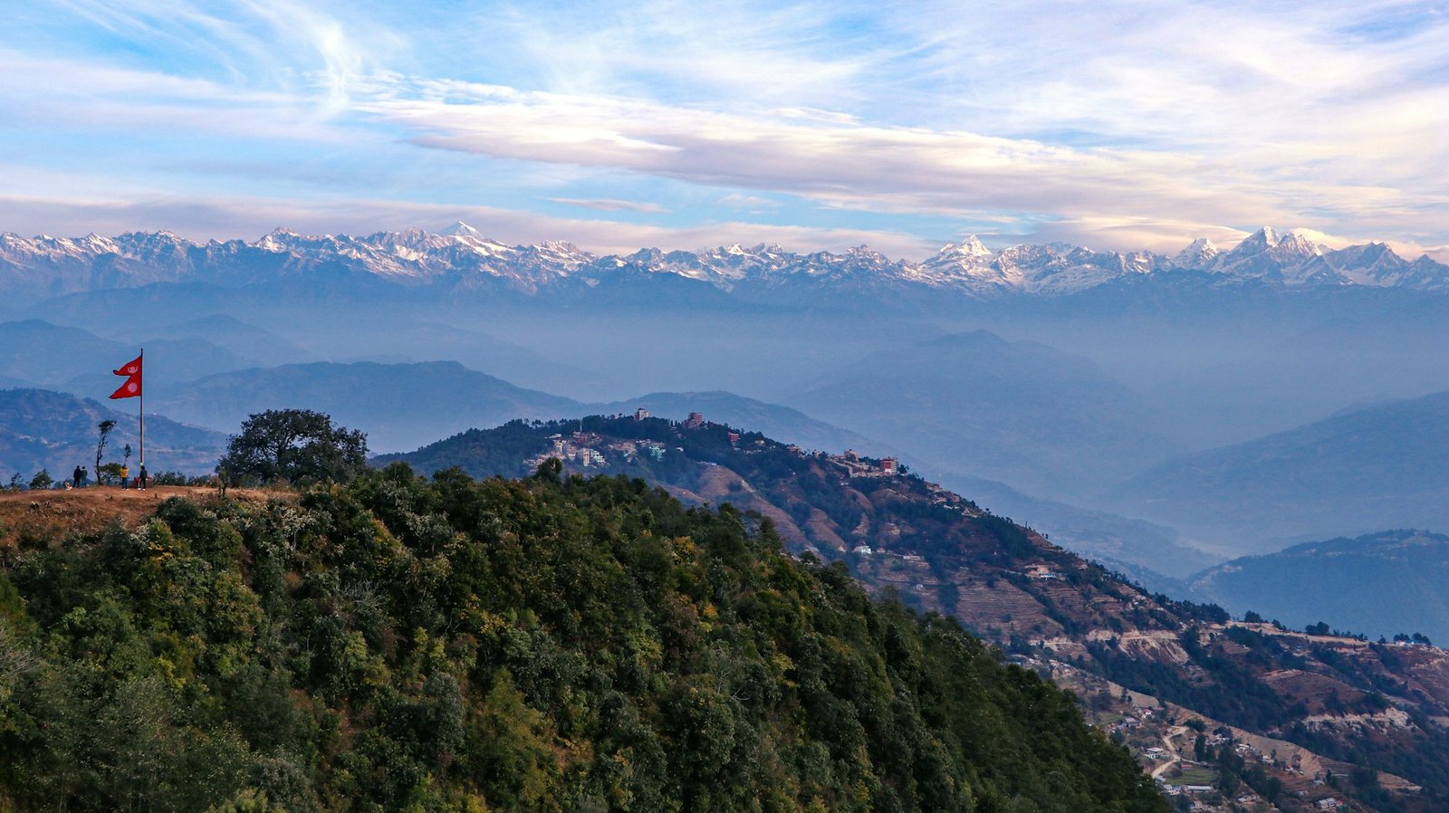
Nagarkot’s reputation rests heavily on its sunrise and sunset views, and the visibility of Langtang, Ganesh Himal, Dorje Lakpa, the Annapurna range, and even Mount Everest on clear days. Calibrating expectations here matters.
On a genuinely clear day — most likely in the post-monsoon autumn months — the Langtang range (including Langtang Lirung and Dorje Lakpa) is the most consistently visible and most dramatic part of the panorama from Nagarkot, given its relative proximity. Ganesh Himal is also commonly visible. Everest and the Annapurna range are visible only on the clearest days, typically in winter or immediately post-monsoon when atmospheric haze is at its lowest — and even then, they appear as distant, smaller profiles compared to the closer Langtang range, since both are considerably further away than Langtang.
The practical guidance: come for the Nagarkot sunrise expecting a genuinely beautiful Langtang-range panorama as your reliable reward, and treat Everest/Annapurna visibility as a clear-day bonus rather than the expectation. Arriving with the latter as your baseline expectation is the most common source of disappointment among visitors.
Permits for Chisapani Nagarkot Hiking
- The Sundarijal–Chisapani leg passes through Shivapuri Nagarjun National Park, and an entry permit for the park is required. This is obtained at the Sundarijal checkpoint at the start of the trail — you do not need to arrange this in advance in Kathmandu.
- This is a national park entry permit, not a TIMS-style trekking permit. The TIMS Card system, used for major Himalayan trekking routes, does not apply to this hike.
No permit is required for the Chisapani–Nagarkot leg itself, or for the optional Changu Narayan extension, since these sections fall outside the national park boundary.
Do You Need a Guide?
For a hike this close to Kathmandu, with regular village contact, generally good trail marking, and multiple points where you intersect roads and settlements, this is genuinely one of the more viable solo/independent hikes in the Kathmandu Valley region. Many hikers — both visitors and Kathmandu-based expats — do this route independently using offline map apps (the trail is well-mapped on most hiking apps) without difficulty.
That said, a local guide adds real value beyond navigation here: route selection (helping you choose between the shorter ridge route and the longer Jhule route based on your fitness and time), local knowledge of the Tamang villages along the way, and — if you’re combining this with an extension to Changu Narayan or beyond — help planning the logistics of getting back to Kathmandu from less-frequented endpoints.
The honest framing: solo is genuinely practical here in a way it often isn’t for higher-altitude Himalayan routes. A guide is a value-add for context and route optimization, not a safety necessity, for the standard 2-day version. For the longer variants or extensions, a guide’s logistical knowledge becomes more useful.
Is This A Good Preparation Hike For Everest Base Camp, Annapurna, Or Langtang?
What Chisapani Nagarkot hiking does prepare you for: multi-hour daily walking with a daypack, sustained uphill effort (the Sundarijal–Chisapani climb is a genuinely useful test of your legs and cardiovascular fitness for multi-day trekking), and the basic rhythm of trekking days — morning start, multi-hour walk, afternoon arrival, overnight at a lodge or teahouse.
What Chisapani Nagarkot hiking doesn’t prepare you for: altitude. At 1,900–2,200 meters, this hike involves no altitude adjustment whatsoever — EBC, Annapurna Circuit, and Langtang all involve sustained time above 3,000 m and, for EBC and Annapurna, above 5,000 m, where altitude becomes the dominant physical factor regardless of your fitness level. It also doesn’t prepare you for multi-day cumulative fatigue across a week or more, or for the more basic accommodation and food options found on higher routes (Nagarkot and Chisapani both have comfortable lodges with hot meals).
The honest verdict: this is a genuinely useful one-to-two-day fitness check and a good way to test your boots, daypack, and general walking stamina before a bigger trip. It is not a meaningful altitude or endurance simulation for what EBC, Annapurna, or Langtang actually demand. Use it for what it’s good for — gear testing and a fitness baseline — without over-relying on it as preparation for the harder parts of a high-altitude trek.
Best Time for Chisapani Nagarkot Hiking
Autumn (late September to November): The strongest overall window for Chisapani Nagarkot Hike. Post-monsoon clarity gives this hike its best mountain-viewing conditions — both for the Langtang panorama from Nagarkot and for general visibility along the forested ridge sections. Trail conditions in Shivapuri Nagarjun National Park are at their best, having dried out from monsoon mud.
Spring (March to May): A close second for Chisapani Nagarkot hiking best season, with the added appeal of rhododendron and other flowering trees through the forest sections, plus mustard and wheat visible in the terraced fields along the Chisapani–Nagarkot route. Haze can build more than in autumn as spring progresses, which slightly reduces long-distance mountain visibility toward late April and May, though closer views (Langtang range) generally remain good.
Winter (December to February): Genuinely underrated for this specific hike. Crisp, cold, clear air often produces the sharpest long-distance mountain visibility of the year — this is frequently when the more distant Everest and Annapurna views are most likely on a clear day. The trade-off is cold nights at Chisapani and Nagarkot’s altitude, and shorter daylight hours to work with on the longer route variants. For hikers who don’t mind the chill, this is an excellent off-season choice with far fewer other hikers on the trail.
Monsoon (June to August): Not recommended. Muddy trails through Shivapuri Nagarjun National Park’s forest sections become genuinely slippery and unpleasant, leeches are common in the wetter forest stretches, and mountain visibility from Nagarkot drops to near zero on most days. If you’re in Kathmandu only during monsoon and want to do this hike anyway, treat it as a forest-and-culture walk rather than a mountain-viewing trip, and expect wet feet.
FAQs for Chisapani Nagarkot Hiking
- How far is the Chisapani Nagarkot hiking, really?
The Sundarijal–Chisapani leg is 11–16 km depending on the exact trail taken (4–6 hours). The Chisapani–Nagarkot leg is 12–26 km depending on whether you take the shorter ridge route or the longer route via Jhule and Kartike Bhanjyang (6–8 hours). A standard 2-day trip totals roughly 22–30 km; a 3-day trip including the Changu Narayan extension can total 45–50 km. - Is the Chisapani Nagarkot hiking difficult?
It’s moderate — no technical sections, but the Sundarijal–Chisapani climb is a sustained multi-hour uphill forest walk that will challenge hikers without regular cardiovascular exercise. Reasonable fitness for 5–6 hours of walking with some steep sections is the real requirement, not prior trekking experience. - What’s the best time to go?
Autumn (late September–November) offers the most reliable combination of clear mountain views and good trail conditions. Spring (March–May) is a strong alternative with added floral interest. Winter (December–February) often delivers the sharpest long-distance views for those who don’t mind cold nights. Avoid monsoon (June–August). - Do I need a permit?
Yes — a Shivapuri Nagarjun National Park entry permit, obtained at the Sundarijal checkpoint at the start of the trail. No advance booking or TIMS Card is required for this hike. - Can I see Mount Everest from Nagarkot?
On genuinely clear days, yes, though it appears as a distant, relatively small profile compared to the much closer and more dramatic Langtang range, which is the more reliable visual highlight. Treat Everest visibility as a clear-day bonus, particularly likely in winter, rather than a guaranteed feature.