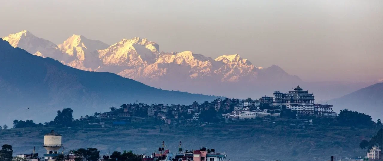
Hiking places in Kathmandu are defined by one unusual feature: proximity without compromise. The city sits in a bowl-shaped valley surrounded by forested hills, several of which are protected national park land. Within an hour of Thamel, you can be climbing through oak and rhododendron forest to a ridge with Himalayan views, or walking terraced fields toward a Buddhist monastery.
That accessibility is the point. Unlike a Himalayan trek that demands two weeks, permits, and altitude preparation, most Kathmandu hikes can be completed in a single day. You sleep in your own bed. You eat dinner in the city. You see mountains that would otherwise require a domestic flight.
What most guides fail to explain is that not all of these hikes are interchangeable. A short forest climb to a monastery is a different experience from a full-day ascent of the valley’s highest hill. The right trail depends on your fitness, your available hours, and whether you want forest, culture, mountain views, or a combination. This guide explains the differences clearly, with 2026 pricing, current permit requirements, and the logistical detail that actually matters when you are planning your day.
Hiking Places in Kathmandu at a Glance
| Hike | Elevation | Duration | Difficulty | Permit | Best For |
|---|---|---|---|---|---|
| Jamacho (Nagarjun) | 2,095 m | 4–6 hrs | Easy–Moderate | Yes (Shivapuri) | Forest, monastery, short climb |
| Champadevi | 2,285 m | 5–7 hrs | Moderate | No | Ridge views, temple, forest |
| Shivapuri Peak | 2,732 m | 5–6 hrs | Moderate–Hard | Yes (Shivapuri) | Valley’s second-highest, serious hike |
| Phulchowki | 2,782 m | 6–9 hrs | Hard | No | Highest hill, birdwatching, forest |
| Chandragiri | 2,551 m | 4–10 hrs | Moderate | No (cable car available) | Views, temple, cable car option |
| Nagarkot–Changunarayan | 2,195 m | 3–5 hrs | Easy | No | Sunrise, villages, UNESCO temple |
| Namobuddha | 1,750 m | 4–5 hrs | Easy–Moderate | No | Monastery, terraced fields, culture |
| Chisapani | 2,050–2,215 m | 4–5 hrs (one way) | Moderate | Yes (Shivapuri) | Overnight trek, village stay |
On permits: Shivapuri Nagarjun National Park charges NPR 1,000 for foreign nationals, NPR 600 for SAARC nationals, and NPR 100 for Nepali citizens. The fee is payable at the gate. Trails outside the national park do not require a park permit. TIMS cards are not required for any Kathmandu Valley day hikes.
Jamacho (Nagarjun): The Short Forest Climb
Jamacho, also called the Nagarjun hike, is the most accessible proper hike near Kathmandu. The trailhead is at the Raniban gate on the western edge of the valley, roughly 30–45 minutes by taxi from Thamel. The route climbs through dense forest inside Shivapuri Nagarjun National Park to the Jamacho Gumba, a small Buddhist monastery at approximately 2,095 metres.
Distance and time: The round trip is about 8–10 kilometres with 650–700 metres of elevation gain. Most hikers take 2–3 hours to ascend and 1.5–2 hours to descend, for a total of 4–6 hours door to door.
Difficulty: Easy to moderate. The trail is well-defined, with stone steps in sections and dirt paths elsewhere. There are no technical challenges. The steady ascent is the main effort.
What you see: Forest, birdlife, occasional langur monkeys, and valley views from the monastery. The site is quiet and shaded, making it pleasant even in warmer months.
Permit: Shivapuri Nagarjun National Park entry fee applies.
Getting there: Taxi to the Raniban gate near Balaju. Public transport is possible but less convenient. Return the same way, or arrange pickup.
Who it suits: Beginners, families with older children, solo travelers, and anyone with limited time who wants a genuine forest experience. No previous hiking experience is required, and the trail is straightforward enough to hike without a guide.
Champadevi: The Southern Ridge Walk
Champadevi is one of the closest proper hikes to central Kathmandu, and for many travelers, it is the most rewarding single-day outing in the valley. The summit sits at approximately 2,285 metres on the southwestern rim, with a Hindu temple and Buddhist stupa at the top. The views, on clear days, stretch from Annapurna in the west to Gaurishankar in the east, with Ganesh Himal and Langtang directly ahead.
Trailheads and distance: The main starting points are Pharping (shorter, steeper) and Hattiban (longer, more gradual). Pharping is about 16–20 kilometres from Thamel, a 45–60 minute drive. Published distances vary by route, ranging from 6 to 10 kilometres round trip.
Duration: 5–7 hours depending on starting point and pace. The Pharping route is steeper and shorter; the Hattiban route is more gradual.
Difficulty: Moderate. The trail alternates between shaded forest and open ridge, with some steep sections but no scrambling.
What you see: Pine and rhododendron forest, the Champadevi Temple and stupa at the summit, and panoramic views of both the Kathmandu Valley and the Pharping Valley.
Permit: None required.
Getting there: Taxi to Pharping or Hattiban trailhead. Public buses also run to Pharping from Ratna Park.
Who it suits: Travelers who want a proper half-day hike with a temple at the top, moderate fitness levels, and anyone based in the southern part of the valley. The trail is suitable for first-time hikers and families with older children.
Shivapuri Peak: The Serious Day Hike
Shivapuri Peak is the second-highest point on the Kathmandu Valley rim, at 2,732 metres. The hike is inside Shivapuri Nagarjun National Park and is a genuine full-day effort. It is not a casual stroll. The ascent is sustained, the trail is long, and the reward is the highest viewpoint accessible by a day hike from the city.
Trailheads: The main entry is at Budhanilkantha (north side of the valley). Another route starts from Sundarijal (northeast) and passes the sacred Baghdwar source of the Bagmati River.
Duration: 5–6 hours round trip from the park entrance, covering roughly 12 kilometres. The elevation gain from the gate at approximately 1,400 metres to the summit is significant.
Difficulty: Moderate to hard. The trail includes long uphill sections and requires good fitness. It is steeper and more intense than the ridge walks.
What you see: Dense forest, birdlife, the Baghdwar (source of the Bagmati), and valley views from the summit.
Permit: Shivapuri Nagarjun National Park entry fee applies.
Getting there: Taxi to Budhanilkantha or Sundarijal.
Who it suits: Experienced hikers, travelers training for longer treks, and anyone who wants a full-day forest and summit experience without leaving the valley.
Phulchowki: The Valley’s Highest Hill
Phulchowki is the highest hill encircling the Kathmandu Valley, with a summit elevation of approximately 2,782 metres. It sits above Godawari in Lalitpur district, about 14 kilometres southeast of central Kathmandu. The trail starts near the Godawari Botanical Garden and climbs through dense forest to a temple at the top.
Distance and time: Published round-trip distances range from 12 to 22 kilometres, depending on the route and starting point. The elevation gain is approximately 1,000–1,280 metres. Most hikers take 4–6 hours to reach the summit and 2–3 hours to descend. Total: 6–9 hours.
Difficulty: Hard. This is a long, sustained ascent. It is not technical, but it requires endurance and good fitness.
What you see: Dense forest, birdlife (Phulchowki is a renowned birdwatching site), and panoramic views from the summit. On clear days, the Himalayan ranges—including Manaslu, Ganesh Himal, Langtang, and even Everest—are visible.
Permit: None required for the trail. The Godawari Botanical Garden may charge a small entrance fee if you pass through.
Getting there: Taxi or public bus to Godawari. The trailhead is near the botanical garden entrance.
Who it suits: Fit hikers, birdwatchers, and travelers who want the highest viewpoint on the valley rim. Not suitable for beginners or anyone with limited time.
Chandragiri: Hike Up, Cable Car Down
Chandragiri Hill, at 2,551 metres, sits on the southwestern rim of the Kathmandu Valley. It is best known for its cable car, which runs from Thankot to the summit. But it is also a legitimate hiking destination. You can hike up and take the cable car down—or combine it with a ridge walk from Champadevi.
Hiking routes: The most common approach is from Hattiban, which connects to the Champadevi trail. A longer option traverses the ridge from Champadevi to Chandragiri. The summit has the Bhaleshwor Mahadev Temple and a viewing platform.
Duration: 4–6 hours for a hike up and cable car down. The full ridge traverse from Champadevi takes 7–10 hours.
Difficulty: Moderate. The Hattiban route is steep in sections. The ridge traverse is longer and more demanding.
What you see: Forest, the temple at the summit, and panoramic views. The cable car descent offers a different perspective.
Permit: None for hiking. The cable car ticket is purchased separately.
Getting there: Taxi to Hattiban trailhead, or to the cable car base station at Thankot.
Who it suits: Travelers who want a hike with a cable car option, mixed-fitness groups, and anyone combining a ridge walk with a temple visit.
Nagarkot to Changunarayan: The Classic Sunrise Hike
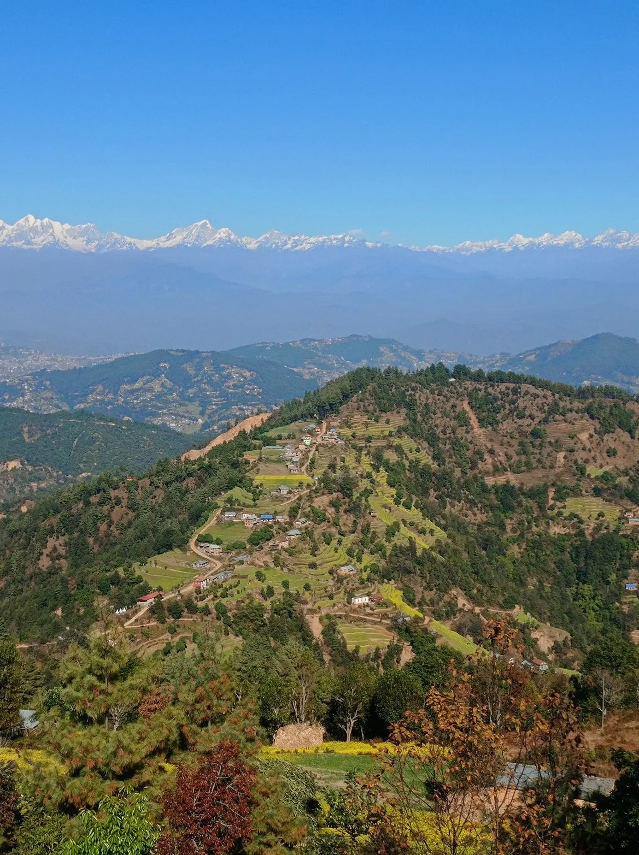
Nagarkot is the most popular sunrise viewpoint near Kathmandu, at approximately 2,195 metres on the eastern rim of the valley. The classic hike descends from Nagarkot to Changunarayan, a UNESCO World Heritage temple, passing through Tamang villages, terraced fields, and forest.
Distance and time: The full hike is about 12–15 kilometres and takes 3–5 hours. Shorter options exist—starting from Telkot reduces the distance.
Difficulty: Easy. The route is mostly downhill, with some uneven sections. No technical difficulty. The trail has direction boards at key junctions, making it straightforward to do independently.
What you see: Sunrise over the Himalayas (weather permitting), traditional villages, terraced farmland, forest, and the ancient Changunarayan Temple at the end.
Permit: None required. Changunarayan Temple has an entrance fee for foreigners.
Getting there: Taxi to Nagarkot (1–1.5 hours from Kathmandu). Return from Changunarayan by taxi or public bus.
Who it suits: Travelers who want a sunrise experience, families, casual hikers, and anyone interested in combining nature with cultural heritage. No guide is needed.
Namobuddha: The Cultural Hike
Namobuddha is a sacred Buddhist site about 40 kilometres east of Kathmandu, near Dhulikhel. The hike typically starts from Dhulikhel or Panauti and winds through Tamang villages, terraced fields, and pine forest to the Thrangu Tashi Yangtse Monastery at approximately 1,750 metres.
Distance and time: About 10 kilometres, taking 4–5 hours. The trail includes some steep sections and, depending on the route, a climb of roughly 1,000 steps to the monastery.
Difficulty: Easy to moderate. The distance is manageable, but the steps and elevation gain require basic fitness.
What you see: Terraced farmland, traditional villages, forest, and the large monastery complex at Namobuddha. The site is one of Nepal’s most important Buddhist pilgrimage destinations.
Permit: None required.
Getting there: Taxi to Dhulikhel or Panauti (1–1.5 hours from Kathmandu). Return from Namobuddha by taxi.
Who it suits: Cultural travelers, photographers, and anyone who wants a hike with a meaningful destination rather than just a viewpoint. The full loop from Dhulikhel is 19.5 kilometres with 690 metres of elevation gain and requires very good fitness, but shorter one-way routes are available.
Chisapani: The Overnight Option
Chisapani is a village at approximately 2,050–2,215 metres on the northern rim of the valley, inside Shivapuri Nagarjun National Park. It is usually done as an overnight trek—hike from Sundarijal to Chisapani on Day 1, stay overnight, then continue to Nagarkot on Day 2. The full Chisapani–Nagarkot route is 35–40 kilometres over two to four days.
Day hike option: It is possible to hike from Sundarijal to Chisapani and return the same day, but it is a long day—4–5 hours of walking in each direction. Most hikers recommend staying overnight rather than returning the same day.
Difficulty: Moderate. The ascent from Sundarijal is steady, and the trail is well-defined. The trail follows the pipeline road and enters the national park about an hour from Sundarijal.
What you see: Forest, Tamang villages, and mountain views from Chisapani. The overnight stay offers sunset and sunrise.
Permit: Shivapuri Nagarjun National Park entry fee applies.
Getting there: Public bus from Ratna Park to Sundarijal costs NPR 70–80 and takes about one hour. Taxi is faster but more expensive.
Who it suits: Travelers with two days available who want a short trek experience without committing to a full Himalayan trek.
Which Kathmandu Hike Should You Choose?
The right hike depends on your fitness, your available time, and what you want from the day.
If you have half a day and want forest: Jamacho. It is short, accessible, and inside the national park.
If you want a proper half-day hike with views: Champadevi. The ridge walk and temple make it a satisfying outing.
If you want the highest viewpoint and have a full day: Shivapuri Peak or Phulchowki. Both are serious hikes requiring good fitness.
If you want a sunrise experience: Nagarkot to Changunarayan. The sunrise is the draw, and the hike down is manageable.
If you want culture with your hike: Namobuddha. The monastery is the destination.
If you want a cable car option: Chandragiri. Hike up, ride down.
If you want an overnight experience: Chisapani. Stay in a village guesthouse and continue to Nagarkot the next day.
If you are hiking with children or older family members: Nagarkot to Changunarayan or Jamacho. Both are relatively gentle.
If you are training for a longer trek: Shivapuri Peak or Phulchowki. The sustained ascent and full-day duration build endurance.
Practical Planning: What You Need to Know
Transportation
Taxis are the most practical way to reach trailheads. Fares vary by distance and negotiation. Public buses run to some trailheads—Pharping, Godawari, Sundarijal, Budhanilkantha—but are slower and less predictable. A bus from Ratna Park to Sundarijal costs around NPR 80 and takes about an hour. For groups, hiring a private vehicle for the day is often the most efficient option. Most trailheads are 30–60 minutes from the city centre by taxi.
Best time to hike
October to December is the strongest window. The monsoon has cleared the air, and mountain views are at their sharpest. Spring (March–April) is warmer with rhododendron blooms. Winter (December–February) is cold but clear, with frost on upper trails. Monsoon (June–September) brings leeches, mud, and reduced visibility—it is not recommended for forest hikes.
What to wear and carry
Comfortable hiking shoes or trail runners. Layers—mornings can be cold, middays warm. Rain jacket, even in dry season. 1–2 litres of water. Snacks. Sunscreen and hat. Trekking poles if you have knee concerns. A headlamp if you are doing a sunrise hike.
Guide or no guide?
None of these hikes require a guide. The trails are well-defined, and navigation is straightforward. However, a guide adds value if you want cultural interpretation, if you are hiking alone and prefer company, or if you are unfamiliar with Nepali trail conditions. For Shivapuri and Phulchowki, a guide can help with pacing and route-finding on the less-traveled sections.
Returning before dark
Most day hikes can be completed between sunrise and sunset. Start early—by 7:00–8:00 AM for full-day hikes—and plan to be back at the trailhead by late afternoon. Carry a headlamp as backup.
Hiking in Kathmandu as Trek Preparation
If you are preparing for a longer Himalayan trek, Kathmandu‘s day hikes offer useful physical conditioning. The sustained ascents, uneven terrain, and full-day duration build the endurance and leg strength you need for multi-day trekking.
But be clear about the difference: Kathmandu Valley hikes do not provide altitude acclimatization. The valley sits at approximately 1,400 metres, and the highest day-hike summits reach 2,700–2,800 metres. This is not high enough to trigger the physiological adaptations needed for Everest Base Camp or Annapurna Base Camp. Use these hikes for fitness, not for altitude preparation.
Planning Your Hike with Wonder Hikes Nepal
Wonder Hikes Nepal can help travelers choose the right Kathmandu Valley hike for their fitness, schedule, and interests. The company arranges guided day hikes, transport to trailheads, national park permits, and combination itineraries that pair hiking with cultural sightseeing.
If you are unsure which trail suits you—or if you want to combine a hike with a longer Nepal trek—contact Wonder Hikes Nepal for current information on trail conditions, seasonal accessibility, and itinerary options.
FAQ
1.What are the best hiking places in Kathmandu?
The main options are Jamacho, Champadevi, Shivapuri Peak, Phulchowki, Chandragiri, Nagarkot–Changunarayan, Namobuddha, and Chisapani. Each suits different fitness levels and time constraints.
2.Which hike is easiest in Kathmandu?
Jamacho is the easiest proper hike—short, well-defined, and inside Shivapuri Nagarjun National Park. Nagarkot to Changunarayan is also gentle, mostly downhill.
3.What is the best short hike near Kathmandu?
Jamacho (4–6 hours) and Champadevi (5–7 hours) are the most practical short hikes. Both can be done in half a day.
4.Is Shivapuri good for beginners?
The Jamacho trail inside Shivapuri is suitable for beginners with basic fitness. Shivapuri Peak is a more serious full-day hike and requires good endurance.
5.Do I need a permit for Shivapuri?
Yes. Shivapuri Nagarjun National Park charges NPR 1,000 for foreign nationals, NPR 600 for SAARC nationals, and NPR 100 for Nepali citizens. Payable at the gate.
6.How long does the Shivapuri hike take?
The Jamacho trail takes 4–6 hours round trip. Shivapuri Peak takes 5–6 hours. Duration depends on trailhead and pace.
7.Which hike has the best mountain views?
Phulchowki and Shivapuri Peak offer the broadest Himalayan panoramas on clear days. Nagarkot is the classic sunrise viewpoint. Views depend on weather and visibility.
8.Can I hike in Kathmandu during monsoon?
Monsoon hiking is possible but not recommended for forest trails. Leeches are prolific, trails are muddy and slippery, and mountain views are usually obscured.
9.Which Kathmandu hike is best for families?
Nagarkot to Changunarayan and Jamacho are the most family-friendly. Both are relatively gentle and can be shortened if needed.
10.Can I hike without a guide?
Yes. None of the main day hikes require a guide. Trails are well-defined, and navigation is straightforward. A guide adds value for cultural interpretation and pacing.
11.What should I wear for hiking in Kathmandu?
Comfortable hiking shoes or trail runners, layered clothing, and a rain jacket. Carry water, snacks, sunscreen, and a hat.
12.How much does hiking near Kathmandu cost?
Costs are mainly transport (taxi or private vehicle) and national park permits where applicable. A taxi to a trailhead costs NPR 800–1,500 depending on distance. Shivapuri park entry is NPR 1,000 for foreigners.
13.Which is the highest hill near Kathmandu?
Phulchowki, at approximately 2,782 metres, is the highest hill encircling the Kathmandu Valley. Shivapuri Peak is second at 2,732 metres.
14.What is the best sunrise hike near Kathmandu?
Nagarkot is the most popular sunrise hike. The view depends on weather, but on clear mornings, the Himalayan skyline is visible.
15.Are the published hike distances accurate?
Distances vary by trailhead and route. For example, Champadevi can be 6–10 kilometres depending on whether you start from Pharping, Hattiban, or Machhegaun. Always confirm the specific route you plan to take.
Final Thoughts
Hiking places in Kathmandu are more varied than most travelers expect. Within an hour of the city, you can climb through national park forest to a monastery, walk a ridge to a temple, summit the valley’s highest hill, or follow terraced fields to a Buddhist pilgrimage site.
The key is matching the hike to your day. If you have four hours and want forest, choose Jamacho. If you want a proper half-day with views and a temple, choose Champadevi. If you have a full day and good fitness, choose Shivapuri Peak or Phulchowki. If you want sunrise and culture, choose Nagarkot to Changunarayan.
Plan for the season, carry the right layers, and start early. The trails are accessible, the permits are straightforward, and the views—when the weather cooperates—are worth the climb.