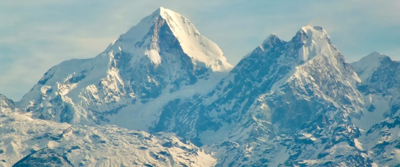
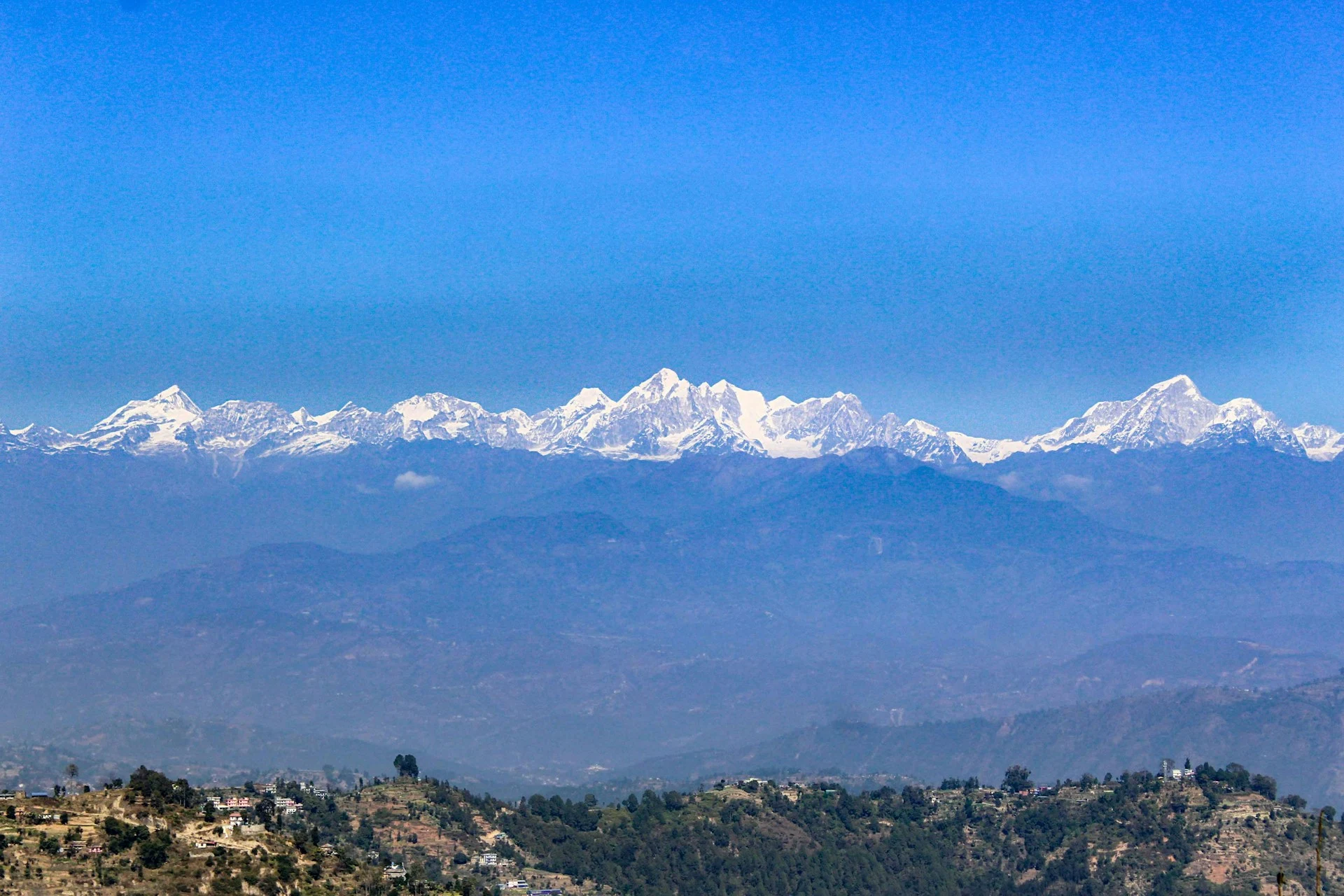
Langtang Himal is a mountain range. It is not the same thing as the Langtang Valley, and it is not the same thing as Langtang National Park. The range is the collection of peaks along Nepal’s northern border. The valley is the glacial corridor that runs along its southern flank. The national park is the protected area that contains both.
This distinction matters because most search results collapse them together. When someone types “Langtang Himal” into Google, they usually find articles about the Langtang Valley Trek — which is useful, but not the same subject. The range itself is rarely explained properly. Its highest peak, Langtang Lirung, is often mentioned in passing without context. The geographical relationship between the peaks, the valley, and the trekking routes is left vague.
This guide fixes that. It explains what the Langtang Himal range actually is, which peaks belong to it, how the valley connects to the mountains, and what the 2026 access situation means for trekkers planning a visit in the next twelve months.
What Langtang Himal Is — and What It Is Not
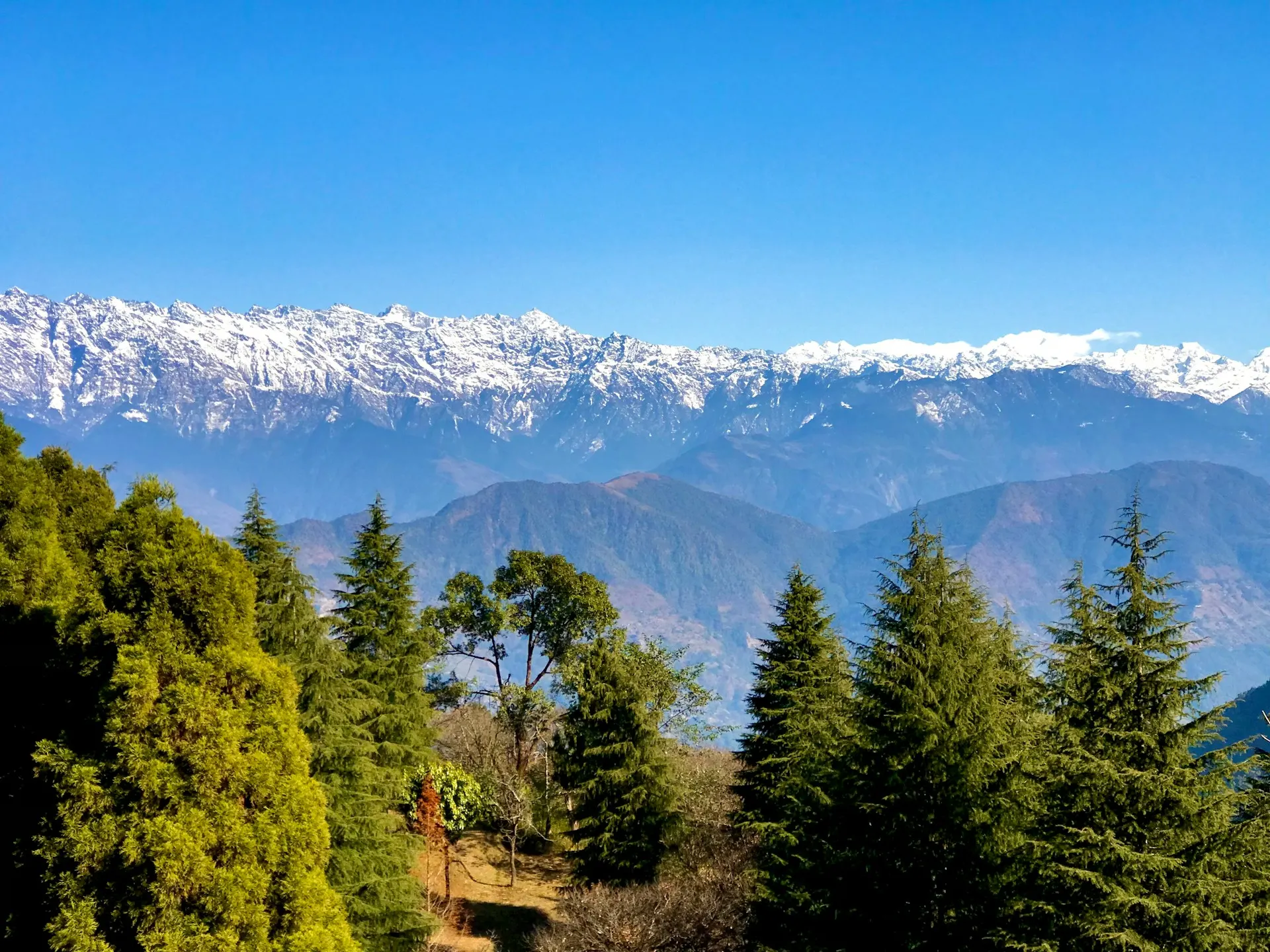
Langtang Himal is a subrange of the Nepalese Himalayas, situated southwest of the eight-thousander Shishapangma and roughly 130 kilometres north of Kathmandu. It is part of the larger Mahalangur Himal system, though it is usually treated as a distinct geographical unit because its peaks and valleys are separated from the Khumbu by the Bhote Koshi river corridor.
The range runs roughly east to west along the Nepal-Tibet border. Its southern slopes descend into the Langtang Valley and the mid-hills of Rasuwa and Nuwakot districts. Its northern slopes fall into Tibetan territory.
It is not a single mountain. It is a ridge system containing one 7,000-metre summit, several 6,000-metre peaks, and a large number of smaller, rarely visited summits. The highest point, Langtang Lirung, sits at approximately 7,227 metres. Some sources cite 7,234 or 7,245 metres — discrepancies of this kind are common in Himalayan geography and reflect different survey methods or historical records. The most widely accepted modern figure places it just above 7,200 metres.
What Langtang Himal is not is the same as the Langtang Valley. The valley is where trekkers walk. The range is what they look at.
Where the Range Sits on the Map
The range lies primarily in Rasuwa District, with its southern slopes extending into Nuwakot and Sindhupalchowk Districts. The Langtang River flows east to west through the valley — unusual for Nepal, where most major rivers flow south from Tibet. This river joins the Bhote Koshi, which forms the eastern boundary of the national park and continues south as the Trishuli River.
The main access point for trekkers is Syabrubesi, a small town at approximately 1,460 to 1,550 metres, reached by road from Kathmandu via Trishuli Bazaar and Dhunche. In normal conditions, the drive takes seven to eight hours. Dhunche, at around 2,000 metres, is the district headquarters and the location of the Langtang National Park entry checkpoint.
To the north lies the Tibetan border and the Qomolangma National Nature Preserve. To the south, the range descends into the mid-hills that separate it from the Kathmandu Valley.
The Peaks That Belong to Langtang Himal
The Langtang Himal contains a mix of expedition peaks, trekking peaks, and unnamed or rarely visited summits. Only a small number are accessible without mountaineering experience.
| Peak | Elevation (approx.) | Classification | Accessible to Trekkers? |
|---|---|---|---|
| Langtang Lirung | 7,227 m | Expedition peak | No |
| Langtang Ri | 7,205 m | Expedition peak | No |
| Dorje Lakpa | 6,966 m | Technical climbing peak | No |
| Loenpo Gang | 6,979 m | Expedition peak | No |
| Changbu | 6,781 m | Expedition peak | No |
| Langshisa Ri | 6,427 m | Technical climbing peak | No |
| Naya Kanga | 5,844 m | Trekking peak | Guided ascent only |
| Yala Peak | 5,520 m | Trekking peak | Guided ascent, beginner-friendly |
Elevation figures vary slightly between sources. The figures above use the most widely accepted modern values.
Langtang Lirung: The Range’s Defining Summit
Langtang Lirung is the highest peak in the range and the anchor of the entire Langtang landscape. It dominates the view from Kyanjin Gompa, its north face rising steeply above the Langtang Glacier. It is listed as the 99th-highest mountain in the world.
The peak has a reputation for danger. Only a small number of successful ascents have been recorded despite decades of attempts, and several climbers have died on its slopes. Its east face was first climbed in 2024 by a Czech-Slovak team, a route described as one of the last unsolved climbing problems in the Himalaya.
On 26 August 2026, a rock and ice avalanche from the northern side of Langtang Lirung triggered the flood that swept down the Trishuli and Bhote Koshi rivers, destroying roads and bridges and cutting off access to the valley. Satellite imagery suggests a large-scale collapse on the mountain’s north face, with ice and rock debris entering the valley below. This event is a reminder that Langtang Lirung is not a static feature of the landscape — it is an active, changing mountain system.
For trekkers, Langtang Lirung is a visual presence rather than a climbing objective. It is not a trekking peak. It requires full expedition logistics and high-altitude mountaineering experience.
Other Notable Peaks in the Range
Langtang Ri is the second-highest peak at approximately 7,205 metres, situated on the Nepal-Tibet border at the head of the Langtang Glacier. It has received relatively few attempts, all by the southwest ridge. Its summit lies on the international boundary, making it a sensitive climbing objective.
Dorje Lakpa is arguably the most photogenic peak in the region. Its elegant pyramid shape is visible from Kathmandu on clear days and from many points along the Langtang Valley trek. At approximately 6,966 metres, it sits in the Jugal Himal, southeast of the Langtang Valley. It is sometimes classified as part of the Langtang range and sometimes as a separate group — the geographical boundaries between Himalayan subranges are rarely sharp.
Yala Peak (5,520 m) is the most accessible climbing objective in the Langtang region. It is classified as a trekking peak by the Nepal Mountaineering Association and is often used as a first Himalayan summit for trekkers with no prior mountaineering experience. The standard route involves walking on snow and glacier, but it is not technically demanding.
Naya Kanga (5,844 m), also known as Ganja La Chuli, is a glaciated summit west of the Ganja La pass. It is a more serious climbing objective than Yala Peak, requiring glacier travel and steep snow slopes. It is classified as a trekking peak but is better suited to climbers with some previous mountaineering experience.
Loenpo Gang (6,979 m) and Changbu (6,781 m) are visible from the upper valley. Langshisa Ri (6,427 m) sits near the Langtang Glacier. Kimshung and Dragmarpo Ri are lesser-known summits within the range.
The Langtang Valley: A Corridor Through the Mountains
The Langtang Valley is a glacial trough that runs along the southern side of the Langtang Himal range, carved by the Langtang River and its tributary glaciers. It is the primary trekking route through the region and the reason most travellers visit.
The valley begins near Syabrubesi and climbs gradually through subtropical forest, then temperate rhododendron and oak, then sub-alpine bamboo, and finally alpine terrain above the tree line. The trail passes through Tamang villages — Lama Hotel, Ghodatabela, Thangshyap, and Mundu — before reaching Kyanjin Gompa, the highest settlement in the valley at approximately 3,870 metres.
The valley is often called the “Valley of Glaciers” because of the number of glacial systems that feed into it. From Kyanjin Gompa, you can see the Langtang Glacier, the Langshisa Glacier, and the debris-covered ice of the upper valley. The landscape changes dramatically as you gain altitude, from dense forest to open yak pastures to bare moraine.
The valley suffered catastrophic damage in the 2015 earthquake, when the village of Langtang was buried by an avalanche and over 200 people died. The rebuilding process has taken years, and the valley has slowly recovered. The August 2026 flood has added another layer of disruption, though the valley itself and the trail above Syabrubesi remain intact.
Kyanjin Gompa: The End of the Road and the Start of the Views
Kyanjin Gompa is the focal point of the Langtang Valley Trek. It is a small settlement built around a monastery, with a handful of teahouses, a cheese factory that dates back to the 1950s, and a yak pasture that opens onto a wide amphitheatre of peaks. From the village, Langtang Lirung dominates the northern skyline. To the west, the Langtang Glacier flows down from the border. To the east, the Langshisa Glacier and the peaks around Yala Peak frame the valley.
The monastery at Kyanjin is an active religious site, not a museum. It was rebuilt after the 2015 earthquake, which destroyed much of the original structure and devastated the surrounding village. The reconstruction is a testament to the resilience of the Tamang community that lives here year-round.
The cheese factory is a curious piece of Himalayan history. It was established with Swiss assistance in the 1950s and continues to produce yak and chauri milk cheese at 3,870 metres. Production has declined in recent years due to farmer migration, but the factory remains a working part of the village economy.
Kyanjin Gompa is also the main acclimatisation stop on the trek. Most itineraries include a rest day here, with a hike to Kyanjin Ri or Tserko Ri to help the body adjust to altitude before returning down the valley.
Viewpoints That Reward the Climb
Kyanjin Ri is a ridge above the village at approximately 4,350 to 4,773 metres, depending on which point you reach. The lower viewpoint is accessible to most trekkers and takes two to three hours to climb. The higher point offers a wider panorama but requires more effort. From the ridge, you can see Langtang Lirung, Langtang Ri, Dorje Lakpa, and the glaciers of the upper valley.
Tserko Ri is the higher and more demanding option. It sits at approximately 4,984 metres and takes five to six hours to climb from Kyanjin Gompa, with three to four hours for the descent. The trail is steep and exposed in places, but it is not technical. The summit offers a panoramic view of Langtang Lirung, the Langtang Glacier, Shishapangma in the distance, and the Tibetan border peaks. It is one of the best viewpoints in the entire Langtang region.
The choice between Kyanjin Ri and Tserko Ri depends on acclimatisation, fitness, and weather. Tserko Ri is the better view but the harder day. Many trekkers do Kyanjin Ri on their first day in the village and Tserko Ri on the second, using the time to acclimatise gradually.
Glaciers, Forests, and a Landscape in Transition
Langtang Himal contains over seventy glaciers of varying sizes. The largest is the Langtang Glacier, which flows south from the border peaks and feeds the Langtang River. The Langshisa Glacier, further east, is another major system. These glaciers are not static. Research shows that the Langtang catchment lost approximately 15.8% of its glacier area between 2000 and 2023, a loss rate of about 0.91 square kilometres per year. The Langtang Glacier itself has undergone tributary separations as its mass has declined.
This matters for trekkers because the landscape you see today is not the landscape that existed fifty years ago. The debris-covered ice, the moraine walls, and the glacial lakes are all part of a system in transition. Understanding this adds a layer of meaning to the trek: you are not just walking through a beautiful valley, you are walking through a changing one.
Below the glaciers, the valley passes through distinct vegetation zones. Subtropical forests below 1,000 metres give way to temperate rhododendron and oak, then sub-alpine bamboo and fir, and finally alpine shrubs and grasslands. The rhododendron blooms in spring are one of the valley’s signature experiences, particularly in the lower sections between Syabrubesi and Lama Hotel.
Langtang National Park: Protection and Purpose
Langtang National Park was established in 1976 as Nepal’s first Himalayan national park and the country’s fourth protected area. It covers approximately 1,710 square kilometres across Nuwakot, Rasuwa, and Sindhupalchowk Districts. The park contains twenty-six village communities and includes the Langtang Valley, the Gosaikunda lake system, and the forests and alpine pastures that surround them.
The park is linked to the Qomolangma National Nature Preserve in Tibet to the north and east, creating a transboundary protected area. It is part of the Sacred Himalayan Landscape, a conservation initiative that recognises the cultural and spiritual significance of the region alongside its ecological value.
For trekkers, the park is not just a boundary on a map. It is the reason the forests are intact, the wildlife is present, and the trail is maintained. The park entry permit is a mandatory part of the trek, and the revenue supports conservation and community development in the region.
Tamang Culture in the High Valleys
The Langtang Valley is home to Tamang communities whose ancestors are thought to have migrated from Tibet and intermingled with Tamang groups from the Helambu area. The culture is distinct from Sherpa culture in the Khumbu, though the two share Tibetan Buddhist roots. Tamang villages are characterised by stone houses, mani walls, prayer flags, and gompas that blend Tibetan Buddhist practice with local traditions.
The 2015 earthquake devastated the Langtang Valley. The village of Langtang itself was buried by an avalanche, and over 200 people died. The rebuilding process has taken years, and many families have not returned. The Tamang Heritage Trail, which runs through villages like Gatlang, Briddim, and Thuman, was developed in part to support cultural tourism and economic recovery in the region.
For trekkers, the cultural dimension of Langtang is not a side attraction. It is part of the experience. The villages are not stage sets; they are living communities. Respectful behaviour — asking before photographing people, dressing modestly at religious sites, and supporting local businesses — matters.
Wildlife You Might Actually See
Langtang National Park is home to a range of Himalayan wildlife. The red panda is the most celebrated species, and the park shares about 24% of Nepal’s red panda population. Red pandas are difficult to spot because they are reclusive and live in fir-jhapra bamboo forests between 2,800 and 3,900 metres — exactly the elevation band you pass through on the trek.
Other mammals include Himalayan tahr, ghoral, serow, musk deer, muntjac, Himalayan black bear, rhesus monkey, langur monkey, and snow leopard. Snow leopards are present but rarely seen. Birdlife is diverse, with 373 recorded species including the tragopan and impeyan pheasant. Migratory birds pass through the valley in spring and autumn.
Wildlife sightings are never guaranteed. The best chances come in the early morning and late afternoon, in the quieter sections of the trail, and in the forest zones below Kyanjin Gompa.
The Langtang Valley Trek: What It Involves
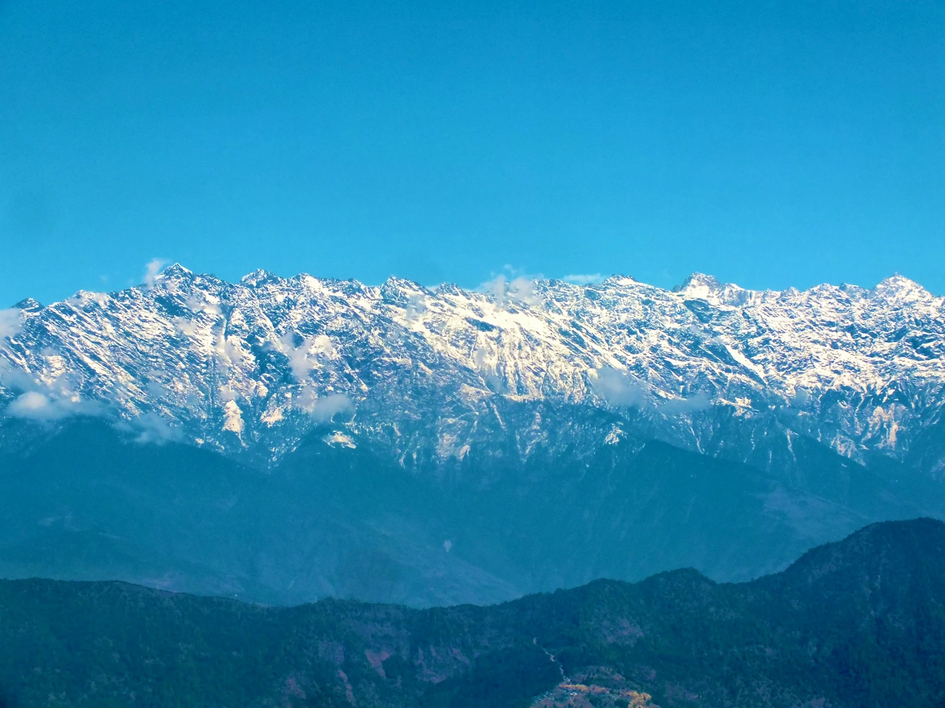
The standard Langtang Valley Trek takes seven to ten days from Kathmandu, depending on whether you add side trips to Kyanjin Ri or Tserko Ri. The route follows the Langtang River upstream from Syabrubesi through Lama Hotel, Ghodatabela, Thangshyap, and Mundu, reaching Kyanjin Gompa on day four or five. After a rest day and a viewpoint hike, the return follows the same trail back to Syabrubesi.
| Day | Stage | Altitude | Walking Time |
|---|---|---|---|
| 1 | Drive Kathmandu to Syabrubesi | 1,460 m | 7–8 hours drive |
| 2 | Syabrubesi to Lama Hotel | 2,480 m | 6–7 hours |
| 3 | Lama Hotel to Ghodatabela | 3,030 m | 5–6 hours |
| 4 | Ghodatabela to Langtang Village | 3,430 m | 4–5 hours |
| 5 | Langtang Village to Kyanjin Gompa | 3,870 m | 3–4 hours |
| 6 | Kyanjin Gompa rest day / Kyanjin Ri | 4,773 m | 3–4 hours |
| 7 | Tserko Ri day hike or return | 4,984 m | 5–6 hours |
| 8 | Kyanjin Gompa to Lama Hotel | 2,480 m | 6–7 hours |
| 9 | Lama Hotel to Syabrubesi | 1,460 m | 5–6 hours |
| 10 | Drive Syabrubesi to Kathmandu | 1,400 m | 7–8 hours |
The trek is graded moderate. There is no high pass to cross on the standard route, no technical terrain, and no need for climbing equipment. The maximum altitude on the standard trek is Kyanjin Gompa at 3,870 metres, though side hikes to Kyanjin Ri (4,773 m) or Tserko Ri (4,984 m) take you higher. The trail is well established, with teahouses at regular intervals.
The hardest day is the first day of walking from Syabrubesi to Lama Hotel, which involves about 1,000 metres of climbing. Altitude becomes noticeable above 3,500 metres, so a slow pace, hydration, and rest are essential.
Trekking vs Climbing in Langtang
Trekking in Langtang means walking the valley trail, staying in teahouses, and hiking to viewpoints like Kyanjin Ri and Tserko Ri. It does not require technical equipment or climbing experience.
Climbing in Langtang means ascending a peak. Yala Peak is the most accessible option, classified as a trekking peak and suitable for beginners with guided support. Naya Kanga is more demanding, requiring glacier travel and steep snow. Langtang Lirung, Langtang Ri, and Dorje Lakpa are expedition peaks requiring full mountaineering skills and logistics.
The distinction matters because some operators blur the line between trekking and climbing. If a climb is described as “suitable for beginners” and involves fixed ropes and glacier travel, ask specific questions about the skills required and the guide’s qualifications.
Best Seasons for Mountain Views
Mountain visibility in the Langtang region depends on weather, season, and luck. No one can guarantee a clear view.
Autumn (late September to November) offers the most stable conditions. The monsoon has cleared, the air is dry, and visibility is generally at its best. October and November are the classic months for clear mountain views — but also the busiest.
Spring (March to May) brings warmer temperatures and rhododendron forests at lower elevations. Visibility is good, but afternoon cloud is more common than in autumn. March through May is the second-best window — slightly less reliable skies but far fewer trekkers.
Winter (December to February) offers clear skies but extreme cold at high elevations. Many teahouses close, and some passes become difficult.
Monsoon (June to early September) is not recommended. Cloud, rain, and leeches at lower elevations make the trek uncomfortable, and mountain views are obscured.
2026 Access: What the Floods Changed and What They Didn’t
On 26 August 2026, a rock and ice avalanche from the northern side of Langtang Lirung sent a flood down the Trishuli and Bhote Koshi rivers. The access road from Betrawati to Rasuwagadhi and Syabrubesi was destroyed over a 42-kilometre section. Syabrubesi Bazaar, the starting point for the Langtang Valley Trek, was severely damaged. The road through Dhunche to Syabrubesi remains closed while reconstruction is underway.
This is a temporary condition, not a permanent geographical change. The Langtang Himal, the Langtang Valley, and the trekking routes within the park are intact. The mountains have not moved. The trail from Syabrubesi into the valley is not the same as the road that leads to Syabrubesi. The Trekking Agencies’ Association of Nepal lists the Langtang and Kyanjin valley as safe, and the trail above Syabrubesi is walkable, with teahouses standing.
The recommended alternative approach is the walk in from Sundarijal via Helambu, Thadepati, Ghopte, Gosaikunda, Thulo Syabru, and then into the Langtang Valley. This route avoids the destroyed road entirely. It is longer and harder than the standard itinerary, and it puts the Laurebina La pass in the first half rather than at the end.
Nobody has announced a reopening date for the road. The Department of Roads is prioritising the Bidur to Betrawati section, but the Dhunche, Syabrubesi, and Rasuwagadhi road will be difficult to rebuild soon because there is practically no trace of it left in places. For 2026 and early 2027, trekkers should expect delays, alternative arrangements, or temporary suspension of the standard Langtang Valley Trek. Helicopter access may be possible but is expensive.
This is a serious disruption. It is not a reason to write off Langtang permanently. The valley is intact. The trail is intact. The mountains are still there. Access will be restored. In the meantime, anyone planning a Langtang trek should check current conditions with a reputable operator before booking.
Permits, Guides, and Costs in 2026
Two permits are required for the Langtang Valley Trek: the Langtang National Park Entry Permit and the TIMS Card. The park permit costs NPR 3,000 (approximately USD 22) for foreign trekkers. The TIMS card costs NPR 2,000 for individual trekkers and NPR 1,000 for group trekkers. Total permit costs come to roughly NPR 5,000, or about USD 37.
Since February 2025, a licensed guide is mandatory for trekking in Langtang. Independent, unguided trekking is no longer permitted. This rule was introduced to improve safety and ensure that trekkers are properly supported in remote areas. Guide costs vary, but expect to pay around USD 25–30 per day for a licensed guide.
Package prices for the Langtang Valley Trek from Kathmandu vary widely depending on the operator, group size, and inclusions. Budget options start around USD 449 per person, while mid-range and premium packages run from USD 690 to USD 1,990. These typically include permits, guide, accommodation, and meals during the trek, but not transport to and from the trailhead or personal expenses.
Langtang Compared with Everest and Annapurna
| Feature | Langtang Valley | Everest Base Camp | Annapurna Base Camp |
|---|---|---|---|
| Duration from Kathmandu | 7–10 days | 12–14 days | 7–11 days |
| Max sleeping altitude | 3,870 m (Kyanjin Gompa) | 5,364 m (EBC) | 4,130 m (ABC) |
| Max point reached | 4,984 m (Tserko Ri) | 5,545 m (Kala Patthar) | 4,130 m (ABC) |
| Difficulty | Moderate | Demanding | Moderate |
| Crowds | Low | High | Medium |
| Access | Road from Kathmandu | Flight to Lukla | Road to Nayapul |
| Culture | Tamang and Tibetan | Sherpa | Gurung and Magar |
| Best for | Quiet trails, culture, accessible trekking | High mountains, iconic views | Varied landscapes, shorter trek |
Langtang is the quietest of the three. It offers a genuine Himalayan experience without the crowds, and the cultural dimension is as strong as the mountain scenery. Everest offers the highest peaks and the most iconic views, but at a higher cost and with more logistical complexity. Annapurna sits between the two in terms of difficulty and popularity.
For trekkers who have limited time, are concerned about altitude, or want a less crowded experience, Langtang is often the better choice. For trekkers whose primary goal is standing at Everest Base Camp or seeing Kala Patthar at sunrise, Langtang is not a substitute.
Planning Your Trek with Wonder Hikes Nepal
Wonder Hikes Nepal organises treks in the Langtang region with a focus on matching the itinerary to the traveller’s goals and experience. The company works with local Tamang and Sherpa guides who know the valley, the weather patterns, and the current trail conditions.
Given the 2026 access disruption, the team can advise on alternative approaches, realistic timelines, and whether a Langtang trek is feasible for your dates. They can also arrange Yala Peak climbing for trekkers who want to add a summit to the valley trek, or extend the itinerary to Gosaikunda and Helambu for a longer cultural and geographical experience.
The company’s approach is practical rather than promotional. If conditions do not allow a trek, they will say so. If a different route would suit you better, they will recommend it. That kind of honesty is more useful than a hard sell, especially in a season when access conditions are changing.
[Plan your Langtang trek with Wonder Hikes Nepal →]
Final Thoughts
Langtang Himal is not the highest range in Nepal. It does not contain an eight-thousander. It does not have the same name recognition as Everest or Annapurna. What it has is a combination of qualities that are increasingly rare in Himalayan trekking: quiet trails, accessible terrain, deep cultural roots, and a landscape that feels lived-in rather than staged.
The 2026 floods have disrupted access, and that disruption is real. But the mountains are still there. The valley is still there. The trail is still walkable. Understanding the difference between the range and the valley — between the mountains and the trail that passes through them — changes how you experience the trek. You stop looking for a single summit and start seeing a system: peaks, glaciers, rivers, forests, villages, and the people who have adapted to living in one of the most dynamic mountain environments on Earth.
That is what makes Langtang worth the journey.
11. 15 FAQs
1. Where is Langtang Himal located?
Langtang Himal is in north-central Nepal, primarily in Rasuwa District, about 130 kilometres north of Kathmandu. It runs along the Nepal-Tibet border, with the Langtang Valley on its southern flank. The nearest access town is Syabrubesi.
2. What is the highest peak in Langtang Himal?
Langtang Lirung is the highest peak at approximately 7,227 metres. Some sources cite 7,234 or 7,245 metres — discrepancies in Himalayan elevations are common. It is the 99th-highest mountain in the world.
3. Can beginners trek the Langtang Valley?
Yes. The Langtang Valley Trek is graded moderate and is suitable for first-time trekkers with reasonable fitness. There is no technical terrain and no high pass on the standard route. A licensed guide is mandatory, which adds a layer of safety for beginners.
4. How many days do I need for the Langtang Valley Trek?
Seven to ten days from Kathmandu, depending on whether you add side trips to Kyanjin Ri or Tserko Ri. The standard itinerary is eight days. Shorter versions are possible but skip acclimatisation hikes.
5. What permits are needed for Langtang in 2026?
Two permits: the Langtang National Park Entry Permit (NPR 3,000) and the TIMS Card (NPR 2,000 solo, NPR 1,000 group). A licensed guide is also mandatory since February 2025. Total permit costs come to roughly USD 37.
6. Is Langtang accessible in 2026 after the floods?
Access is currently disrupted. The flood of 26 August 2026 destroyed the road from Betrawati to Syabrubesi. The trail and mountains are intact, and the valley is safe, but the road is closed for reconstruction. The recommended alternative approach is the walk in from Sundarijal via Helambu and Gosaikunda.
7. What wildlife can I see in Langtang National Park?
Red panda, Himalayan tahr, ghoral, serow, musk deer, muntjac, Himalayan black bear, rhesus monkey, langur monkey, and snow leopard (rare). The park has 373 recorded bird species including the tragopan and impeyan pheasant.
8. Is Langtang less crowded than Everest?
Yes, significantly. Langtang receives far fewer trekkers than Everest or Annapurna. The trails are quiet even in peak season, and teahouses are rarely full. This is one of the main reasons trekkers choose Langtang over the more famous routes.
9. What is the best time to visit Langtang Himal?
Autumn (late September to November) offers the most stable weather and clearest visibility. Spring (March to May) is also good, with warmer temperatures and rhododendron blooms. Monsoon is not recommended for mountain views.
10. How difficult is the Langtang Valley Trek compared to Everest Base Camp?
Langtang is easier. The maximum sleeping altitude is 3,870 metres at Kyanjin Gompa, compared to 5,364 metres at Everest Base Camp. There is no high pass, and the daily walking distances are shorter. Langtang is a better choice for first-time trekkers or anyone concerned about altitude.
11. What is the culture like in Langtang Valley?
The valley is home to Tamang communities with Tibetan Buddhist traditions. You will see stone houses, mani walls, prayer flags, and gompas. The culture is distinct from Sherpa culture in the Khumbu. Respectful behaviour at religious sites is expected.
12. Can I climb a peak in Langtang?
Yala Peak (5,520 m) is the most accessible trekking peak, suitable for beginners with guided support. Naya Kanga (5,844 m) is more demanding, requiring glacier travel and steep snow. Langtang Lirung, Langtang Ri, and Dorje Lakpa are expedition peaks for experienced mountaineers only.
13. How much does the Langtang Valley Trek cost?
Package prices from Kathmandu start around USD 449 per person for budget options and run from USD 690 to USD 1,990 for mid-range and premium packages. These typically include permits, guide, accommodation, and meals during the trek, but not transport to the trailhead or personal expenses.
14. Do I need travel insurance for Langtang?
Yes. Travel insurance that covers high-altitude trekking and helicopter evacuation is strongly recommended. The nearest hospitals are in Kathmandu, and evacuation from the Langtang Valley can be expensive. Given the 2026 access disruption, evacuation logistics may be more complex than usual.
15. Is Langtang worth visiting in 2026?
The valley and trail are intact, and the mountains are unchanged. Access is disrupted, but alternatives exist. If you are flexible about dates and willing to check current conditions, Langtang remains one of the most rewarding treks in Nepal. If you need a guaranteed, straightforward itinerary, you may want to wait until the road is rebuilt.
Ready to plan your trek?
Tell us your dates and group size. We reply on WhatsApp within a few hours.