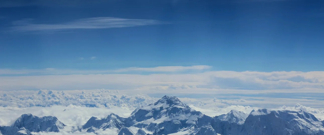
Peaks near Everest get described in a lot of misleading ways online. Most articles list every 6,000-metre mountain in eastern Nepal and call them all “near Everest” — as if Mera Peak, Cho Oyu, and Ama Dablam share the same postcode. They do not.
For a trekker planning the Everest Base Camp route or a Gokyo extension, this vagueness creates a specific problem: you arrive in the Khumbu expecting a wall of eight-thousanders from every ridge, and you leave confused about which mountain was which. The 2026 trekking season has made one thing clear — travellers want precision, not padding. They want to know exactly what they are looking at, from where, and under what conditions.
This guide treats the mountains around Everest as a landscape you move through, not a checklist you tick off. It follows the trail from Lukla to Kala Patthar, explaining which peaks appear at each stage, which ones you can climb, and which views are genuinely worth the effort.

The Mountains Around Everest: Why “Near” Needs a Definition
When someone searches for mountains near Mount Everest, they may mean three completely different things. Treating these as interchangeable is where confusion begins.
The Everest massif proper includes Lhotse, Nuptse, and Changtse — peaks physically connected to or immediately adjacent to Everest’s summit block. These are the mountains you might describe as “next to Everest” in a literal geographical sense.
The Khumbu skyline peaks include Ama Dablam, Pumori, Thamserku, Kangtega, Cholatse, and Taboche. These are not attached to Everest, but they dominate the views along the standard trekking route. Most trekkers photograph these far more than they photograph Everest itself.
The wider Everest-region climbing peaks include Island Peak, Lobuche East, Mera Peak, Cho Oyu, and Makalu. They sit within the broader Mahalangur Himal and Khumbu region, but calling them “near Everest” requires a generous definition of proximity. Mera Peak, for instance, is in the Hinku Valley — a different drainage system entirely.
Understanding this distinction matters because your itinerary determines which category you actually experience. A standard EBC trek delivers the first two. A Gokyo extension adds Cho Oyu and the widest panorama in the region. A peak-climbing itinerary introduces the third.
The Everest Massif: Four Peaks That Share a Summit Block
Lhotse (8,516 m)
Lhotse is not merely close to Everest — it is joined to it. The two summits are connected by the South Col, the saddle that climbers cross on the standard South Col route. At 8,516 metres, Lhotse is the fourth-highest mountain in the world.
From the trekking perspective, Lhotse is surprisingly difficult to identify from lower elevations because it often merges visually with Everest’s mass. The clearest views come from Kala Patthar and the upper Khumbu, where its sharp profile separates from Everest. From Tengboche and Dingboche, it appears as a distinct pyramid to the right of Everest on clear days.
Lhotse is a full expedition objective. It is not a trekking peak, and it is not climbed by trekkers under any commercial itinerary.
Nuptse (7,861 m)
Nuptse is the mountain most trekkers mistake for Everest. Its long, dark western ridge dominates the skyline from Namche Bazaar, and from Tengboche it often looks larger than Everest itself. This is not an illusion — from the Nepali side, Nuptse stands closer to the viewer and presents a broader face.
The critical fact for trekkers: Nuptse blocks the view of Everest’s summit from Everest Base Camp. This is not a weather issue. It is geometry. Standing on the Khumbu Glacier at Base Camp, you are in the shadow of Nuptse’s southern wall, and the summit pyramid of Everest is hidden behind it.
This single geographical fact is the reason Kala Patthar exists as a viewpoint. The ridge of Kala Patthar sits at an angle that clears Nuptse’s profile, allowing the Everest summit to appear.
Changtse (7,543 m)
Changtse sits on the Tibetan side of the border, immediately north of Everest’s summit. It is connected to Everest by the North Col. From Nepal, Changtse is largely hidden behind Everest itself and is not a peak you will see clearly during a standard trek. Some sources claim marginal glimpses from Kala Patthar, but these are unreliable.
Pumori (7,161 m)
Pumori rises directly above Gorak Shep and Kala Patthar, forming the backdrop to the final stages of the EBC trek. Its name means “Unmarried Daughter” in Sherpa — a reference to a local legend about a daughter who married a suitor from Tibet and never returned.
From Kala Patthar, Pumori appears close enough to feel within reach, though it is a serious expedition peak requiring technical climbing skills. It is visible from Lobuche, Gorak Shep, and throughout the upper Khumbu.
The Peaks That Dominate the Khumbu Skyline
Ama Dablam (6,812 m)
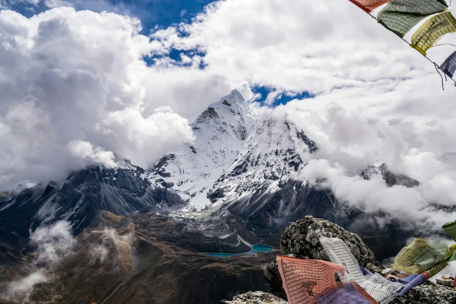
If you ask trekkers which mountain they remember most from the Everest region, many will say Ama Dablam — not Everest. Its distinctive shape, a steep pyramid with a hanging glacier on the southwest face, makes it immediately recognisable from Namche Bazaar, Tengboche, Dingboche, and Pangboche.
Ama Dablam is a technical climbing objective, not a trekking peak. It requires rock, ice, and mixed climbing skills, and it is not suitable for trekkers without prior alpine experience.
Thamserku (6,608 m) and Kangtega (6,782 m)
These two peaks form a distinctive pair visible from the lower Khumbu, particularly between Phakding and Namche. Thamserku is the sharper of the two; Kangtega is broader with a characteristic saddle shape. They are not climbed commercially and are rarely the focus of a trek, but they frame the eastern skyline beautifully in the early stages of the route.
Cholatse (6,440 m) and Taboche (6,501 m)
These two peaks stand west of Dingboche and form a dramatic gateway to the Gokyo Valley. They are visible from Dingboche, Lobuche, and the Thukla Pass. Taboche is the larger and more prominent of the two; Cholatse is sharper and more technical. Neither is a trekking peak.
What You See Along the EBC Trail — Stage by Stage
The mountains around Everest do not appear all at once. They reveal themselves in sequence as you gain altitude and move up the Khumbu Valley. Understanding this sequence helps you know what to look for and when to get your camera ready.
Lukla to Phakding (2,610 m to 2,610 m)
The trail begins in the Dudh Koshi valley, below the main Himalayan skyline. The first significant peak is Kongde Ri (6,187 m), visible to the northwest. Kusum Kanguru (6,367 m) appears further along, a triple-summited peak that is technically demanding and rarely climbed. Thamserku becomes visible as a sharp, jagged shape to the north.
Namche Bazaar (3,440 m)
Namche is where the first major panorama opens. On a clear morning, you can see Everest (distant, often cloud-covered), Lhotse, Nuptse, Ama Dablam, Thamserku, and Kongde Ri. The classic viewpoint is the ridge above the village, near the Sagarmatha National Park headquarters or the Everest View Hotel.
Ama Dablam is the standout from Namche. Its shape is unmistakable, and on clear mornings it catches the first light while Everest remains in shadow.
Tengboche (3,860 m)
Tengboche sits on a ridge above the Imja Khola, with the monastery as its focal point. The mountain views here rank among the best on the entire trek. Ama Dablam dominates the view to the north. Thamserku and Kangtega stand to the east. Everest, Lhotse, and Nuptse form a dramatic wall to the northeast, though Everest itself is often partially hidden behind Nuptse’s western ridge.
Dingboche (4,410 m)
Dingboche marks a shift into the higher, drier upper Khumbu. From here, you can see Ama Dablam to the south, Lhotse and Lhotse Shar to the northeast, Cholatse and Taboche to the west, and Island Peak (Imja Tse, 6,189 m) to the east. Makalu is sometimes visible in the far distance on exceptionally clear days.
A short side trip to Nagarjuna Danda or the ridge above Dingboche gives a wider panorama and is a worthwhile acclimatisation walk.
Lobuche and Gorak Shep (4,940 m to 5,164 m)
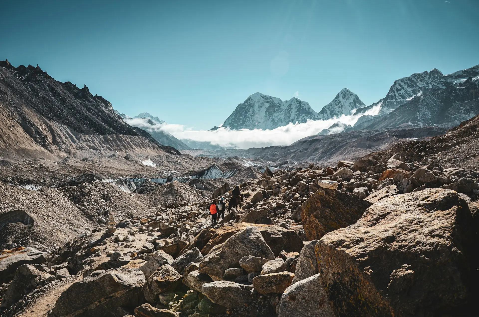
The trail from Dingboche to Lobuche crosses the Khumbu Glacier’s lateral moraine and passes the Thukla Pass, marked by memorials to climbers who died on Everest. The landscape becomes starker, and the peaks feel more immediate.
From Lobuche, Pumori becomes prominent. Lobuche East (6,119 m) rises nearby. Nuptse, Lhotse, and Everest are visible in the distance, though Everest’s summit remains partly obscured.
Gorak Shep is the last settlement before Base Camp. It sits in a shallow bowl beneath Pumori, with the Khumbu Glacier stretching to the south.
Base Camp vs Kala Patthar: The View Everyone Gets Wrong
This is the most important correction in this article. Everest Base Camp (5,364 m) does not offer the classic Everest summit view. The summit is hidden behind Nuptse. What Base Camp offers is proximity, atmosphere, and the sight of the Khumbu Icefall — not a panoramic mountain vista.
Kala Patthar (5,545 m lower viewpoint; 5,644 m true summit) is the viewpoint that clears Nuptse’s ridge. The hike from Gorak Shep takes two to three hours over steep but non-technical rocky trail. Most trekkers leave around 4:00 to 4:30 a.m. with headlamps to reach the viewpoint before sunrise.
From Kala Patthar, the view includes Everest (summit visible on clear days), Nuptse, Lhotse, Pumori, Thamserku, Kangtega, Taboche, Cholatse, and the Khumbu Glacier. The Everest summit appears as a dark pyramid above Nuptse’s shoulder — not the towering white mass many people expect.
If you have to choose one, choose Kala Patthar for the view and Base Camp for the experience of standing at the foot of the mountain.
Gokyo Valley: The Wider Panorama Most Trekkers Miss
Gokyo is a side valley west of the main Khumbu route, reached via a steep climb from Dole or by crossing the Cho La pass. It is known for its turquoise glacial lakes and for Gokyo Ri (5,357 m), a viewpoint many trekkers consider superior to Kala Patthar.
From Gokyo Ri, you can see Cho Oyu (8,188 m) to the north, Everest and Lhotse to the east, and Makalu to the southeast. The view is broader than Kala Patthar because Gokyo Ri sits further west, giving a wider angle on the Everest group. The lakes in the foreground add depth to photographs.
Cho Oyu is the sixth-highest mountain in the world and the closest eight-thousander to Gokyo. It is visible from the village itself and dominates the northern skyline. Unlike Everest, it is not blocked by intervening ridges.
Gokyo is not part of the standard EBC trek. It requires either a detour adding several days or a different itinerary entirely (EBC + Gokyo via Cho La, or the Three Passes Trek).
Climbing the Peaks Near Everest: Trekking Peaks vs Technical Mountaineering
Nepal’s trekking peaks are classified by the Nepal Mountaineering Association and require permits separate from trekking permits. They are not “easy hikes.” They involve glacier travel, fixed ropes, and real mountaineering skills.
Island Peak (Imja Tse) — 6,189 m
The most popular trekking peak in the Everest region. The climb involves glacier travel with crevasse crossings, a steep headwall (45 to 70 degrees depending on conditions) ascended on fixed rope using a jumar, and a summit ridge that demands comfort with exposure. Most trekkers combine it with the EBC trek, using the acclimatisation gained along the way.
Lobuche East — 6,119 m
Multiple experienced operators rank Lobuche East as the most technical of the three main Everest-region trekking peaks. The summit day involves sustained steep ground — mixed rock and ice, not just snow — a longer push from high camp, and a narrower, more exposed summit ridge.
Mera Peak — 6,476 m
The highest trekking peak in Nepal. Technically, the standard route is a long snow slope at roughly 30–35 degrees with a short fixed-rope section near the summit. What makes Mera Peak hard is altitude and duration — you spend more days above 5,000 metres than on either of the other two peaks. The approach through the Hinku Valley is remote and less crowded.
Technical and Expedition Peaks
Ama Dablam (6,812 m), Pumori (7,161 m), Everest, Lhotse, and Nuptse are expedition objectives requiring full technical skills, permits, and logistics. No trekking company sells these as treks.
When to Go for the Best Mountain Views
Mountain visibility in the Khumbu depends on weather, season, and luck. No one can guarantee a clear view.
Autumn (late September to November) offers the most stable conditions. Meteorological research has determined that the post-monsoon season offers a markedly better opportunity for trekkers wanting to see Everest’s summit than the pre-monsoon climbing season. October and November are the classic months for clear mountain views — but also the busiest.
Spring (March to May) brings warmer temperatures and rhododendron forests at lower elevations. Visibility is good, but afternoon cloud is more common than in autumn.
Winter (December to February) offers clear skies but extreme cold at high elevations. Many teahouses close, and some passes become difficult.
Monsoon (June to early September) is not recommended for mountain views. Cloud, rain, and leeches at lower elevations make the trek uncomfortable.
Viewpoint Comparison: Which Ridge Gives You What
| Viewpoint | Elevation | Best For | What You See |
|---|---|---|---|
| Namche ridge | 3,440 m | First panorama | Everest (distant), Lhotse, Nuptse, Ama Dablam, Thamserku |
| Tengboche | 3,860 m | Cultural + mountain drama | Ama Dablam, Thamserku, Kangtega, Everest group |
| Dingboche ridge | 4,410 m | Upper Khumbu scale | Ama Dablam, Lhotse, Cholatse, Taboche, Island Peak |
| Gorak Shep | 5,164 m | Base for Kala Patthar | Pumori, limited views from village |
| Kala Patthar | 5,545 m | Classic Everest summit view | Everest, Nuptse, Lhotse, Pumori, Khumbu Glacier |
| Gokyo Ri | 5,357 m | Widest panorama | Cho Oyu, Everest, Lhotse, Makalu |
| Chhukung Ri | 5,550 m | Close views of Island Peak | Island Peak, Lhotse, Imja Valley |
Practical Advice for Mountain Watching on the Khumbu Trail
Start early. Cloud builds through the day. The clearest views are usually before 10 a.m. Plan photography and viewpoint visits accordingly.
Carry a peak identification chart or app. It is surprisingly difficult to distinguish Everest from Nuptse from Lhotse when standing in front of them. A laminated chart or a phone app like PeakFinder transforms the experience.
Do not chase every view. Cloud can obscure everything within minutes. Accept it, drink tea, and try again later.
Acclimatise properly. Altitude sickness ruins more mountain-viewing experiences than bad weather. Follow a sensible acclimatisation schedule.
Respect the weather. High winds, snow, and whiteout conditions are real risks above 5,000 metres.
Five Myths About the Everest Landscape
“Everest is visible throughout the entire trek.” False. Everest is often hidden behind Nuptse, Lhotse, or cloud. Many trekkers reach Kala Patthar without having clearly seen the summit.
“Base Camp has the best Everest view.” False. Base Camp is a proximity experience, not a viewpoint. The summit is blocked by Nuptse.
“The highest mountain is always the most impressive.” False. From most points on the trek, Ama Dablam is more visually striking than Everest. Nuptse often looks bigger than Lhotse.
“Trekking peaks are just difficult hikes.” False. Island Peak, Lobuche East, and Mera Peak all involve glacier travel, fixed ropes, and real mountaineering skills.
“Every mountain in the Everest region is near Everest.” False. Mera Peak is in a different valley. Cho Oyu is on the Tibetan border. Makalu is a separate massif.
Which Trek Matches Your Mountain-View Goals?
Classic EBC Trek (12–14 days from Lukla). Gives you Namche, Tengboche, Dingboche, Gorak Shep, Kala Patthar, and Base Camp. Best for trekkers whose primary goal is standing at Base Camp. Excellent mountain views, but Everest itself is not guaranteed.
EBC + Gokyo via Cho La (15–17 days). Adds Gokyo Ri and the turquoise lakes to the standard EBC route. Best for trekkers who want both Base Camp and the widest possible panorama.
Three Passes Trek (17–20 days). Crosses Kongma La, Cho La, and Renjo La. Visits EBC, Gokyo, and Chhukung. The most demanding standard route in the Khumbu.
Island Peak or Lobuche East climbing itineraries (16–20 days). Add a trekking peak summit to the EBC route. Best for trekkers with some mountaineering experience.
Gokyo Lakes Trek (12–14 days). Focuses on Gokyo Ri and the lakes, without going to Base Camp. Best for trekkers whose priority is mountain views over Base Camp itself.
Planning Your Everest Region Trek with Wonder Hikes Nepal
Wonder Hikes Nepal organises treks in the Everest region with a focus on matching the itinerary to the traveller’s actual priorities — not just selling a standard package.
If your main goal is mountain views, the team can advise on routes that maximise panorama: Gokyo Ri, Tengboche, Dingboche, and the side ridges that many trekkers skip. If Base Camp is the priority, they can build in the right acclimatisation schedule to give you the best chance of clear views at Kala Patthar. If you want to climb a trekking peak, they can assess your experience and recommend Island Peak, Lobuche East, or Mera Peak — or tell you honestly if you are not ready.
The company works with local Sherpa guides who know the terrain, the weather patterns, and the viewpoints that are not on the standard itinerary. That local knowledge is what turns a good trek into a memorable one.
[Plan your Everest region trek with Wonder Hikes Nepal →]
FAQs
1. Which mountain is closest to Everest?
Lhotse is the closest major peak, connected to Everest via the South Col at around 7,900 metres. Nuptse is also immediately adjacent, forming the western wall of the Everest massif. Changtse, on the Tibetan side, is just north of the summit.
2. What mountains can you see from Everest Base Camp?
From Base Camp itself, you can see Nuptse rising to the west and the Khumbu Icefall to the south. The summit of Everest is not visible because Nuptse blocks it. Pumori is visible above the camp, and the surrounding moraine and glacier dominate the foreground.
3. Can you see Everest from Base Camp?
No. The summit of Everest is hidden behind Nuptse when you stand at Base Camp. You are standing at the foot of the mountain, but the summit itself is not visible. Kala Patthar is the viewpoint that clears Nuptse.
4. Which peaks can you see from Kala Patthar?
On a clear day, Kala Patthar offers views of Everest’s summit, Lhotse, Nuptse, Pumori, Thamserku, Kangtega, Taboche, Cholatse, and the Khumbu Glacier. Visibility is never guaranteed, but Kala Patthar gives the best chance of seeing Everest’s summit from the Nepali side.
5. Is Lhotse next to Everest?
Yes. Lhotse is connected to Everest via the South Col, the saddle between the two summits. It is the fourth-highest mountain in the world at 8,516 metres. From Kala Patthar, Lhotse appears as a sharp peak to the right of Everest.
6. Can you see Ama Dablam on the EBC trek?
Yes, frequently. Ama Dablam is visible from Namche Bazaar, Tengboche, Dingboche, and Pangboche. It is one of the most recognisable and photographed peaks on the trek.
7. Can you see Cho Oyu from Everest?
Not from the standard EBC trek. Cho Oyu is visible from Gokyo Ri and the Gokyo Valley, which is west of the main Khumbu route. To see Cho Oyu, you need to include Gokyo in your itinerary.
8. What mountains can you see from Namche Bazaar?
On a clear day, Namche offers views of Everest (distant), Lhotse, Nuptse, Ama Dablam, Thamserku, Kongde Ri, Taboche, and Cholatse. The best viewpoint is the ridge above the village.
9. What mountains can you see from Dingboche?
From Dingboche, you can see Ama Dablam, Lhotse, Lhotse Shar, Cholatse, Taboche, and Island Peak. Makalu is sometimes visible in the far distance on exceptionally clear days.
10. Which peaks near Everest can tourists climb?
Island Peak (6,189 m), Lobuche East (6,119 m), and Mera Peak (6,476 m) are the main trekking peaks in the Everest region. They are classified by the Nepal Mountaineering Association and require guided ascents. They are not simple hikes.
11. What is the best trek for mountain views in the Everest region?
For the widest panorama, the Gokyo Lakes Trek or EBC + Gokyo via Cho La is hard to beat. Gokyo Ri offers views of Cho Oyu, Everest, Lhotse, and Makalu in a single sweep.
12. Is it better to go to Kala Patthar or Everest Base Camp?
They serve different purposes. Base Camp is about proximity and atmosphere. Kala Patthar is about the view. If you can do both, do both.
13. What is the best time of year to see the peaks near Everest?
Autumn (late September to November) offers the most stable weather and clearest visibility. Spring (March to May) is also good. Monsoon is not recommended for mountain views.
14. How hard is it to see Everest clearly?
Harder than most people expect. Everest is often hidden by cloud, and even on clear days, its summit is blocked by Nuptse from many viewpoints. Kala Patthar is the best bet.
15. Do I need a guide to see the peaks near Everest?
For the standard EBC trek, a guide is not legally required but is strongly recommended for safety and local knowledge. For trekking peaks, a licensed guide is mandatory.
Final Thoughts
The mountains around Everest are not a backdrop. They are the landscape you move through, each with its own shape and relationship to the mountain you came to see.
Most trekkers arrive thinking about Everest. They leave remembering Ama Dablam. They remember the way Nuptse catches the last light from Tengboche, the silence at Gokyo Ri, the cold at Kala Patthar, the strange flatness of Base Camp after all those days of climbing.
Understanding which peaks are where — and why some are visible and some are not — changes the experience. You stop looking for a single summit and start seeing a whole range. That shift is what turns a trek into something you carry with you.
Ready to plan your trek?
Tell us your dates and group size. We reply on WhatsApp within a few hours.