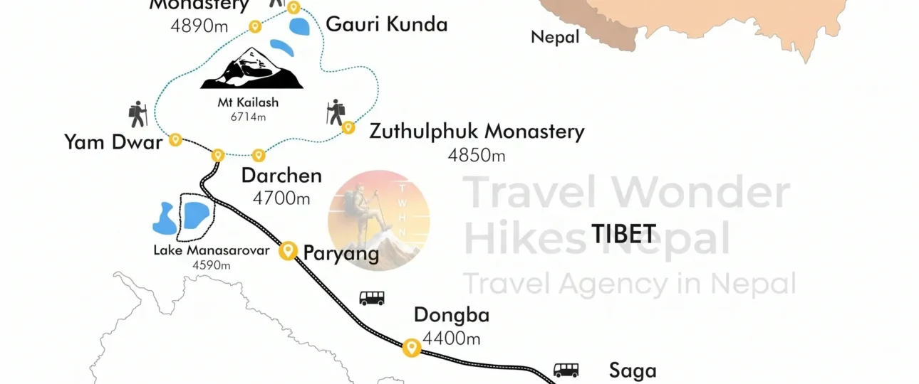
Mount Kailash sits at 31.06784°N, 81.31193°E in Burang County, Ngari Prefecture, in the far west of China’s Tibet Autonomous Region. It rises to 6,638 meters (21,778 feet) as the main peak of the Gangdise Range, roughly 70 kilometers north of Nepal‘s northwestern border and approximately 1,200 kilometers west of Lhasa.
Those coordinates answer the basic question. But a map pin alone does not help you plan a pilgrimage. The Kailash Tibet map is a layered document — it shows a location, a travel corridor, a walking route, an altitude profile, and a cultural landscape all at once. Each layer tells a different part of the story. Understanding how they fit together is what separates a vague plan from a realistic one.
This guide breaks down every layer of the Kailash map: where the mountain is, how the approach routes work, what the Kora looks like stage by stage, and what the map cannot tell you about 2026 travel conditions.
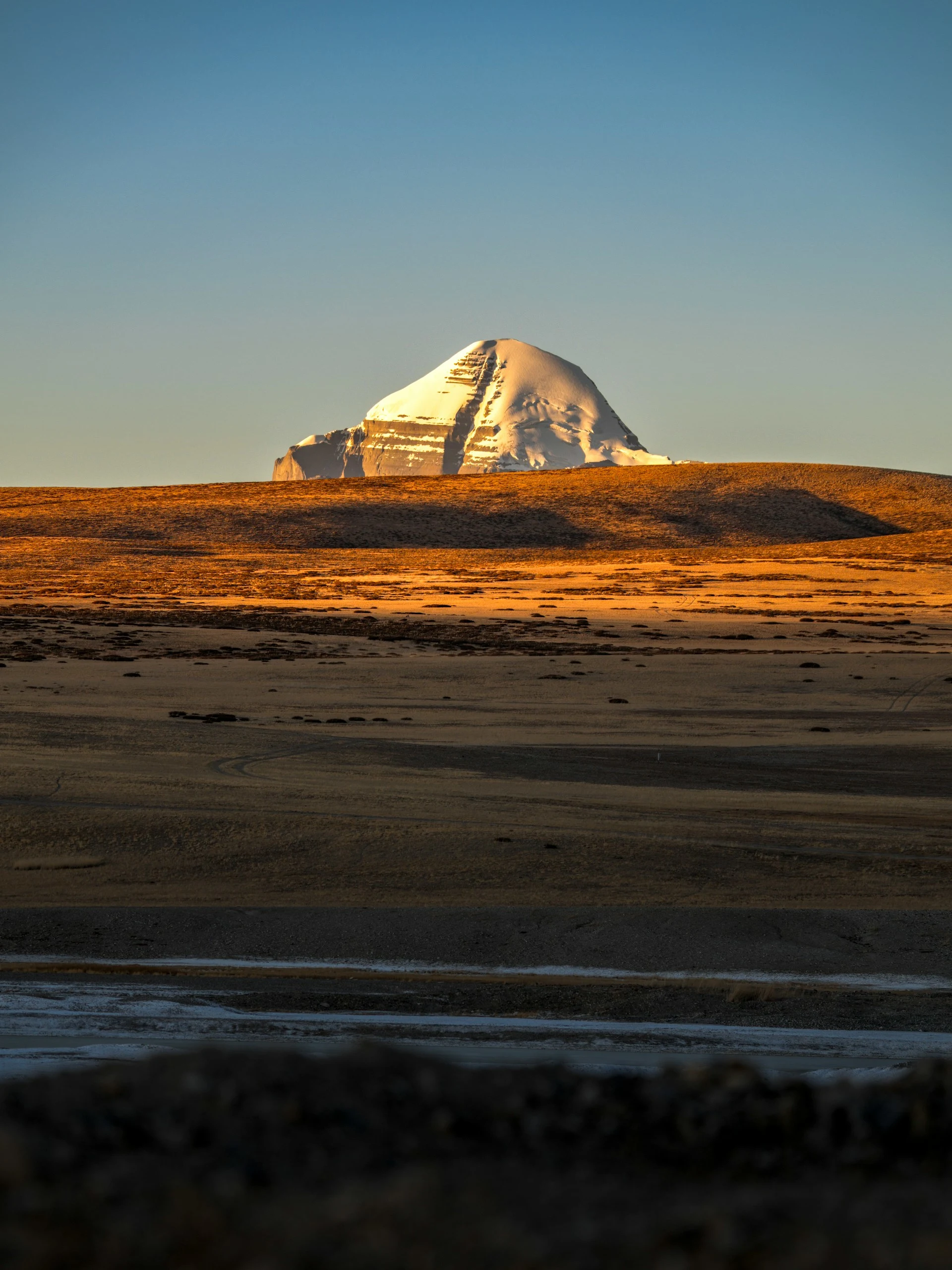
Where Is Mount Kailash on the Tibet Map?
The precise location of Mount Kailash on a Tibet map is northern Purang County, in the Ngari Prefecture of western Tibet. It is not in the central Tibetan plateau near Lhasa, and it is not part of the Everest region. It sits in the Transhimalaya — the Gangdise Shan — which runs parallel to but north of the main Himalayan range.
The mountain is positioned less than 100 kilometers from the tri-junction of China, India, and Nepal. This proximity to three countries is one reason the region feels more accessible on a map than it actually is. Political borders do not follow geography in ways that make travel simple.
Lake Manasarovar sits approximately 35 kilometers to the south of the summit. Lake Rakshastal lies immediately west of Manasarovar, separated by a narrow neck of land. Together, the mountain and the two lakes form the sacred geography that draws pilgrims from four religions.
Mount Kailash Map at a Glance
| Feature | Detail |
|---|---|
| Location | Burang County, Ngari Prefecture, Tibet, China |
| Coordinates | 31.06784°N, 81.31193°E |
| Elevation | 6,638 m (21,778 ft) |
| Mountain range | Gangdise Shan (Transhimalaya) |
| Nearest pilgrimage base | Darchen (4,675 m) |
| Sacred lakes | Manasarovar (freshwater), Rakshastal (saltwater) |
| Main Kora | Outer Kora, ~52 km, 2–3 days |
| Highest Kora point | Dolma La Pass, ~5,630 m |
| Climbing status | Prohibited (sacred mountain) |
Why the Kailash Tibet Map Can Be Confusing
Map scale is the first source of confusion. On a continental map, Kailash appears close to Nepal and India. The road distance from Kathmandu to Darchen exceeds 800 kilometers. The road distance from Lhasa is between 1,200 and 1,600 kilometers depending on the route. Visual proximity on a map does not translate to short travel times.
The second issue is naming. Digital map searches for “Kailash Mountain” can return a small hill with the same name rather than the sacred peak in Purang County. Navigation tools should be directed to “Kailash Mountain Viewpoint, Purang County, Ngari Prefecture, Tibet” to avoid confusion.
The third confusion is about what a map line represents. A route drawn between Darchen and Dolma La is a trace on paper. On the ground, that trace crosses terrain above 5,000 meters where walking speed drops dramatically and weather can change within an hour. The map shows the path; it does not show the effort.
Mount Kailash and Lake Manasarovar Map
The relationship between Kailash and the two lakes is central to reading a Kailash Manasarovar map correctly.
Lake Manasarovar (Mapam Yumtso) is a freshwater lake at 4,588 meters. It is fed by glaciers from the Kailash range and is considered one of the holiest lakes in Asia. Hindu tradition holds that it was created by Brahma, and bathing in its waters is believed to purify sins.
Lake Rakshastal sits immediately west of Manasarovar, separated by a narrow strip of land. It is a saltwater lake, and its name means “Lake of the Demon” in Sanskrit. The contrast between the two lakes — one freshwater and sacred, the other saltwater and associated with demons — is a fundamental distinction that any accurate map must preserve.
Darchen sits between Manasarovar and the mountain’s western approach. From Darchen, the Kora begins by heading south, then west, circling the mountain in a clockwise direction.
Important Places to Identify on a Kailash Map
Darchen (4,675 m) — The base town for the Kora. Basic guesthouses, limited services, and the starting point for the outer circuit.
Yam Dwar (Gate of Death) — Approximately 6 kilometers from Darchen, marked by the Tarboche prayer flagpole. Many pilgrims drive to this point and begin walking from here, saving 6–7 kilometers of road walking.
Dirapuk Monastery (5,080 m) — First overnight stop on the Kora. The north face of Kailash is directly visible from the monastery grounds.
Dolma La Pass (5,630 m) — The highest point of the outer Kora and the defining physical challenge.
Zutulpuk Monastery (4,835 m) — Second overnight stop. The trail descends here after crossing Dolma La.
Lake Manasarovar — The sacred freshwater lake, visited by many pilgrims before or after the Kora.
Lake Rakshastal — The saltwater lake west of Manasarovar, traditionally considered its spiritual opposite.
Lhasa — The capital of Tibet, the main starting point for overland travelers arriving from mainland China.
Kathmandu to Mount Kailash Map
The Nepal approach to Kailash has traditionally been the preferred route for pilgrims traveling from South Asia. The most commonly used overland corridor runs through the Rasuwagadhi–Kerung border crossing.
The standard route follows this sequence: Kathmandu → Rasuwagadhi (Nepal side) → Kerung/Gyirong (Tibet side) → Saga → Lake Manasarovar → Darchen → Kailash Kora → return the same way. The total distance from Kathmandu to Darchen is approximately 817 kilometers, and the journey typically takes 10 days including acclimatization stops.
A significant 2026 caveat applies. A flash flood in the Rasuwa region on August 26, 2026 severely damaged infrastructure around Rasuwagadhi and disrupted the Kerung border corridor. Cross-border travel through this route was affected, and the condition of Nepal’s northern gateways became an important planning consideration for Kailash pilgrims. Alternative crossings, including Kodari–Zhangmu and the helicopter route via Nepalgunj–Simikot–Hilsa, exist but each carries its own access conditions and logistical requirements.
A helicopter approach also exists: Kathmandu → Nepalgunj → Simikot → Hilsa by helicopter, then by road to Purang, Manasarovar, and Darchen. This route is faster but significantly more expensive and remains weather-dependent.
A map shows where these routes exist. It does not confirm that any given route is currently open.
Lhasa to Mount Kailash Map
For travelers approaching from mainland China or already in Tibet, the Lhasa route is the standard overland option. Two main corridors connect the capital to western Tibet.
The southern route (G318/G219) covers approximately 1,500–1,600 kilometers, passing through Shigatse, Saga, and Zhongba before reaching Darchen. Most of this road is asphalt, and it passes near Everest Base Camp. The gradual elevation gain makes it the better choice for acclimatization. Allocate at least four days for the drive to avoid triggering altitude sickness.
The northern route covers approximately 1,200 kilometers through more remote terrain, passing through Namtso Lake, Baingoin, and Nyima. Road conditions are inferior to the southern route, with many sections consisting of gravel or dirt surfaces. Rain can make driving difficult. This route is less traveled but offers a different perspective on the Tibetan plateau.
Kailash Kora Map: The Complete Walking Route
The Outer Kora is the circumambulation route that circles Mount Kailash at its base. It is approximately 52 kilometers long and is typically completed in two to three days. The route follows a fixed clockwise sequence. Bön practitioners walk counterclockwise.
| Day | Route | Approx. Distance | Highest Point | Main Challenge |
|---|---|---|---|---|
| Day 1 | Darchen/Yam Dwar to Dirapuk | ~20 km | 5,080 m | Gradual ascent, first high-altitude walking |
| Day 2 | Dirapuk to Zutulpuk via Dolma La | ~19–22 km | 5,630 m | Steep 600 m ascent to pass, long descent |
| Day 3 | Zutulpuk back to Darchen | ~7–13 km | 4,835 m | Short, mostly downhill |
Distance figures for the Kora vary across published sources. Some list the full circuit at 52 kilometers, others at 54 kilometers, and at least one measurement places it at approximately 47.9 kilometers. The discrepancy reflects different starting points (Darchen versus Yam Dwar) and whether side detours to monasteries are included. Neither figure is incorrect; they measure slightly different things. Travelers should plan for approximately 50–54 kilometers of walking over the full circuit.
Kailash Kora Map: Day 1
The first day begins at Darchen (4,675 m) or, for those who take a vehicle to Yam Dwar, at the Tarboche flagpole. From there, the trail follows the Lha Chu valley northward toward Dirapuk Monastery (5,080 m). The walking is relatively gentle — approximately 400 meters of elevation gain — and the north face of Kailash comes into view as you approach the monastery.
The main challenge on Day 1 is altitude, not terrain. You are walking above 4,600 meters for the first time on the route. Pacing matters more than fitness. Rushing this day is a common cause of altitude sickness later on the circuit.
Kailash Kora Map: Day 2
The second day is the defining stage of the Kora. The route climbs from Dirapuk toward Dolma La Pass, gaining approximately 600 meters of elevation over roughly 6 kilometers of trail from the monastery to the pass. At this altitude, where oxygen availability is roughly half the sea-level value, physical effort feels disproportionately difficult.
After crossing the pass, the trail descends steeply toward Zutulpuk Monastery (4,835 m). The descent is long and hard on the knees. Most pilgrims start this day early to reach the pass before midday clouds and wind build. The total distance for Day 2 is approximately 19–22 kilometers, depending on the exact route taken.
This is the day where realistic pacing is most critical. Rushing the ascent risks altitude sickness. Lingering too long at the pass risks exposure to cold and wind. The balance is individual, but the general principle is steady progress without excessive stops.
Kailash Kora Map: Day 3
The final day is a short, mostly downhill walk from Zutulpuk back to Darchen. The trail follows the Dunglung Chu valley and involves approximately 7–13 kilometers of walking, depending on whether you stop at Darchen or continue to the vehicle pickup point. It is the easiest day of the Kora and serves as a gentle return to the starting point.
Dolma La Pass on the Kailash Map
Dolma La is the highest point on the Outer Kora. Published elevations range from 5,630 meters to 5,648 meters, with some GPS measurements placing it as high as 5,700 meters. The variation reflects different survey methods, but all sources agree that the pass sits well above 5,600 meters.
The pass is not just a geographical waypoint. It is a spiritual threshold. Pilgrims traditionally leave a piece of clothing or a personal item at the pass as a symbolic act of leaving behind negativity. The terrain around the pass is rocky and exposed, and snow is possible even in summer.
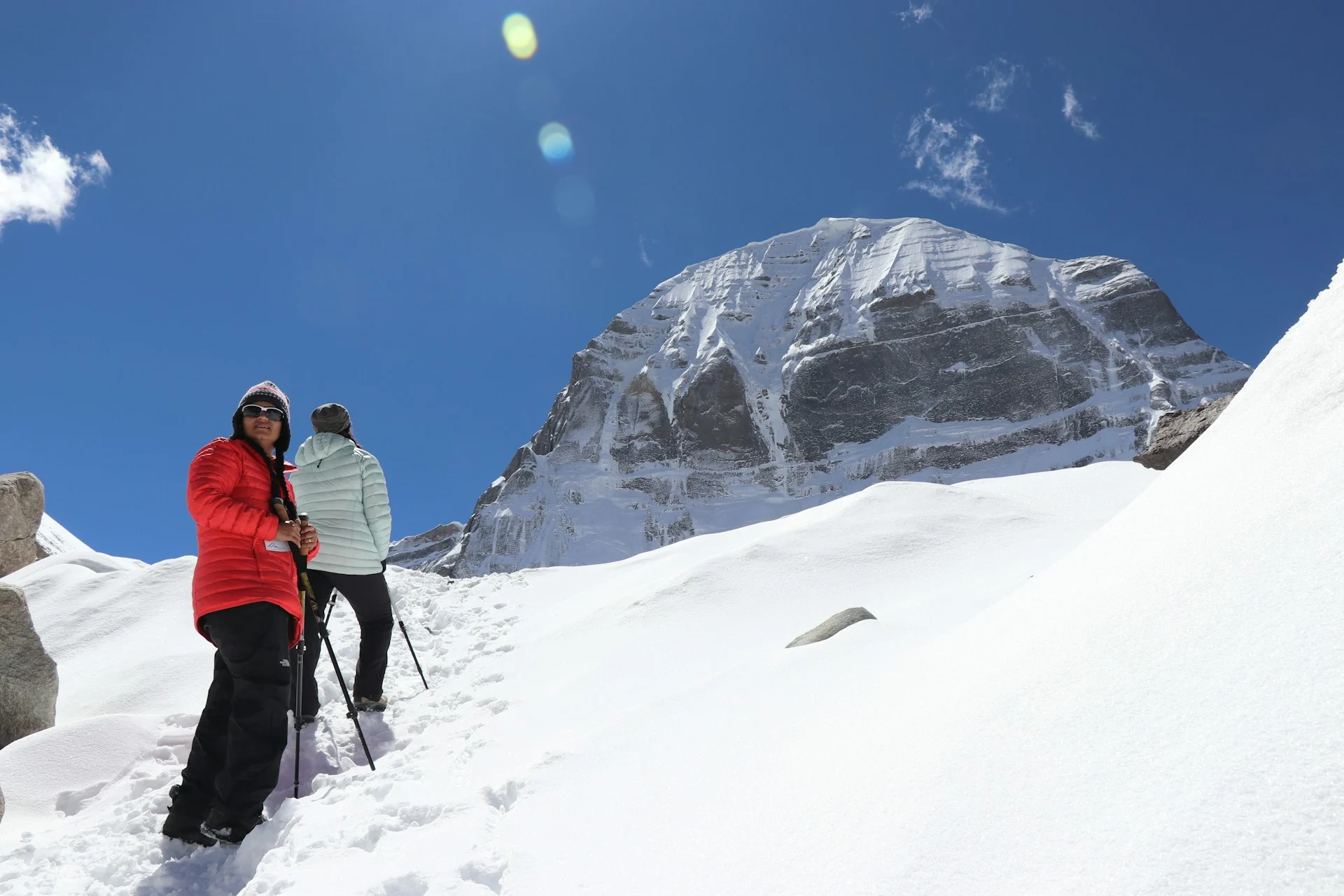
Outer Kora vs Inner Kora Map
There are two circumambulation routes around Mount Kailash. They are fundamentally different experiences.
The Outer Kora circles the base of the mountain at a respectful distance. It is approximately 52 kilometers and takes two to three days. It is open to most pilgrims who are properly acclimatized and holds a standard Tibet permit.
The Inner Kora (also called Nandi Parikrama or Ashtapada Circuit) circles closer to the mountain’s south face. It is approximately 30–35 kilometers and can be attempted in a single long day by experienced high-altitude trekkers. The terrain is rugged, unmarked, and involves sections of rock scrambling. There are no lodges or water sources along the route.
Traditional Tibetan Buddhist practice reserves the Inner Kora for pilgrims who have completed thirteen Outer Koras. In practice, access for foreign travelers depends on special permits from Chinese authorities. As of 2026, the Inner Kora requires additional permissions beyond the standard Tibet permit matrix, and access is not guaranteed for all applicants.
For the vast majority of travelers and pilgrims, the Outer Kora is the practical choice.
Mount Kailash Elevation Map
Understanding the elevation profile of the Kora is essential for realistic planning. Mount Kailash summit elevation and the altitude of the walking route are two different things.
| Point | Elevation |
|---|---|
| Mount Kailash summit | 6,638 m (21,778 ft) |
| Darchen (Kora start) | ~4,675 m |
| Dirapuk Monastery (Day 1 stop) | ~5,080 m |
| Dolma La Pass (highest Kora point) | ~5,630–5,648 m |
| Zutulpuk Monastery (Day 2 stop) | ~4,835 m |
Walking around Kailash is not climbing Mount Kailash. The mountain itself has never been climbed and climbing is prohibited by Chinese authorities due to its religious significance. The Kora is a high-altitude walking pilgrimage, not a mountaineering expedition.
How to Read a Kailash Tibet Map Before Your Trip
A map is a planning tool, not a travel guarantee. Here is a practical checklist for reading a Kailash map:
-
Identify your starting point. Are you approaching from Kathmandu, Lhasa, or flying into Ngari Gunsa Airport?
-
Mark the border crossing. For Nepal approaches, confirm whether Rasuwagadhi, Kodari, or Hilsa is currently operational.
-
Trace the road route. Identify major stops — Saga, Manasarovar, Darchen — and estimate realistic driving days.
-
Locate Darchen. This is the hub for the Kora. Everything revolves around this small town.
-
Mark the Kora stages. Dirapuk, Dolma La, Zutulpuk. Understanding the sequence helps with pacing.
-
Note elevations. Know where altitude gains occur and plan acclimatization accordingly.
-
Check current route status. A mapped route is not the same as an open route. Border closures and road damage can change access with little notice.
What Most Kailash Maps Do Not Tell You
A map shows distance. It does not show the effort required to cover that distance at altitude. A 20-kilometer walking day at sea level is manageable for most reasonably fit people. The same distance at 5,000 meters, with half the oxygen available, becomes a different challenge entirely.
A map shows a road. It does not show whether that road is paved, graded, or broken by landslide damage. Road conditions in western Tibet and along the Nepal-Tibet border vary dramatically by season and year.
A map shows a border. It does not show whether that border is open. The Rasuwagadhi crossing was disrupted by flooding in 2026, and access was limited. A map printed last year may not reflect current reality.
A map shows Darchen as a point. It does not show that accommodation is basic and limited, that electricity may be intermittent, and that services for travelers are minimal compared to other trekking hubs.
A map shows the Kora as a loop. It does not show that the second day is disproportionately difficult, that the descent from Dolma La is hard on the knees, or that weather on the pass can turn dangerous without warning.
Common Mistakes When Reading a Kailash Map
Assuming Kailash is in Nepal. The mountain is in China, in the Tibet Autonomous Region. Nepal is approximately 70 kilometers to the south.
Confusing Kailash with Everest. Mount Everest is in the eastern Himalaya. Kailash is in the western Transhimalaya. They are in different mountain systems and different administrative regions, separated by roughly 750 kilometers.
Confusing Manasarovar with Rakshastal. These two lakes are adjacent but fundamentally different. Manasarovar is freshwater and sacred. Rakshastal is saltwater and traditionally associated with demons.
Assuming straight-line distance equals road distance. The map distance from Kathmandu to Kailash may look short, but the road distance exceeds 800 kilometers and takes multiple days.
Assuming a mapped border route is currently open. Border crossings in the Nepal-Tibet region close without notice due to weather and administrative conditions. Verify before traveling.
Confusing summit elevation with Kora elevation. Mount Kailash is 6,638 meters. The Kora reaches approximately 5,630 meters at its highest point.
Assuming the Kora is a normal low-altitude trek. The Kora takes place entirely above 4,500 meters, with the highest point above 5,600 meters. Altitude sickness is a real risk. Acclimatization and realistic pacing are essential.
Frequently Asked Questions
1.Where is Mount Kailash located?
Mount Kailash is in Burang County, Ngari Prefecture, Tibet Autonomous Region, China. It sits in the Gangdise Shan range on the western Tibetan Plateau.
2.Is Mount Kailash in Tibet or Nepal?
It is in Tibet, China. Nepal’s northwestern border is approximately 70 kilometers to the south.
3.Where is Mount Kailash on the map?
Coordinates: 31.06784°N, 81.31193°E. It lies between Lake Manasarovar to the south and the Gangdise range to the north.
4.What country is Mount Kailash in?
China. Specifically, the Tibet Autonomous Region.
5.Where is Darchen?
Darchen is a small town at approximately 4,675 meters, located near the southern base of Mount Kailash. It is the starting point for the Outer Kora.
6.How far is Mount Kailash from Kathmandu?
The overland route is approximately 817 kilometers, depending on the border crossing and route taken. It typically takes 10 days by road, including acclimatization stops.
7.How far is Kailash from Lhasa?
Approximately 1,200 kilometers by the northern route and 1,500–1,600 kilometers by the southern route. The drive takes at least four days.
8.Where is Lake Manasarovar?
Lake Manasarovar is approximately 35 kilometers south of Mount Kailash, at an elevation of 4,588 meters. It is adjacent to Lake Rakshastal.
9.Where does the Kailash Kora start?
The Outer Kora traditionally starts at Darchen or at Yam Dwar (Tarboche), approximately 6 kilometers from Darchen.
10.How long is the Kailash Kora?
Approximately 52 kilometers for the Outer Kora. Some sources list 54 kilometers or 47.9 kilometers, depending on the starting point and measurement method.
11.What is the highest point of the Kora?
Dolma La Pass, at approximately 5,630–5,648 meters.
12.How difficult is the Kailash Kora?
The Outer Kora is moderate to strenuous. The main challenge is altitude, not technical terrain. Most acclimatized trekkers can complete it in three days.
13.Can you climb Mount Kailash?
No. Climbing is prohibited by the Chinese government due to the mountain’s religious significance. No successful ascent has been recorded.
14.What is the difference between Kailash Kora and Parikrama?
They refer to the same practice. “Kora” is the Tibetan term; “Parikrama” is the Sanskrit term. Both mean circumambulation.
15.What route can travelers take from Nepal to Kailash?
The main overland route goes through Rasuwagadhi/Kerung. Alternative routes include Kodari–Zhangmu and Hilsa. A helicopter option exists via Nepalgunj and Simikot. Current border status should be verified before travel due to the 2026 Rasuwa flood disruption.
Planning Your Kailash Journey with Local Expertise
Understanding the Kailash Tibet map is the first step. The second is translating that understanding into a realistic itinerary that accounts for altitude, border conditions, and current access regulations.
For travelers approaching from Nepal, working with an operator who knows the border crossings, the road conditions, and the permit requirements is not a luxury — it is a practical necessity. Wonder Hikes Nepal operates from Kathmandu and specializes in Himalayan trekking and pilgrimage logistics. Their team can help with itinerary planning, permit coordination, and current route information for Nepal-based Kailash approaches. That kind of ground-level knowledge is difficult to replicate from a distance, and it makes a measurable difference when border crossings and mountain weather can change the plan overnight.
Ready to plan your trek?
Tell us your dates and group size. We reply on WhatsApp within a few hours.