
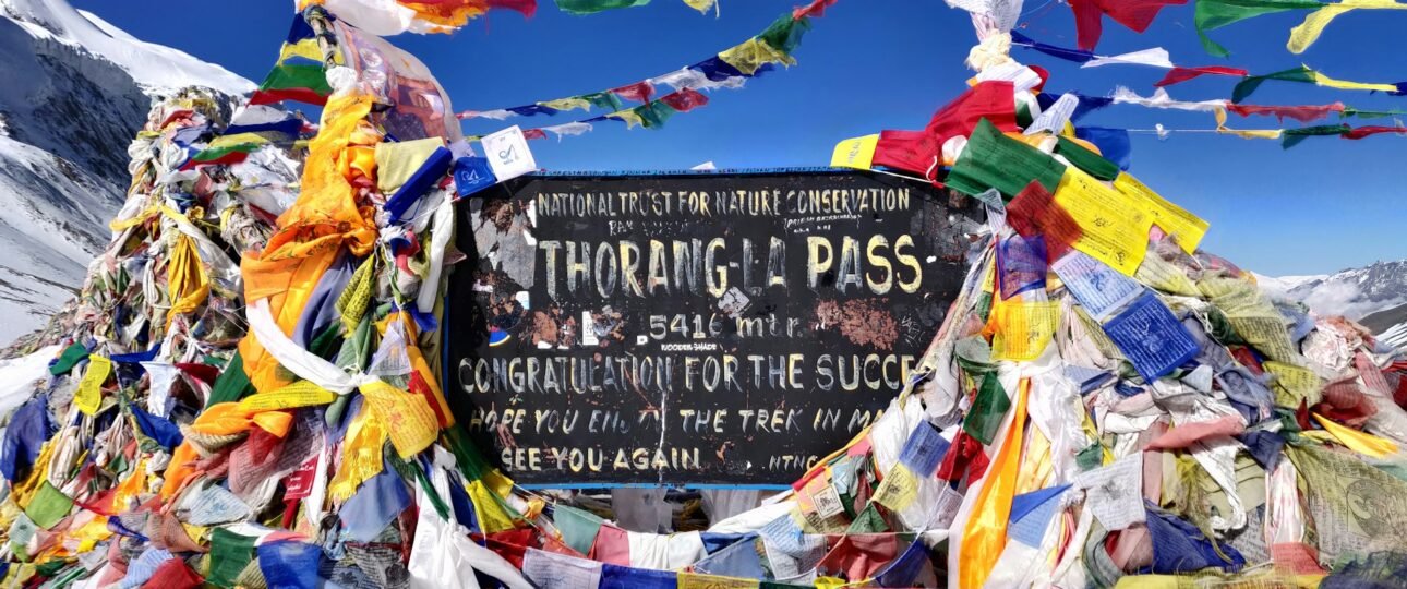
Introduction to Thorong Pass Nepal
Thorong Pass Nepal, better known as Thorong La, is the high point of the Annapurna Circuit and the one day that decides whether the whole trek feels like a triumph or a retreat. At 5,416 metres (17,769 feet), it is 52 metres higher than Everest Base Camp, and the crossing is long, cold and windy rather than technical. This guide covers where the pass is, the stage-by-stage approach from Manang, an hour-by-hour crossing day, the best season, what happens when snow closes the pass, altitude rules, permits and what to pack. The figures come from operator guides and official sources that differ slightly on altitudes and timings, so treat them as typical ranges and confirm details with your guide.
Thorong Pass Nepal at a Glance
If you only need the essentials, start with this table. The crossing is a single long day from the east side of the pass to Muktinath.
| Detail | What to know |
|---|---|
| Height | 5,416 m (17,769 ft), the highest point on the Annapurna Circuit |
| Spellings | Thorong La, Thorung La, Thorong Pass |
| Connects | Manang side (Marsyangdi valley) to Muktinath (Kali Gandaki, Mustang district) |
| Usual direction | Counter-clockwise, so you gain altitude gradually |
| Crossing day | Typically 7 to 10 hours from Thorong Phedi or High Camp to Muktinath |
| Start time | Between about 3:30 and 5:00 a.m. |
| Descent to Muktinath | About 1,600 m, to roughly 3,700 to 3,800 m |
| Best months | October and November, and March and April |
| Main risks | Altitude, cold, wind, and snow that can close the pass |
| Difficulty | Demanding because of altitude and length, not technical climbing |
Where Thorong La Is and Why It Matters
Thorong La sits between the Manang district in the Marsyangdi valley and Muktinath in the Mustang district, which lies in the Kali Gandaki valley. It is the only way to complete the classic Annapurna Circuit, because the road has reached much of the rest of the route. According to the Wikipedia entry on the Annapurna Circuit, the Besisahar to Manang jeep road now follows or crosses the trail for long stretches, and the Thorong La section and the Ghorepani section are the two parts of the circuit that remain without a motor road. That makes the pass the real heart of the trek, and many trekkers organise the whole itinerary around it.
The landscape changes sharply across the pass. The Manang side is dry, high and open, with long views of snow peaks. After the pass you descend into the Mustang side, where Muktinath is a pilgrimage site for both Hindus and Buddhists, and the valley is drier and windier still.
Which Direction Should You Cross?
Most trekkers walk the Annapurna Circuit counter-clockwise, starting in the Marsyangdi valley and finishing in the Kali Gandaki valley. The reason is altitude. Going this way, the daily gain is slower, and the crossing is easier and safer than going from Muktinath up to the pass, where you climb about 1,600 metres in a single day with far less acclimatisation. If you are planning the circuit, stay with the standard direction unless a guide with strong local experience advises otherwise.
The Approach: From Manang to the Foot of the Pass
Every part of a sound plan for crossing Thorong La exists to get you to the pass acclimatised. The standard sequence below runs through the villages of the upper Marsyangdi valley. Altitudes vary slightly between sources, so the figures are approximate.
| Stop | Approx. altitude | Typical walking time | Purpose |
|---|---|---|---|
| Chame | About 2,670–2,700 m | Start of the upper valley | District headquarters, a common starting point for shorter itineraries |
| Pisang | About 3,200–3,300 m | Full days | Gradual gain, mountain views |
| Manang | About 3,520–3,540 m | Rest day | Acclimatisation hub |
| Yak Kharka | About 4,020–4,050 m | About 3 to 5 hours | First night above 4,000 m |
| Letdar | About 4,200–4,250 m | About 1 hour beyond Yak Kharka | Optional stop, or a rest on the way to Phedi |
| Thorong Phedi | About 4,450–4,540 m | About 3 to 4 hours from Yak Kharka | Foot of the pass |
| Thorong High Camp | About 4,850–4,925 m | About 1 to 2 hours up from Phedi | Higher base that shortens crossing day |
Why the Manang rest day matters
Manang is where the circuit’s real acclimatisation happens. Operators describe skipping the rest day as one of the most common reasons trekkers fail to cross, and it is easy to see why: the climb above Manang is the biggest sleeping-altitude jump you have faced so far. Use the day for a short hike and then come back down to sleep, which is the “climb high, sleep low” principle.
Popular options include a walk to Gangapurna Lake or Praken Gompa, or a longer hike to Ice Lake at about 4,600 metres for fit trekkers. The Himalayan Rescue Association also runs a daily altitude talk in Manang that many groups attend, and it is worth hearing even if you have trekked at height before.
Checking your sleeping altitudes
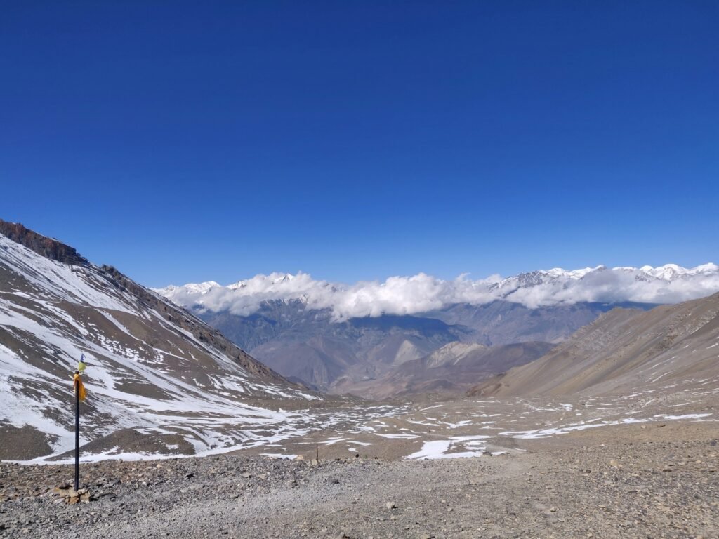
The CDC’s guidance on high-altitude travel recommends that, above 3,000 metres, your sleeping altitude rises by no more than about 500 metres a day, with an extra rest day for every additional 1,000 metres gained. Using typical figures, Manang to Yak Kharka is a gain of about 510 metres, Yak Kharka to Thorong Phedi is about 400 metres, and Phedi to High Camp is another 400 metres. Going straight from Yak Kharka to High Camp would be a jump of about 800 metres, which is why many guides stage the climb through Phedi, or add a night at Letdar. If your itinerary skips these steps, ask your agency why.
The elevation ladder in one table
Seeing the numbers side by side makes the scale of the day clear. These are typical figures, and they vary by a few dozen metres between sources.
| Place | Approx. altitude |
|---|---|
| Manang | 3,540 m |
| Yak Kharka | 4,050 m |
| Thorong Phedi | 4,450 m |
| Thorong High Camp | 4,850 m |
| Larkya La (Manaslu Circuit), for comparison | About 5,100 m |
| Everest Base Camp, for comparison | 5,364 m |
| Thorong La | 5,416 m |
| Muktinath | About 3,700 to 3,800 m |
The Day-by-Day Shape of the Climb
Itineraries vary, but the last stretch before the pass follows a fairly standard rhythm. This is how it commonly looks on a 12 to 16 day circuit, with each day’s typical walking time.
| Day | Plan | Typical walking time |
|---|---|---|
| Arrival at Manang | Reach Manang from Pisang or Ngawal and settle in | About 4 to 7 hours |
| Rest day | Acclimatisation hike to Gangapurna Lake, Praken Gompa or Ice Lake, then sleep in Manang | About 3 to 4 hours for the shorter options |
| Next day | Manang to Yak Kharka | About 3 to 5 hours |
| Next day | Yak Kharka to Thorong Phedi, via Letdar | About 3 to 4 hours |
| Optional | Phedi to High Camp for a shorter crossing day | About 1 to 2 hours, steep |
| Crossing day | Thorong La to Muktinath | About 7 to 10 hours |
| After the pass | Muktinath to Jomsom, then onward to Pokhara | Varies by road or flight |
The days beyond Manang are deliberately short. That is by design, because they leave time to rest, eat and let your body adjust before the big day.
Thorong Phedi or High Camp: Where Should You Sleep?
This is the choice that shapes your crossing day. Both are basic lodges at the foot of the pass, and you can sleep at either, with trade-offs.
| Feature | Thorong Phedi | Thorong High Camp |
|---|---|---|
| Altitude | About 4,450 m | About 4,850–4,900 m |
| Climb to the pass on crossing day | About 950 to 970 m, around 4 to 5 hours | About 520 to 570 m, around 3 to 4 hours |
| Typical start time | About 3:00 to 4:00 a.m. | About 4:00 to 5:00 a.m. |
| Sleep quality | Usually easier, because you sleep lower | Harder, with the highest night so far |
| Crossing day | Longer and colder at the start | Shorter, but you pay for it the night before |
| Best for | Trekkers who sleep poorly at altitude or are cautious | Strong, well-acclimatised trekkers who want a shorter day |
There is no universally right answer. If you are unsure, choose Phedi, because a better night and a gradual gain usually matter more than saving an hour on crossing day. High Camp lodges are also more crowded in peak season, and several guides recommend booking ahead.
What the lodges near the pass are like
Expect basic teahouses. Yak Kharka is described as a bare-bones collection of lodges with cold evenings and a short menu of dal bhat and noodles, and Phedi and High Camp are simpler still. Rooms are small, hot water and charging cost extra if they are available, and everything is carried up, so prices rise with altitude. Eat what you are given even without much appetite, because the cold and altitude blunt hunger, and the crossing burns a lot of energy.
Crossing Day, Hour by Hour
The Thorong La crossing is a long day in the dark, in the cold, at altitude. Here is a realistic schedule from High Camp. From Phedi, add about an hour or two at the start and begin earlier.
| Time | What happens |
|---|---|
| 3:30 to 5:00 a.m. | Wake, light breakfast and hot drinks, and start walking by headlamp |
| 5:00 to 6:30 a.m. | Steady climb, often the coldest hour of the day as the sky begins to lighten |
| 7:30 to 10:00 a.m. | Reach the pass, with prayer flags, a sign and a short rest for photos and tea |
| After about 10:00 a.m. | Wind typically picks up, so do not linger |
| Late morning to early afternoon | Long, steep descent of about 1,600 m on loose trail, usually 3 to 4 hours |
| Early to mid afternoon | Arrive in Muktinath (about 3,700 to 3,800 m), where warm food and lower altitude help you recover |
Operators generally quote 7 to 10 hours from Phedi to Muktinath. Slower or more cautious groups take longer, and a few sources give 10 to 14 hours including breaks, so allow for the long end if you tire easily. The climb from High Camp to the pass is usually listed at three to four hours, though some operators say four to five, and the descent at three to four.
Rules for crossing day
- Start early. The aim is to reach the pass before the wind builds in the late morning.
- Move at a steady pace. Short, slow steps use less oxygen than bursts of effort.
- Eat and drink on the way. Carry snacks and a warm drink in an insulated bottle, because water in a bladder can freeze.
- Keep your hands and face covered. Frostbite is a real risk at the pass, especially in wind.
- Turn back if conditions turn. A whiteout, strong wind or worsening symptoms mean you retreat, and your guide should make that call.
- Save energy for the descent. Many trekkers find the long drop to Muktinath harder on the knees than the climb.
How Hard Is Crossing Thorong La?
The difficulty is real but specific. Thorong La is not technical climbing. There are no ropes, crampons or exposed scrambling in normal conditions. What makes the day hard is a combination of four things.
- Altitude. The air at 5,416 metres holds roughly half the oxygen of sea level, and your body works harder for every step.
- Cold. Pre-dawn temperatures at the pass are very low, with operators reporting figures from around -10°C to -25°C in colder months. Figures vary, so plan for the cold end.
- Wind. The pass is exposed, and afternoon winds can be severe. Operators report gusts above 80 km/h.
- Length. It is a day of 7 to 10 hours or more, followed by a steep descent.
Most trekkers who are properly acclimatised and cross in normal weather complete the day, and the failures that happen are mostly down to altitude illness, rushed schedules or poor weather. If you have trekked at altitude before, you will be better prepared. If you have not, a shorter trek such as Everest View first helps you learn how your body responds. Our guide to the best treks in Nepal compares the Circuit with other high routes.
Best Time to Cross Thorong La
Timing is the biggest factor you can control. Thorong Pass Nepal is a seasonal crossing, and most operators agree on the two main windows.
| Season | Conditions at the pass |
|---|---|
| October to November | The most reliable window, with clear skies and stable weather, but the busiest. Nights are cold, and late October and November can bring storms. |
| March to April | Spring conditions, with warmer days and rhododendrons blooming on the lower trail. March mornings at the pass are cold, and April is usually more stable, though short snowstorms are possible. |
| May | Warmer, but pre-monsoon storms can bring afternoon rain and snow. |
| June to August | Monsoon. The upper circuit lies in a rain shadow and can still be walked, but lower sections are wet and cloudy. |
| December to February | Severe cold and heavy snow. The pass is often impassable or closed for days, and several high lodges shut. |
Early December can be workable if the weather has been clear, but snow can shut the pass with little warning after mid-December. Reports suggest the pass often reopens around mid-February once the heaviest snow has settled, though that varies from year to year. If you are considering a winter trip, read our guide to Nepal in the winter and ask your agency for current conditions. For a wider view of the calendar, see our month-by-month guide to the best time to visit Nepal.
Snow, Closures and the Weather Risk
The pass can close, and it can close without much warning. The Thorong La entry on Wikipedia notes that the pass is often blocked with snow and may be closed for days. Local authorities, lodge owners and guides share this information, and no itinerary should assume the pass is always open.
The risk is not limited to winter. In October 2014, an unseasonal snowstorm linked to a cyclone that hit India struck the Annapurna region at the height of the autumn season. Between 13 and 15 October, many people were trapped near Thorong La, and 43 people died, trekkers, guides and porters among them. It was widely described as the worst trekking disaster in Nepal’s history. Reports at the time pointed to unprepared trekkers, lightly clothed porters and a lack of reliable forecasts. The lessons are practical and still apply:
- Watch the forecast. Check conditions before you leave the last village, and talk to your guide and lodge owners.
- Carry proper clothing. A warm layering system is essential, even in the best season.
- Look after your porters. Make sure staff have adequate warm clothing, footwear and shelter.
- Do not push into a storm. Wait a day in the village if the weather turns, and follow the advice of local authorities.
- Add a buffer day. A spare day lets you wait for a weather window without rushing.
Planning a crossing means accepting that a day of waiting is part of the trip, and not a failure.
Is it safe to cross without a guide?
Many of those who died in 2014 were walking without experience or local knowledge, and that is a strong argument for going with a licensed guide who knows the pass. A guide reads the weather, sets the pace, spots altitude symptoms early and decides when to turn back. Beyond the safety case, the licensed-guide rule on many routes since April 2023 means you will likely need one anyway, so confirm the current requirement with your agency.
Altitude Illness: Symptoms and Rules to Follow
Thorong La is the highest point many trekkers will ever reach, and altitude illness is the main medical risk. The CDC notes that training and fitness do not affect your risk, so a strong hiker is not safer than a beginner.
Acute mountain sickness feels like a hangover. Headache is the main symptom, usually with at least one of loss of appetite, dizziness, fatigue, nausea or vomiting. It typically starts a few hours after ascending, often in the first night at a new altitude, and usually settles if you rest without climbing higher.
The dangerous forms are rarer but need action. Confusion, loss of balance and unusual drowsiness can signal swelling of the brain. Chest congestion, a cough and breathlessness at rest can signal fluid in the lungs. In both cases, descent is urgent.
- Do not go up to sleep higher with symptoms, however mild.
- Tell your guide early. Do not hide a headache to keep to the schedule.
- Descend if symptoms worsen despite rest.
- Talk to a doctor before you go, especially if you have heart or lung conditions or have had altitude illness before. They can advise on whether preventive medication makes sense for you.
For more on how altitude changes your body, see our guide to Nepal’s elevation, terrain and trekking.
If you cannot cross
Not everyone crosses on the first attempt, and turning back is a sound decision when symptoms or weather demand it. The usual plan B is to descend to Manang, rest and take the road out, or to wait a day or two at Phedi or Yak Kharka for conditions or symptoms to settle. Build a spare day into your schedule and keep your insurance details handy so a retreat is a plan, not a crisis.
Permits, Guides and Costs
Rules change often, so confirm current requirements with a registered agency before you pay.
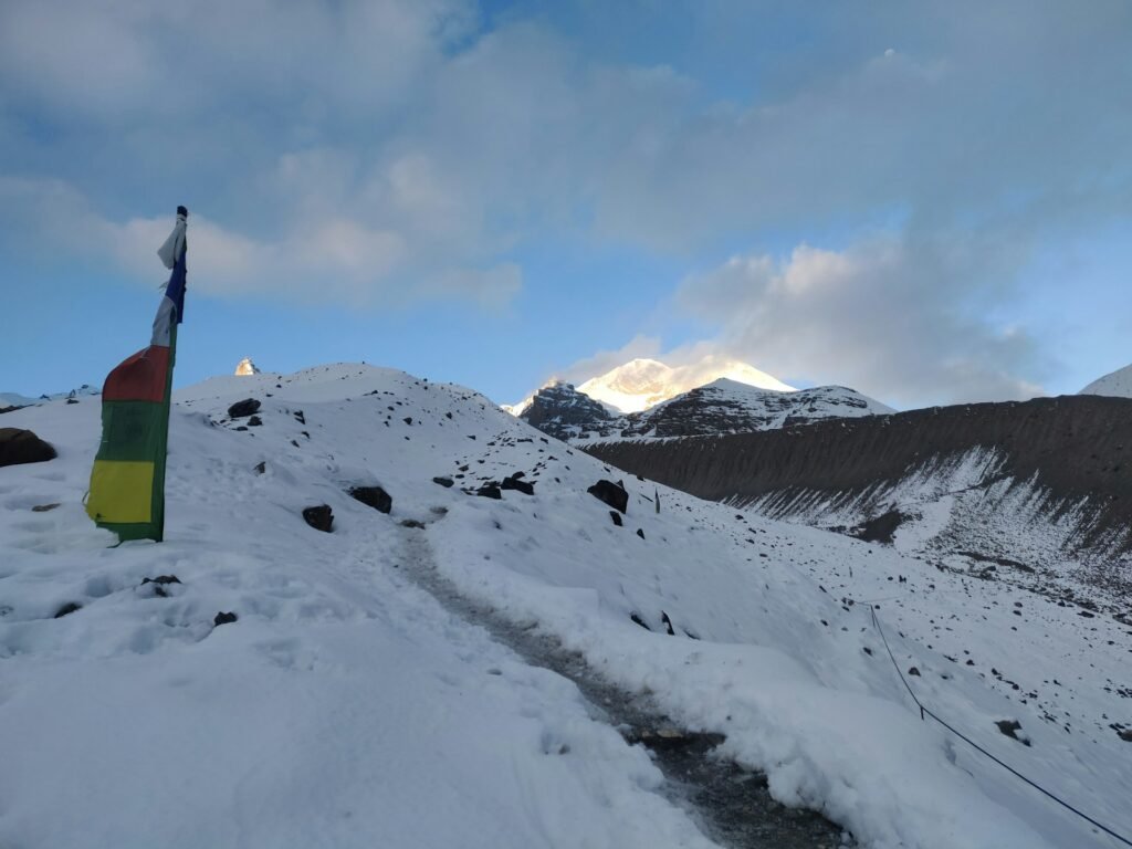
- Annapurna Conservation Area Permit (ACAP). Required for the whole circuit, and reported at about NPR 3,000 (around US$25 to US$30) for most foreigners, with the price not changing by season.
- TIMS card. Some operators list a TIMS card of about US$10, while others report that its requirements have changed. Ask your agency which applies to your dates.
- Licensed guide. Since April 2023, a licensed guide arranged through a registered agency has been required on many national park and conservation-area routes. Check the current rule for the Annapurna Circuit.
- No restricted-area permit. Unlike Manaslu or Upper Mustang, the Circuit does not require a special restricted-area permit.
Operator guides quote full guided circuit packages from roughly US$2,200 to about US$2,700 in 2026, depending on length and inclusions. Costs differ widely, so compare what is included, such as permits, guide, porter, meals and transport. For the full rules and fees, see our trekking permits guide.
Insurance and evacuation
Check that your policy covers the maximum altitude of the trek, which is 5,416 metres, and that it includes helicopter evacuation. Weather can delay both flights and rescues, so a buffer in your schedule is part of your safety plan. Keep your policy number and emergency contacts with your guide.
How Long Is the Annapurna Circuit?
The classic circuit takes about 15 to 21 days when walked in full, and shorter versions of 10 to 14 days are possible, usually starting at Chame or using the jeep road for the lower sections. Tilicho Lake, at about 4,919 metres, is a popular side trip that adds two to three days and builds extra acclimatisation. If your time is short, choose a trimmed itinerary that still keeps the Manang rest day, and avoid cutting acclimatisation to save a day.
After the Pass: Muktinath and the Kali Gandaki Valley
The descent ends at Muktinath, a pilgrimage site for both Hindus and Buddhists at roughly 3,700 to 3,800 metres. Many trekkers spend a rest afternoon here, because the lower altitude helps you sleep and recover. From Muktinath the route follows the Kali Gandaki valley down to Jomsom, where a flight or a road leads on to Pokhara. Flights depend on weather, so leave a spare day before any onward connection.
Training for Thorong La
Train for a long, cold, sustained effort. Several months of long hikes with a small pack, stair or hill sessions and regular cardio build the endurance you need for consecutive days of ascent and the long descent. Practise early starts and walking in the dark in cold weather, and test your boots and layers well before departure. Fitness helps you enjoy the trek, but it does not protect you from altitude, so build the acclimatisation days into your plan.
What to Pack for Thorong La
Pack for the cold and the wind. A warm layering system and a properly rated sleeping bag matter more than any gadget.
- Down jacket. A heavy one you can wear over everything, including at dinner at High Camp or Phedi.
- Layers. Thermal base layers, a warm mid layer and a windproof and waterproof shell.
- Hands, head and face. Insulated gloves with liners, a warm hat, a balaclava or buff and sunglasses or goggles.
- Sleeping bag. Rated for freezing nights at Phedi or High Camp, with a liner for extra warmth.
- Boots and socks. Warm, broken-in boots and spare wool socks.
- Traction. Microspikes for icy sections, and trekking poles for the long descent.
- Headlamp. You will start in the dark, so carry spare batteries, which cold drains quickly.
- Hydration. An insulated bottle or thermos, because bladders and tubes freeze.
- Snacks. Easy, high-energy food you can eat with gloves on.
- Sun protection. Sunscreen and lip balm, because UV is strong at altitude even in the cold.
Thorong La Compared With Other High Passes
At 5,416 metres, Thorong La is among the highest passes on Nepal’s main teahouse routes. It stands higher than Larkya La on the Manaslu Circuit, which reaches about 5,100 metres, and it is 52 metres above Everest Base Camp. What sets it apart is that it is the single compulsory crossing of a very popular circuit, with lodges at both sides, so it is more accessible than most passes of its height. That also means it can be crowded in peak season, and delays at High Camp or Phedi can build up.
Common Mistakes at Thorong La
- Skipping the Manang rest day. It is the most common reason crossings fail.
- Going from Yak Kharka straight to High Camp. The jump is larger than the guideline, so stage it through Phedi or add a night.
- Starting too late. Wind builds after mid-morning, and a late start leaves you exposed on the pass.
- Ignoring the forecast. Unseasonal snow has caught trekkers before, even in October.
- Under-packing for the cold. The pass is far colder than the villages below.
- Forgetting the descent. The drop of about 1,600 metres is long and hard on the knees, so save energy.
- Hiding symptoms. Altitude illness gets worse quickly, so speak up early.
Frequently Asked Questions About Thorong La Pass
- How high is Thorong La Pass? Thorong La is 5,416 metres (17,769 feet) high and is the highest point on the Annapurna Circuit. That is 52 metres higher than Everest Base Camp.
- How long does it take to cross Thorong La? Most trekkers take about 7 to 10 hours from Thorong Phedi or High Camp to Muktinath. From High Camp, the climb to the pass takes about three to four hours, and the descent three to four more.
- What time should I start the Thorong La crossing? Most groups leave between about 3:30 and 5:00 a.m. Start around 4:00 to 5:00 from High Camp and earlier from Thorong Phedi, so you reach the pass before the wind picks up.
- Is Thorong La difficult? It is demanding because of altitude, cold, wind and a long day, not because of technical climbing. Proper acclimatisation, an early start and the right clothing make the biggest difference.
- When is the best time to cross Thorong La? October and November, and March and April, are the most reliable windows. December to February often brings snow, and the pass can close for days.
- Should I stay at Thorong Phedi or High Camp? Phedi, at about 4,450 metres, usually gives a better night but a longer climb of about four to five hours. High Camp, at about 4,850 metres, shortens the climb to about three to four hours but is higher and harder to sleep at.
- Can Thorong La be closed? Yes. Snow can block the pass, and it can stay closed for days, particularly in winter or after unseasonal storms. Check conditions with your guide and lodge owners.
- Do I need a permit for Thorong La? You need an Annapurna Conservation Area Permit for the circuit, reported at about NPR 3,000, and in some cases a TIMS card. A licensed guide is also required on many routes, so confirm the current rules with an agency.
- How do I avoid altitude sickness at Thorong La? Ascend gradually, take the rest day in Manang, keep sleeping-altitude gains to about 500 metres a day above 3,000 metres, and never go higher with symptoms. Descend if they worsen.
- Which direction should I do the Annapurna Circuit? Most trekkers go counter-clockwise, crossing Thorong La from Manang to Muktinath, because the daily altitude gain is slower and the crossing is easier and safer.
Plan Your Thorong La Crossing With Wonder Hikes Nepal
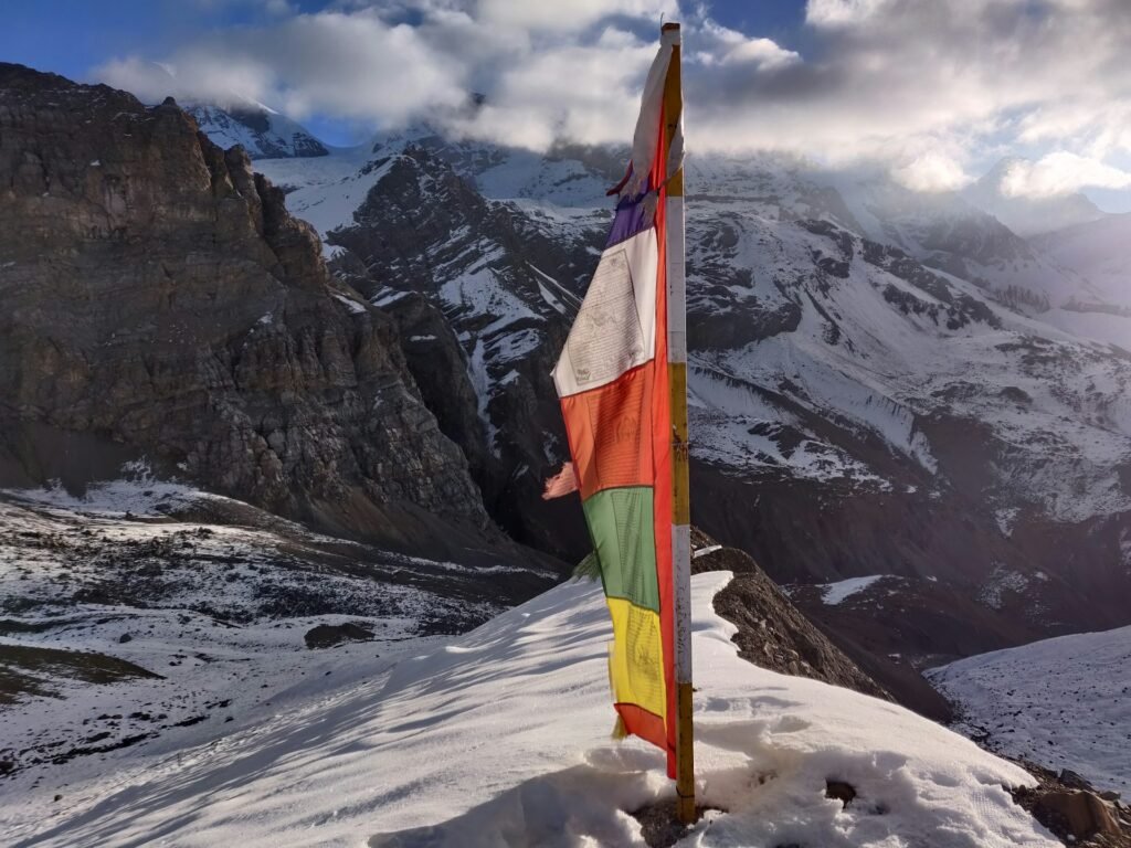
The right plan for Thorong Pass Nepal depends on your dates, your acclimatisation history and your tolerance for cold and early starts. A realistic schedule, a guide who watches the weather and a spare day make the difference between a safe crossing and a stressful one.
To get a plan that fits, contact Wonder Hikes Nepal and share:
- The month or season you are considering and how many days you can spend.
- Your trekking experience and any altitude history.
- Whether you want the full circuit or a shorter version.
- Your rough budget and group size.
Send us those details, and we will help you choose a route and timing that gives you the best chance of a safe, clear crossing.
Ready to plan your trek?
Tell us your dates and group size. We reply on WhatsApp within a few hours.