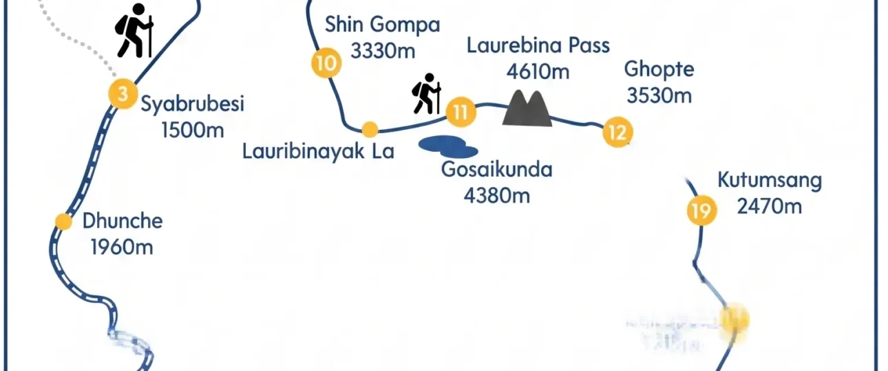
Introduction to Langtang Valley Trek Map
The Langtang Valley Trek Map reveals one of Nepal’s most accessible Himalayan routes. This out-and-back trail follows the Langtang Khola from Syabrubesi to Kyanjin Gompa, covering approximately 51–54 km round trip. The map shows a clear south-to-north route through Langtang National Park, with elevation gain from 1,503m to 3,870m across four trekking days.
What the Map Actually Shows
When examining a Langtang Valley Trek Map, you’ll notice the trail follows a narrow glacial valley. Langtang Lirung (7,234m) dominates the western skyline, while the route itself stays close to the river for most of the journey. The map displays seven main settlements: Syabrubesi, Lama Hotel, Ghoda Tabela, Thangsyap, Langtang Village, Mundu, and Kyanjin Gompa.
Critical map interpretation: The Langtang trek is not a loop. Your Langtang Valley Trek Map will show a single line heading north, then retracing the same path south. This matters for planning because you’ll experience the same terrain twice—climbing on the way up, descending on the return.
Key Geographic Points on the Langtang Map
| Location | Elevation | Distance from Previous Point | Walking Time | Map Significance |
|---|---|---|---|---|
| Syabrubesi | 1,503m | — | — | Trailhead and lowest point |
| Lama Hotel | 2,380m | 9–10 km | 5–6 hours | First night stop |
| Ghoda Tabela | 3,030m | 8–9 km | 5–6 hours | Park checkpoint |
| Thangsyap | 3,140m | 3–4 km | 1–1.5 hours | Rest stop |
| Langtang Village | 3,430m | 4–5 km | 1.5–2 hours | Main settlement |
| Mundu | 3,550m | 1 km | 20–30 min | Alternative overnight |
| Kyanjin Gompa | 3,870m | 4–5 km | 1.5–2 hours | Final destination |
Langtang Valley Trek Distance: Understanding the Numbers
The Langtang Valley Trek distance varies depending on what you include. A Langtang Valley Trek Map showing the core route from Syabrubesi to Kyanjin Gompa covers 25–27 km one way, or 51–54 km round trip. If you add Kyanjin Ri (4,773m) or Tserko Ri (4,984m) side trips, your total trek distance increases to 58–64 km.
Why Published Distances Conflict
Different Langtang Valley Trek Map sources show different distances because:
Map measurement vs. GPS tracking: Your physical map measures straight-line trail distance, while your GPS device records every switchback and detour. GPS readings typically run 10–15% higher than map distances.
Side trip inclusion: Some maps include Kyanjin Ri and Tserko Ri as part of the main route, inflating distances by 7–10 km.
Starting point variation: Some itineraries begin from Dhunche rather than Syabrubesi, adding 15–18 km to the total.
The practical answer: For fitness planning, expect to walk approximately 60 km total if you climb one viewpoint. This represents the typical Langtang Valley Trek distance most trekkers actually cover.
Langtang Valley Trek Elevation Profile
The Langtang Valley Trek elevation profile reveals a challenging but manageable climb. From Syabrubesi at 1,503m, you’ll gain 2,370m of net elevation to reach Kyanjin Gompa at 3,870m. However, cumulative elevation gain—accounting for constant ups and downs—approaches 3,000–3,400m.
Day-by-Day Elevation Breakdown
Day 1: Syabrubesi to Lama Hotel
-
Starting elevation: 1,503m
-
Ending elevation: 2,380m
-
Net gain: 877m
-
Cumulative gain: ~1,000m (due to several short descents)
-
This is the steepest climbing day of the trek
Day 2: Lama Hotel to Ghoda Tabela
-
Starting elevation: 2,380m
-
Ending elevation: 3,030m
-
Net gain: 650m
-
Cumulative gain: ~750–800m
Day 3: Ghoda Tabela to Langtang Village
-
Starting elevation: 3,030m
-
Ending elevation: 3,430m
-
Net gain: 400m
-
Cumulative gain: ~450–500m
Day 4: Langtang Village to Kyanjin Gompa
-
Starting elevation: 3,430m
-
Ending elevation: 3,870m
-
Net gain: 440m
-
Cumulative gain: ~450m (gentlest climbing day)
Viewpoint days (optional):
-
Kyanjin Ri: +903m from Kyanjin Gompa (4,773m summit)
-
Tserko Ri: +1,114m from Kyanjin Gompa (4,984m summit)
Elevation Discrepancies Explained
When comparing Langtang Valley Trek elevation figures across sources, you’ll find variations of 20–50m at most locations. This reflects different measurement points—tea house location vs. trail junction vs. GPS reading. The elevations provided here represent the most commonly accepted figures from multiple reliable sources.
Langtang Valley Trek Route: Village-by-Village Navigation
Syabrubesi (1,503m) — Trailhead
The Langtang Valley Trek route begins in Syabrubesi, a small town in Rasuwa district. Located 7–9 hours by road from Kathmandu, this is where your trek map shows the starting point. The trail heads north from the town center, crossing the Bhote Koshi on a suspension bridge within the first 30 minutes of walking.
Navigation tip: From Syabrubesi, the river should be on your right as you head north. If the river is on your left, you’re heading south—back toward the road.
Lama Hotel (2,380m) — Day 1 Destination
The Langtang Valley Trek map shows this as “Riverside” or “Lama Hotel”—they’re essentially the same place. After 5–6 hours of steep climbing through bamboo and oak forest, you’ll reach a small collection of tea houses along the river.
What your map doesn’t show: The first 2–3 hours from Syabrubesi involve 600m of climbing. This is the hardest section of the entire trek. If you’re struggling here, don’t worry—it gets easier after Day 1.
Ghoda Tabela (3,030m) — Day 2 Destination
The Langtang Valley Trek route passes through Ghoda Tabela, which translates to “horse stable.” This marks the transition from forest to open valley. You’ll find a Nepal Army checkpoint here where your Langtang National Park permit is verified.
Map significance: Above Ghoda Tabela, the valley widens dramatically. The terrain becomes more exposed, and you’ll get your first clear views of Langtang Lirung.
Thangsyap (3,140m) — Rest Stop
The Langtang Valley Trek map shows Thangsyap as a minor settlement between Ghoda Tabela and Langtang Village. It serves as a lunch stop for most trekkers. Don’t plan to overnight here—Langtang Village is only 1.5–2 hours further.
Langtang Village (3,430m) — Day 3 Destination
This is the heart of the Langtang Valley. The current village is a complete rebuild after the 2015 earthquake-triggered avalanche destroyed the original settlement. Your Langtang Valley Trek Map may show the old village location—the rebuilt settlement sits slightly higher on the valley wall.
Emotional significance: This is where the trek becomes truly spectacular. The forest fades, the peaks appear, and you understand why Langtang is called “the valley of glaciers.”
Mundu (3,550m) — Passing Through
The Langtang Valley Trek route passes directly through Mundu, just 20–30 minutes beyond Langtang Village. Many maps show this as a separate destination, but it’s really an extension of Langtang Village. If the main village tea houses are full, Mundu offers quieter alternatives.
Kyanjin Gompa (3,870m) — Final Destination
Your Langtang Valley Trek Map shows this as the endpoint. Kyanjin Gompa is a monastery settlement in a glacial bowl surrounded by peaks. Langtang Lirung (7,234m) dominates the western skyline, while Dorje Lakpa (6,966m) rises to the east.
Side trip junction: From Kyanjin Gompa, three optional trails branch off:
-
Southwest to Kyanjin Ri (4,773m)
-
East to Tserko Ri (4,984m)
-
North to Langshisa Kharka (4,100m)
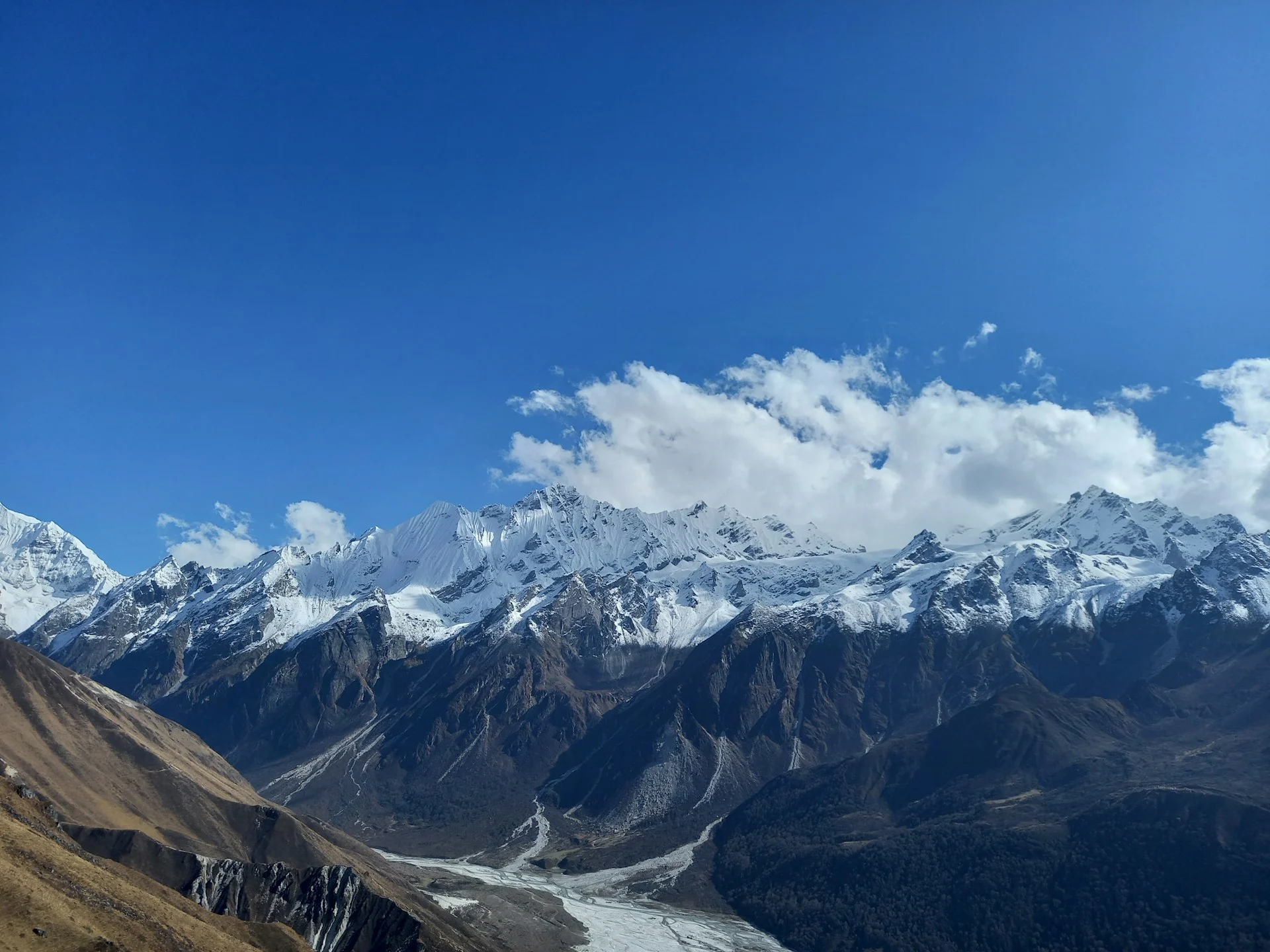
Langtang Valley Trek Map: Side Trips and Route Variations
Kyanjin Ri vs. Tserko Ri: Which Viewpoint?
Both viewpoints appear on the Langtang Valley Trek Map, but they offer different experiences:
| Feature | Kyanjin Ri | Tserko Ri |
|---|---|---|
| Summit elevation | 4,773m | 4,984m |
| Round-trip distance | 7–8 km | 9–10 km |
| Time required | 4–6 hours | 6–8 hours |
| Elevation gain | ~900m | ~1,114m |
| Difficulty | Moderate-challenging | Challenging |
| Best for | Most trekkers | Experienced hikers |
Kyanjin Ri offers excellent views of Langtang Lirung and the upper valley. The trail is steeper but shorter. Most trekkers who attempt this viewpoint succeed.
Tserko Ri provides panoramic views of the entire Langtang range, including peaks visible from no other point. The trail involves sustained climbing at high altitude and should only be attempted in good weather by well-acclimatized trekkers.
Langshisa Kharka Extension
The Langtang Valley Trek Map shows a trail continuing north from Kyanjin Gompa to Langshisa Kharka (4,100m). This yak pasture sits at the base of the Langshisa glacier. The round trip takes 6–8 hours but involves minimal elevation gain. This is an excellent option if you have an extra day and want to explore deeper into the valley without the steep climbing of viewpoint treks.
Main Route vs. Side Routes Summary
Main route (essential): Syabrubesi → Lama Hotel → Ghoda Tabela → Langtang Village → Kyanjin Gompa → Return
-
Distance: 51–54 km round trip
-
Days: 6–7
-
Maximum elevation: 3,870m
Optional side routes:
-
Kyanjin Ri: +7–8 km, +900m elevation
-
Tserko Ri: +9–10 km, +1,114m elevation
-
Langshisa Kharka: +12–14 km, +230m elevation
Langtang Valley Trek Navigation: Maps, GPS, and Offline Tools
The Reality of Trail Navigation
The Langtang Valley Trek route is well-defined and relatively easy to follow. The trail stays close to the river, and the valley walls provide natural orientation. However, navigation tools remain essential for safety, especially in poor weather or if you venture onto side trails.
Best Offline Maps for Langtang (2026)
Organic Maps (formerly Maps.me): Free, works entirely offline, excellent trail coverage for the Langtang region. Download the Nepal map before arrival. This is the best free option for most trekkers.
Gaia GPS: Premium topographic mapping with better contour data than Organic Maps. The elevation data helps you understand the terrain ahead. Subscription required but worth it for serious trekkers.
AllTrails: User-submitted Langtang tracks with recent reviews. Useful for seeing where other trekkers have recently hiked and reading about current conditions.
GPX Files: Proceed with Caution
Many websites offer GPX files for the Langtang Valley Trek. Quality varies significantly. Some GPX tracks:
-
Follow the correct trail but include GPS drift errors
-
Include side trips without clear labeling
-
Show routes that no longer exist after 2015 trail changes
-
Start from different points in Syabrubesi
Recommendation: Treat GPX files as general references, not precise navigation tools. The trail is well-defined on the ground; your GPX track is a backup.
Paper Maps
Himalayan Map House “Langtang Valley” (1:50,000) remains the gold standard for paper maps. It shows accurate contour lines, all settlements, side trails, and national park boundaries. Carry this as a backup to your digital navigation.
Langtang Valley Trek Difficulty: Honest Assessment
Overall Rating: Moderate
The Langtang Valley Trek is classified as moderate difficulty. This places it:
Easier than: Everest Base Camp, Annapurna Circuit, Manaslu Circuit
Similar to: Annapurna Base Camp, Mardi Himal
Harder than: Ghorepani Poon Hill, Langtang Tamang Heritage Trail
Terrain Difficulty
The Langtang Valley Trek route involves no technical climbing, no glacier crossings, and no exposed scrambling. The trail is well-maintained and clearly defined. The hardest terrain factors are:
-
Steep climbing on Day 1 (600m in first 3 hours)
-
Stone steps and rocky sections
-
Long descent on Day 6 (1,490m elevation loss)
-
Possible snow at higher elevations in winter
Altitude Considerations
Maximum sleeping elevation is Kyanjin Gompa at 3,870m. Maximum trekking elevation is Tserko Ri at 4,984m (if attempted). Most trekkers handle this altitude well with proper acclimatization, but altitude sickness is possible. The risk increases significantly on side trips above 4,500m.
Acclimatization recommendations:
-
Spend two nights at Kyanjin Gompa
-
Climb high, sleep low (do viewpoint climbs as day trips)
-
Stay hydrated
-
Ascend gradually—the existing itinerary already allows for good acclimatization
Fitness Requirements
Cardiovascular fitness: You should be comfortable walking 5–7 hours per day with a light backpack. Regular hiking, running, or cycling in the months before your trek will prepare you adequately.
Leg strength: The steep climbs require quadriceps and calf strength. Stair training or hill walking is excellent preparation.
Knee health: The descent from Kyanjin Gompa to Syabrubesi (2,370m elevation loss) is hard on knees. If you have knee issues, bring trekking poles and consider breaking the descent into three days instead of two.
Langtang Valley Trek Season Guide
Best Time to Trek
October–November (Autumn): This is the best season for the Langtang Valley Trek. Clear skies, stable weather, and excellent mountain visibility. Temperatures at Kyanjin Gompa range from 5–15°C during the day to -5–-10°C at night.
March–May (Spring): The second-best season. Rhododendrons bloom in lower sections during March–April. Mornings are clear, but afternoon clouds build throughout the day. Temperatures are similar to autumn.
Shoulder Seasons
December–February (Winter): Possible but challenging. Expect snow above Ghoda Tabela, cold temperatures (-10°C or lower at Kyanjin Gompa at night), and icy trail sections. Kyanjin Ri may be accessible, but Tserko Ri often requires crampons. Fewer trekkers, quieter trails.
June–September (Monsoon): Not recommended. Heavy rain, leeches in lower sections, muddy trails, and potential landslides. Views are often obscured by clouds. Some tea houses close during this period.
2026 Seasonal Note
The 2026 autumn season is expected to be busy. Tea house bookings in Kyanjin Gompa may fill up during peak October weeks. If you’re planning an autumn 2026 trek, book through an agency that can guarantee tea house reservations.
Langtang Valley Trek Planning: Practical Considerations
Permits for 2026
Langtang National Park Entry Permit: Required for all trekkers. Cost varies by nationality (NPR 3,000 for SAARC nationals, NPR 3,500 for other foreigners as of 2026). Available at the park entrance in Dhunche or through your trekking agency.
TIMS Card: Required for all trekkers. Cost is NPR 2,000 for individual trekkers or NPR 1,000 for those trekking through a registered agency.
Guide requirement: As of April 2023, all foreign trekkers must hire a licensed guide. This requirement remains in effect for 2026. Guides can be hired independently in Kathmandu or through a trekking agency.
Transportation to Syabrubesi
Bus: Daily buses depart from Kathmandu’s Machha Pokhari bus station. Journey time is 8–10 hours. Cost: NPR 800–1,200.
Jeep: Shared jeeps depart from Kathmandu and take 7–8 hours. Cost: NPR 1,500–2,000. Private jeeps can be arranged for NPR 18,000–25,000.
Flight option: There is no airport in Syabrubesi. The nearest airport is in Dunche (small, unreliable service) or you can fly to Kathmandu and drive.
Accommodation
All overnight stops on the Langtang Valley Trek have tea houses. These are basic lodges with shared rooms and communal dining areas. Expect to pay:
-
Syabrubesi: NPR 1,000–2,000 for a room
-
Lama Hotel: NPR 800–1,500
-
Ghoda Tabela: NPR 800–1,500
-
Langtang Village: NPR 1,000–2,000
-
Kyanjin Gompa: NPR 1,500–2,500
Food costs range from NPR 500–900 per meal. Prices increase with altitude.
Wonder Hikes Nepal: Your Langtang Valley Trek Planning Partner
After understanding the Langtang Valley Trek Map, route, distances, and elevations, you may be wondering whether to plan independently or work with a local agency. Here’s how Wonder Hikes Nepal can help:
Why choose Wonder Hikes Nepal for your Langtang Trek:
Local expertise: As a Nepal-based trekking company, we know the Langtang Valley intimately. Our guides have trekked this route dozens of times and provide real-time information about trail conditions, tea house availability, and weather patterns that no online map can show.
Permit handling: We arrange all Langtang National Park permits and TIMS cards before your trek begins. No waiting in line, no confusion about requirements, no risk of missing paperwork.
Transportation logistics: We coordinate your Kathmandu-to-Syabrubesi transportation, ensuring you arrive at the trailhead rested and ready to trek.
Tea house reservations: During peak season (October), tea houses in Kyanjin Gompa and Langtang Village fill up quickly. We guarantee your accommodation every night of the trek.
Guide and porter coordination: Our licensed guides know the Langtang Valley Trek route in detail. They handle navigation, manage altitude concerns, and provide cultural context that enriches your experience.
Contingency planning: If weather delays your trek, you develop altitude symptoms, or trail conditions change, we handle the logistics. You focus on trekking; we handle the rest.
Ready to trek Langtang? Contact Wonder Hikes Nepal for a detailed itinerary, current trail conditions, and a personalized quote. Our team responds within 24 hours and provides honest advice—even if that means recommending a different trek better suited to your fitness and experience.
Frequently Asked Questions About Langtang Valley Trek Map
1. Where does the Langtang Valley Trek start?
The Langtang Valley Trek starts in Syabrubesi (1,503m), a town in Rasuwa district reached by a 7–9 hour road journey from Kathmandu. The trailhead begins at the north end of town, crossing the Bhote Koshi river on a suspension bridge.
2. Where does the Langtang Valley Trek end?
The standard Langtang Valley Trek ends at Kyanjin Gompa (3,870m), a monastery settlement surrounded by glaciers and 7,000m peaks. From here, you retrace your route back to Syabrubesi—it’s an out-and-back trek, not a loop.
3. Is the Langtang Trek a loop?
No. The Langtang Valley Trek is an out-and-back route. You walk from Syabrubesi to Kyanjin Gompa, then return along the same trail. Some combination treks (Langtang + Gosaikunda or Langtang + Helambu) form loops but require significantly more time.
4. How many kilometres is the Langtang Trek?
The core Langtang Valley Trek route is 51–54 km round trip. If you add Kyanjin Ri or Tserko Ri side trips, total distance increases to 58–64 km. Most trekkers who climb one viewpoint walk approximately 60 km total.
5. How high is Kyanjin Gompa?
Kyanjin Gompa sits at 3,870m elevation. This is the highest sleeping point on the Langtang Valley Trek. It’s high enough to cause altitude symptoms in some trekkers but low enough that most people adapt well with the standard itinerary.
6. What is the highest point on the Langtang Valley Trek?
The highest point on the main Langtang Valley Trek route is Kyanjin Gompa at 3,870m. If you attempt side trips, Kyanjin Ri reaches 4,773m and Tserko Ri reaches 4,984m. Tserko Ri is the highest trekking point in the Langtang region.
7. How high is Kyanjin Ri?
Kyanjin Ri stands at 4,773m elevation. It’s a viewpoint southwest of Kyanjin Gompa requiring approximately 7–8 km round trip and 900m of elevation gain from Kyanjin Gompa.
8. How high is Tserko Ri?
Tserko Ri reaches 4,984m elevation, making it the highest accessible viewpoint in the Langtang Valley. The round trip from Kyanjin Gompa covers 9–10 km with 1,114m of elevation gain.
9. What villages are on the Langtang Valley Trek route?
The main villages on the Langtang Valley Trek route are: Syabrubesi (1,503m), Lama Hotel/Riverside (2,380m), Ghoda Tabela (3,030m), Thangsyap (3,140m), Langtang Village (3,430m), Mundu (3,550m), and Kyanjin Gompa (3,870m).
10. Can I trek the Langtang Valley using a GPS map?
Yes, but a GPS map should be a backup, not your primary navigation tool. The trail is well-defined and your guide handles navigation. GPS apps like Organic Maps or Gaia GPS provide useful confirmation of your location, especially in poor visibility or on side trails.
11. Can I download a GPX file for the Langtang Trek?
Yes, GPX files are available from various online sources. However, quality varies significantly. Treat GPX tracks as general references. The trail on the ground may differ slightly from GPS tracks due to post-2015 trail reconstruction and natural changes.
12. Is the Langtang trail easy to navigate?
Yes, the main Langtang Valley trail is relatively easy to navigate. The route follows the Langtang Khola river, and the valley walls provide natural orientation. The only potentially confusing junctions are at side trail turnoffs near Kyanjin Gompa.
13. How difficult is the Langtang Valley Trek?
The Langtang Valley Trek is rated moderate difficulty. It requires no technical skills, but demands good cardiovascular fitness and leg strength. The hardest aspects are the steep Day 1 climb (600m in 3 hours) and the long descent from Kyanjin Gompa (1,490m elevation loss).
14. What map should I use for the Langtang Valley Trek?
For digital navigation, use Organic Maps (free) or Gaia GPS (premium) with offline maps downloaded before your trek. For a paper backup, the Himalayan Map House “Langtang Valley” map at 1:50,000 scale is the best available.
15. Is the Langtang Valley Trek route currently accessible?
Yes, as of September 2026, the Langtang Valley Trek route from Syabrubesi to Kyanjin Gompa is fully open. All bridges are intact, tea houses are operating, and no significant trail damage has been reported from the 2026 monsoon season.